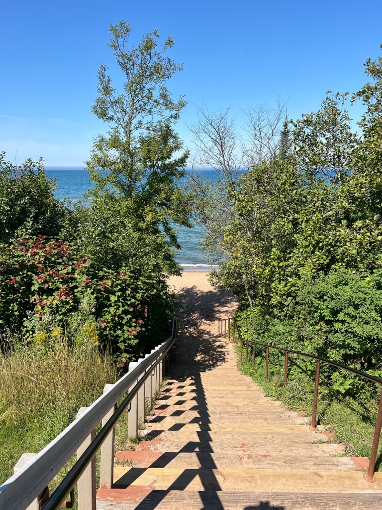
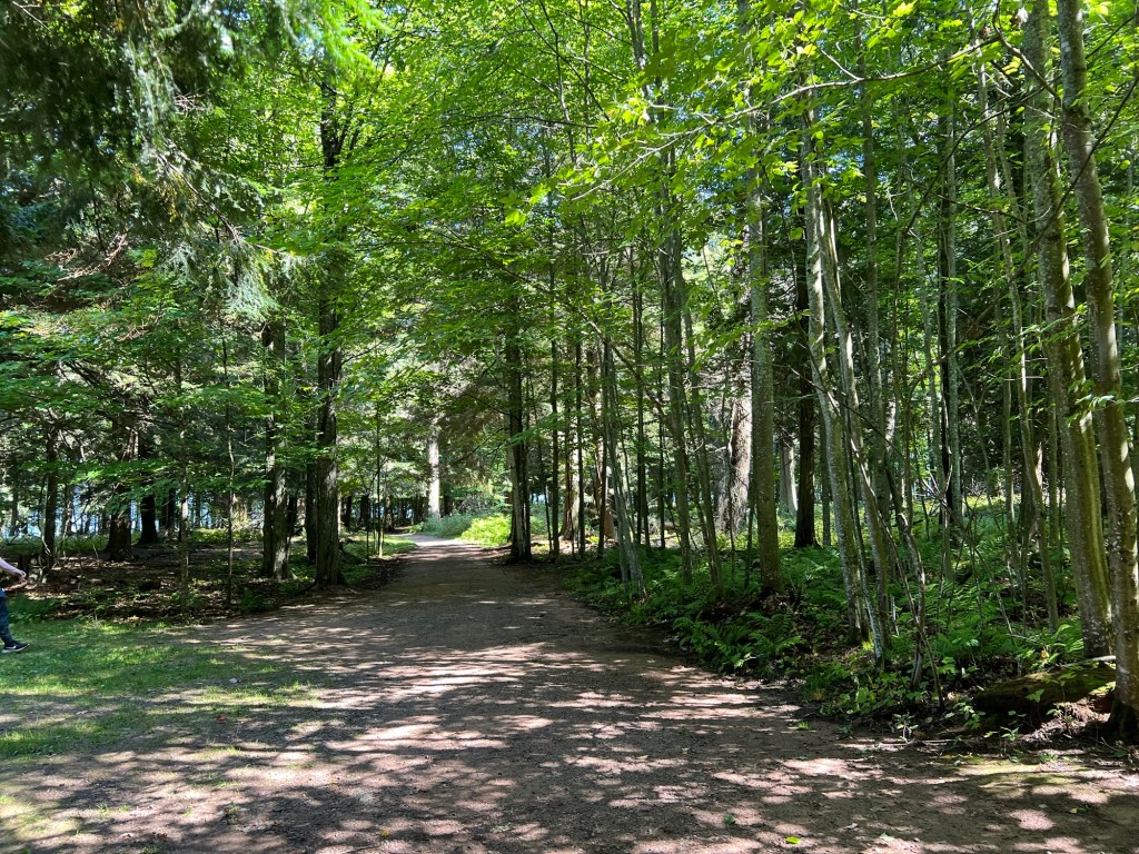
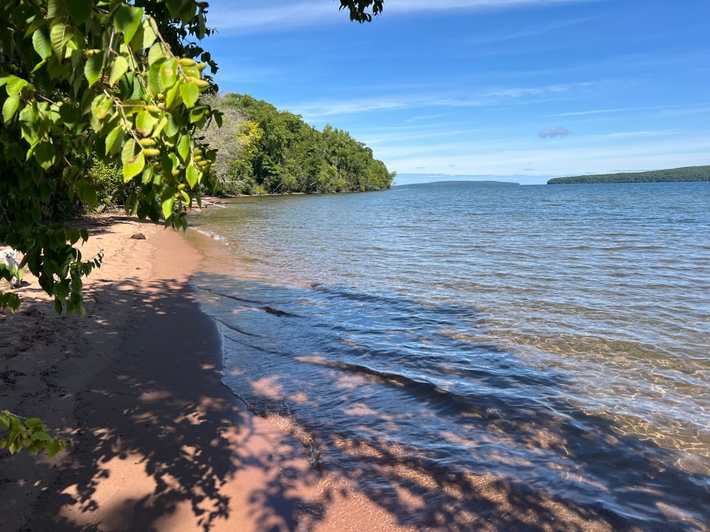
There is only one hiking trail on the mainland part of Apostle Islands National Lakeshore, and that trail starts here, at Meyers Beach.
It runs through the woods for almost two miles before it comes out along the cliffs you can see in the distance. Of course I wanted to walk it, but it would mean an almost 5 mile round trip, and neither Bud nor Matey would do that. So today I went alone.
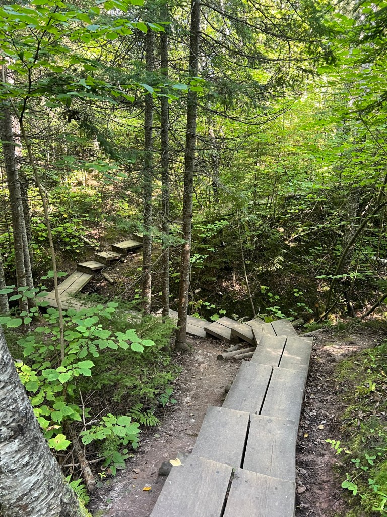
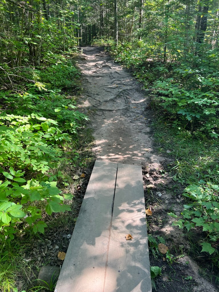
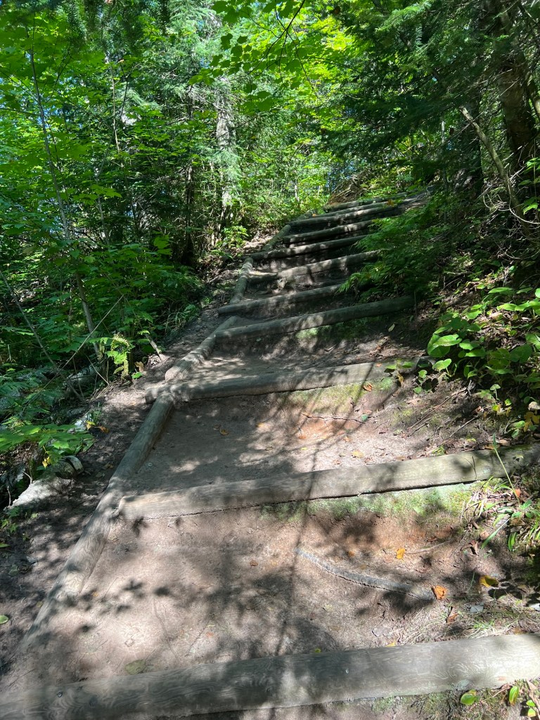
The first three quarters of a mile was entirely on wooden planks, with steps through the gullies…
and bridges over creeks and ravines.
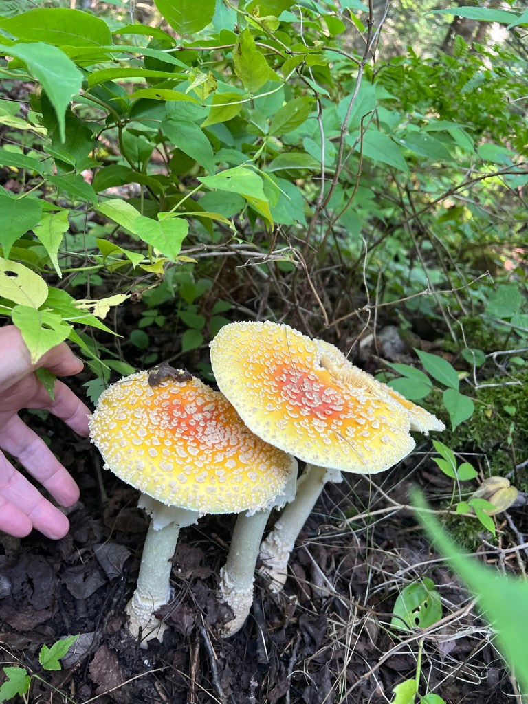
This appears to be mushroom season,
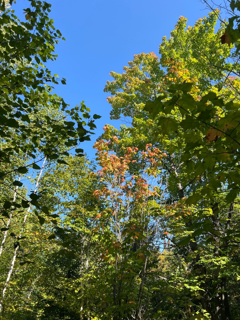
and the leaves are just starting to turn.
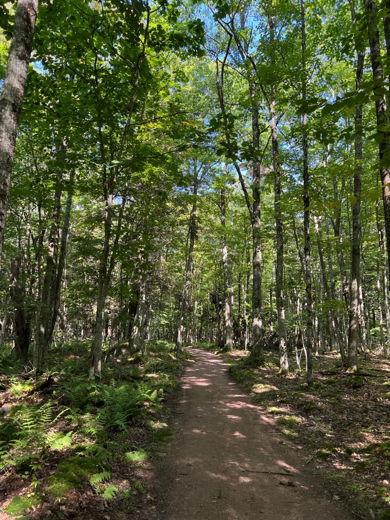
The plankway ended in a well worn track.
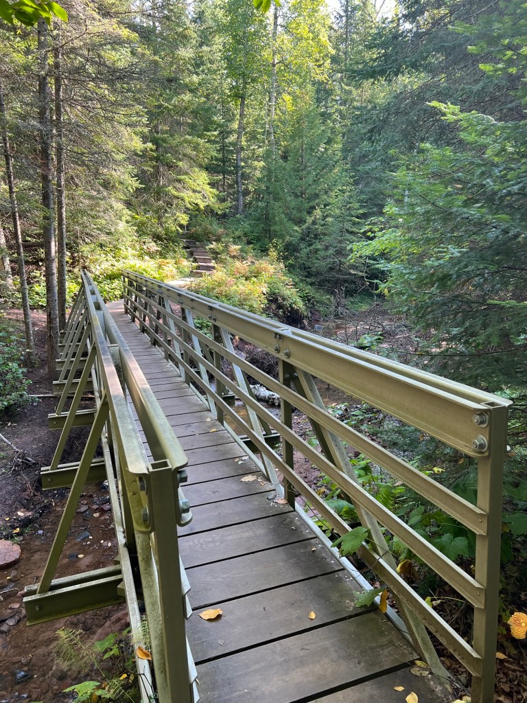
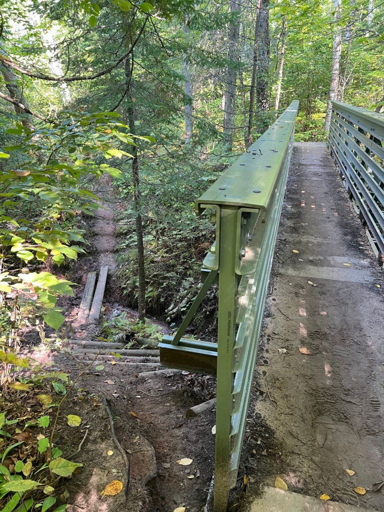
There were bridges and I was happy to take this new bridge instead of the steep trail.
There were still some pretty steep places to negotiate.
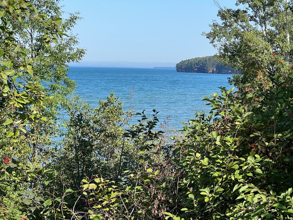
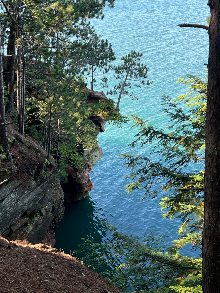
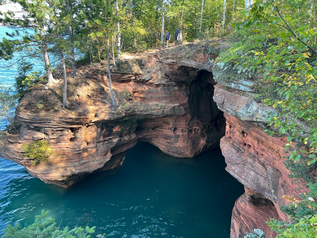
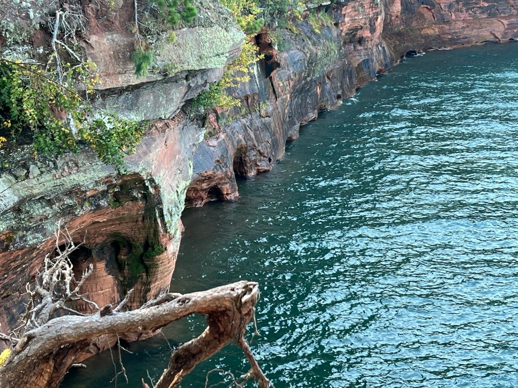
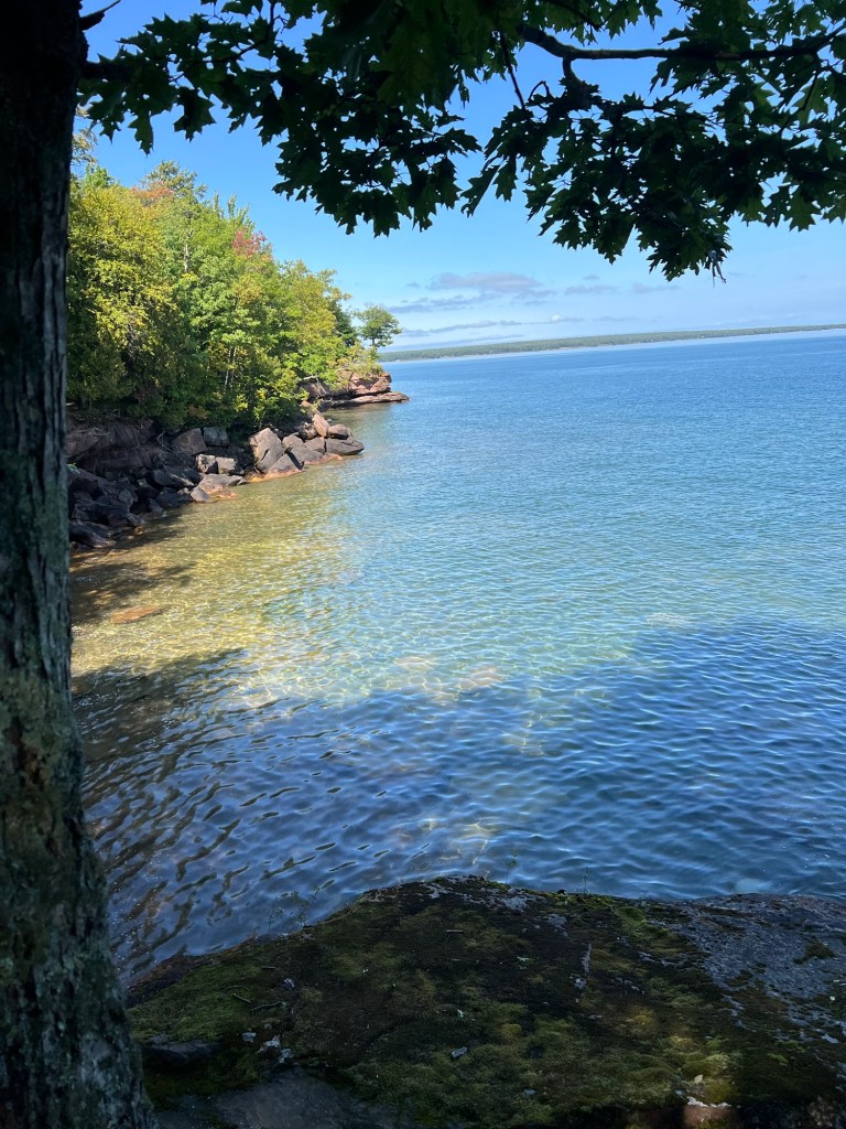
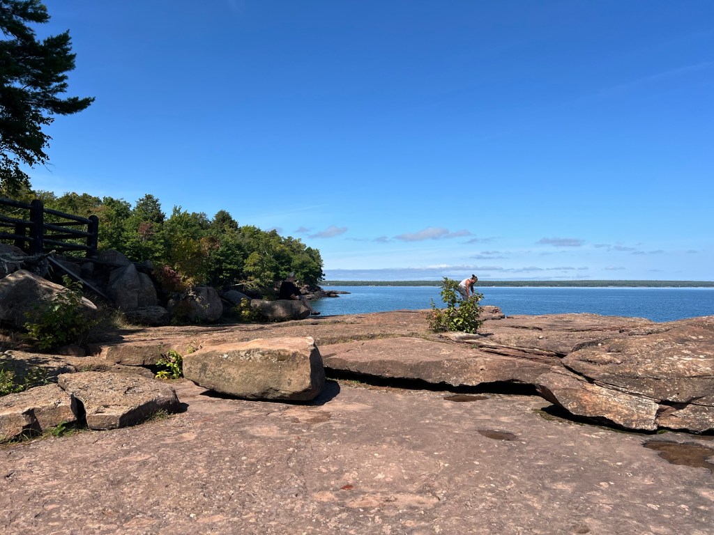
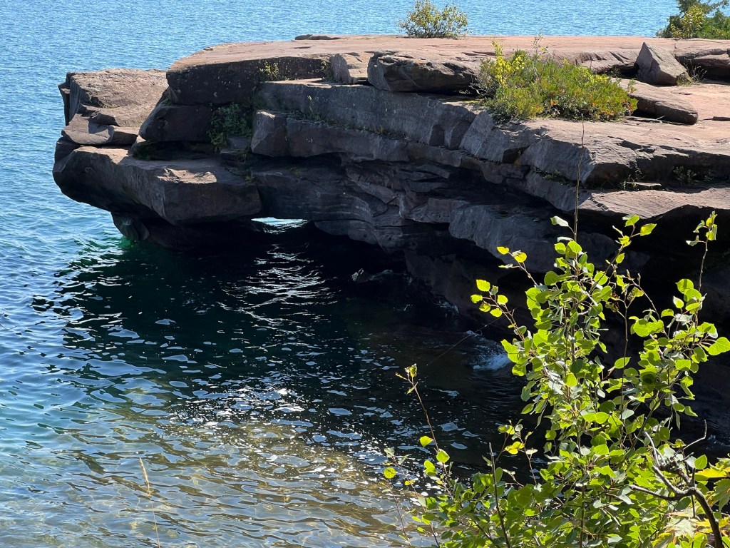
Then, after 1.8 miles, the lakeshore, just as promised.
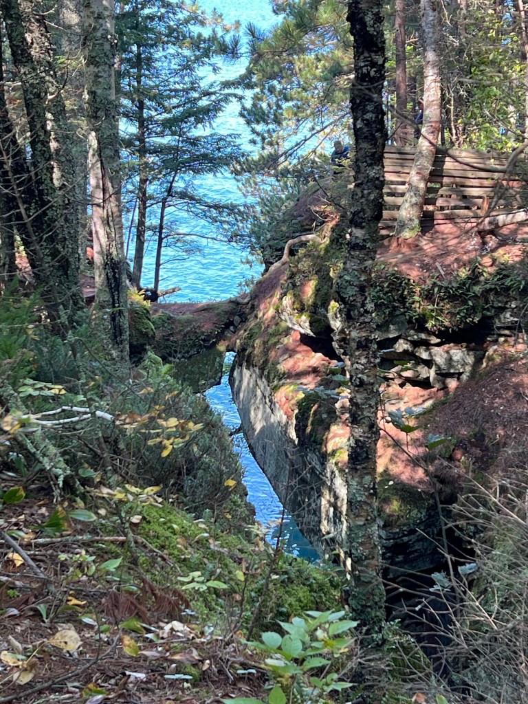
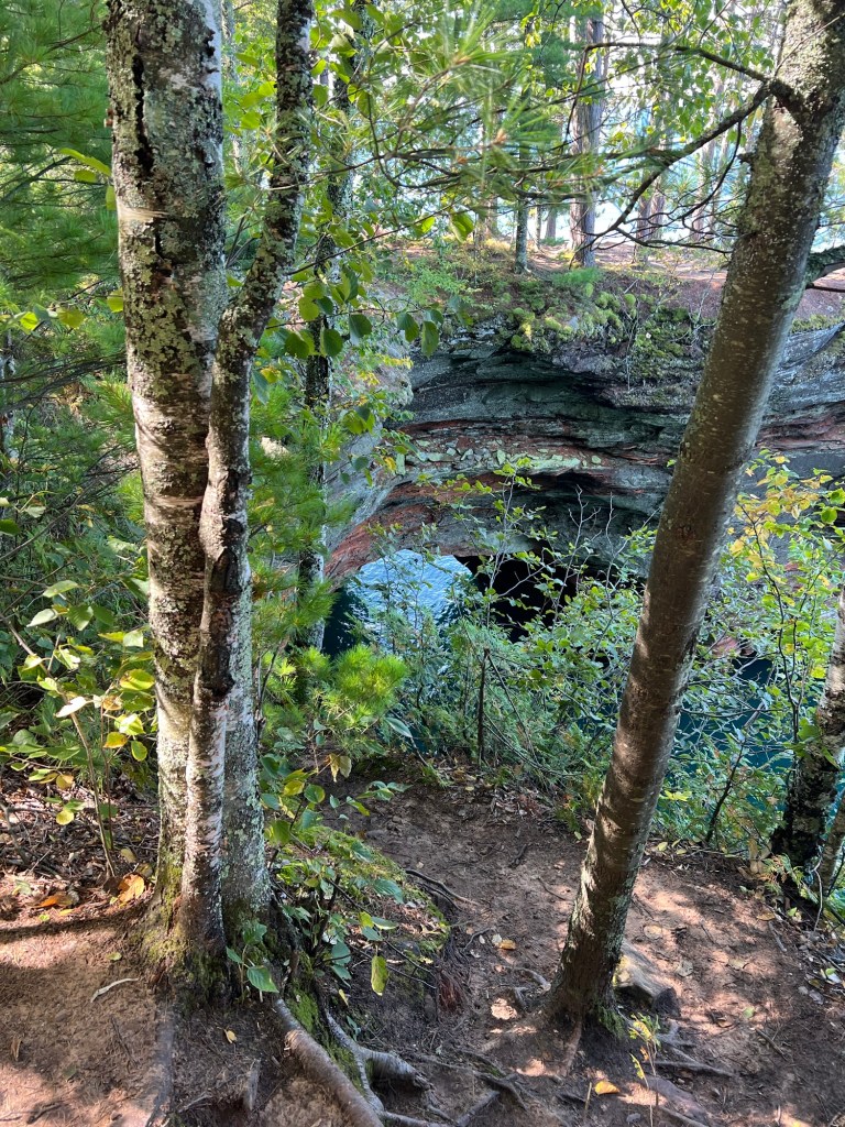
There was a bridge across this ravine and fencing to keep people off the natural bridge that still remained.
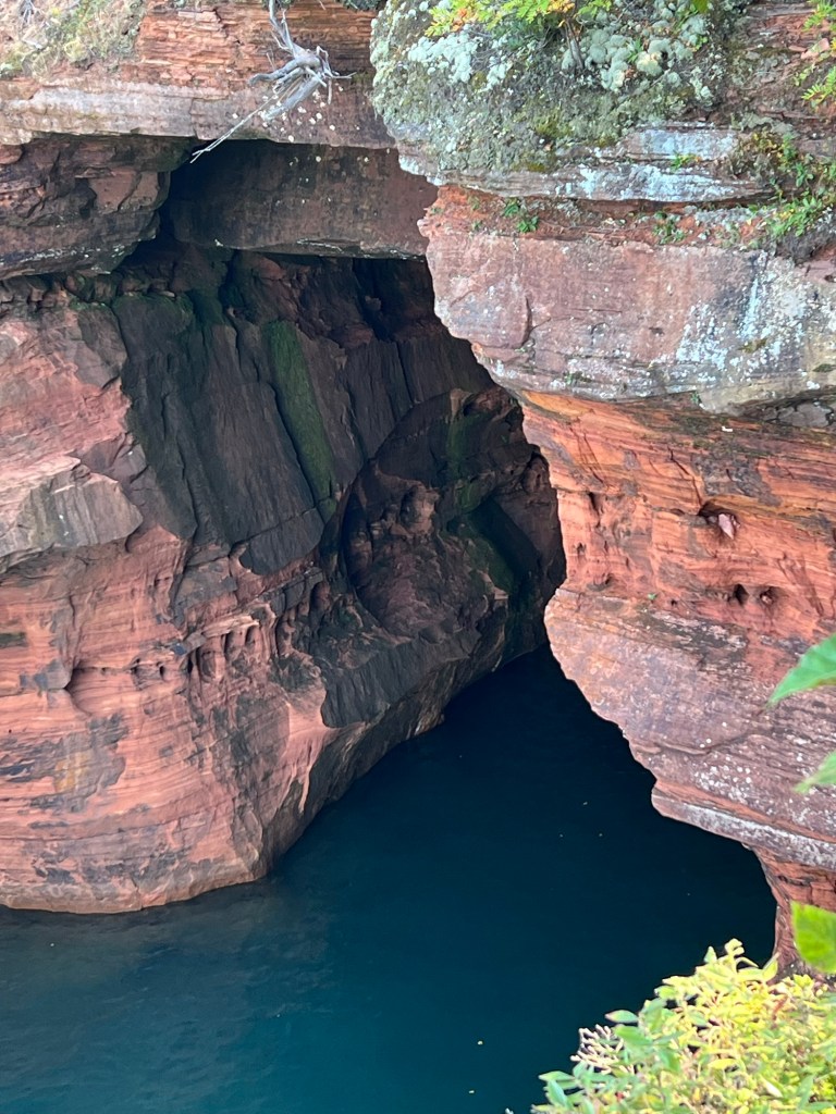
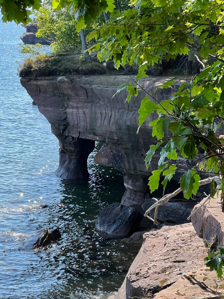
To the right of the trail bridge the ravine ended in a cave.
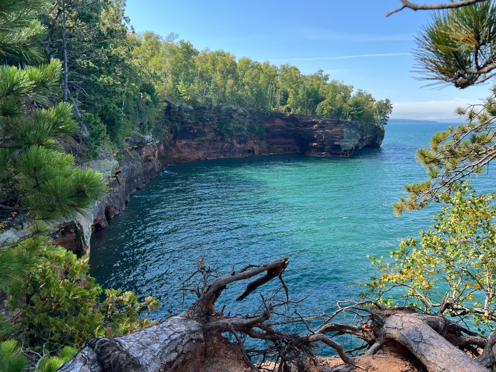
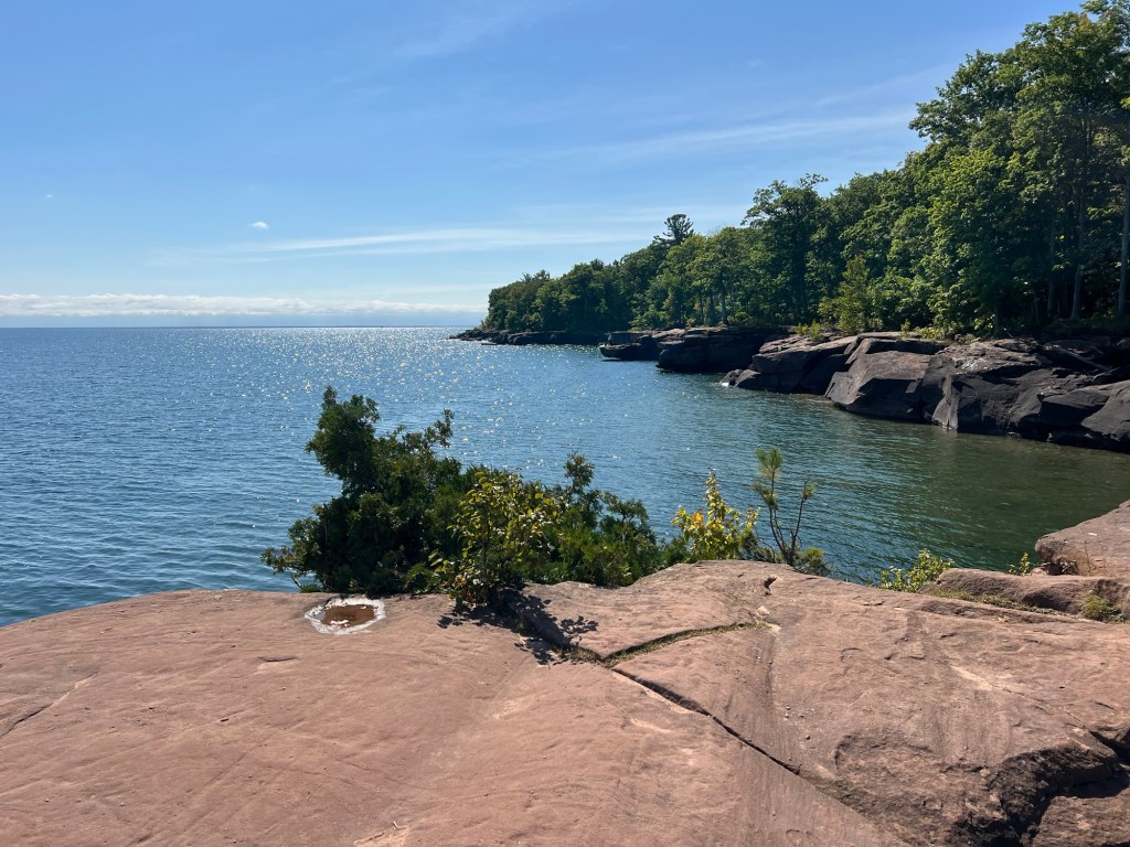
It seemed that every vista…
was more spectacular than the last.
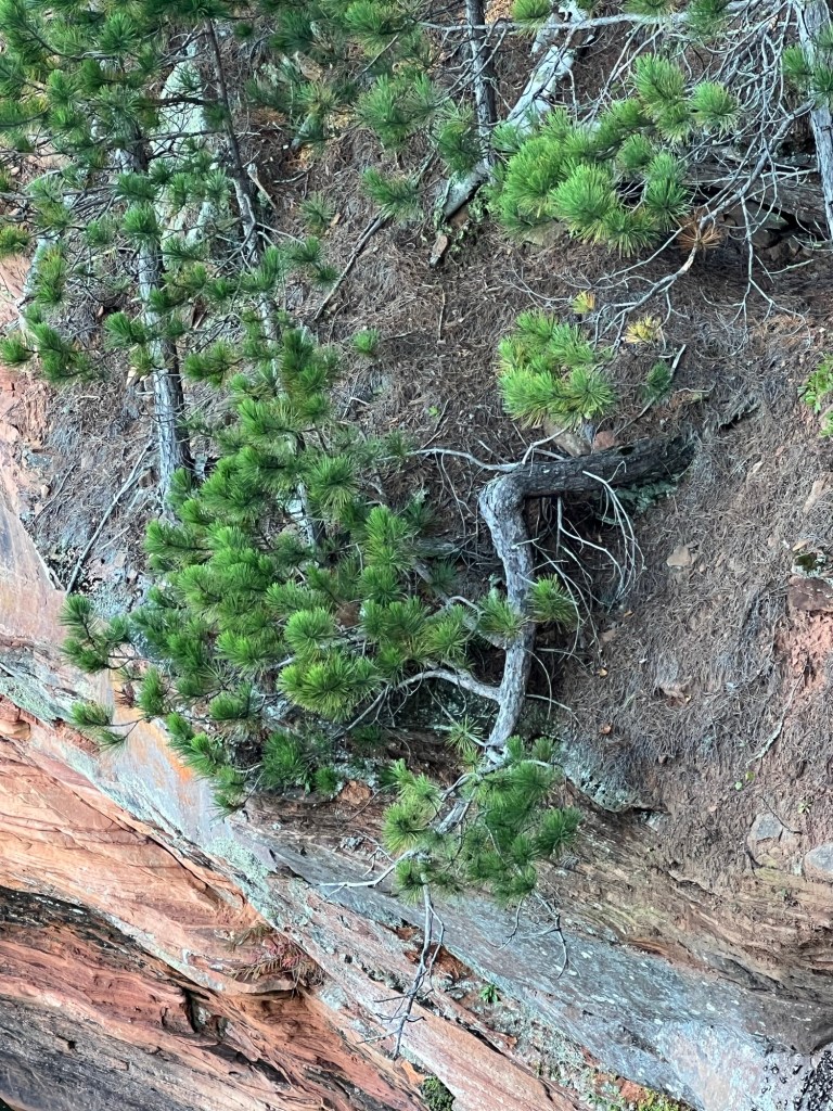
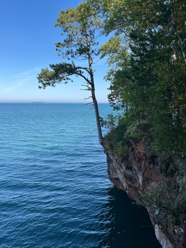
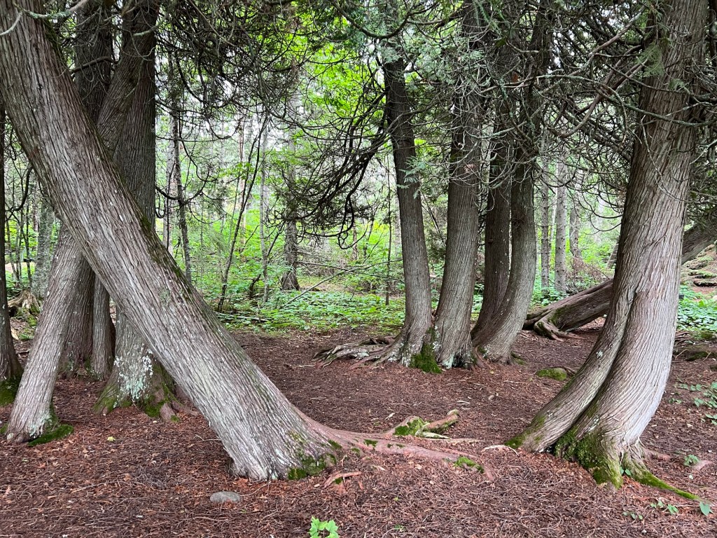
I found another entry for my tree hall of fame.
He was clinging on the wall above some lake caves.
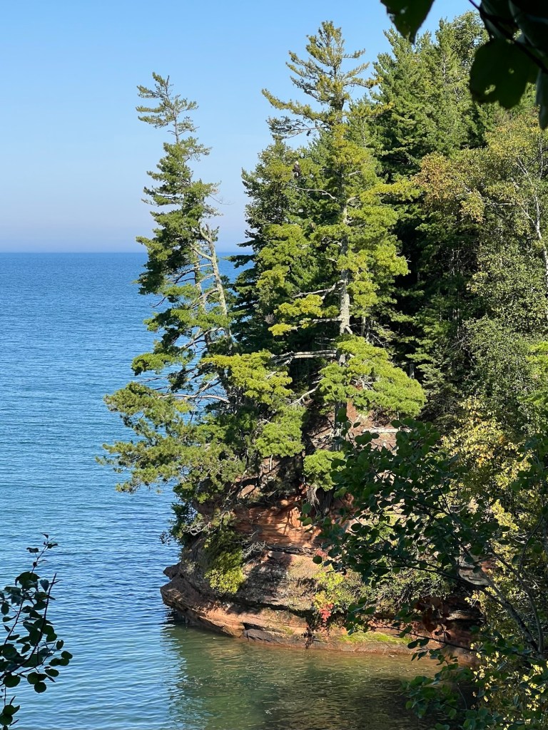
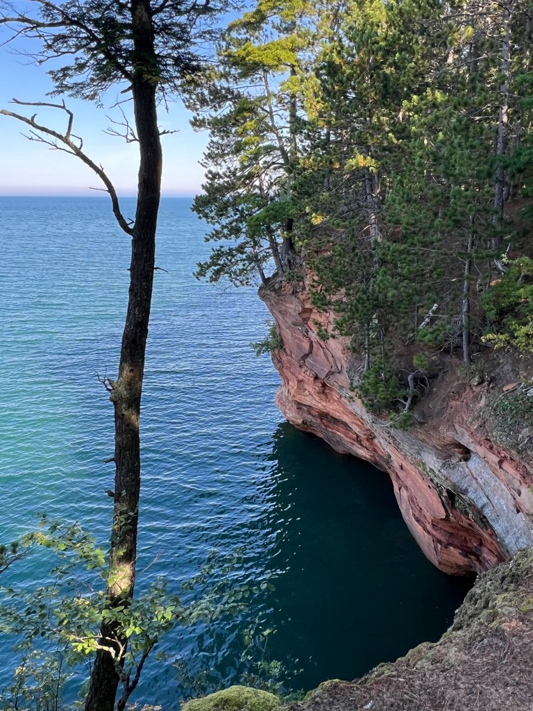
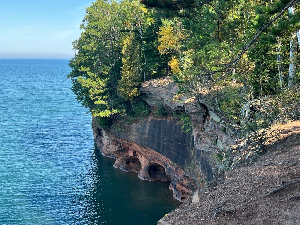
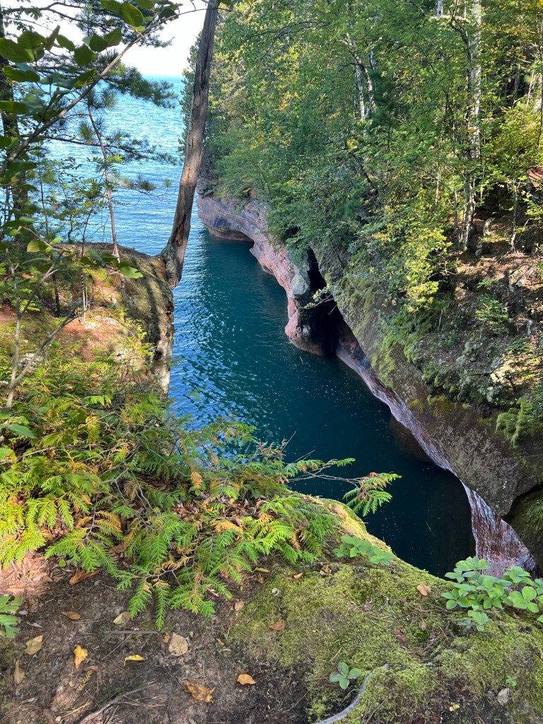
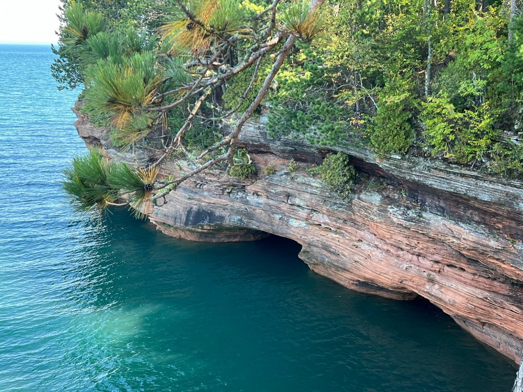
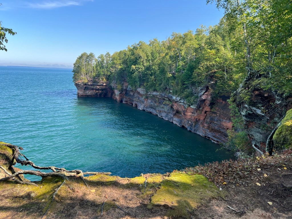
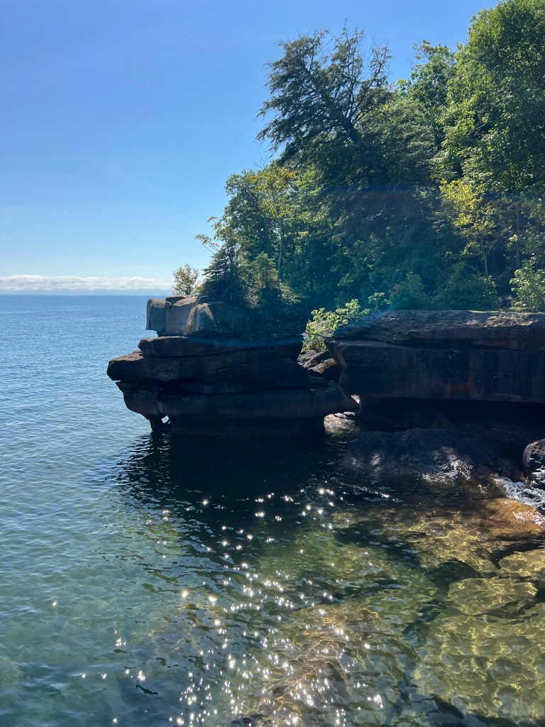
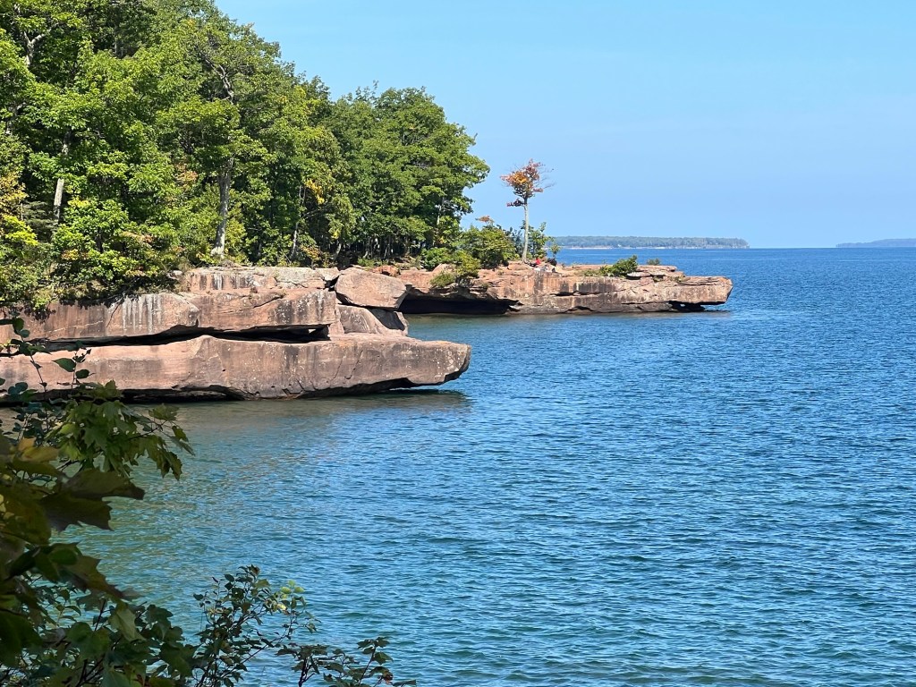
Cliffs,
crevices,
overhangs,
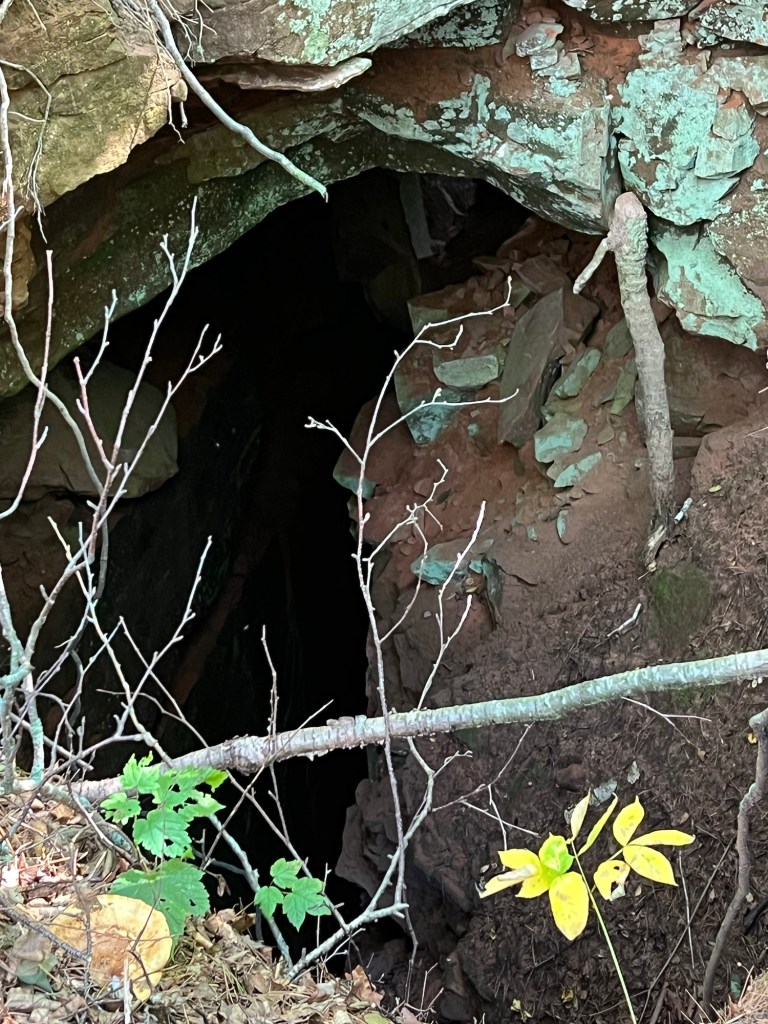
and caves, some really big caves, lined the shore.
See the couple on the other side? I waited for them to get in sight to show the scale.
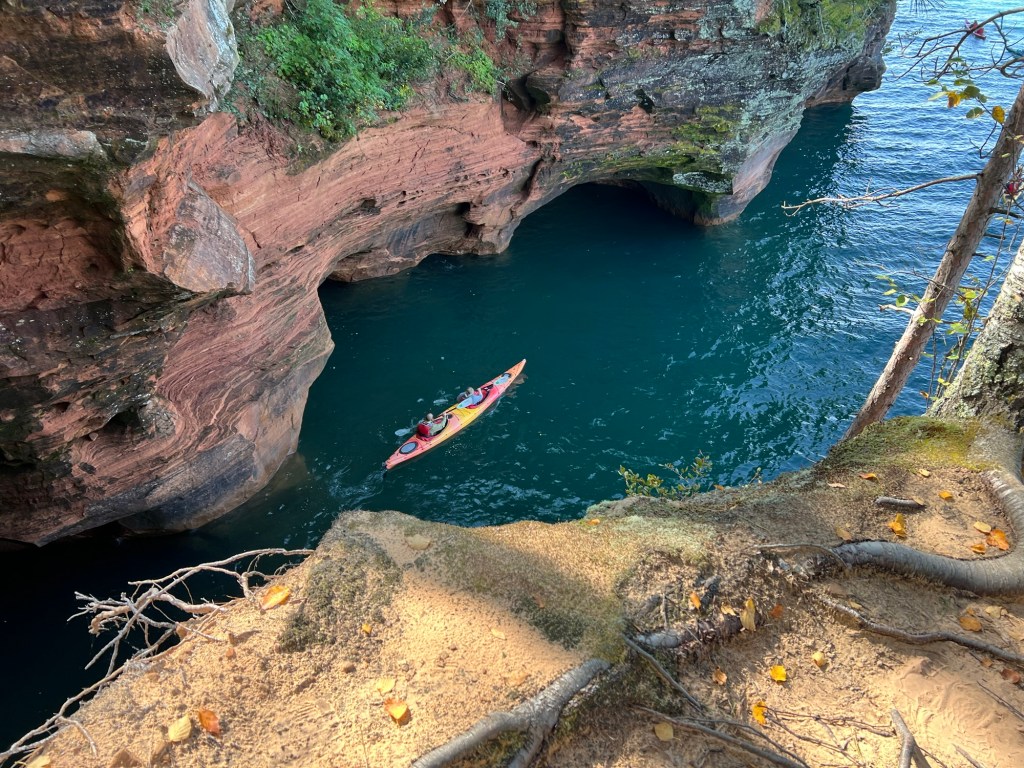
Better yet, I caught these kayakers coming out of the cave.
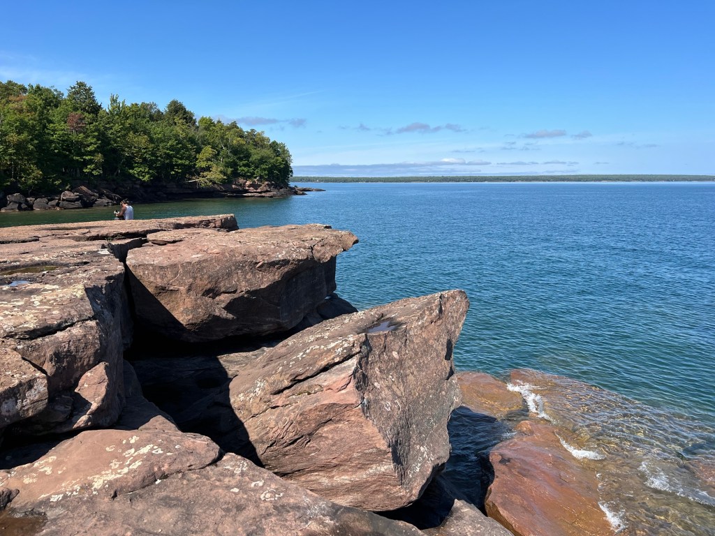
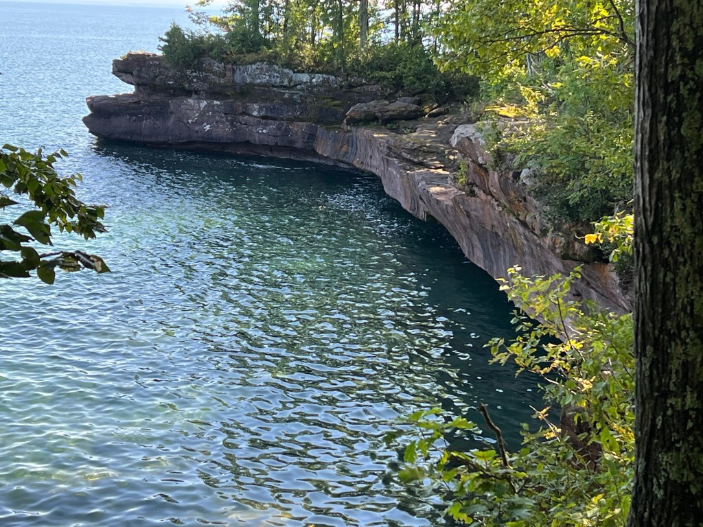
The last section I visited is called the bowl.
I walked to the far end of the bowl for these shots.
That’s about as close to the edge as I wanted to get, and this is where I turned around. From what I read the spectacular stuff ended here.
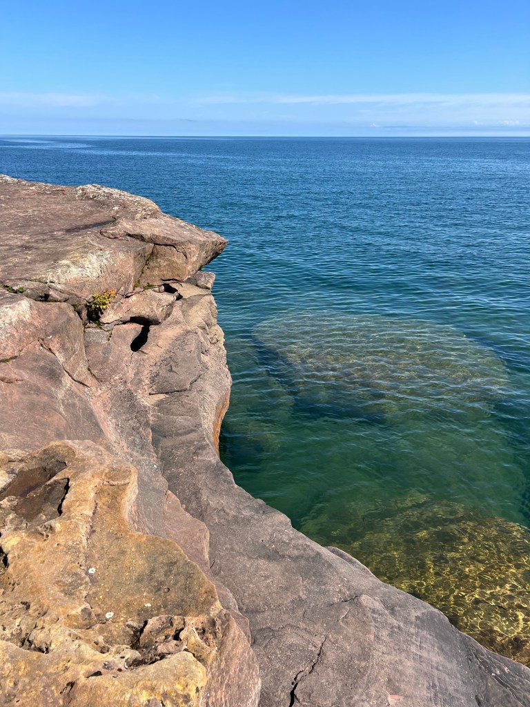
On the way back I saw that one of the points I’d walked out on had a water passage underneath it.
It was a beautiful day and a beautiful place, well worth the 4.77 mile walk. I won’t feel bad moving on, now.
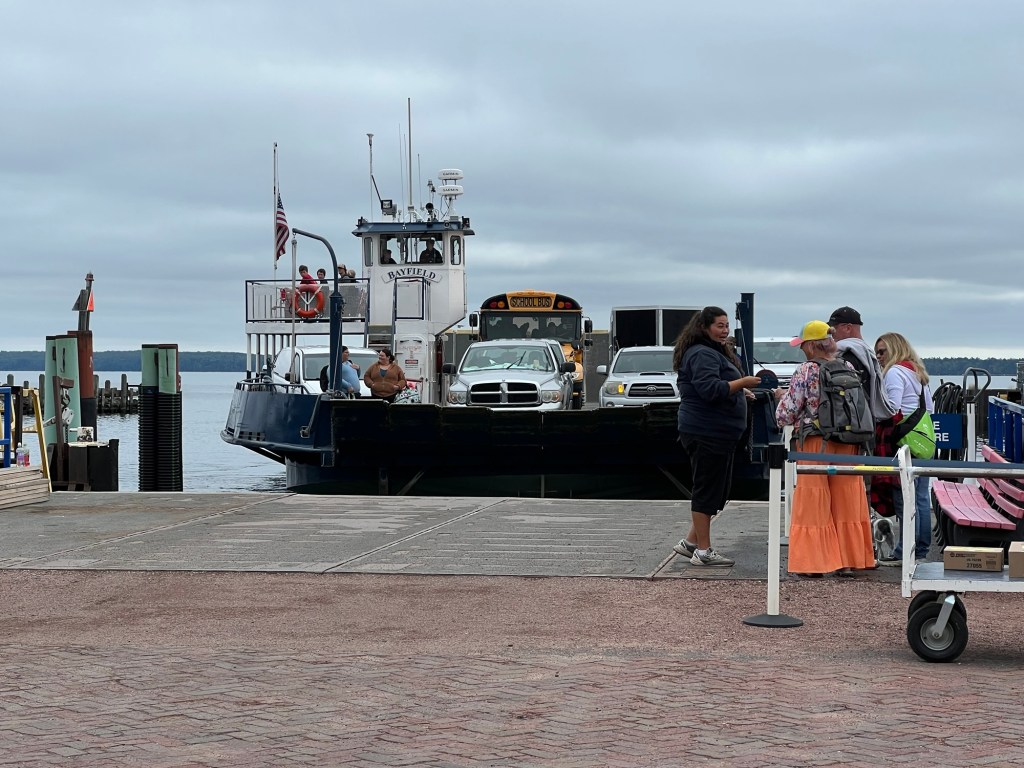
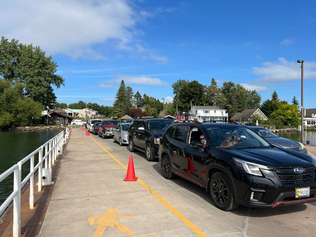
On Thursday we decided we’d make the ferry trip to Madeline Island and visit the state park there. If you don’t own a boat this is the only way you can get out on one of the islands right now. There are tour boats, but after Labor Day they don’t make any runs where they drop you off on the islands to hike or camp. But the ferry to Madeline Island runs all year, as long as they can get through the ice. Notice the school bus! This was the 11:30 AM ferry from the island, so not sure what was going on with the bus, but there were students on it.
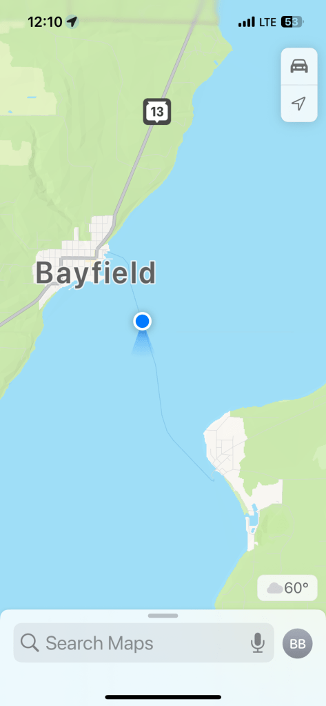
Anyway, once they unloaded we drove aboard and at 12:10 PM were well on our way from Bayfield to LaPointe, on Madeline Island. It was cool and cloudy but the clouds were supposed to clear a bit.
We drove all the way around the island and pretty much just saw trees. We came to Big Bay State Park and went to the Point Trail. More nice trees.
Then we came to the shoreline,
and it was beautiful.
The water was crystal clear.
This is the point, and it is a huge rocky outcrop.
The rocks along the shore are sculpted by the waves. By this time, Bud wasn’t feeling too great, so he went back to the truck to rest and Matey and I continued along the shore.
More rocks and caves.
Whole stretches of the shore were undercut.
The clouds were mostly gone and the sunshine peeked from under the rocks.
With the sun at my back the red rocks glowed.
Such a beautiful place.
Matey and I looped back through the woods.
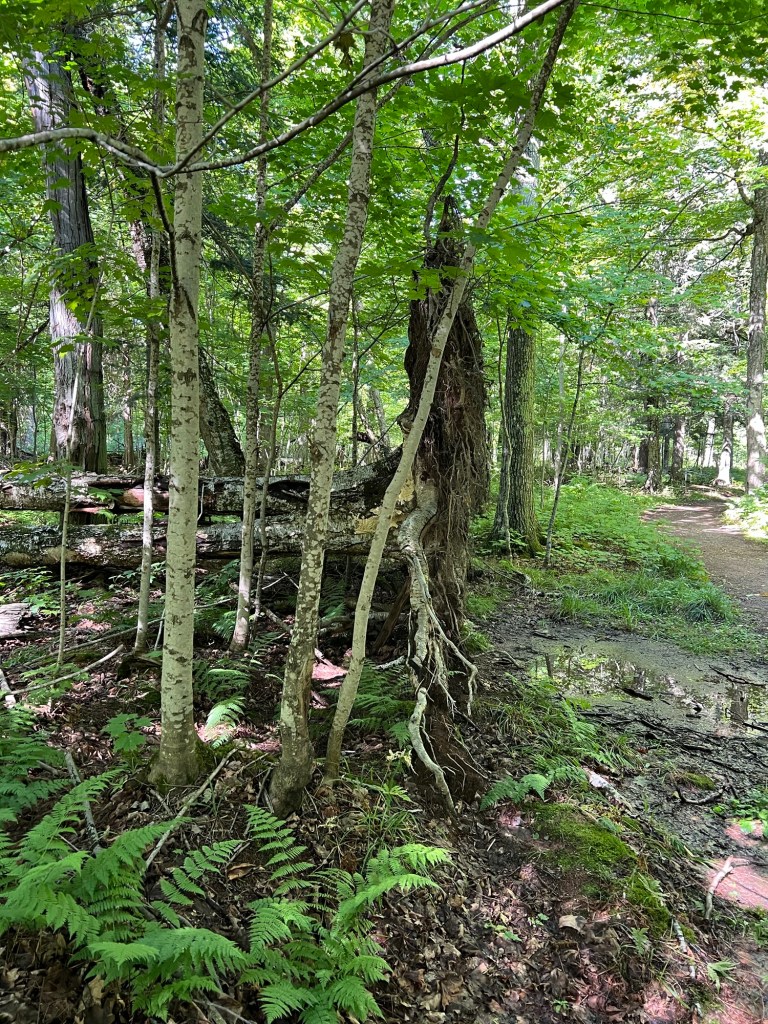
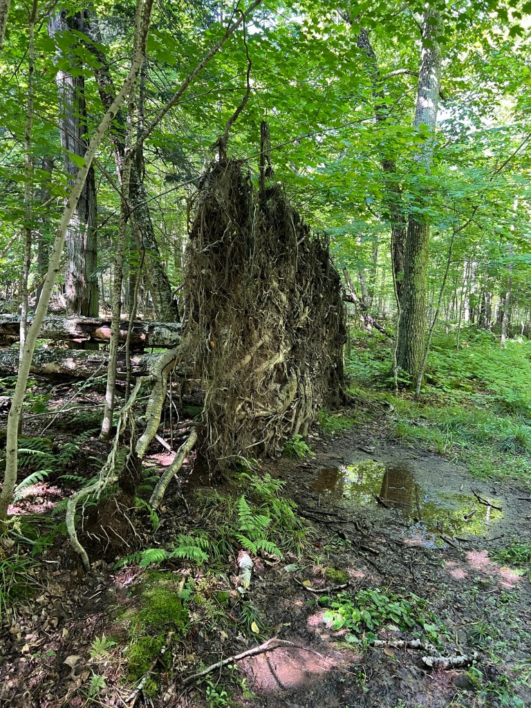
That’s a paper birch root “ball”, but it’s more like a giant dinner plate.
It was over six feet in diameter but only about a foot thick. The Anishinaabeg sign in the Frog Bay Tribal National Park mentioned that paper birch have a very shallow root system. They sure do!
Back in LaPointe we lined up for the ferry…
and took it back to Bayfield. The clouds were building up,again, they just went away so we could see that gorgeous shoreline.
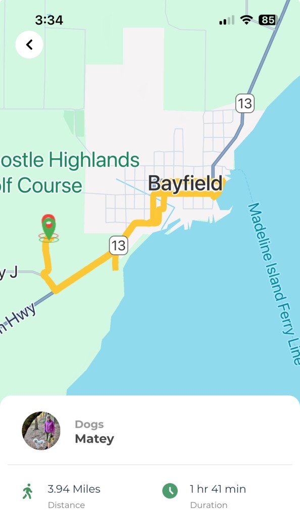
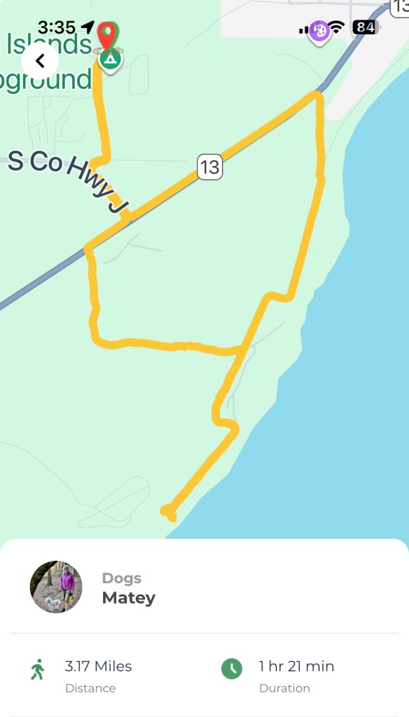
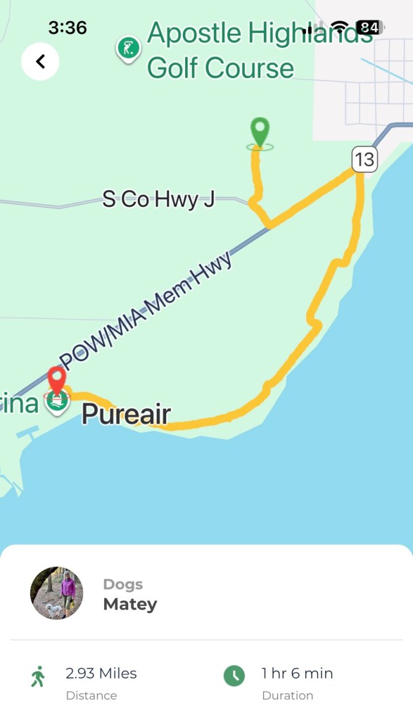
Tuesday Bud had to go back to a dentist in Duluth because his front tooth broke while we were in Black Beach Campground. He drove to Duluth then and they X-rayed and took impressions. The whole time we were in Duluth they couldn’t see him. So Tuesday he drove 90 miles back so they could pull the tooth, put a bone graft in, and give him a temporary fake tooth to hold the space open while everything heals. Anyway, Matey and I were at the camper and I decided to take Matey into town in the stroller. This is from the app that tracks our walks. I wanted to take the Brownstone Trail, which I thought I could access from a little dead end road just down the highway. I couldn’t find the trail. The little tail below the 13 is my aborted attempt.
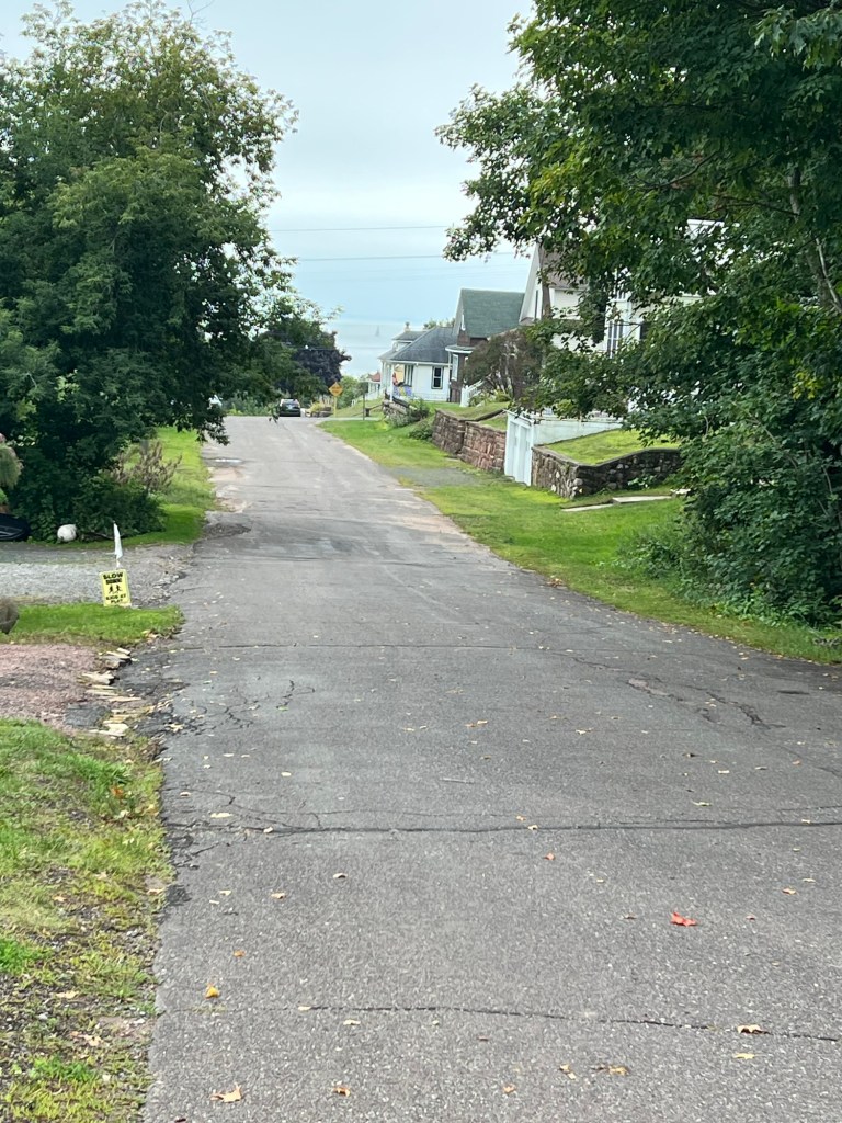
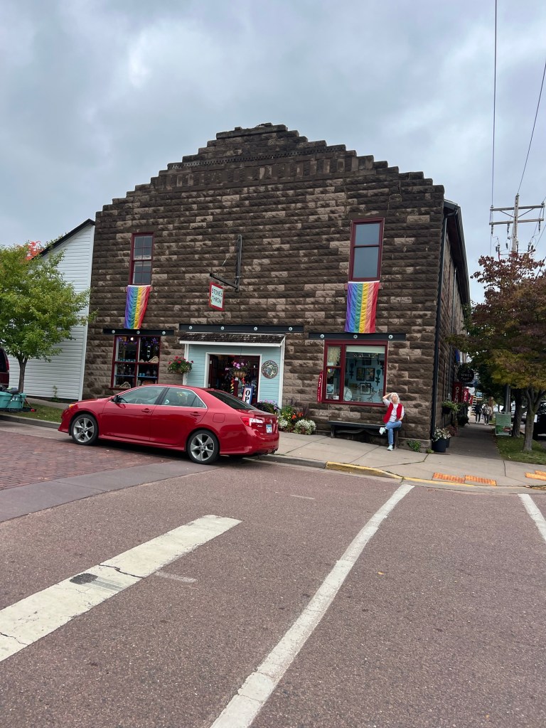
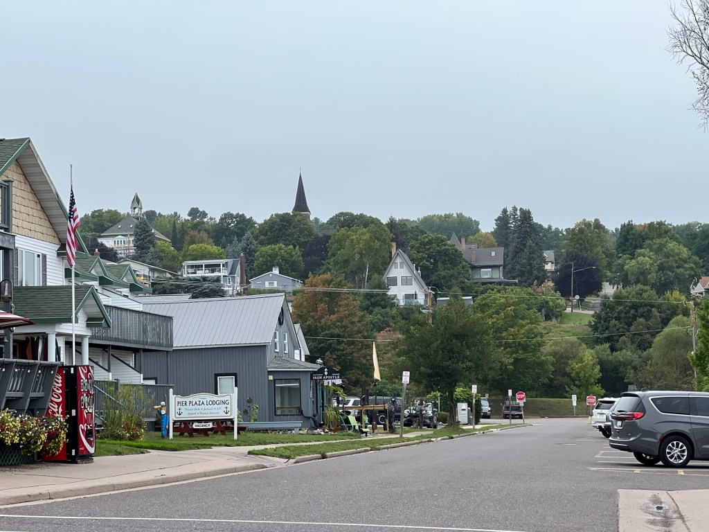
I did make it into town,
which is quite pretty, and all hills.
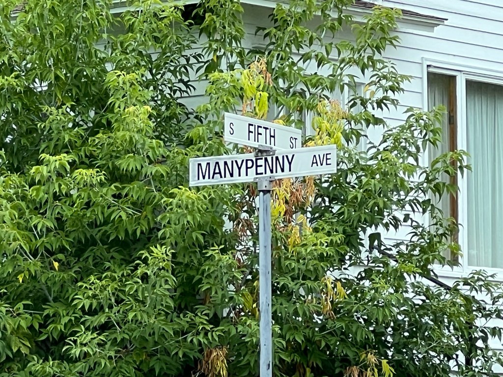
This was the corner of Manypenny and Fifth. I took a photo of the sign just because I love the street name.
That would be a fun address. We walked down Manypenny…
to the harbor.
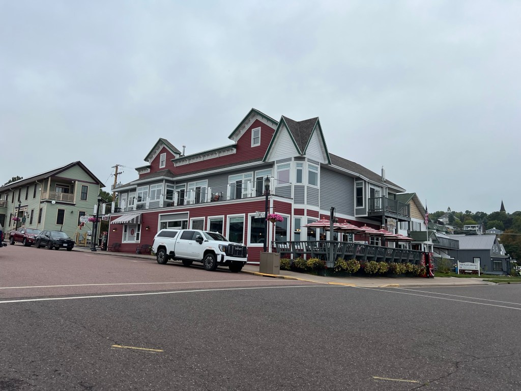
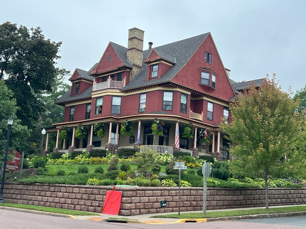
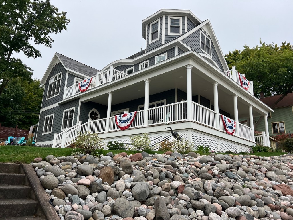
Bayfield is a touristy little town,
but nicely done.
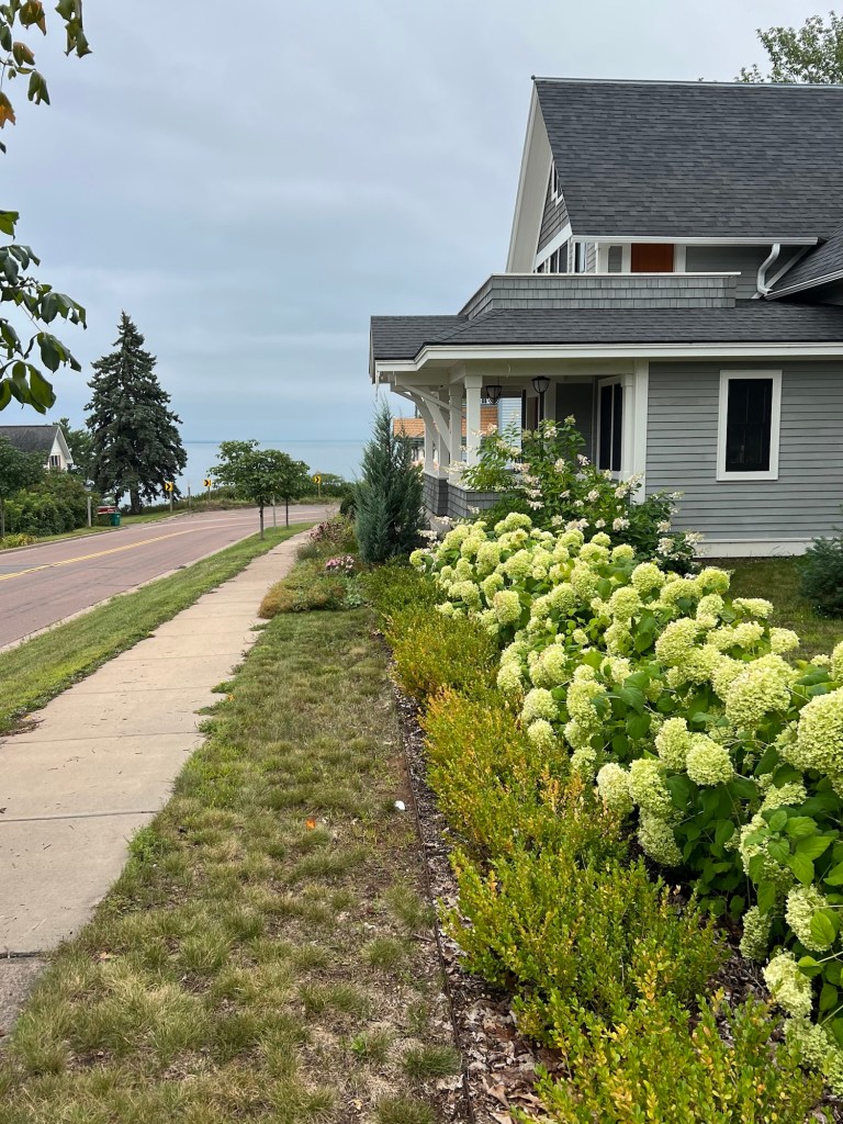
There are several beautiful old places that are hotels and restaurants.
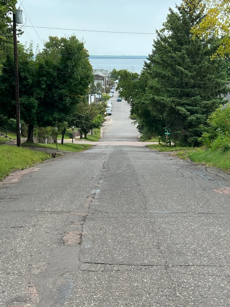
The hillsides afford nice views,
and everywhere you look there’s Lake Superior.
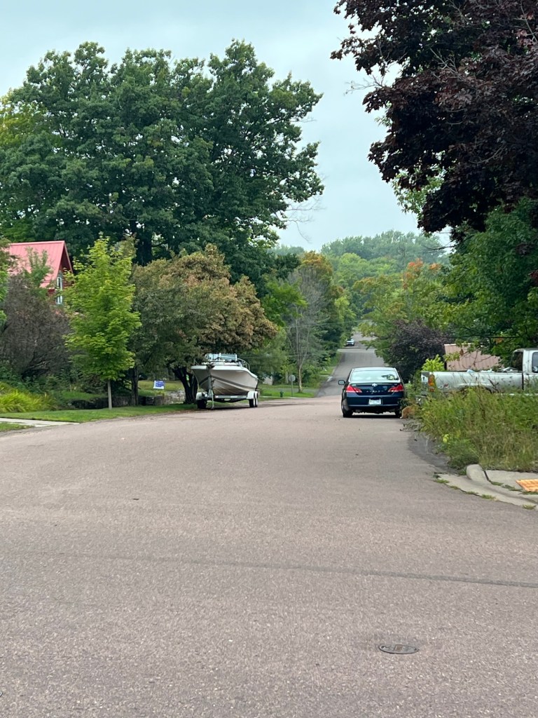
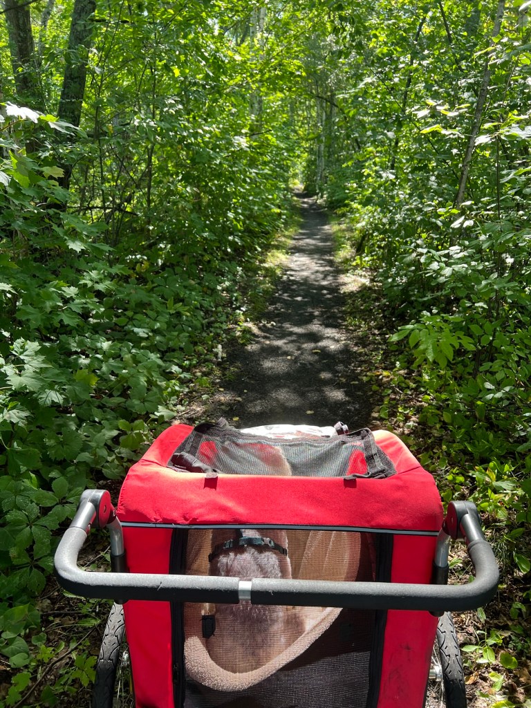
I was disappointed that I didn’t get to go on the Brownstone Trail, but I found out the part from town to the little road near us is not revamped and not bike or stroller friendly, but the trail did continue southwest, away from town. So the next day I decided to go that way.
This was better.
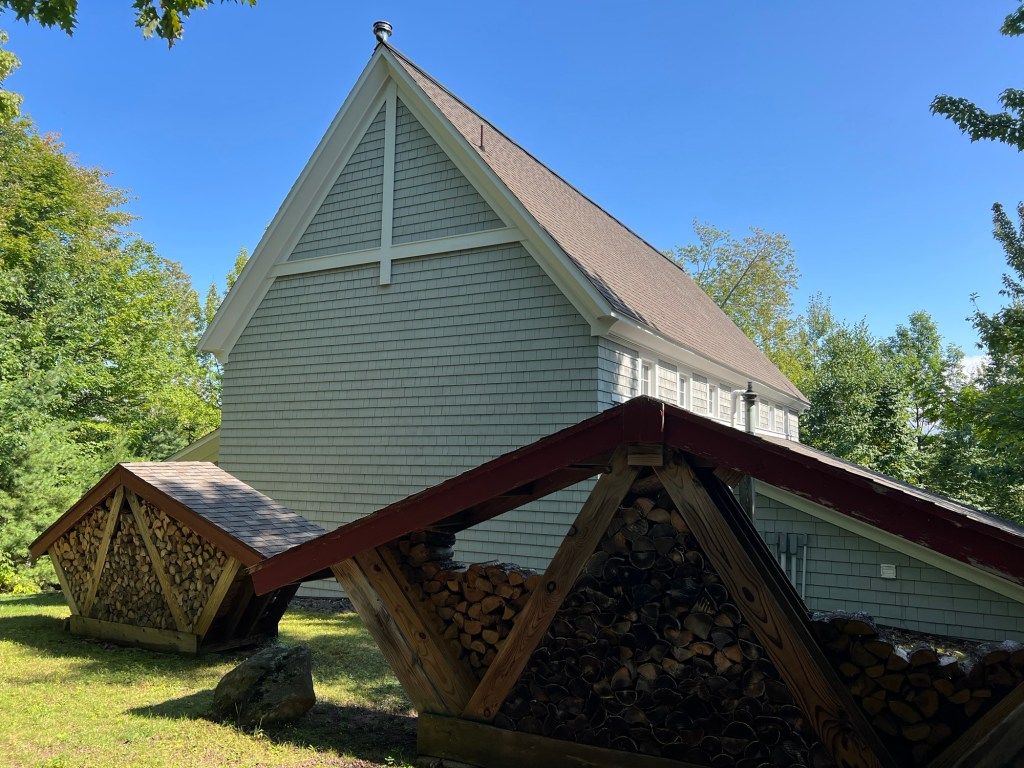
We walked behind some interesting old properties.
These people’s wood storage was art.
There were some steep portions, but it was doable.
The only lake views were right at the start of the trail,
and where I turned around.
I could have walked further, but I didn’t want to have to come back too far along the highway and I didn’t want to have Bud come and get us as he was hurting from the surgery on his mouth. So I backtracked to this little dirt road…
and only had a few hundred yards to come back along 13.
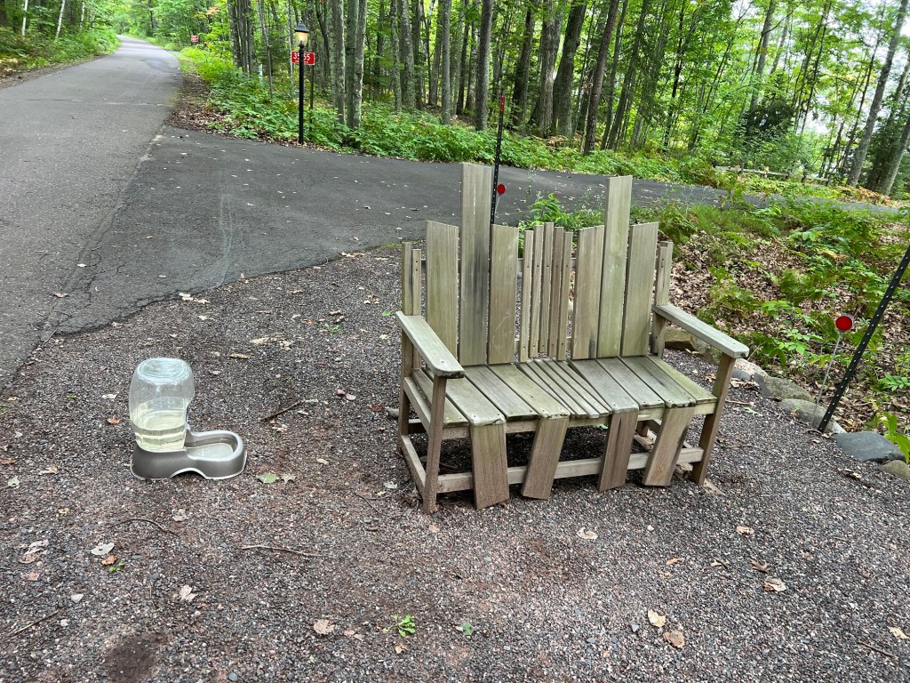
Today Bud was feeling better, so he agreed to pick me up and Matey and I got to walk to the end of the trail.
Turns out most of the rest of it was along a private road.
There were beautiful houses but I was most impressed with this. This bench and dog watering station…
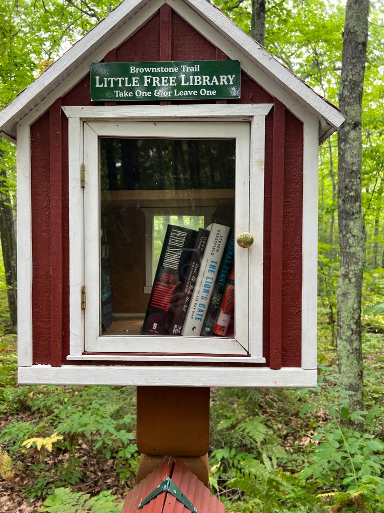
were next to the Little Free Library,
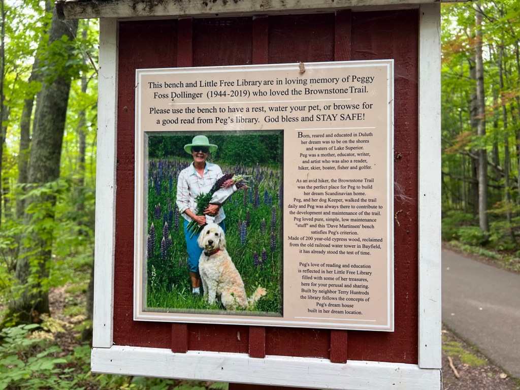
built by a neighbor in memory of Peggy Foss Dollinger. What a lovely legacy!
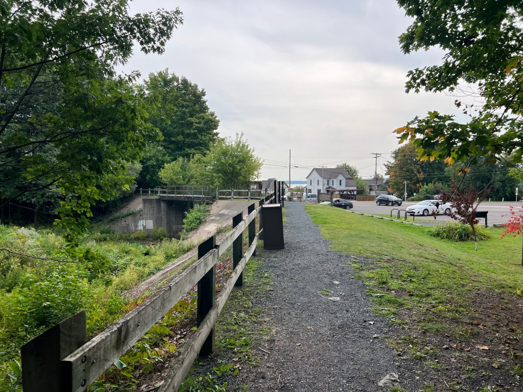
Earlier today the three of us had gone into town to a short trail there.
This was the Iron Bridge Trail, part of the Big Ravine Nature Preserve.
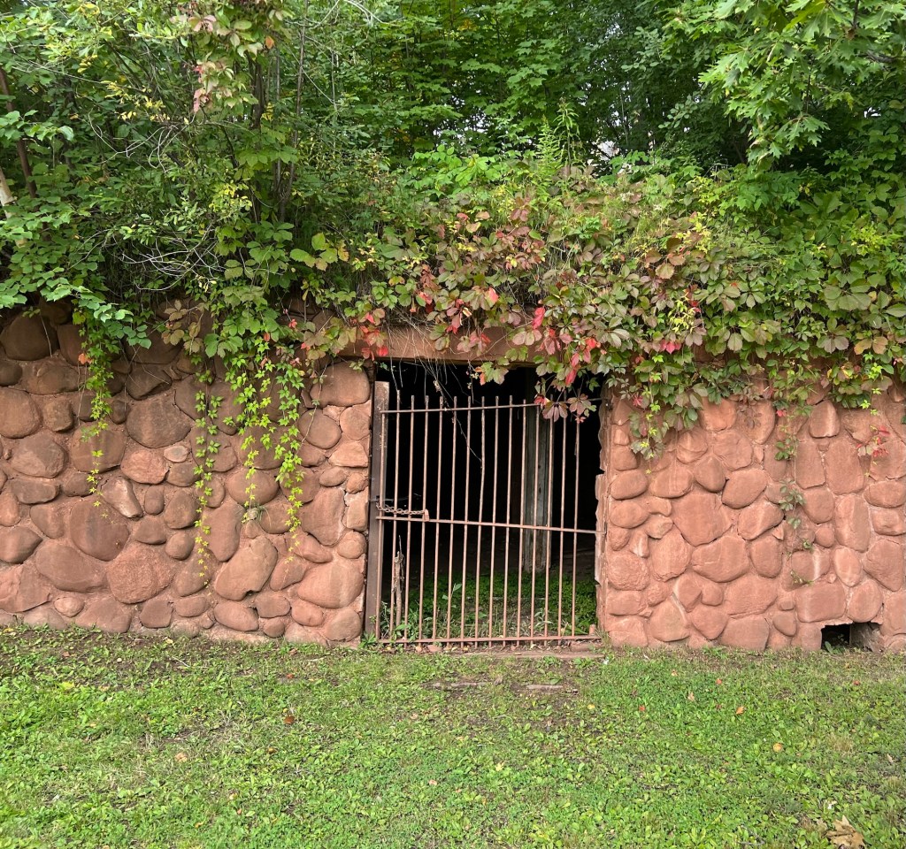
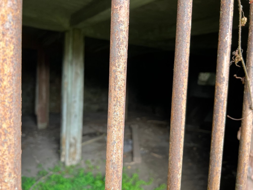
At the start was this structure.
It’s an old apple storage shed built by William Knight into the slope beneath his house and made from fieldstones collected from his orchards. This area is known for apples and I was able to buy some Wealthy’s from a local orchard.
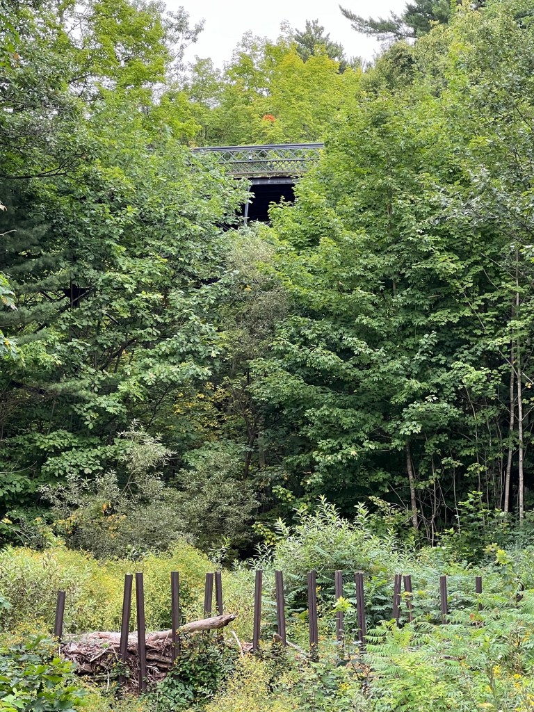
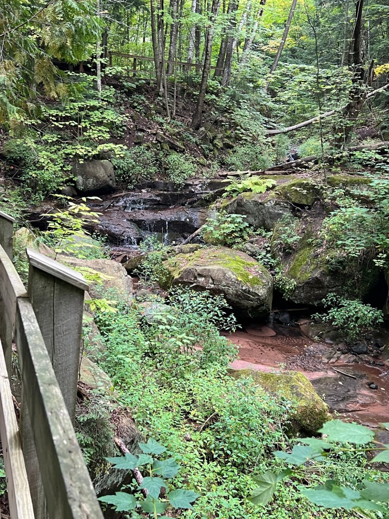
Just up the trail you get a glimpse of the iron bridge for which the trail is named. Those stakes are pieces of railroad rails implanted to catch debris when the creek floods to keep the debris out of the underground portion of the creek just below. The creek was rerouted after a flood buried downtown in mud and debris in 1942.
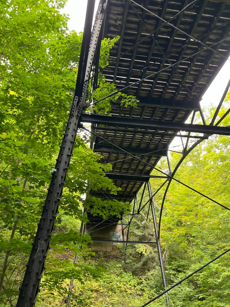
The bridge from below. The wrought iron bridge was built across the ravine in 1912 by Wausau Iron Works.
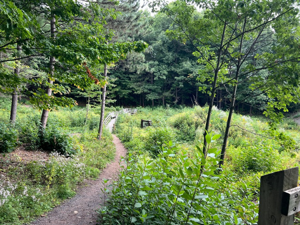
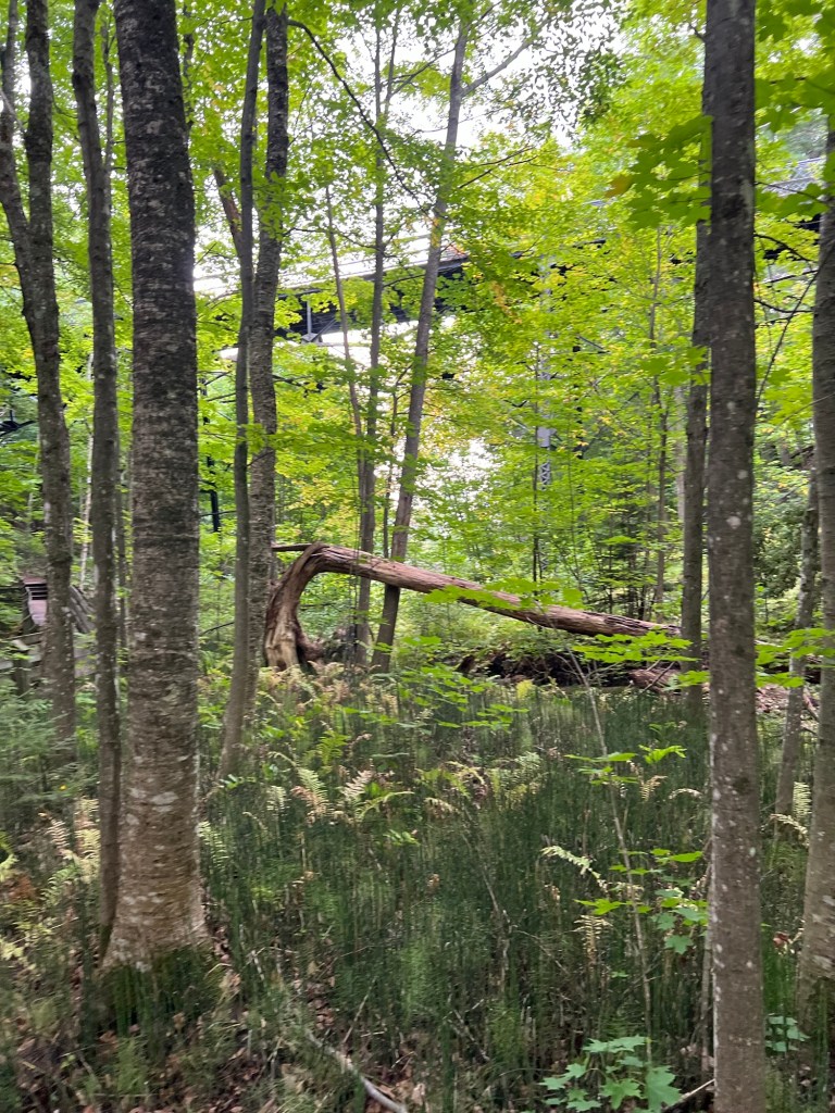
The trail continued up the ravine, now forested.
Looking back down you can see the bridge and the rather unusual ground cover of ferns and equisetum.
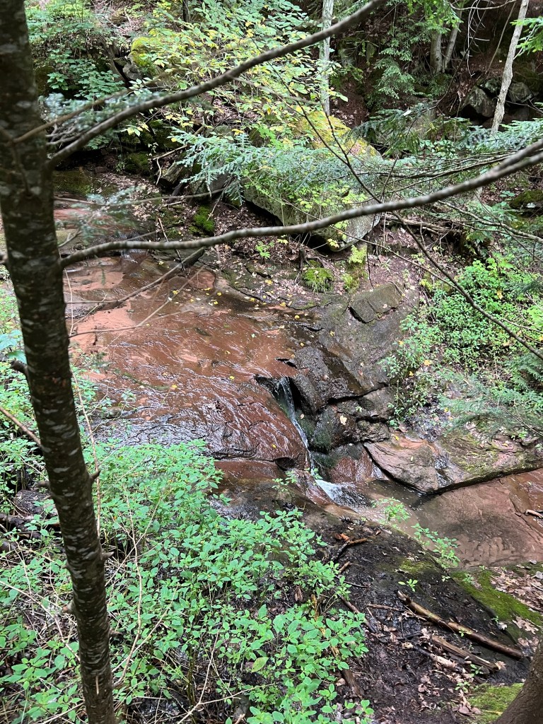
There was a trickle of a waterfall…
that came down in steps along the trail, which was starting to climb here.
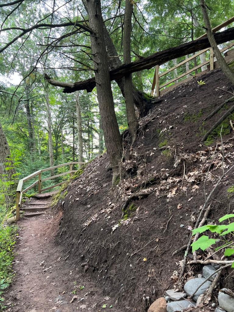
We went up…
and up,
and came out of the ravine by the school. Can you see the peak of the old school completely surrounded by the newer parts? That part was the new school when the bridge was built to give easier access from Catholic Hill to School Hill.
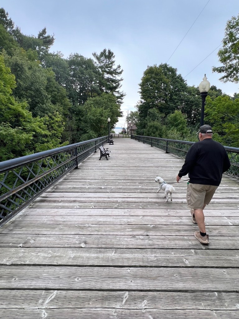
We walked down the street and across the iron bridge, a pedestrian only bridge since the 60’s.
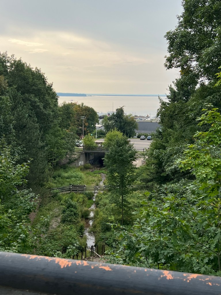
There’s a nice view from the middle and you can see where the creek goes into the culvert where it now flows under downtown and out to the lake.
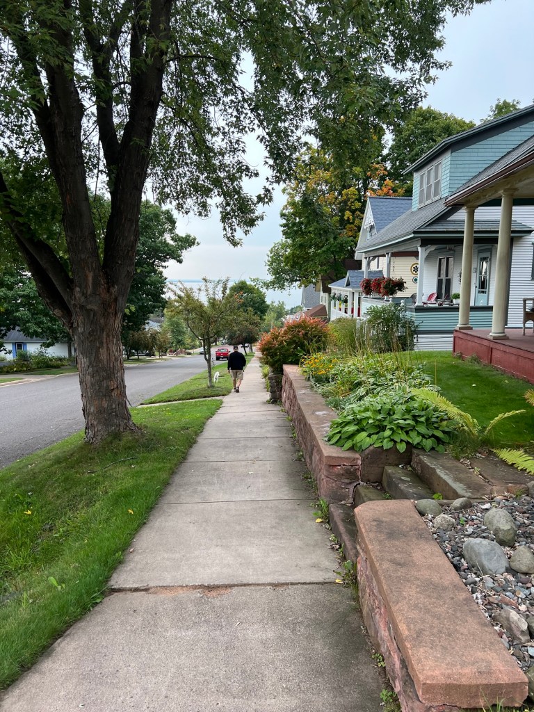
We continued down the streets,
past more pretty houses.
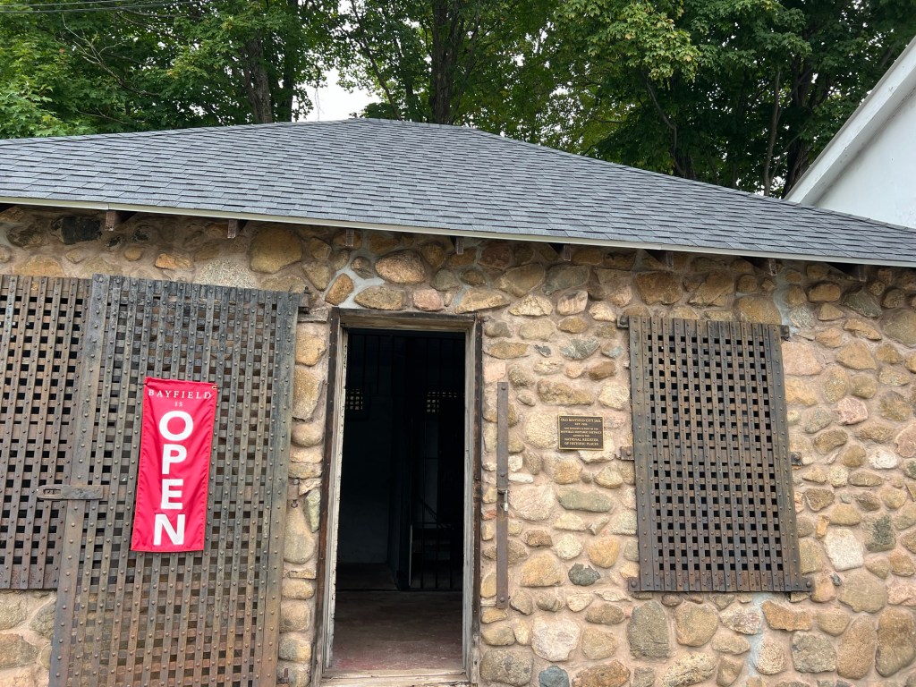
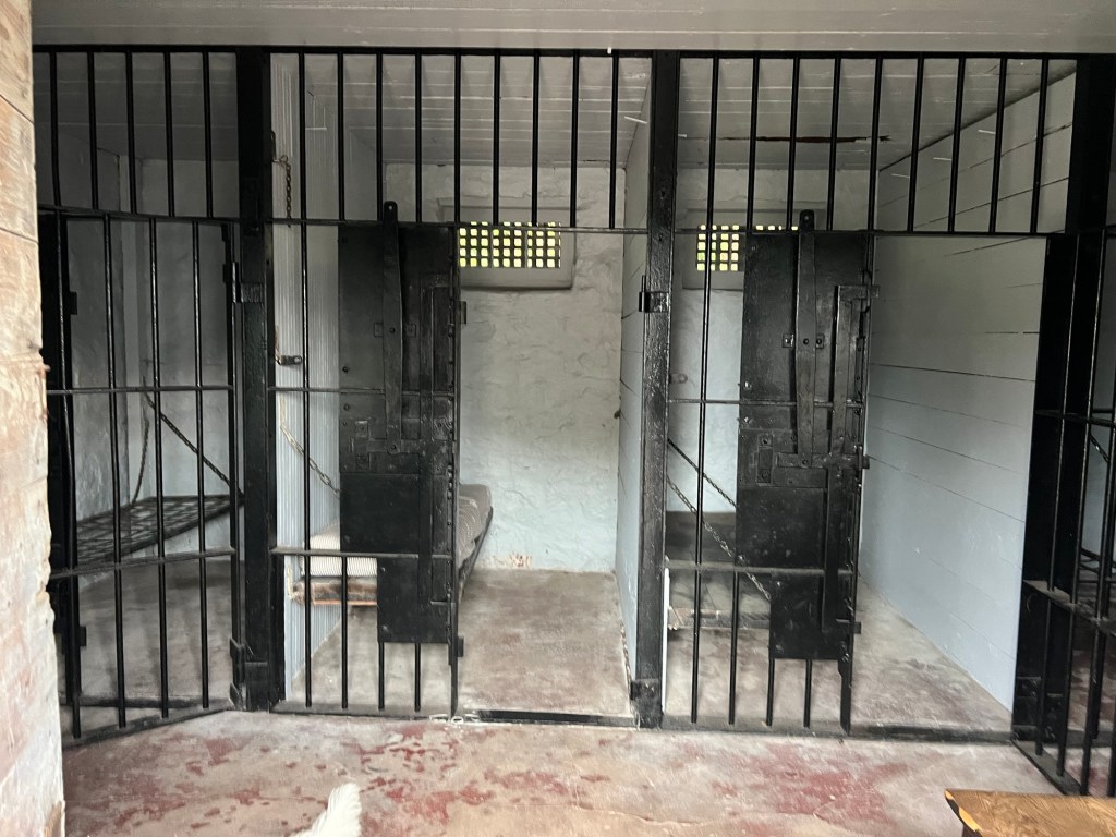
We came back to the parking lot from the other side and saw this building,
the old jail.
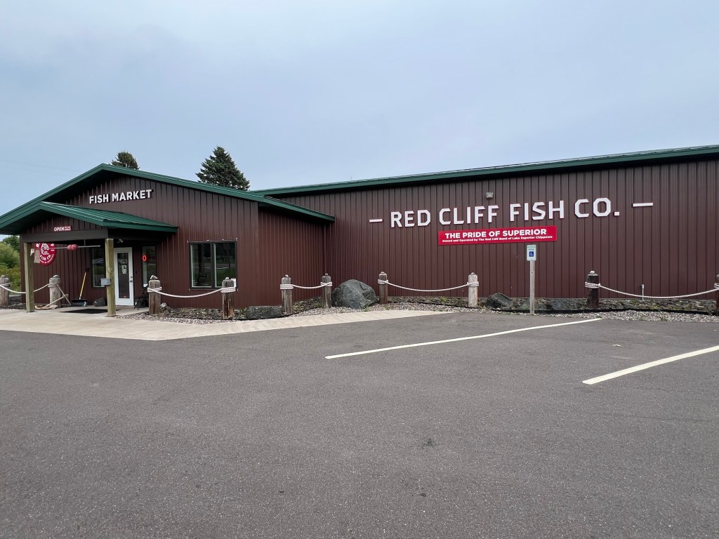
Then we went into the hills to get apples for me and came down to the shore and went to Red Cliff where Bud was able to get smoked whitefish and frozen walleye from the Red Cliff Chippewas, or Ojibways or as they call themselves, the Anishinaabeg. It’s nice to get a taste of a place, as well as taking in the sights.
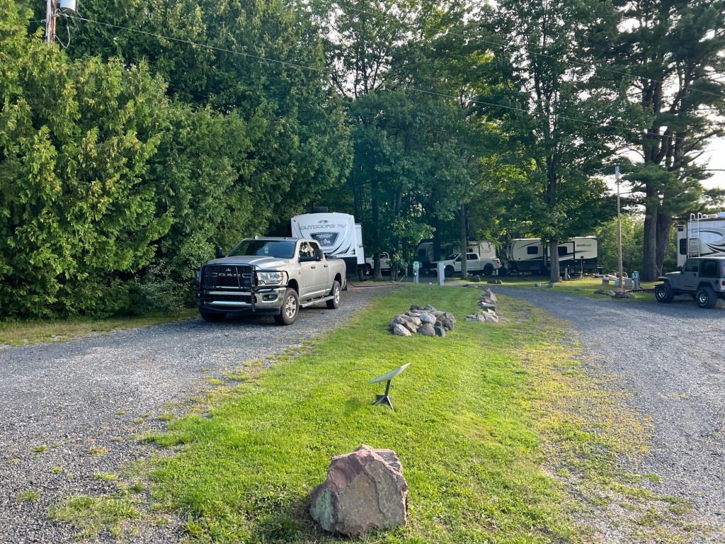
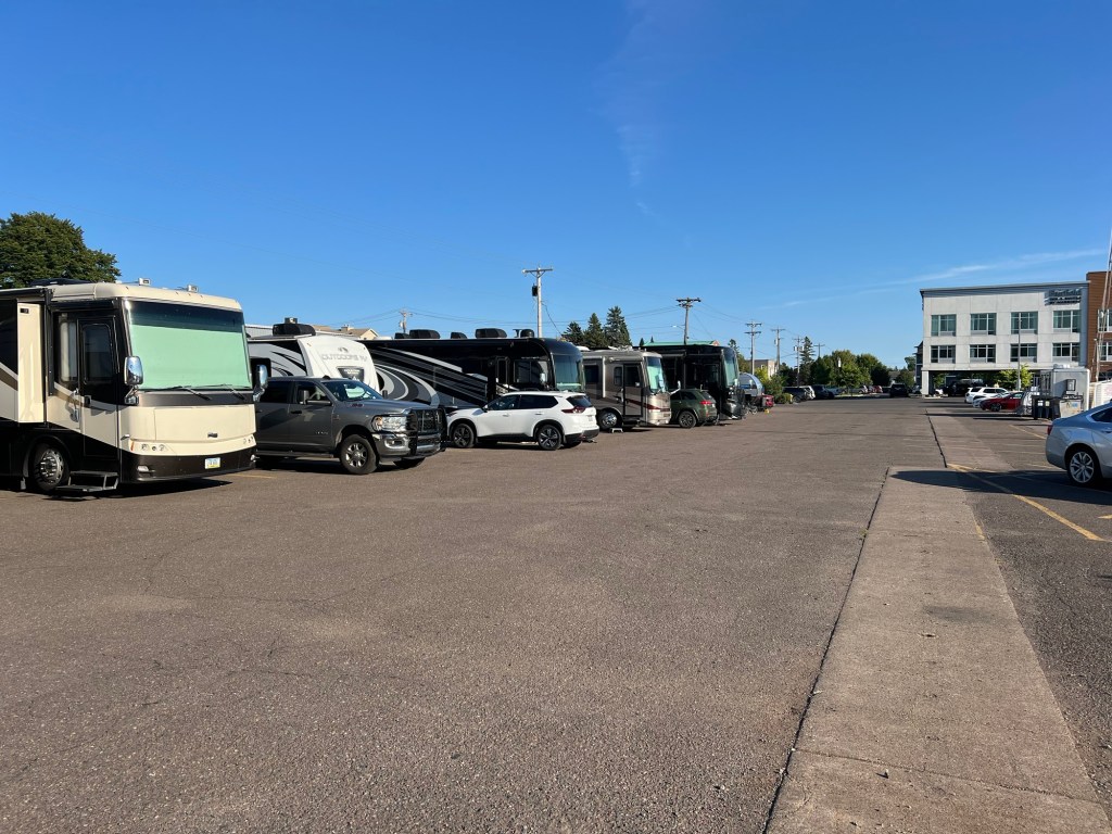
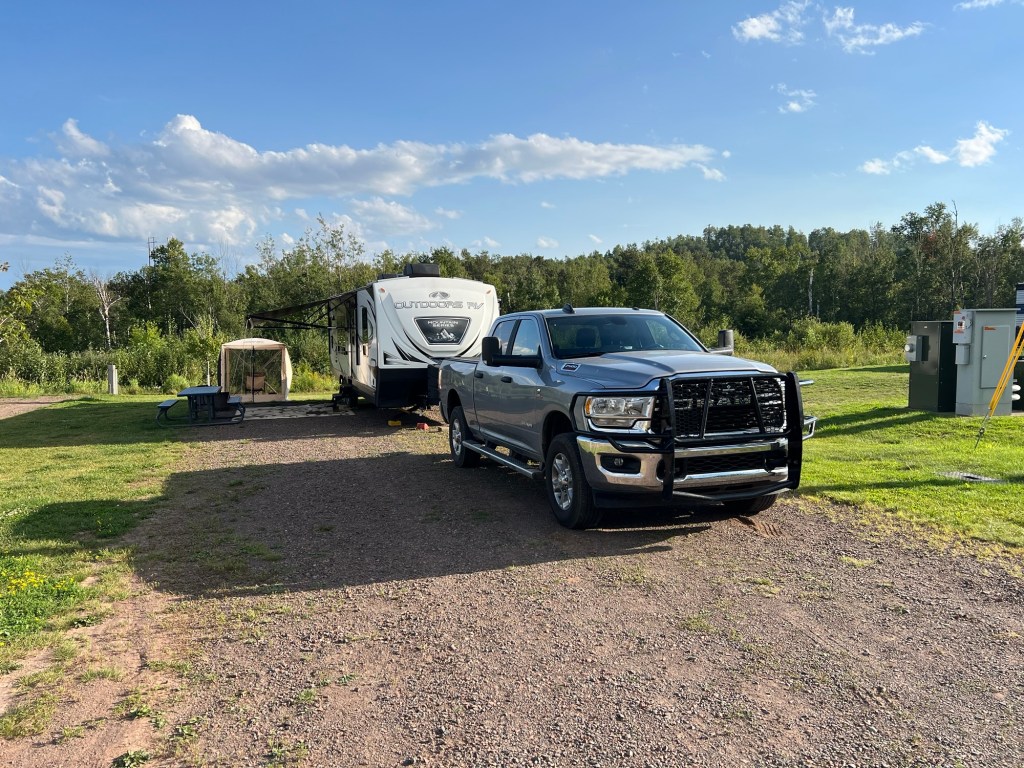
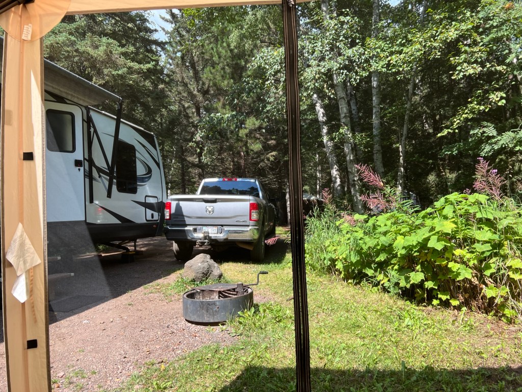
We’re at another commercial campground, but this is a far cry from our parking lot digs.
This is the Apostle Islands Area Campground, just south of Bayfield, WI and, as the name says, in the area of the Apostle Islands National Lakeshore. It is very nicely done.
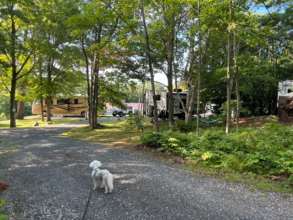
We’re in the old part and the roads and sites are tighter, but we still have enough privacy…
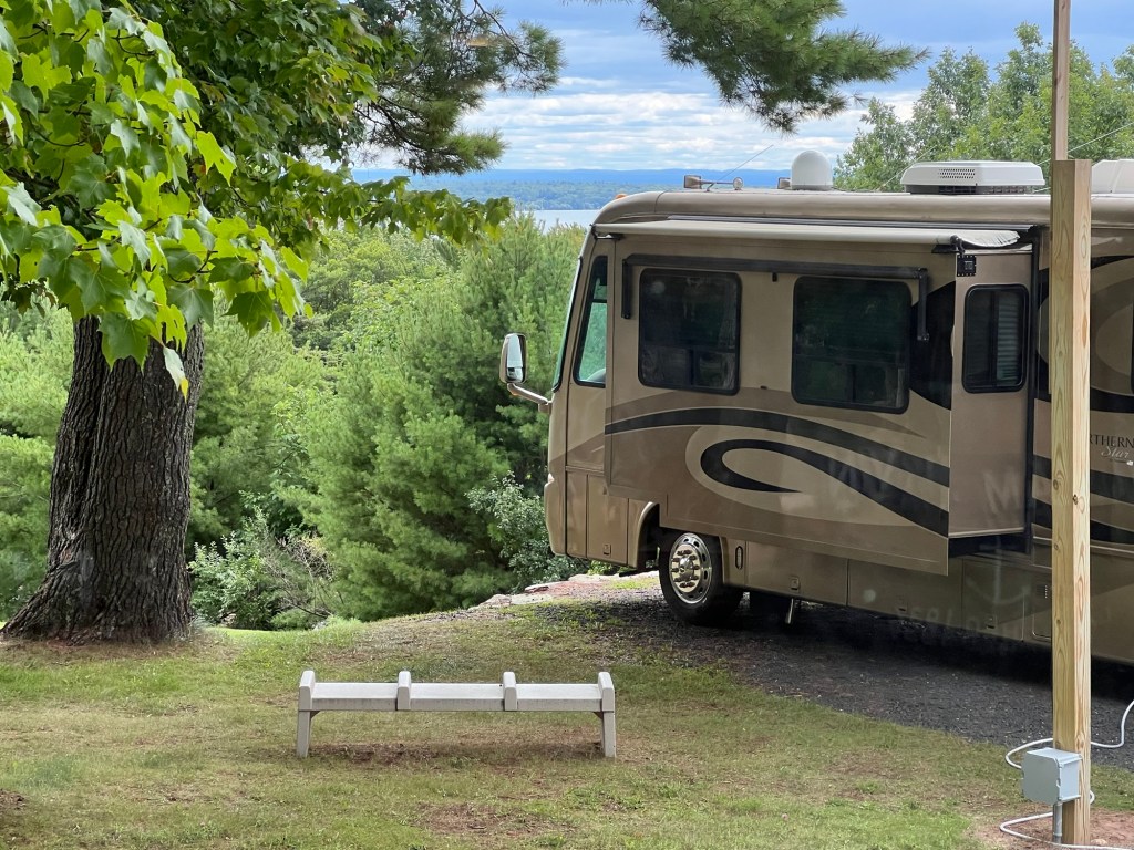
and when you’re standing and look out the dinette window you can just see Lake Superior between the motorhome and the tree across the street. The land past the water is one of the islands. Nice enough.
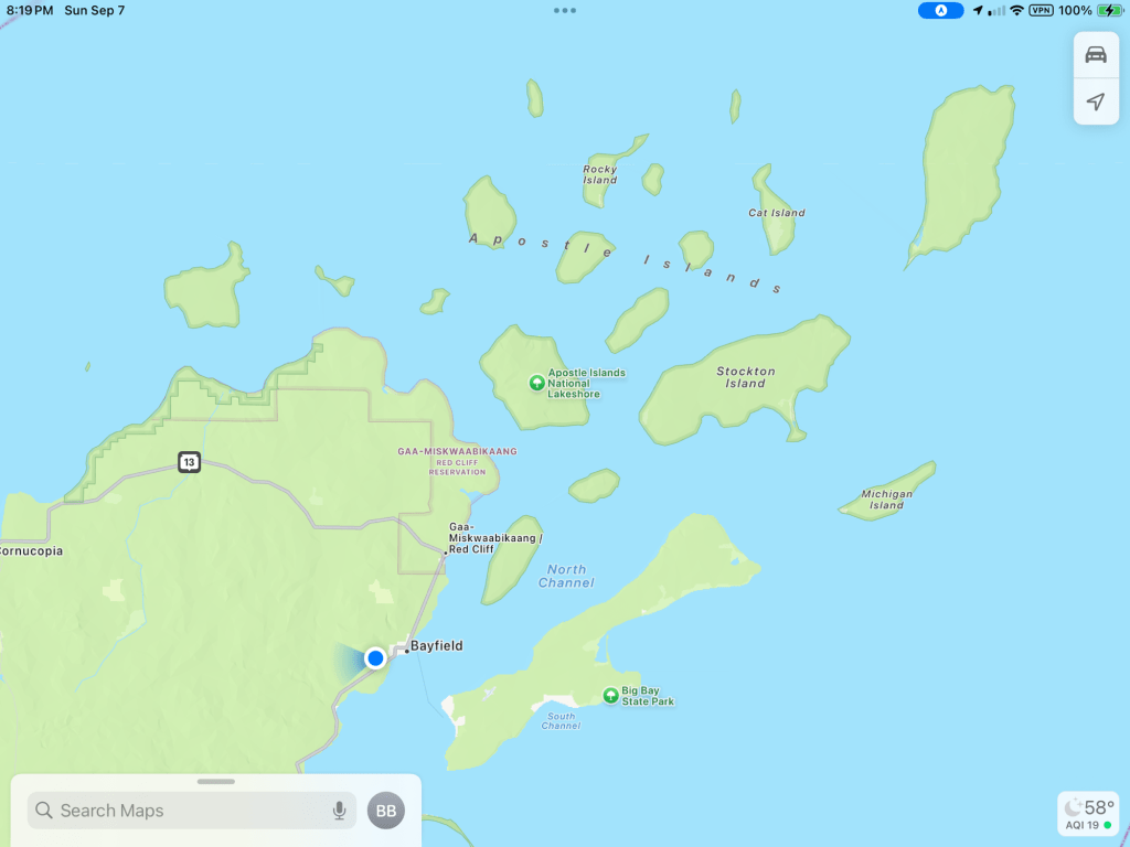
Most of the Apostle Islands National Lakeshore is out on the Apostle Islands and only reachable by boat. There is a little strip of land along the north side of the peninsula we are on that is also part of the National Park. The only national park camping is out on the islands, so we weren’t going there!
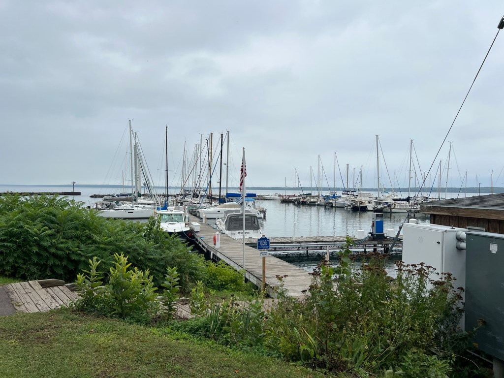
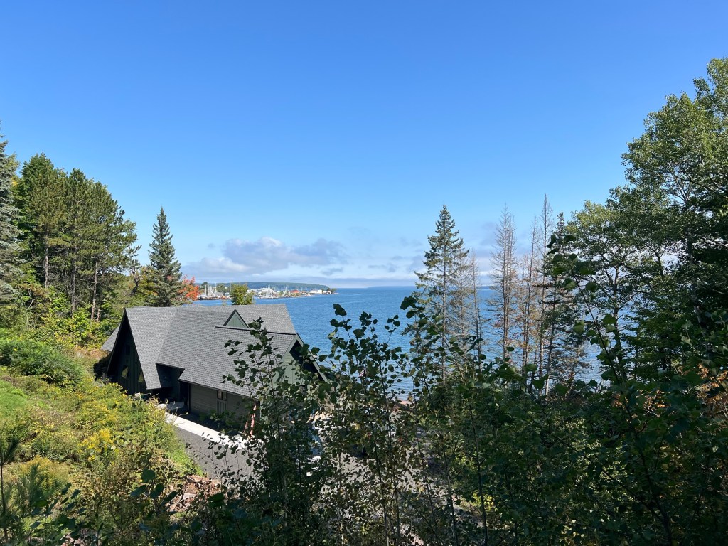
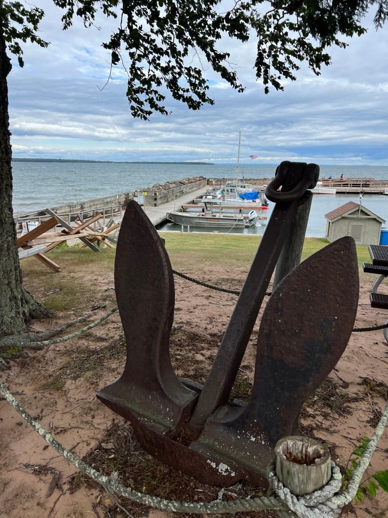
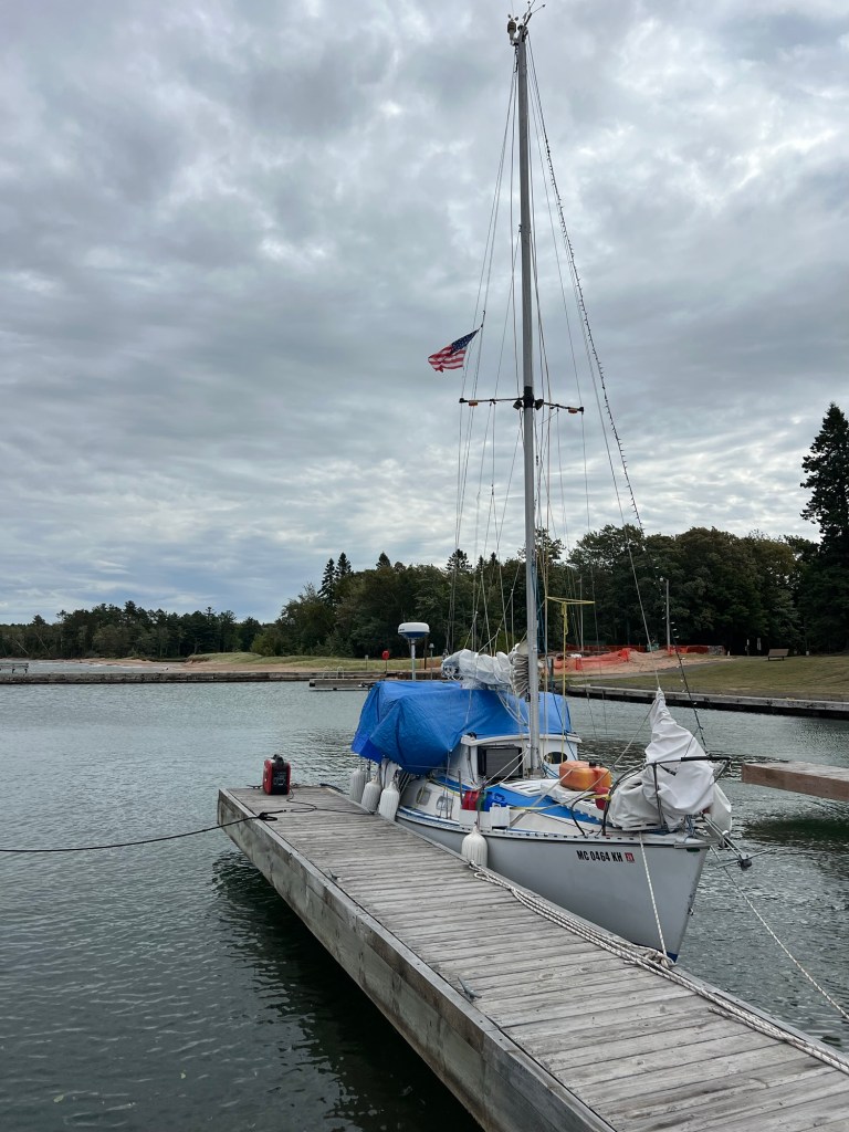
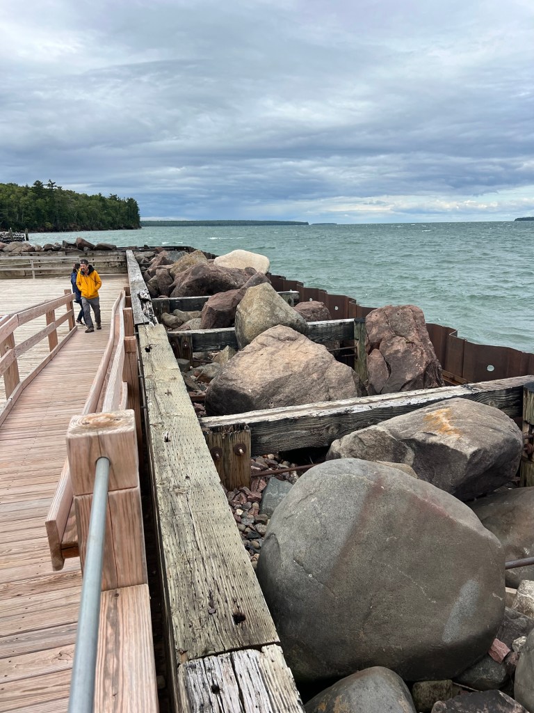
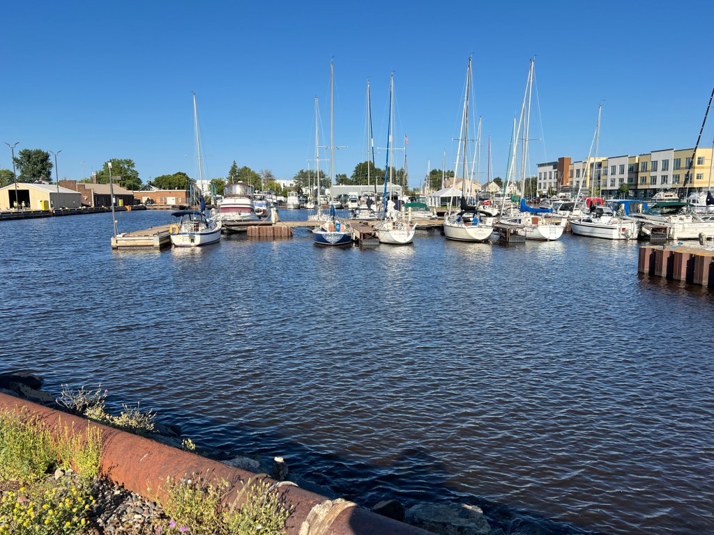
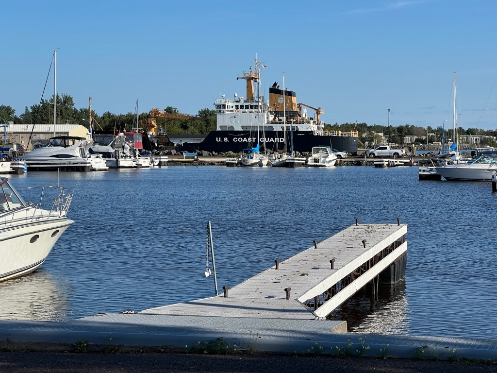
Saturday we took a drive up to the park visitor center on the north shore, about 30 minutes away. There was this very nice little marina there.
This is obviously a live-aboard sailor staying there for $15 a night. No electric, but he has a generator sitting out on the dock. He’ll need it, nights have been getting down to the upper 40’s lately.
It was only about 50 when we were there, cloudy and windy so we didn’t linger long.
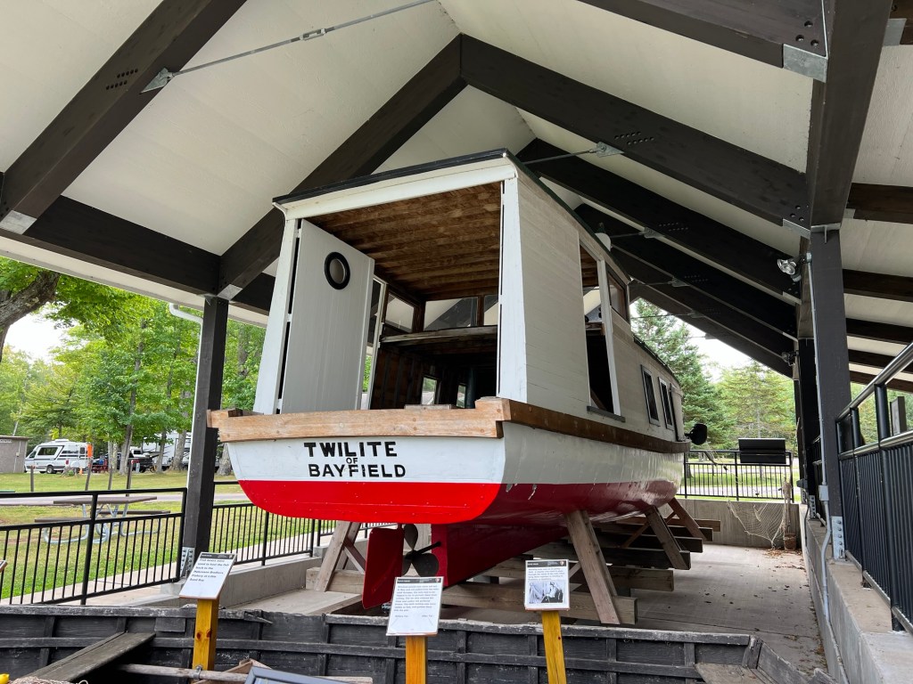
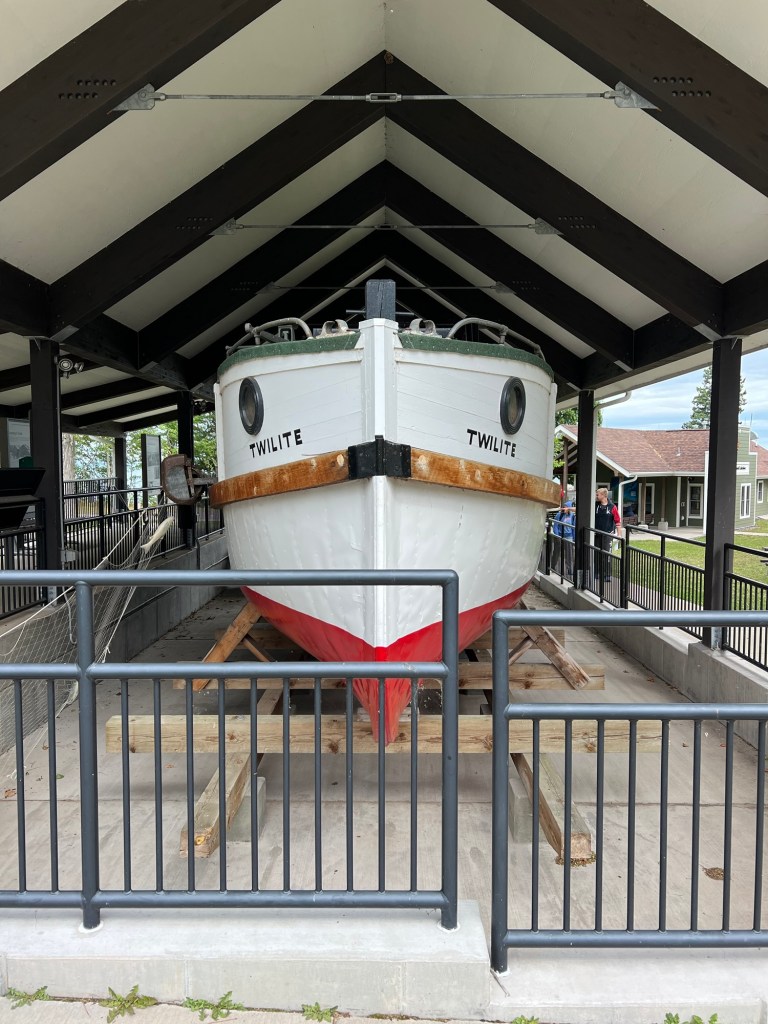
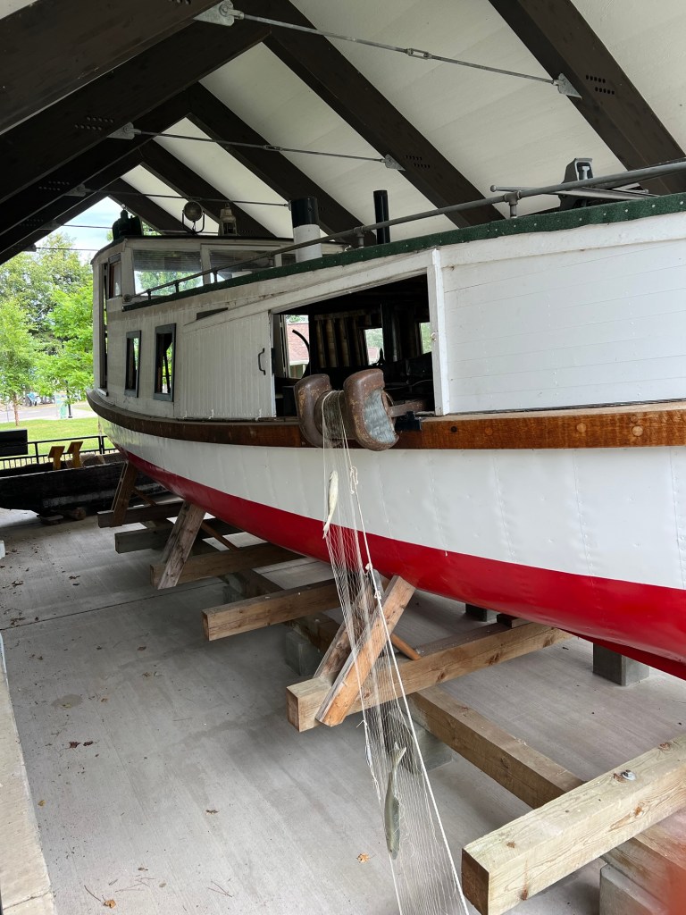
We took the time to visit the display of the fishing boat, the Twilite.
We’ve seen a lot of fishing boats like this on the Great Lakes; they’re covered.
This display showed how they fish off a covered boat. The sides have sliding panels so they can open an area on whichever side they wish to pull in the net.
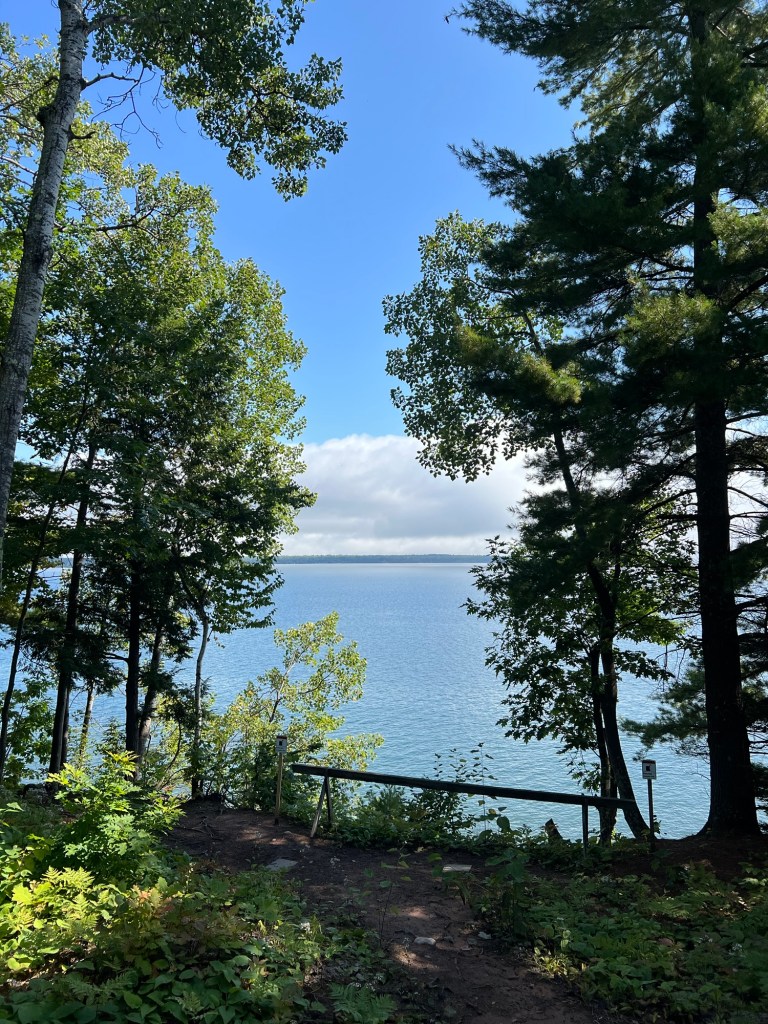
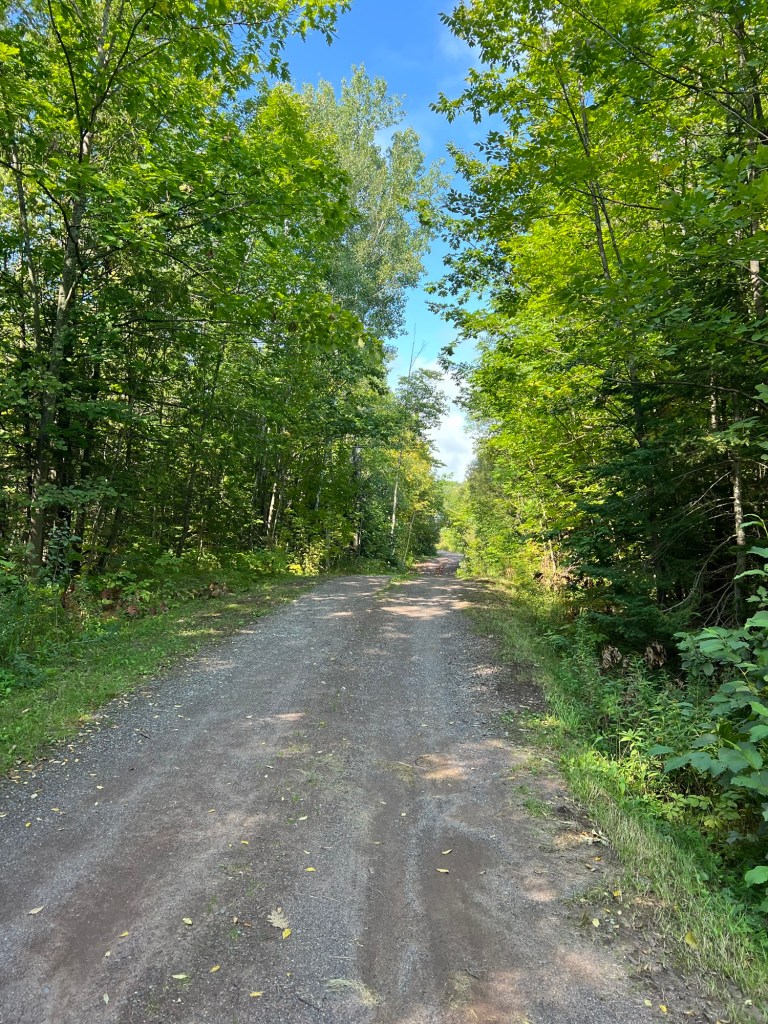
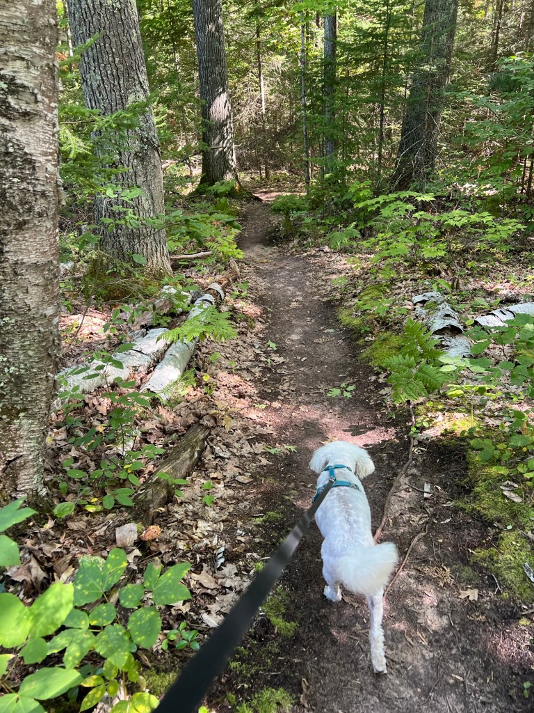
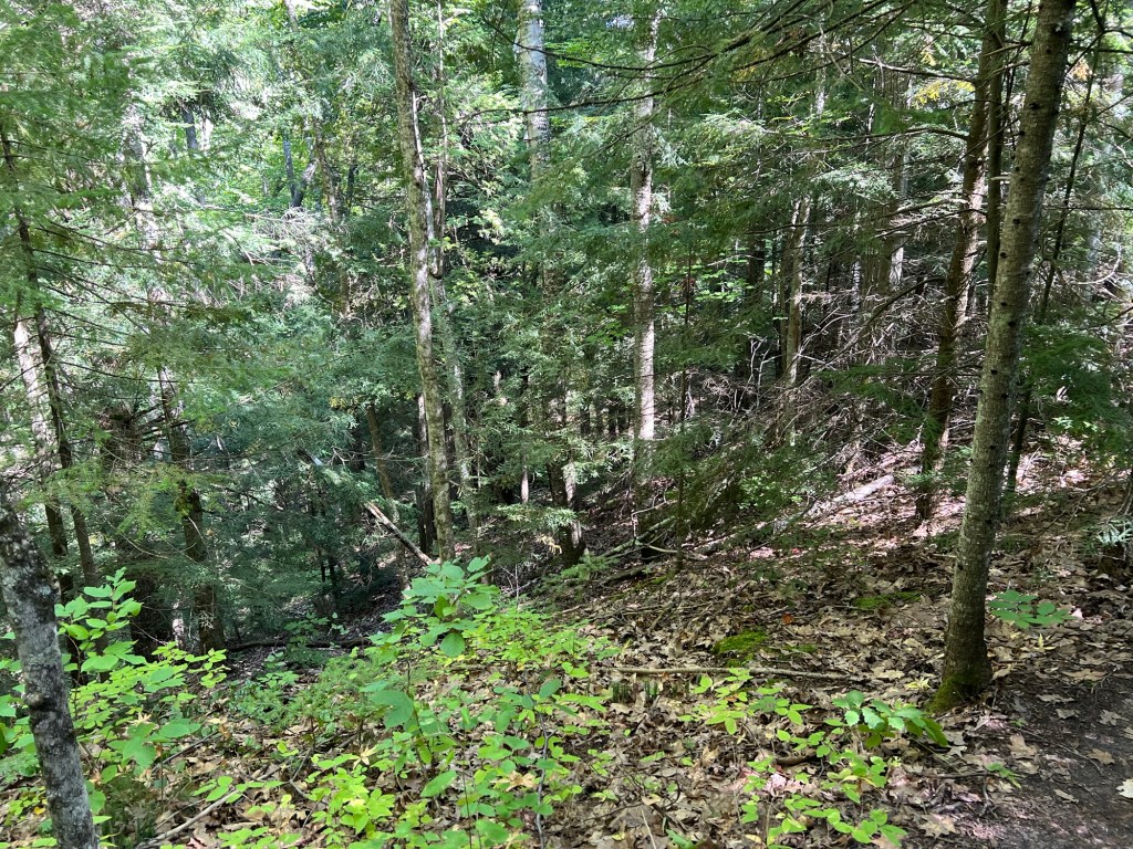
Today it was nicer, less wind, more sun, so we wanted to take a walk. I had found what sounded like a nice trail just a few miles away on the reservation of the Red Cliff Band of the Ojibways.
It was at Frog Bay Tribal National Park, the first Tribal National Park in the United States.
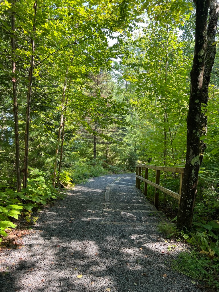
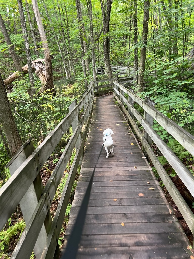
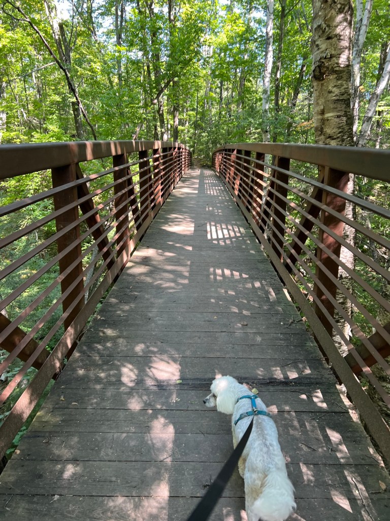
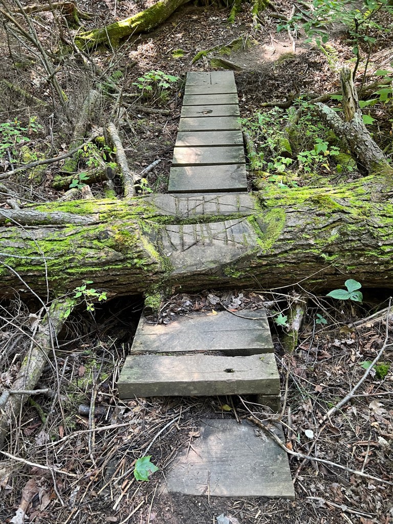
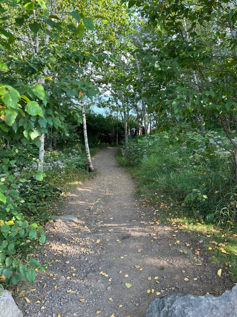
The trail started on a bridge across a ravine.
It was easy to follow…
and had just enough structure to protect you from mud and the forest from compaction. I liked the way they modified these fallen trees rather than removing them.
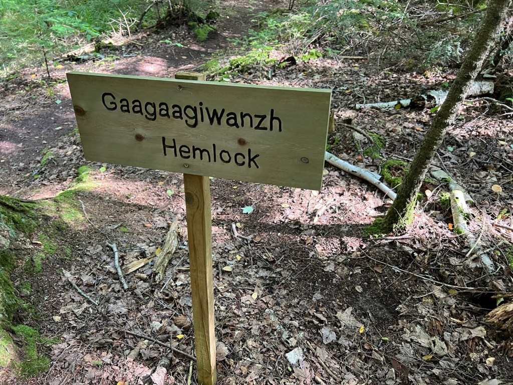
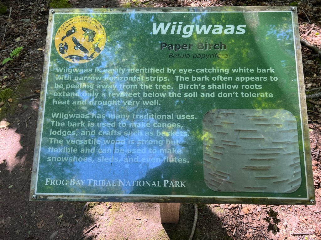
But best of all they had trees labeled in Anishinaabeg as well as English. Many of the signs were hand carved,
but some were printed signs with more information.
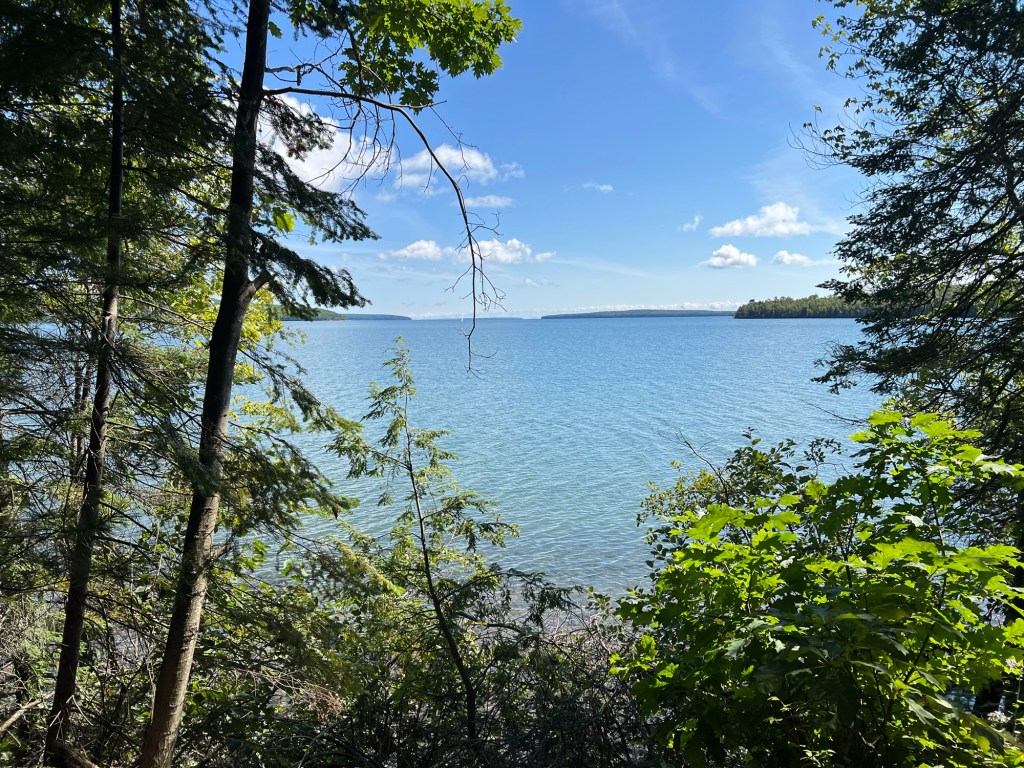
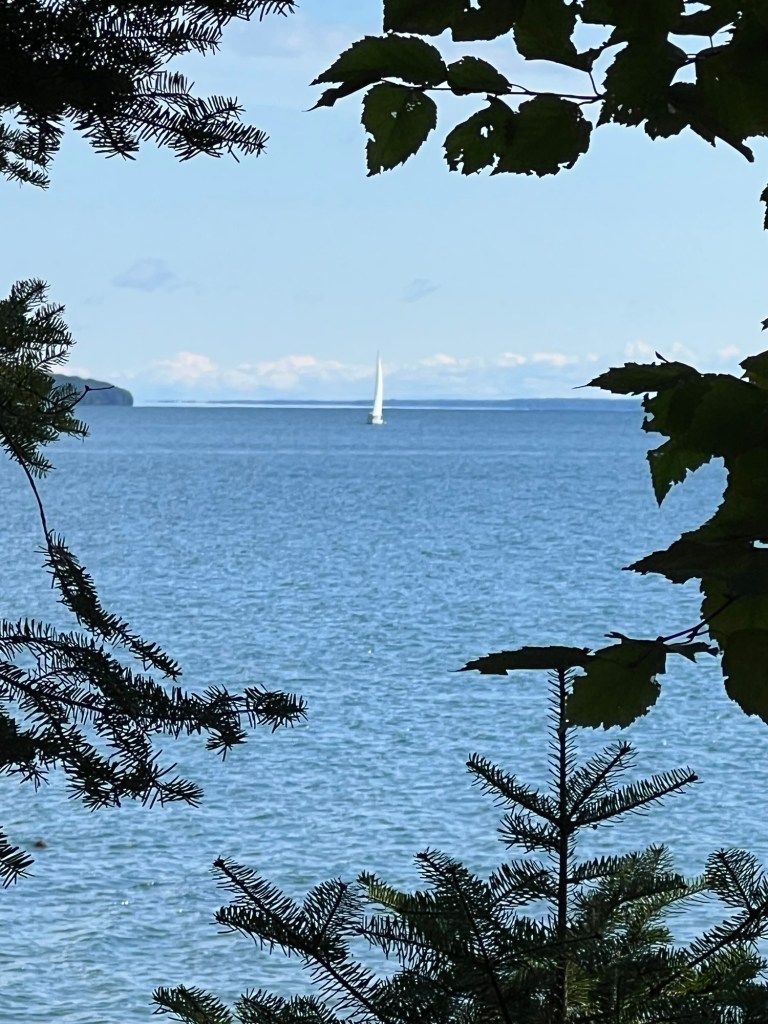
After a nice meander through the woods…
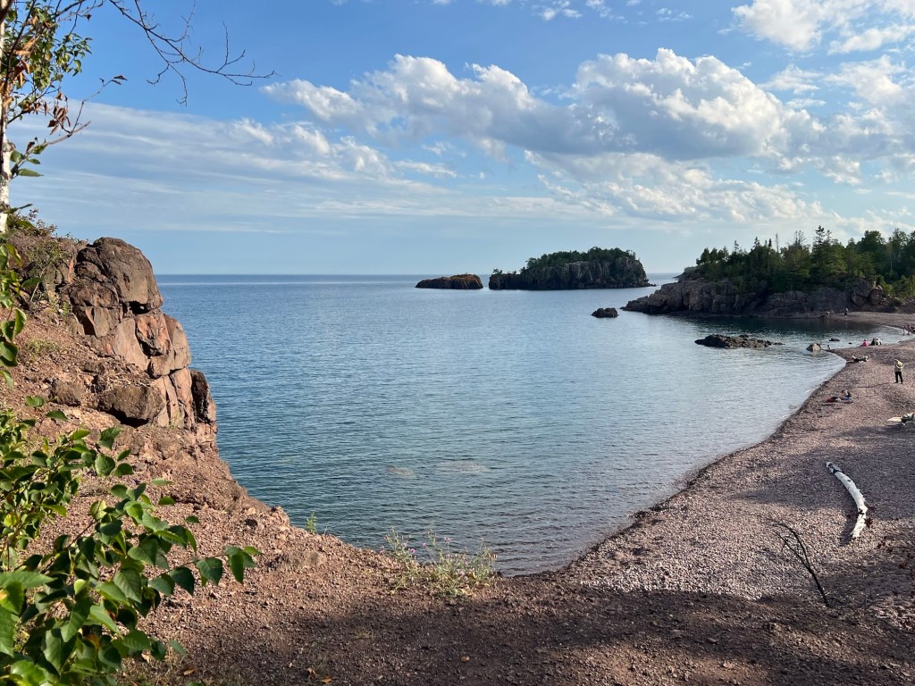
we came to the edge of the lake.
There was a sailboat out there among the islands.
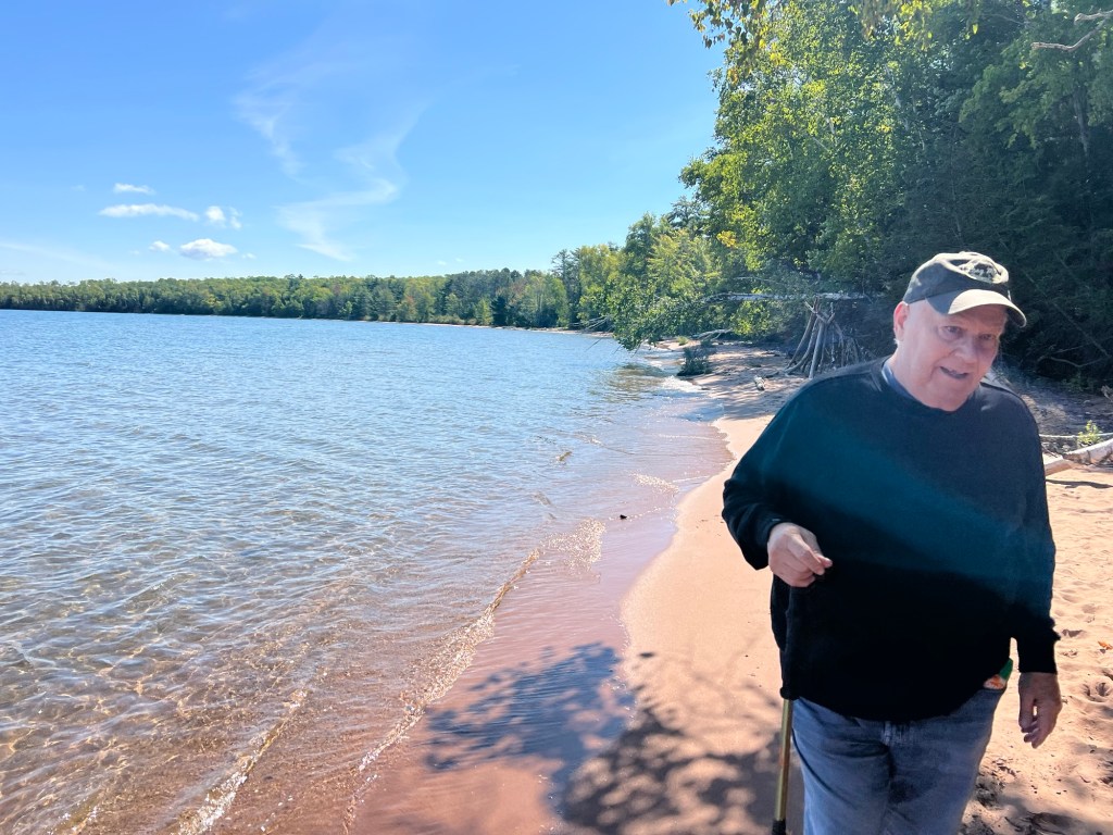
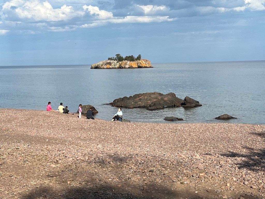
The trail led to this nice little beach.
You could see a number of the Apostle Islands just offshore.
There was a bench and we sat and enjoyed the view for a bit and then looped back to the parking lot on a more direct dirt track. What a lovely discovery.
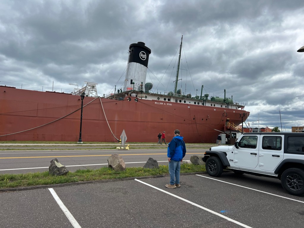
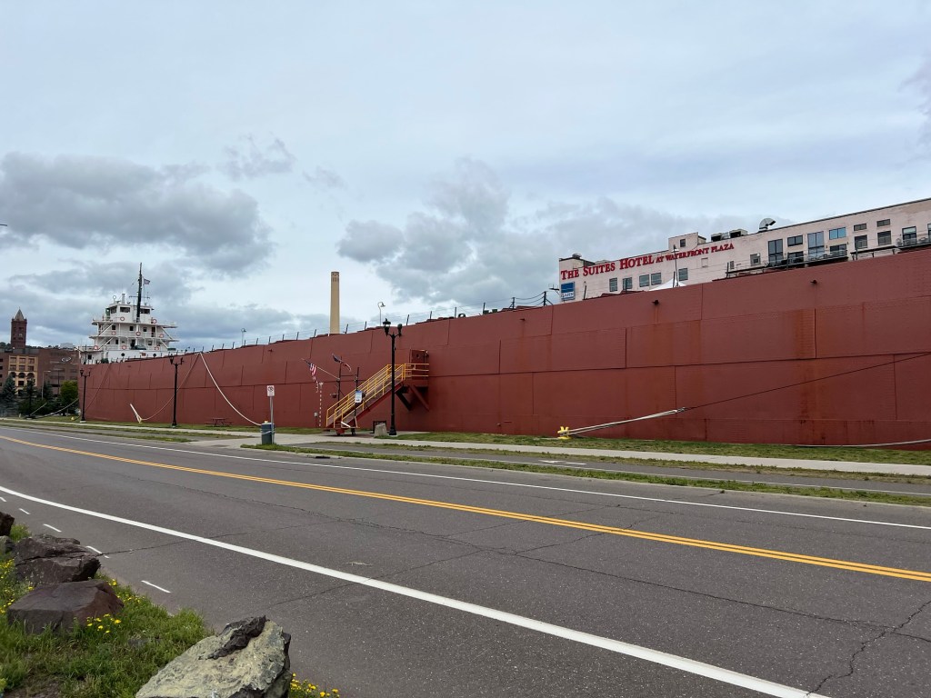
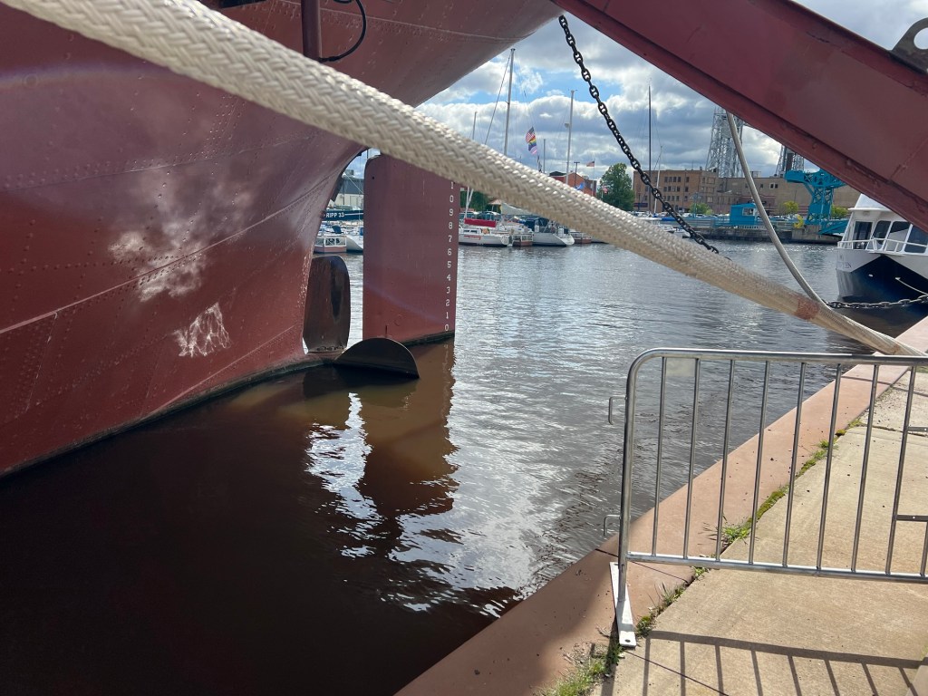
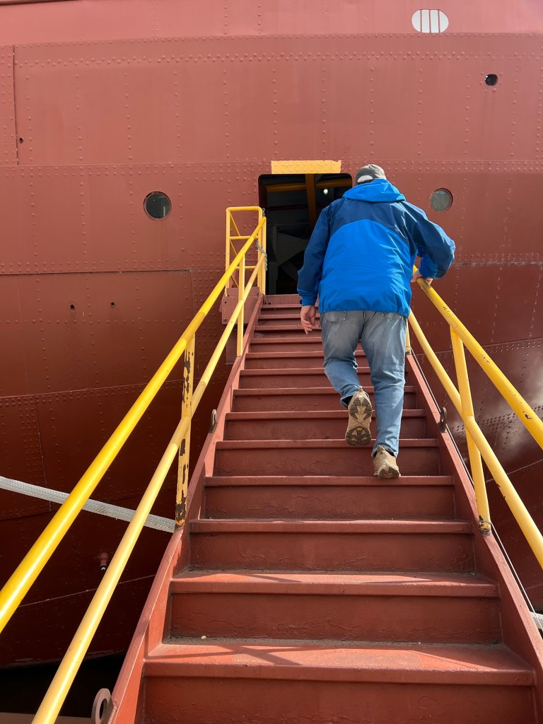
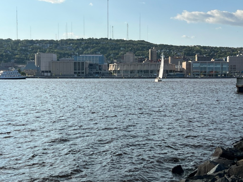
Thursday was our last day in Duluth and it was chilly and drizzly, so it seemed like a good day to tour the William A. Irvin, a retired bulk carrier owned by the city and berthed just across the canal from our parking lot campground.
She was built for US Steel in 1937 and when she was launched in 1938 she was the biggest ship on the Great Lakes at 610 feet long and 60 feet wide. She was named for the president of US Steel at the time, William Irvin.
Her last voyage was in December of 1978, hauling a small load of coal from Sandusky to Duluth. Although many of her crew expected to be back aboard in the spring, the move in December from the unloading dock to the Fraser Shipyards where she was prepared for winter was the last time this 15’ 6” propeller drove her through the water. (In use there would be enough weight in her hold to sink the hull to the point where the entire propeller was underwater.)
Since then when she has been moved in the harbor tugboats have moved her. And recently when she was taken to a shipyard to have her hull refurbished, front end loaders inched her out of her slip, as there is only 15 inches to spare in the gate through which she must exit. The docent said she made it out and back without a scratch. Good thing they have tugs and front end loaders, as this huge ship has just a single screw and no thrusters!
Although she is massive, she was retired when USS launched its first 1,000 footer. And so she became a tour boat.
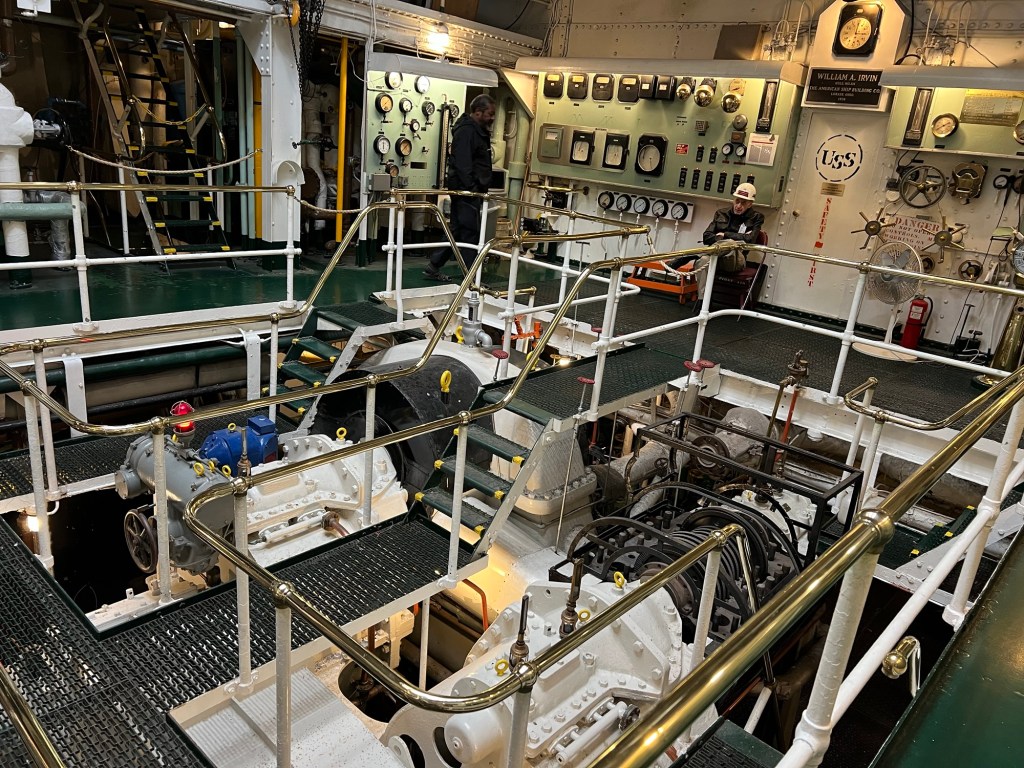
The tour starts near the stern in the engine room, where you can see her two coal fired steam engines. They burned 1.2 tons of coal per hour and generated 2,000 horsepower.
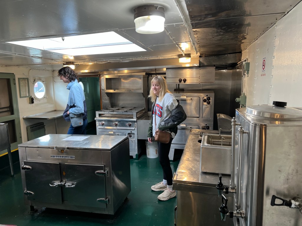
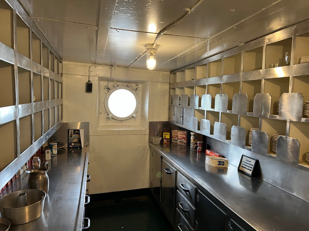
Also in the stern are the main galley,
and the pantry.
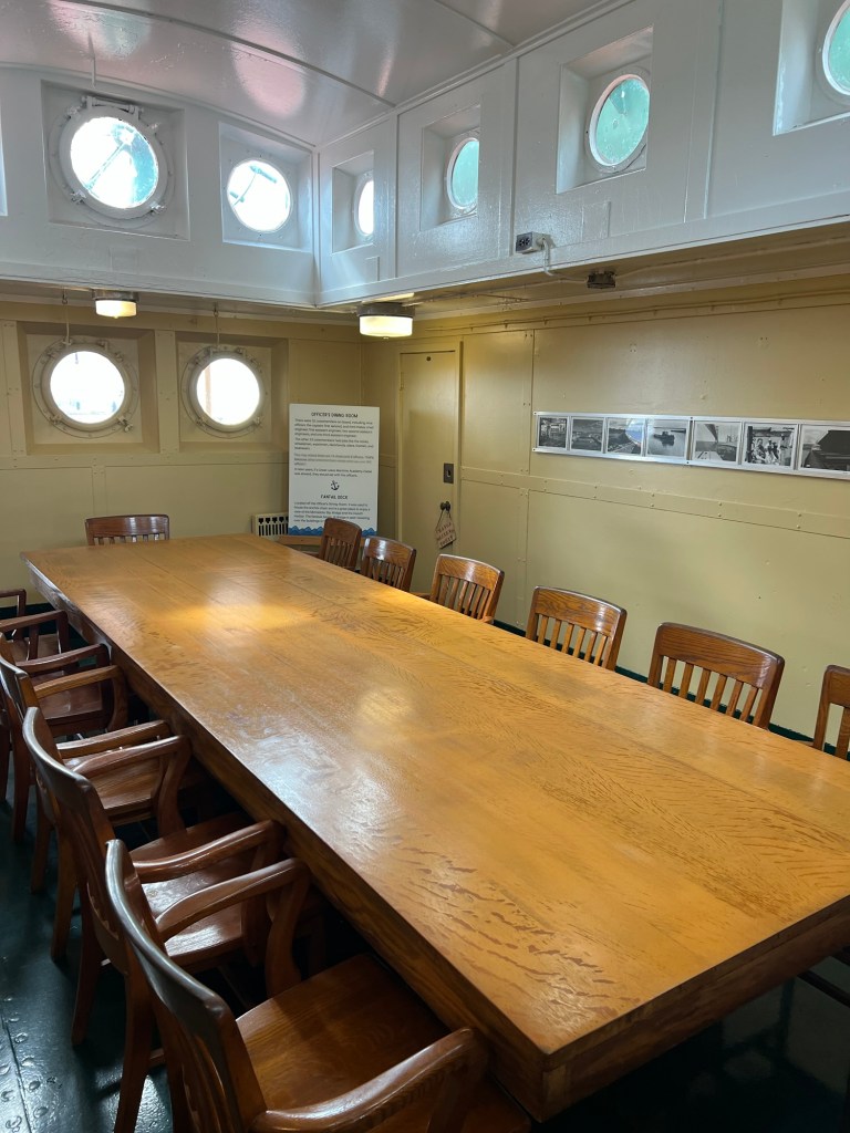
The Irvin carried 9 officers and 22 crew. This was the officers dining room in the stern.
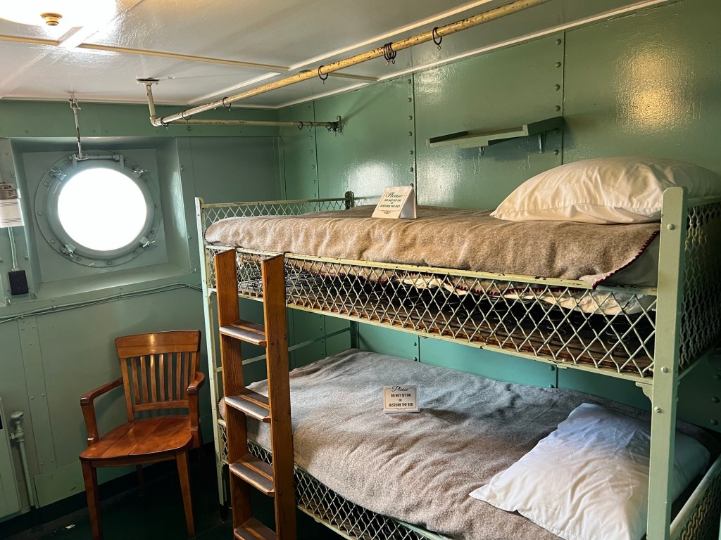
And this was one room of the crew quarters.
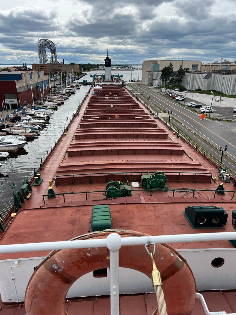
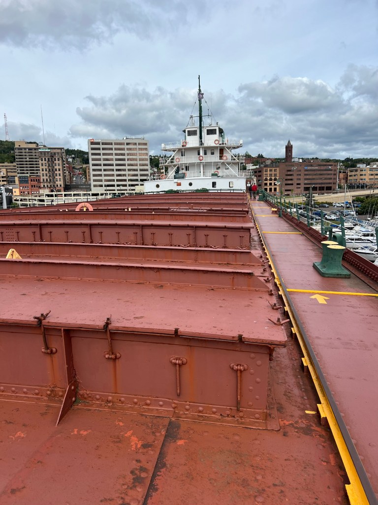
Walking up to the bow and looking back you really got a sense of the size of this ship. She was the flagship of the USS fleet for many years. She was one of the first ships to be welded, not riveted. She was also one of the first ships to have below deck passages from bow to stern so in bad weather the crew didn’t need to walk on the deck.
In 1940, using the new Hulett cranes on the shore, the William A. Irvin set a record that still stands by unloading 13,856 tons of iron ore in 2 hours and 55 minutes. Ships are now self unloading, which requires no machinery on shore, and they can unload somewhat faster than that record, but no ship without self unloading has ever beat her record.
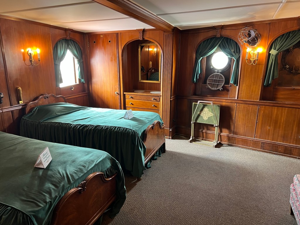
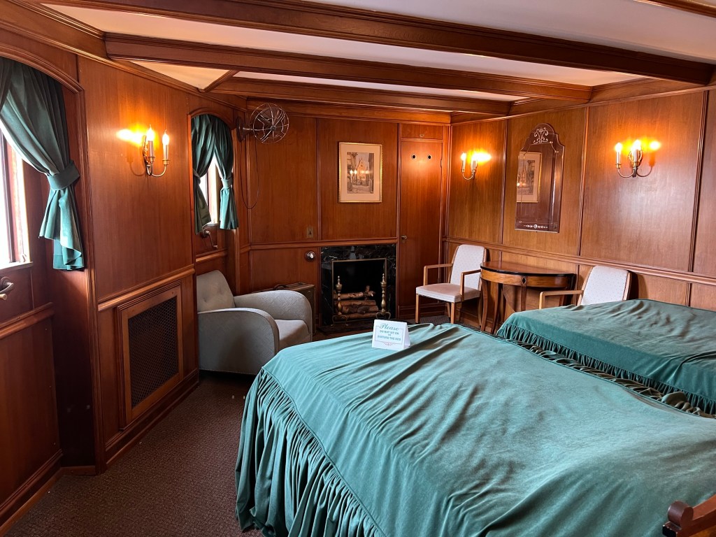
The Irvin was also unusual in that she had three decks to her bow cabin, not the usual two.
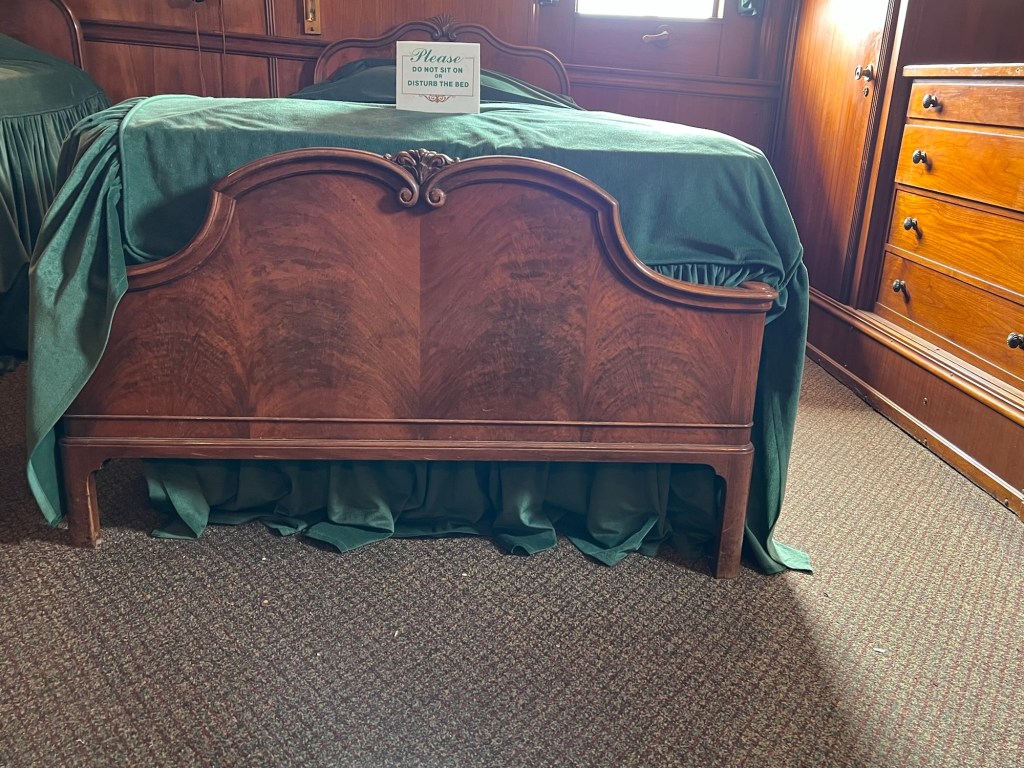
The added middle deck accommodated four guest cabins,
with electric fireplaces.
Since the decks are cambered for strength, the legs on the beds were different lengths to fit the camber.
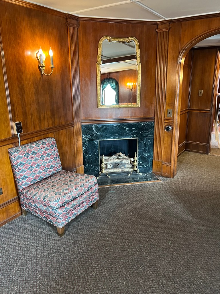
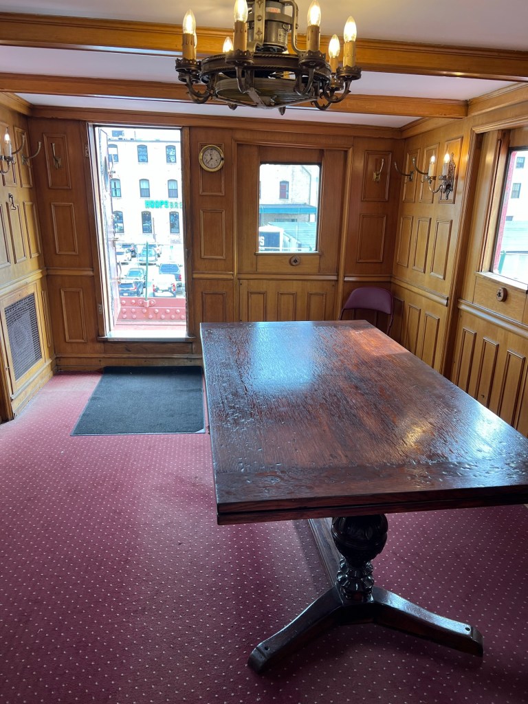
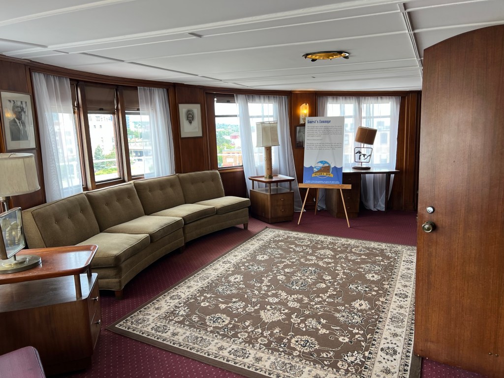
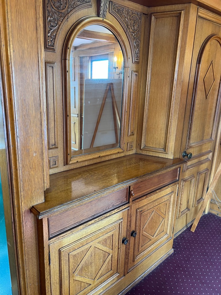
There was a dining room…
and a lounge.
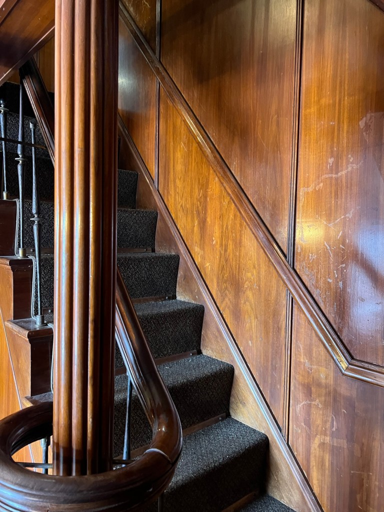
It was all done in oak and walnut veneer.
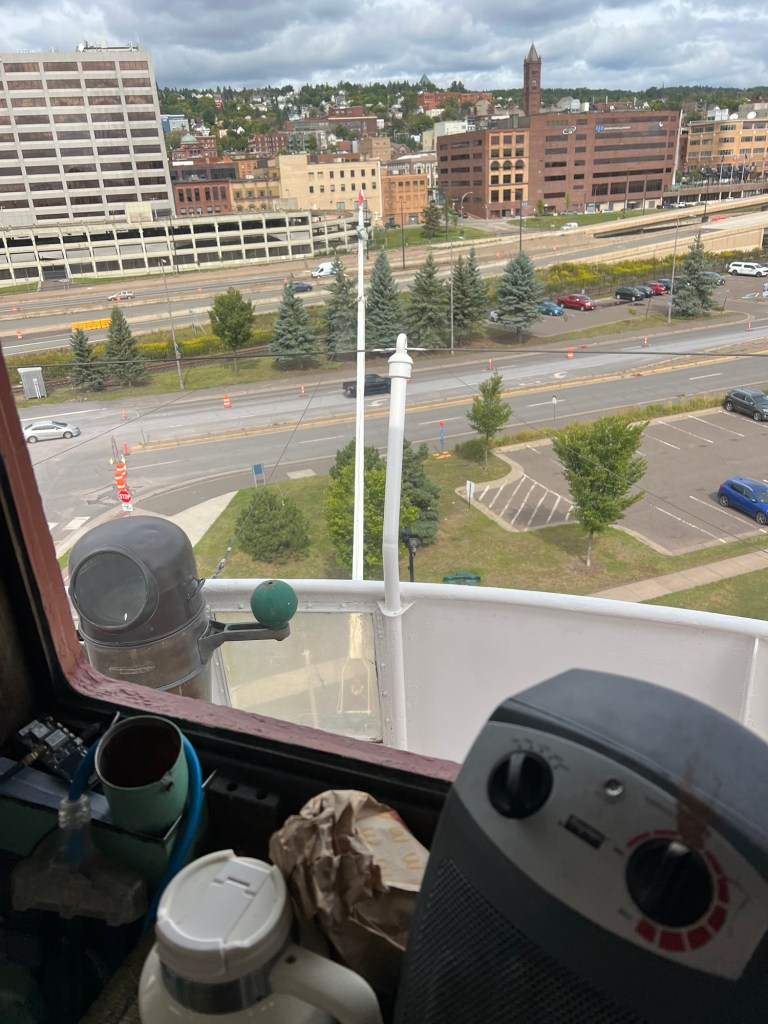
Going up to the top deck…
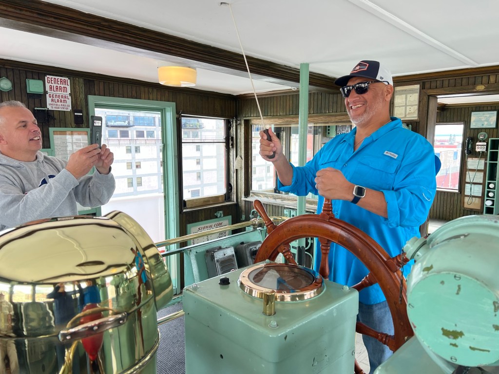
you find the wheelhouse. There were four retired navy men who were visiting and obviously enjoying the nostalgia. The docent explained that since this wasn’t a navy ship it was a wheelhouse, not a bridge. You had a wheelman at the wheel, not a helmsman at the helm.
The cabin and its wheelhouse were at the very front of the ship. I asked why now all the lake freighters have the wheelhouse in the back. The docent said that’s because of radar. Without radar you need the captain and the wheelman right at the front so they can see obstacles in the fog. With radar, it’s cheaper to build everything in the stern, where the engine and engine room and most of the crew have to be. And you don’t need to go between the bow and the stern anymore.
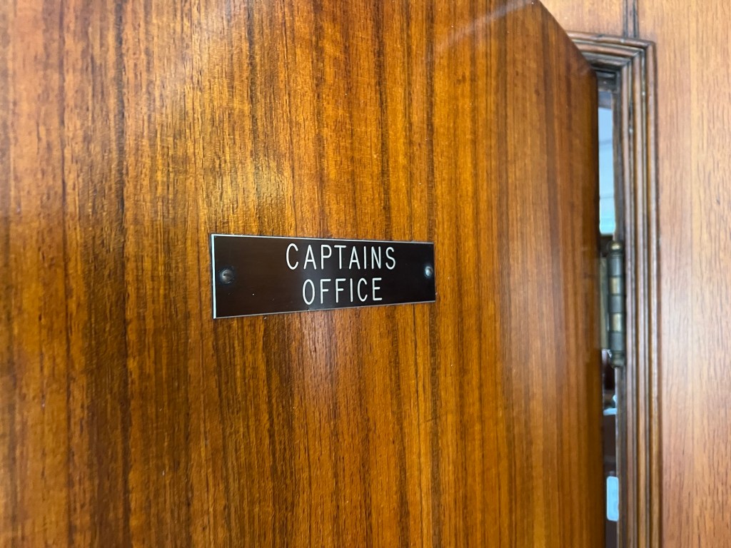
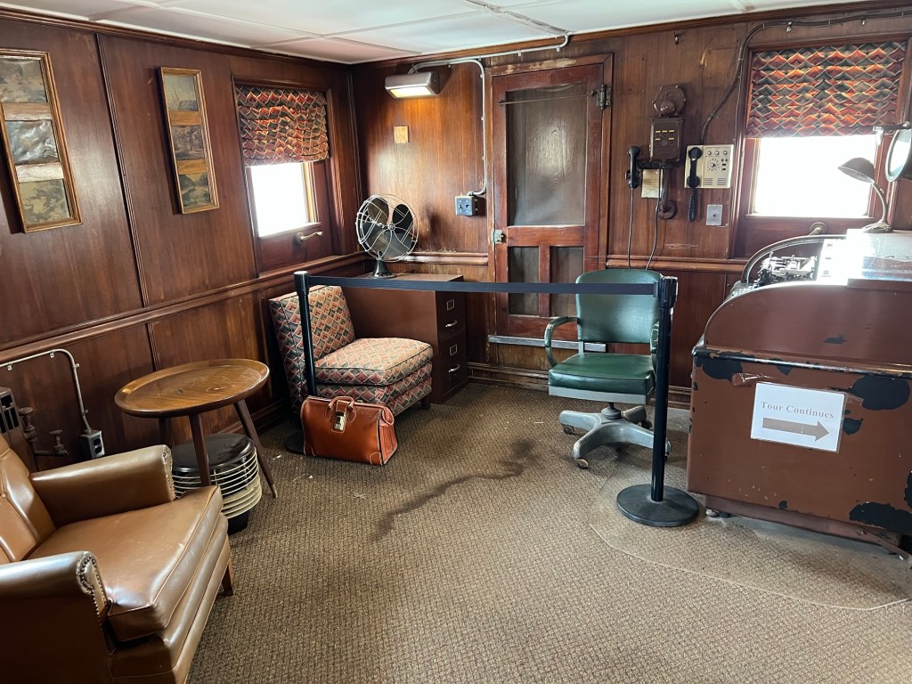
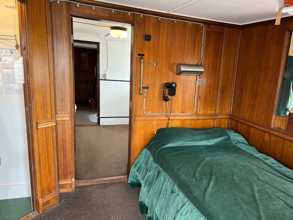
On the Irvin the Captain’s office,
which we walked through,
and his quarters are on the top deck of the bow cabin, just behind the wheelhouse. I noticed the phone on the wall behind his bed so he can always be reached at a moment’s notice.
That was a fun tour, and with accommodations like this I would have loved being a guest back when she sailed!
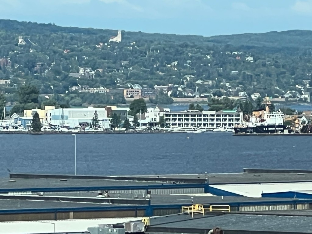
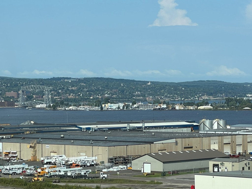
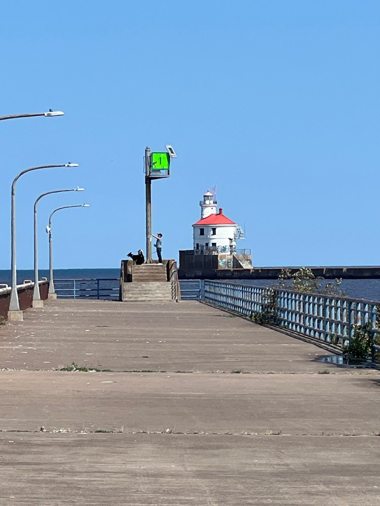
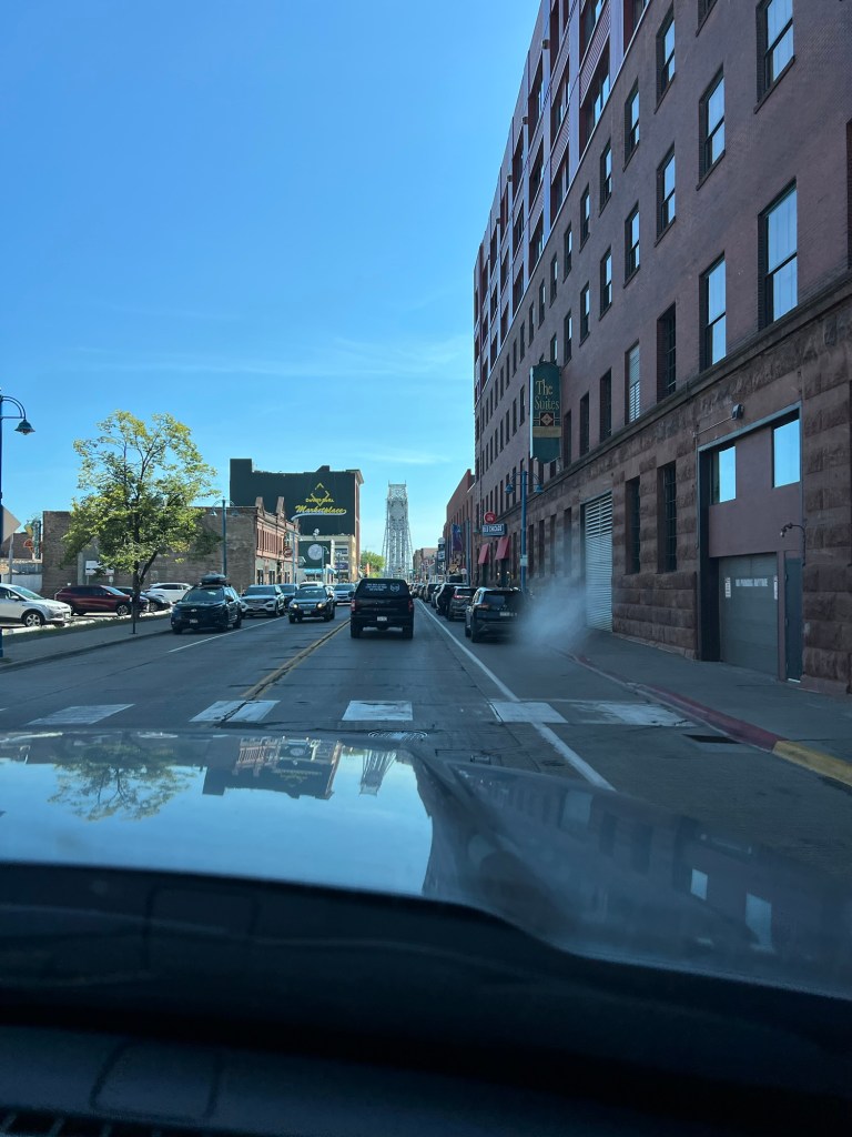
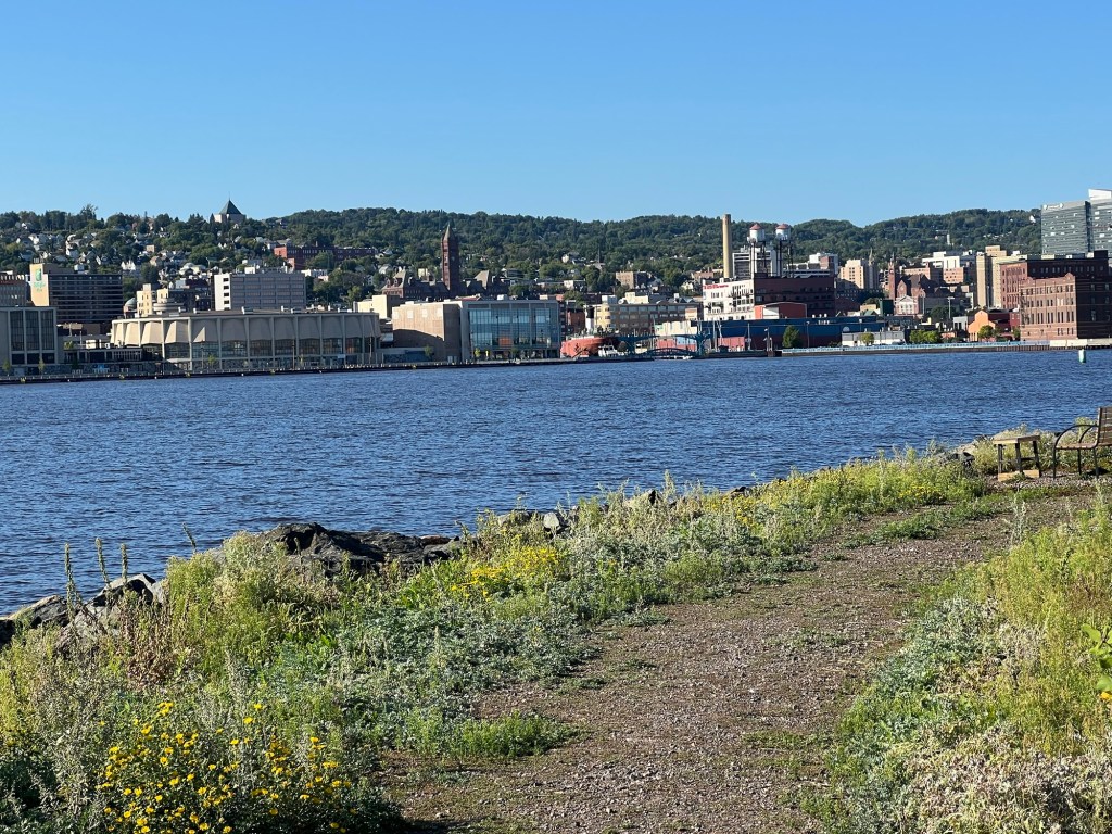
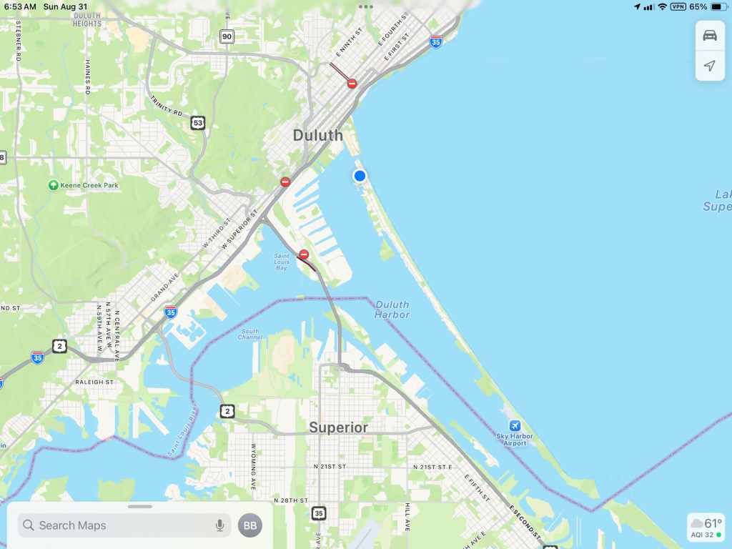
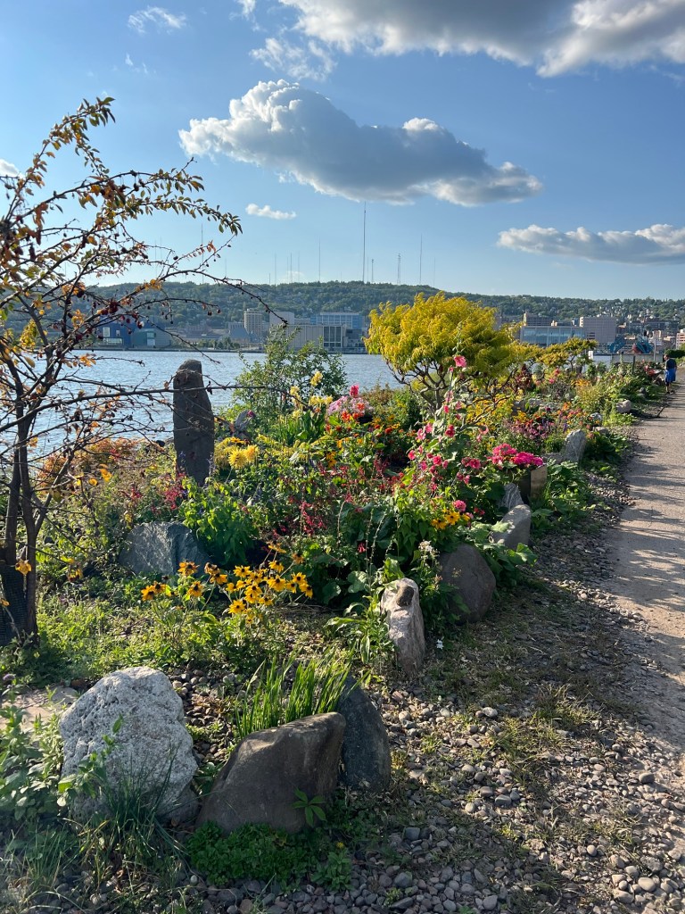
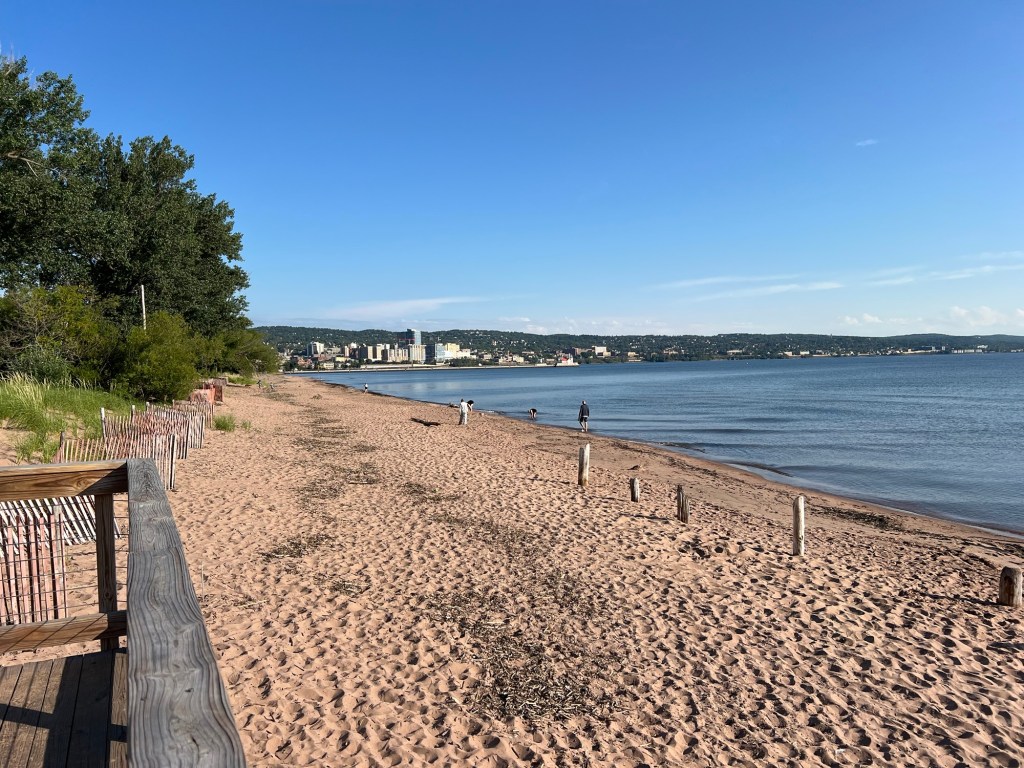
There are two cities here, Duluth, MN, along the side of this ridge,
and Superior, WI, which occupies much flatter land to the east.
They share this huge harbor,
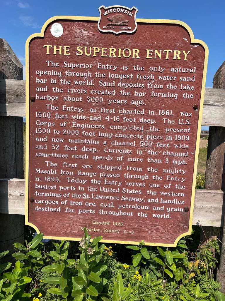
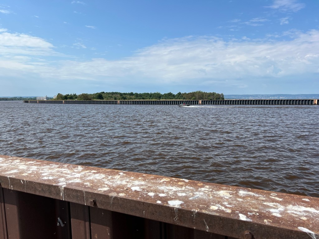
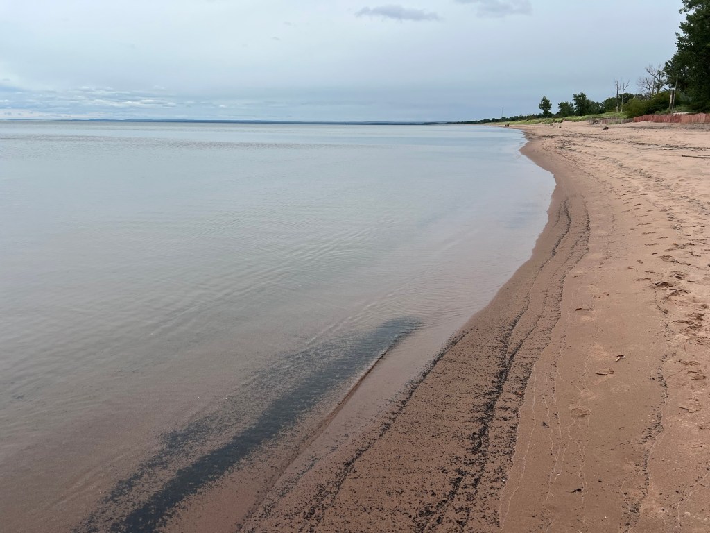
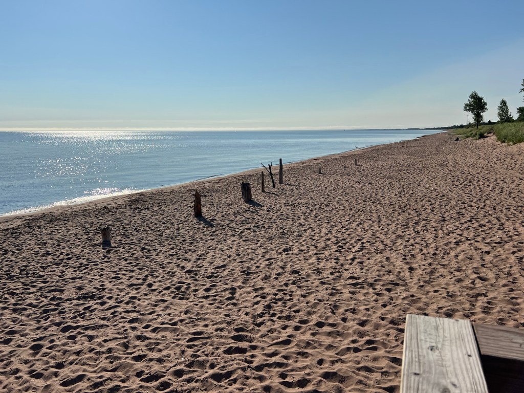
which is formed by the longest fresh water sand bar in the world. We are staying on the western end of the bar, Park Point, Duluth. The other day we drove around to see the eastern end, Wisconsin Point.
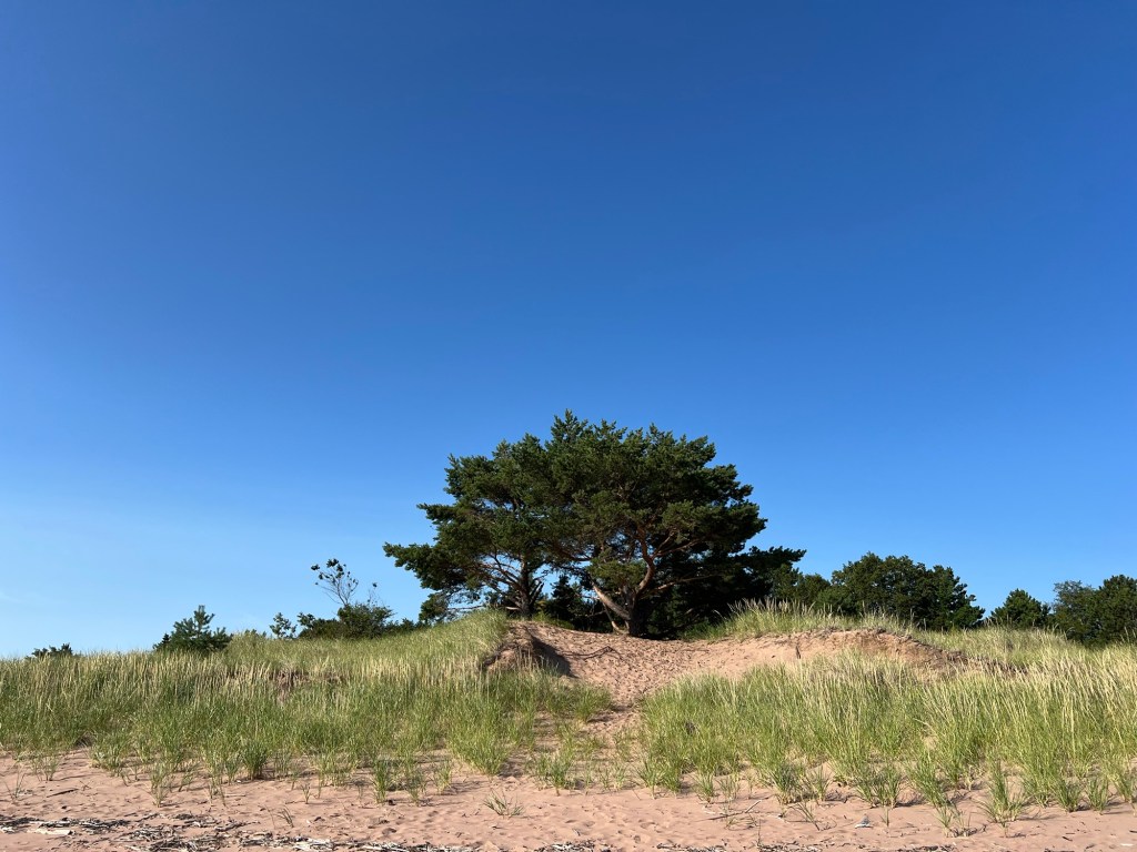
This end has no houses, just beaches, and I was surprised to find a white pine woods.
The cut here is unbridged. This is the only natural entrance to the harbor.
It does have jetties and lights and is navigable. Before the Army Corps of Engineers added concrete piers and jetties the entrance was shallow and difficult to navigate.
Today I took a picture of the sand bar from our western end of the beach. If you enlarge it and look closely you can see the white lighthouse at the natural opening way out on the arc of the bar.
Duluth wanted a canal on their end of the bar, as the natural entrance favored Superior. The canal was dug in the fall of 1870 and finished in the spring of 1871. The Army Corps of Engineers warned that the change in water flow made by the canal might harm the natural entrance. Duluth went ahead and started digging. Superior filed an injunction. The digging moved faster than the courts; the first boat went through the canal on May 6, 1871 and Superior’s suit was heard in June. As things turned out, the canal did not harm the natural entrance, but it did provide a more direct entry.
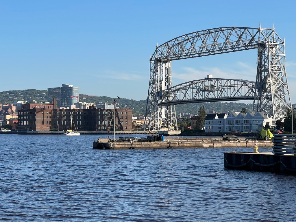
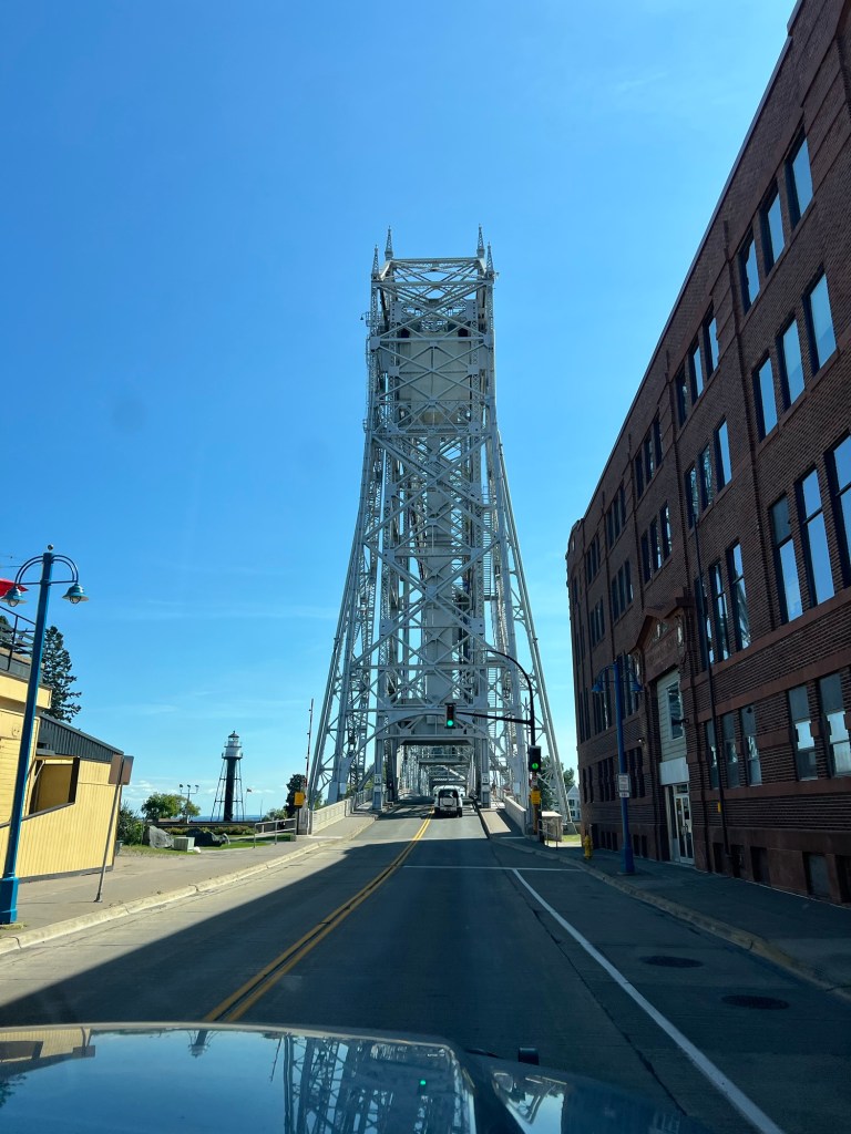
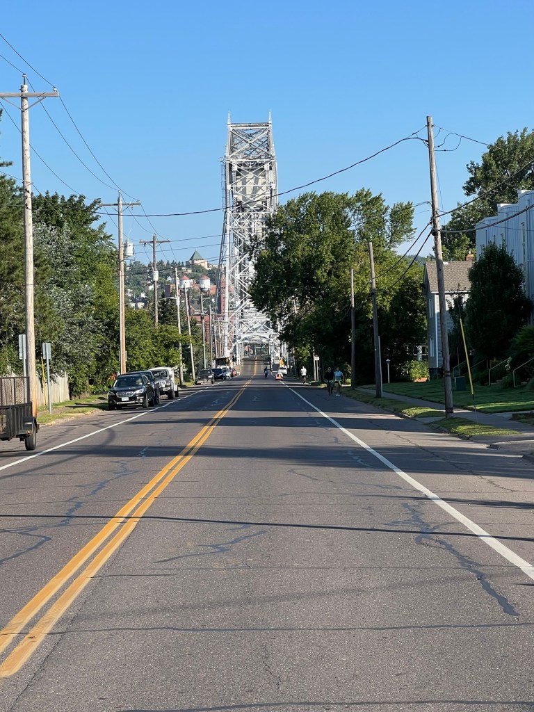
Today, the canal and the Aerial Lift Bridge define Duluth, which has a population of almost 88,000.
Superior has some incredibly large factories on their side of the harbor, but Duluth snagged the most business and the most growth and Superior’s population is 26,600, less a third of Duluth.
Superior does have a Municipal Forest, something I’ve never seen before. There’s a great disc golf course there.
We played there a couple of times.
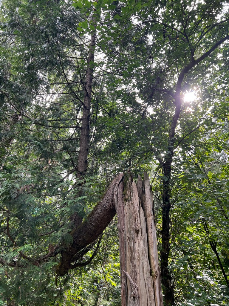
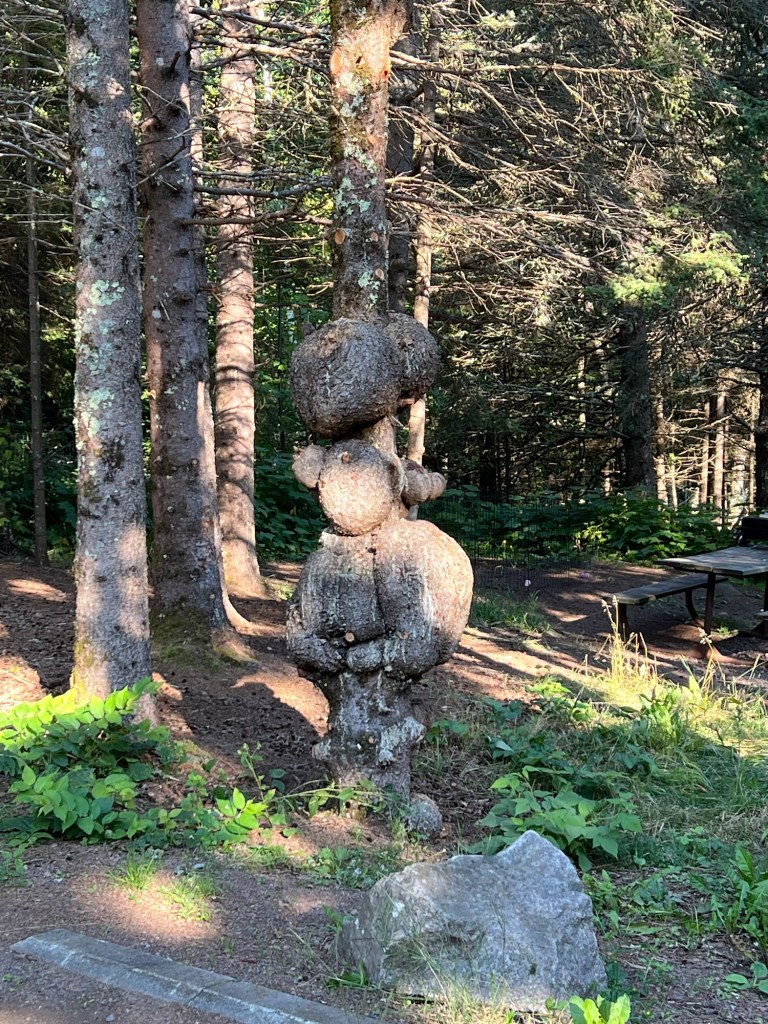
It also has a new nominee to my tree hall of fame! This tree has a full sized vertical tree growing up from a lone horizontal branch that survived some horrific damage to the main trunk. Amazing!
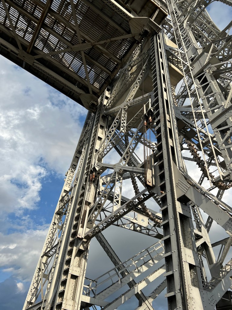
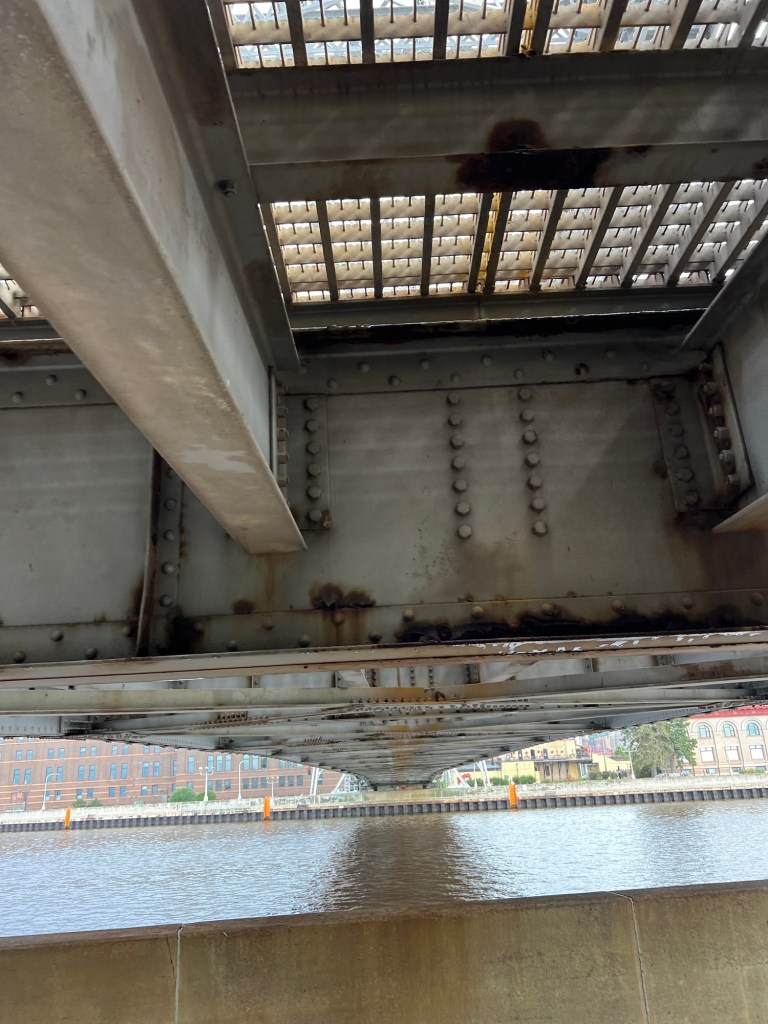
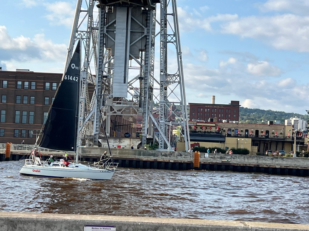
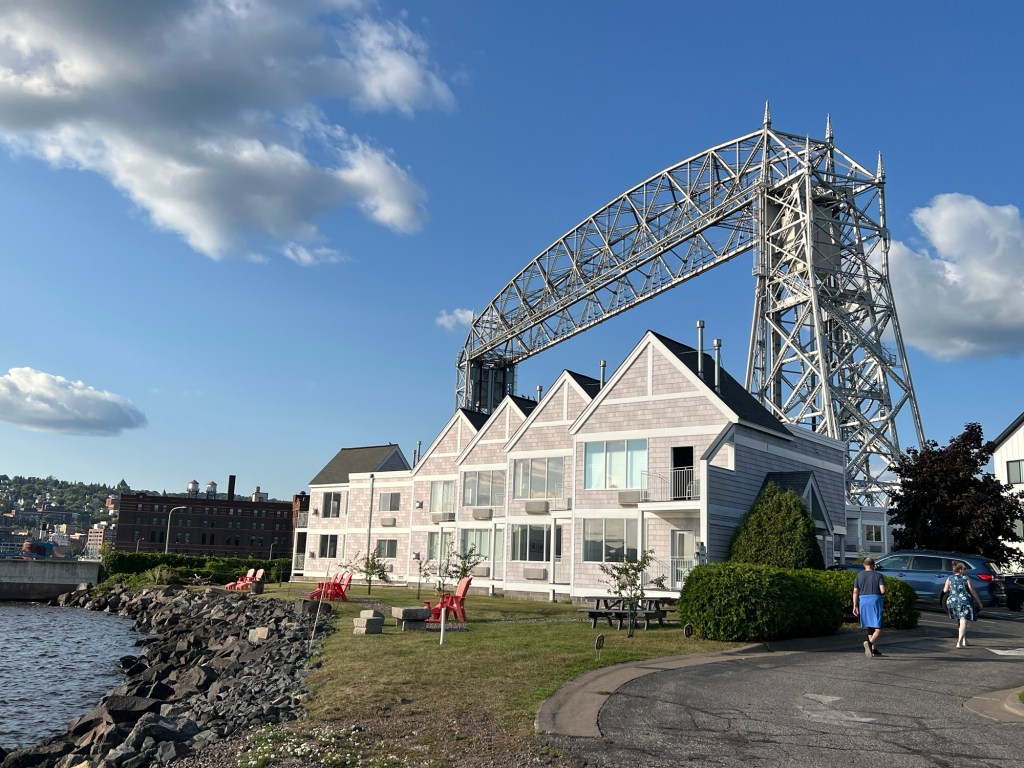
We’re happy to be just a few blocks from the canal. The Aerial Lift Bridge is fascinating. See the huge chains that raise and lower the bridge deck and counterweights.
This is directly under the bridge when it’s down. You can see the steel deck immediately above me and then the bottoms of the girders across the span.
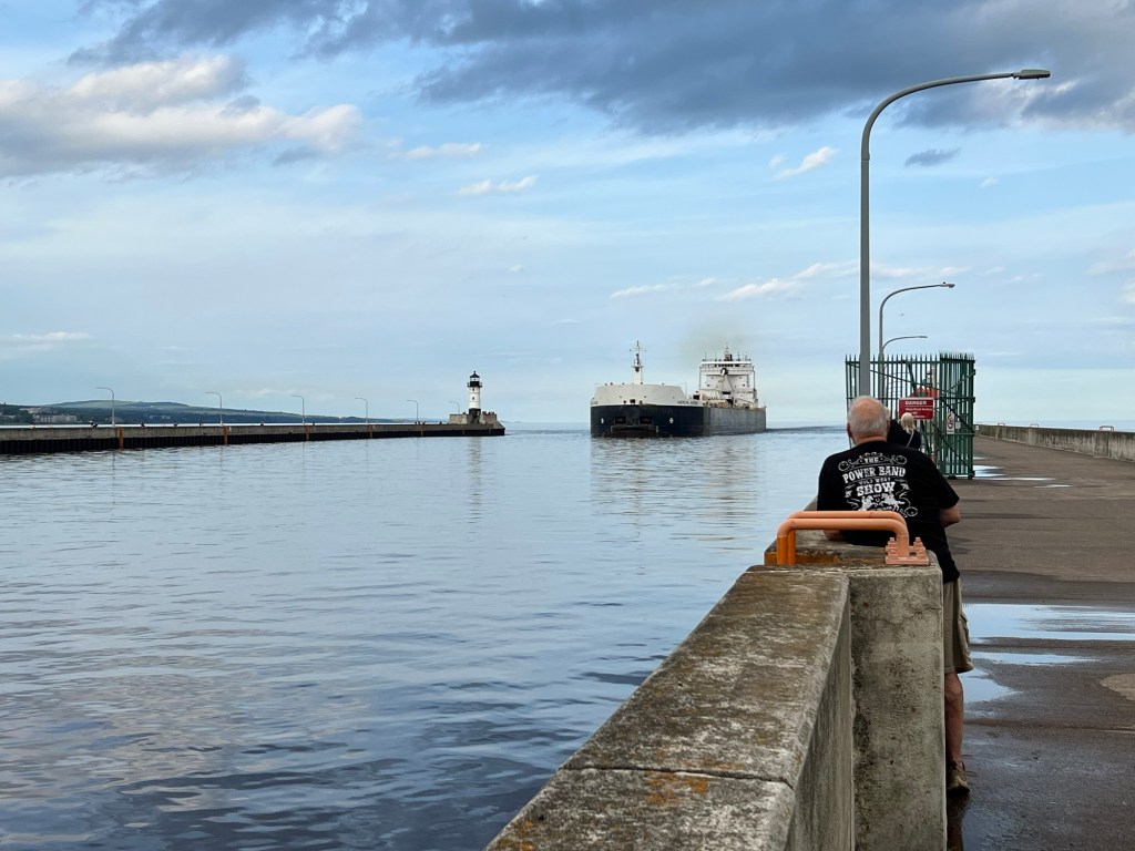
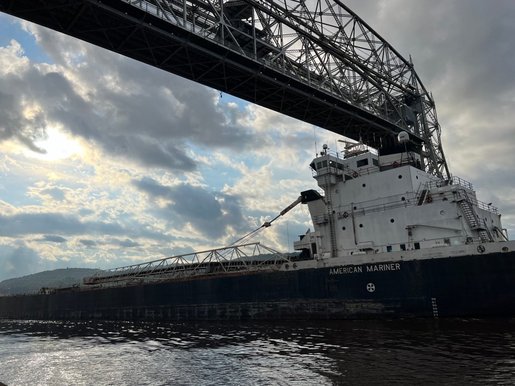
Tuesday evening we saw the American Mariner come in.
The bridge doesn’t always raise to full height, but it did for this ship. She is a 740 foot long bulk carrier. The longest ship now sailing the Great Lakes is 1,013 feet long, but this was still an impressive sight.
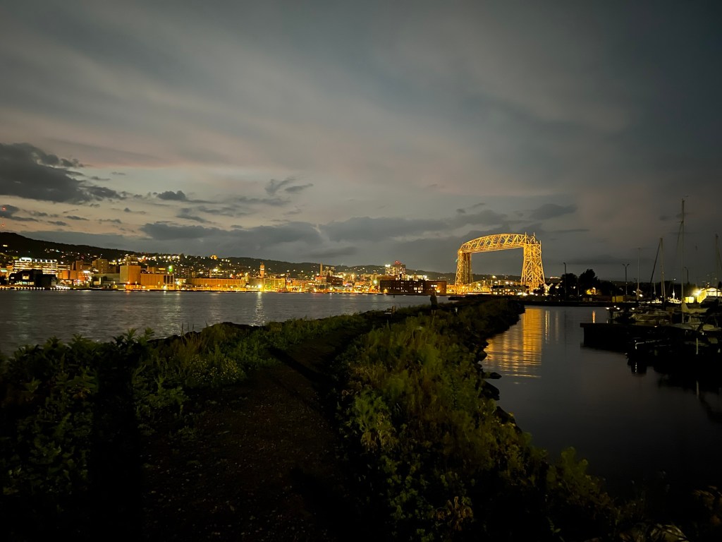
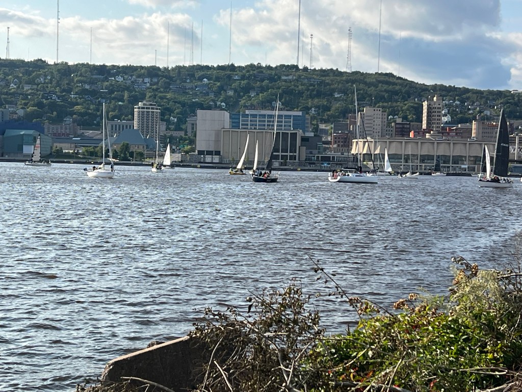
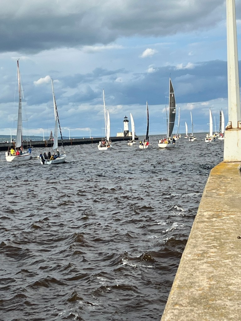
Then last evening a whole group of sailboats was gathered at our end of the harbor. A local told me it was race night. Suddenly they all headed towards the bridge and I realized the bridge was going to go up to let them into the lake.
Matey and I made it just in time to see the last boat go under the bridge,
and the whole group go out between the piers.
We may be in the city, but there’s a lot of interesting and beautiful things around us.
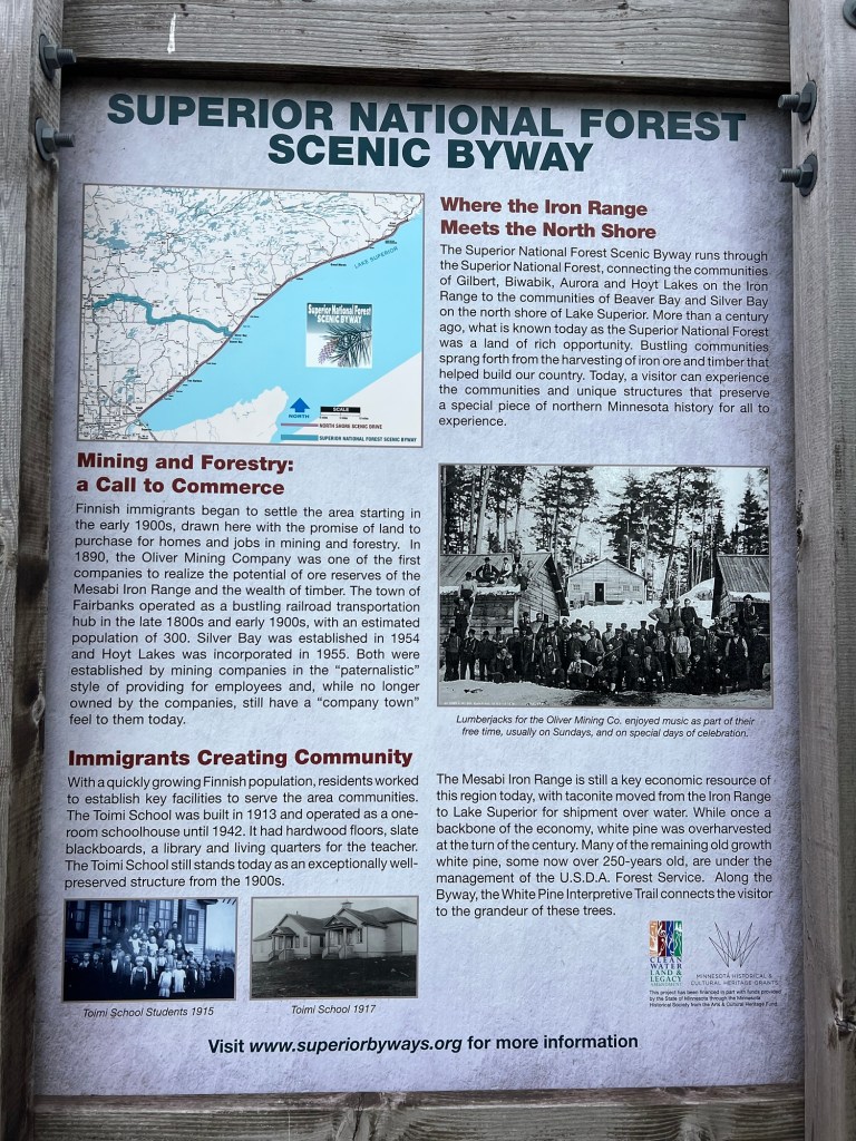
When we visited Beaver Bay and the Beaver River we saw this sign about the Superior National Forest Scenic Byway, so we thought we’d check it out. I had a bit of trouble finding information on places to see because the website referenced on the sign now gives information about the best online gambling apps. Huh?
Anyway, a lot of poking around gave me two possible sites.
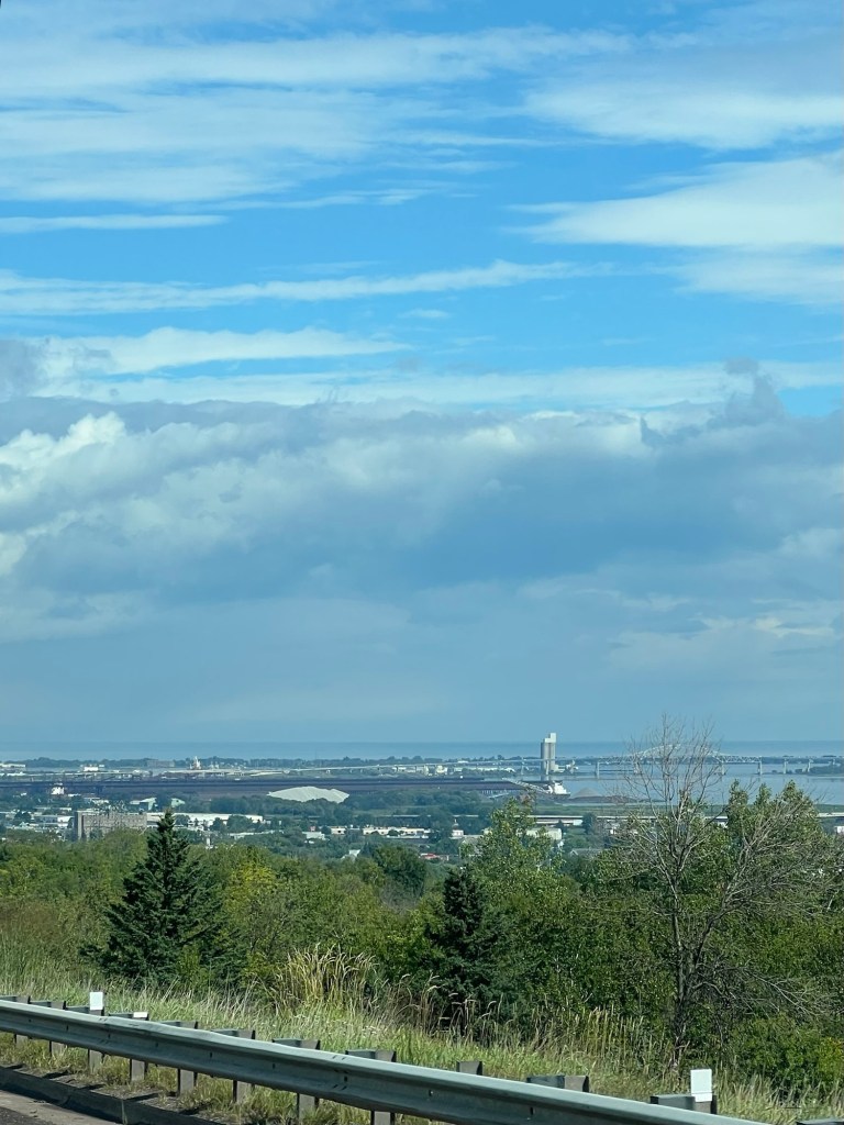
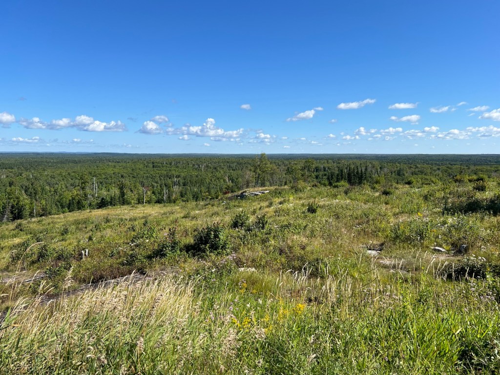
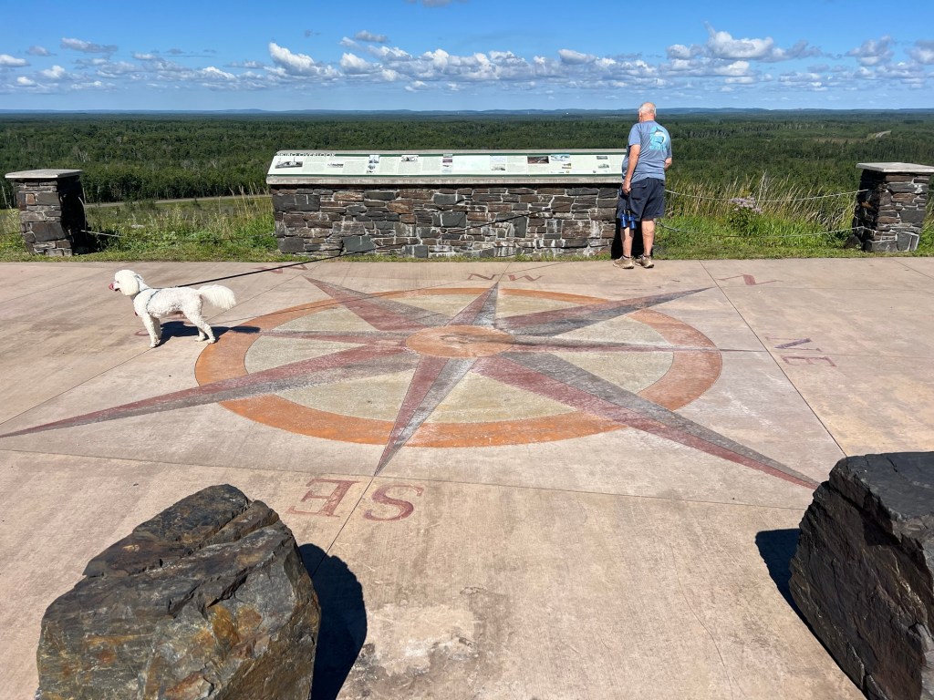
The first was the Skibo Overlook, and at 1802 feet it gave a pretty panoramic view out towards the Iron Range.
Between their compass rose on the concrete, their sign and our binoculars we identified a couple of the mining facilities out near the horizon.
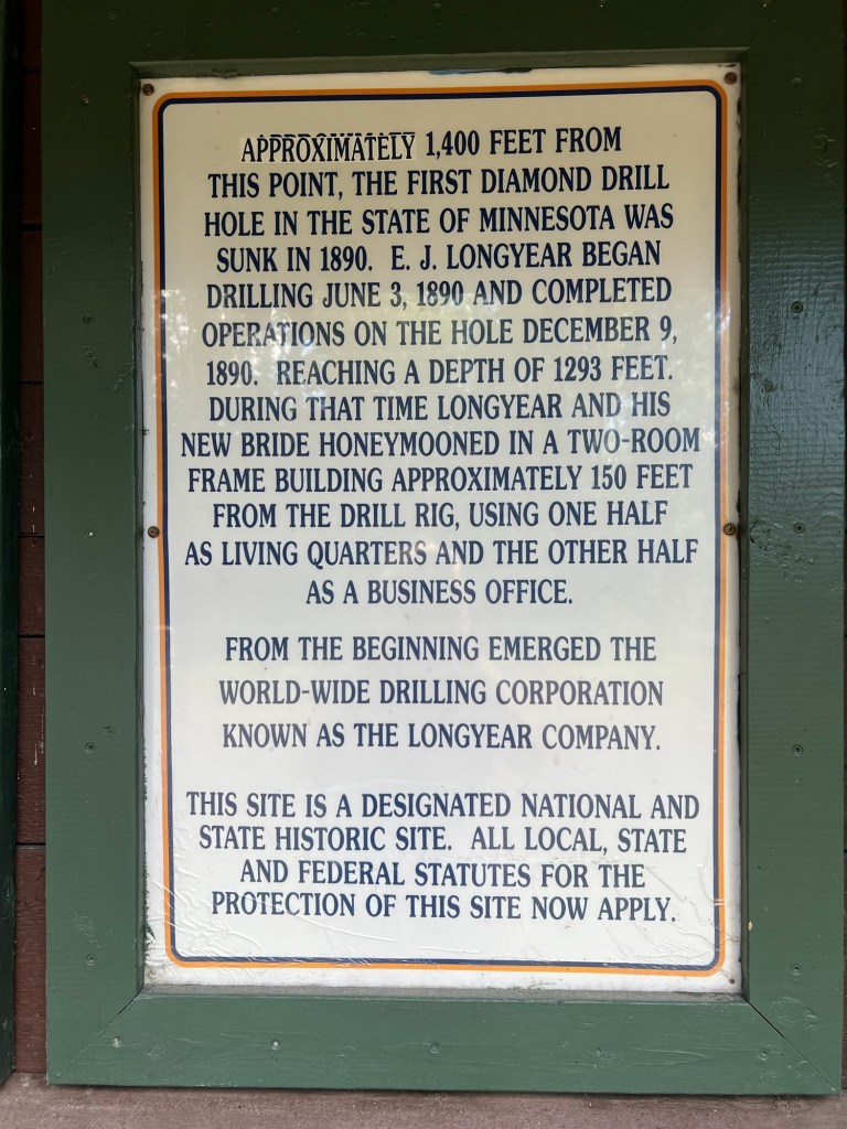
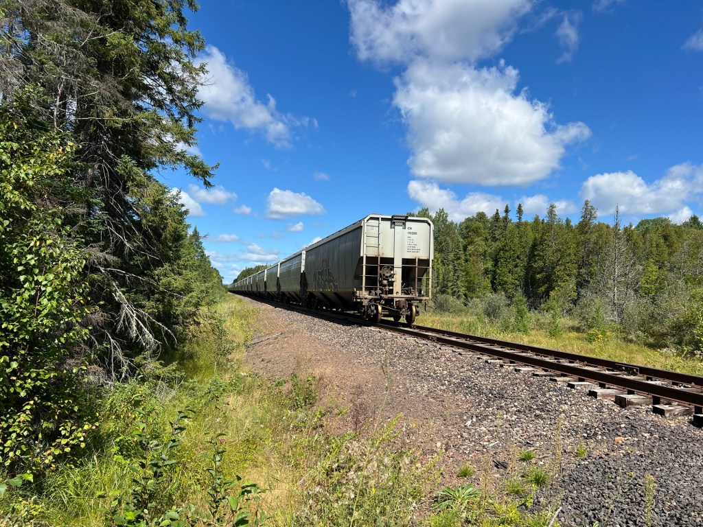
We then went on to try to find the Longyear Drill Site just outside of Hoyt Lakes. I found reference to it online, but it wasn’t a point on Apple Maps. I pinned the road from information on Google Maps. When we got to the road there was a dead end sign. We drove up and I checked Google Maps again, we were on the right road, but when you clicked on the site Google Maps listed it as permanently closed. We found a parking area and this sign.
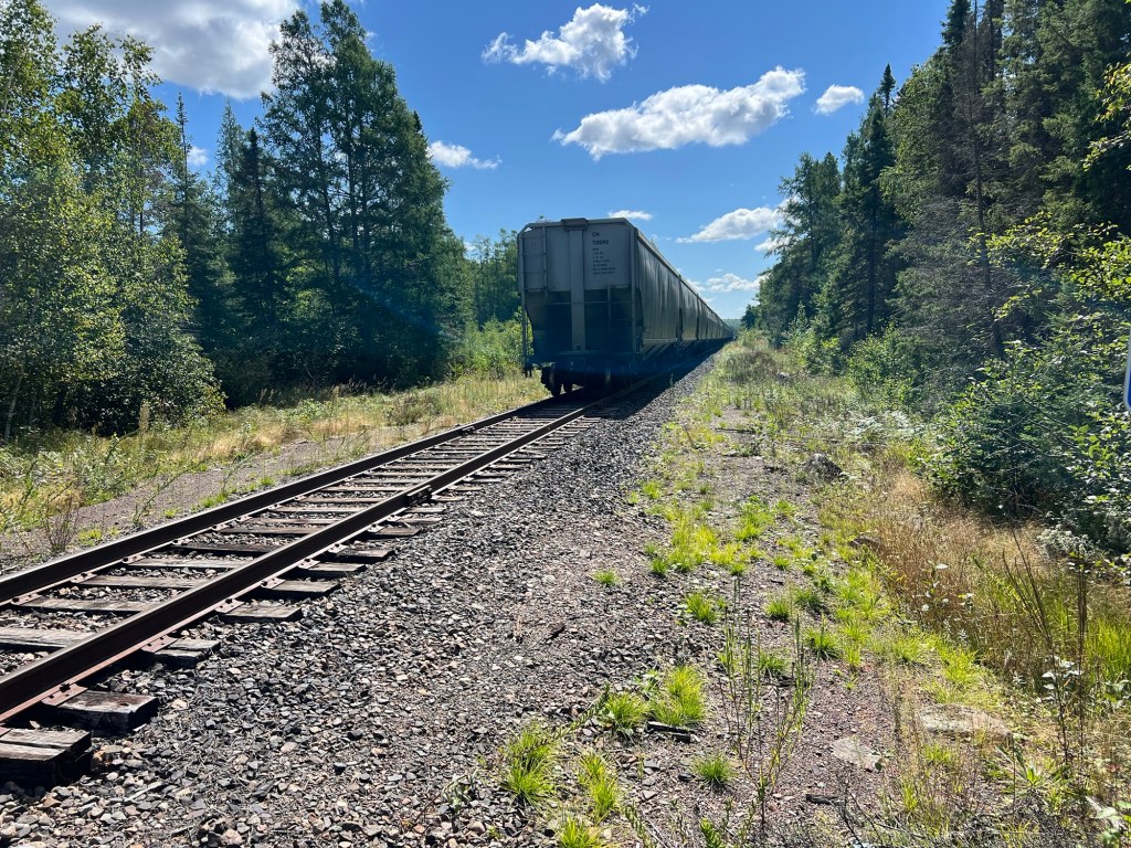
There was a dirt road leading back which soon crossed a section of railroad tracks.
In both directions there was a long string of cars. We thought these might be cars waiting to transport the taconite to Silver Bay for processing.
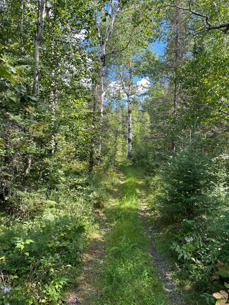
About a quarter mile back Bud lost faith and because he was being attacked by mosquitoes he turned back.
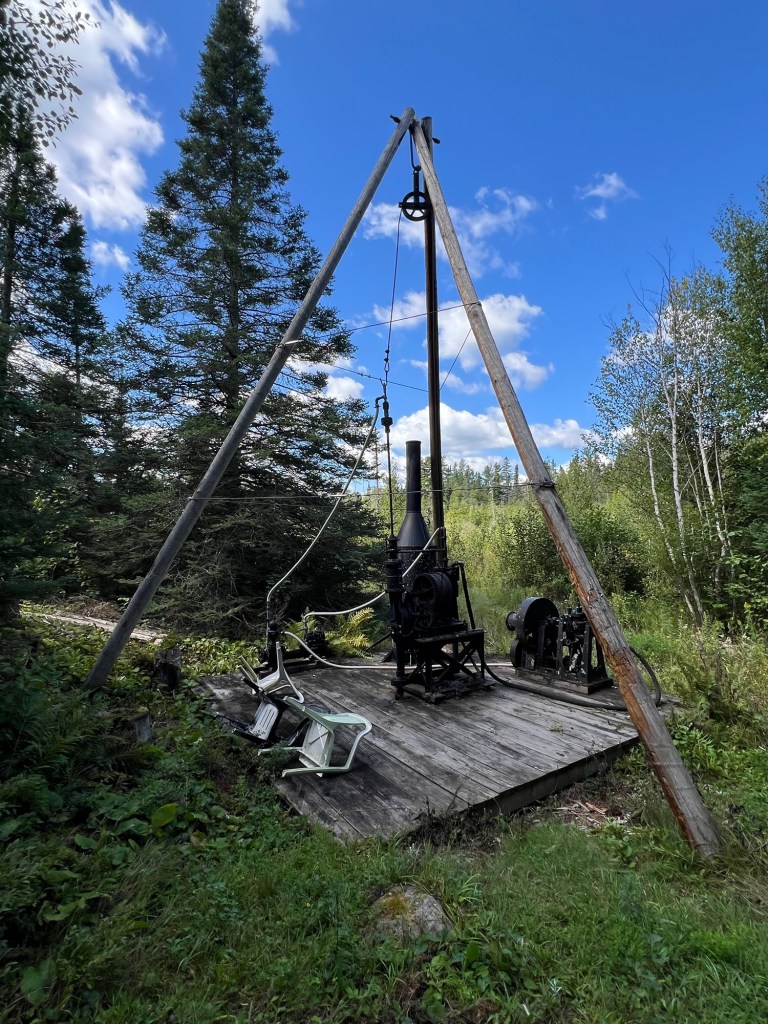
About a tenth mile further on Matey and I found the site.
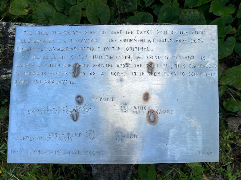
Although the sign says the equipment and rigging have been duplicated as near as possible to the original, I don’t think they’re including the plastic lawn chairs. Anyway, since rock core sampling is so common now, to all kinds of research, it was interesting to come to the place where the first core was drilled.
On the way out we had seen a sign for the White Pine Picnic area in Superior National Forest, so we bought some food to go at Hoyt Lakes and came back here.
Too many mosquitoes here to eat outside but it was great to see these giants, some of which were 250 years old. Not many survived the intensive logging, but these grandparents did. It is one of my great sadnesses that we have almost wiped out the old growth forests, and I like to visit what’s left whenever I can.
That was almost our last exploring on the north shore of Superior. One of Bud’s incisors broke while he was eating that lunch (in the truck, away from the bugs) so he spent Wednesday and Thursday driving to Duluth to deal with that. Thankfully it doesn’t hurt and he did manage to get it looked at and impressions taken to start the process of getting an implant. The tooth will get pulled on September 9th. The final work can’t be done until four months later, but they will put some sort of placeholder in. He now lisps and looks like a hillbilly.
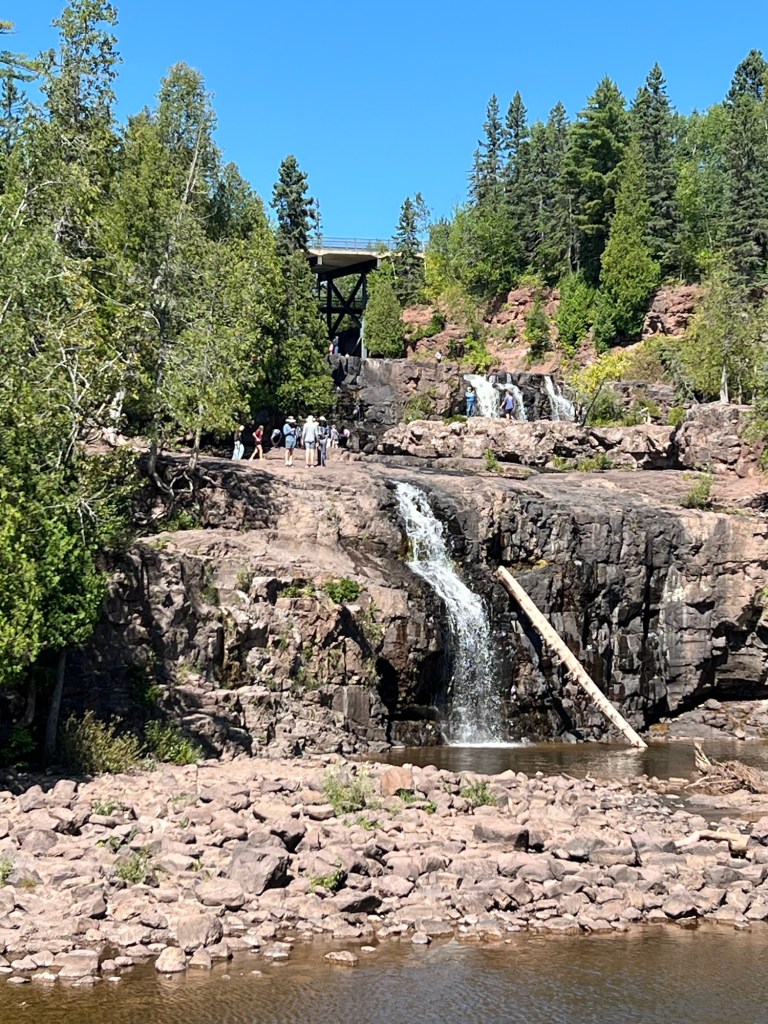
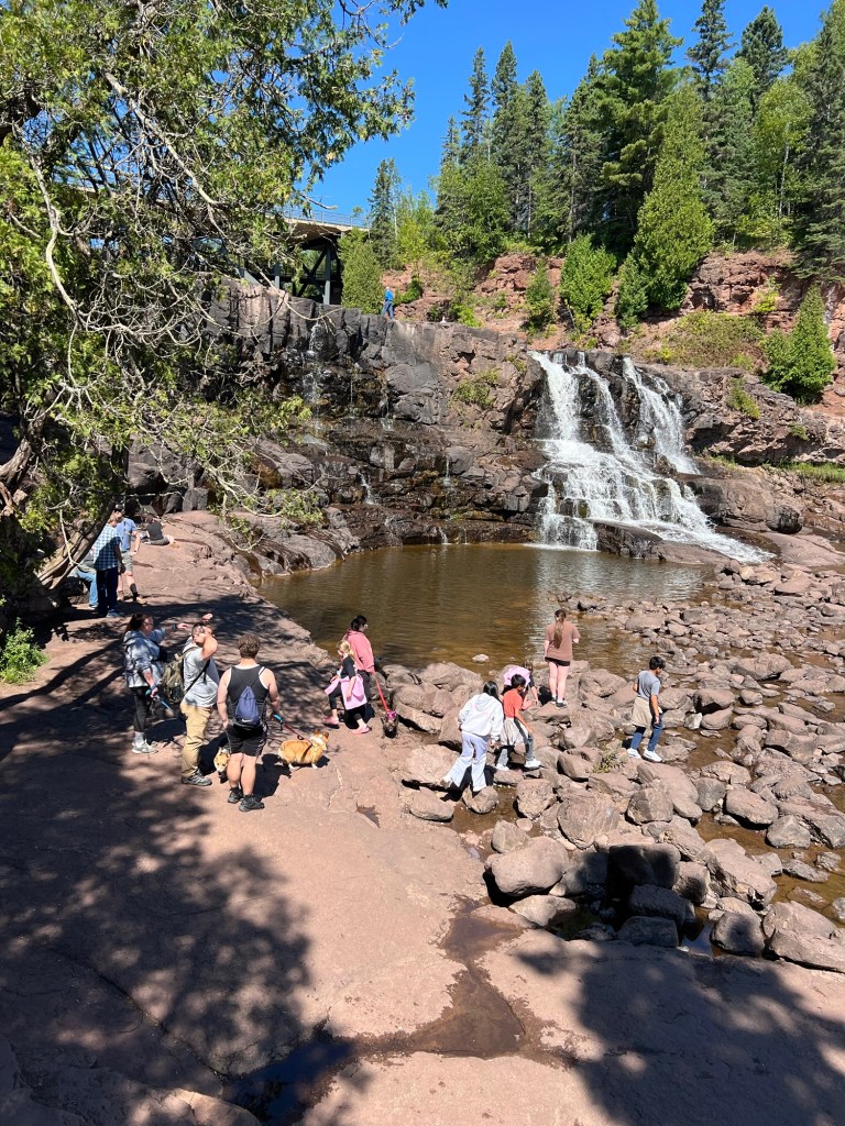
Friday we left Black Beach and Silver Bay, but we had extra time so we stopped at Gooseberry River State Park. This was another state park that charged no fee and had ample parking for campers. So we opened the camper and had lunch, then walked to the two lower falls.
There were a lot of people there, but it was very pretty.
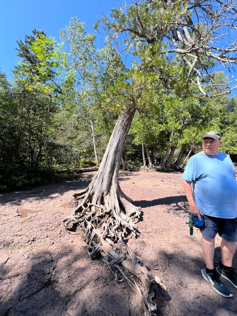
Of course I noticed the trees. This arborvitae was managing to live with its damaged roots clinging to bare rock. That is not dried red mud, it is red rock!
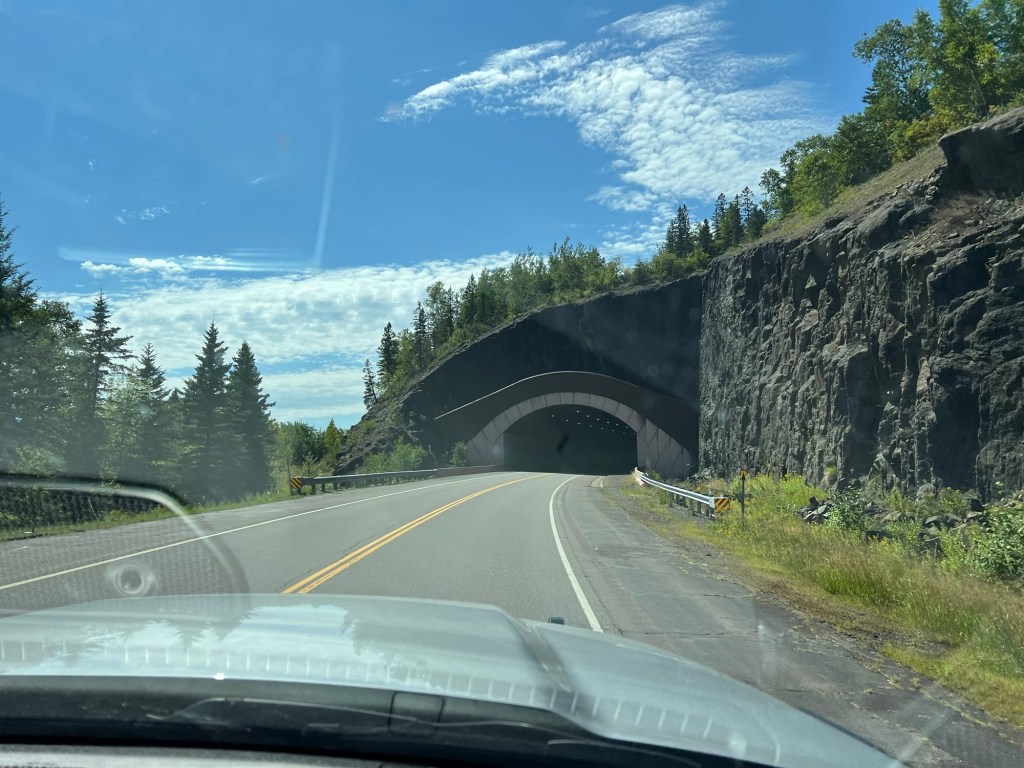
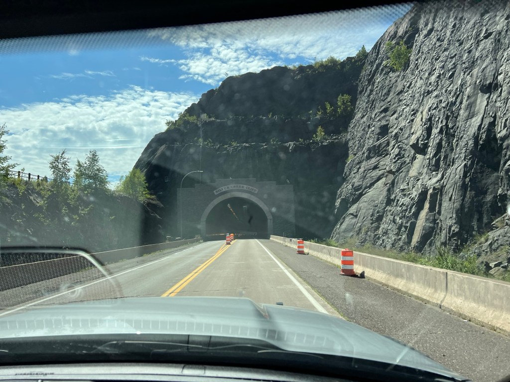
Then we headed on south on US 61 through the Lafayette Bluff Tunnel…
and the Silver Creek Cliff Tunnel and into Duluth, leaving the north shore behind.
I’ve written before that there are trade-offs in campgrounds and that’s definitely the case here. No trees, not much privacy, but the sites are plenty big, there are full hookups and 50 Amp service. Our Starlink loves it so our internet is blazing fast and I dumped YouTube TV with their sign in requirements and we went with streaming DIRECTV, and had no problem opening an account in Minnesota with a billing address in Arkansas.
We are about a quarter mile from Agate Beach. Matey and I first approached it from here, and that’s about a 30 foot cliff down to the beach.
A short walk took us to a trail down.
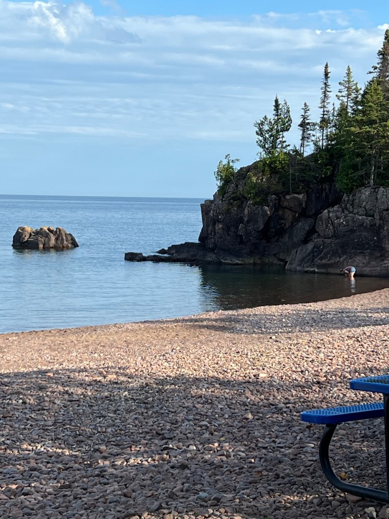
A nice little cove,
picturesque, but rocky.
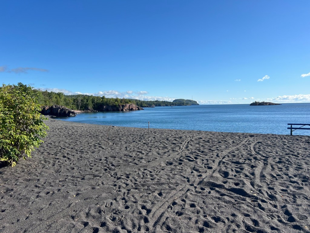
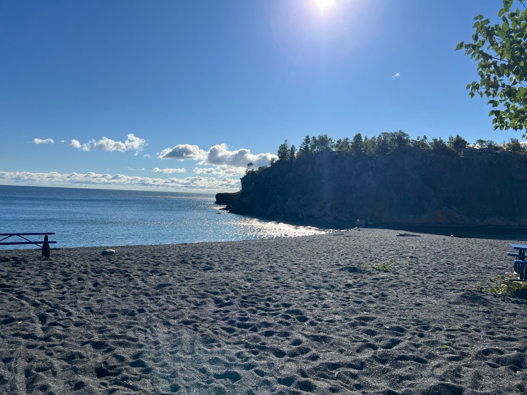
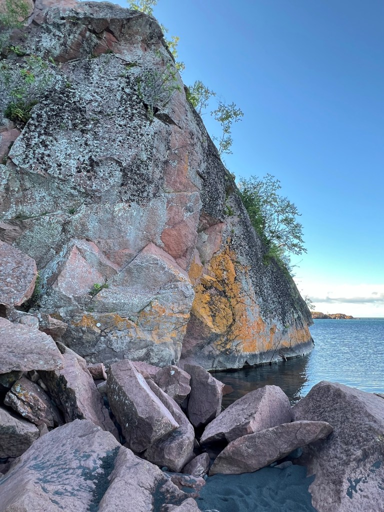
The next morning we drove about three-quarters of a mile to Black Beach, and that is black sand.
It, too, is in a lovely cove. The sand reaches right out to that island of rock and I thought perhaps we could walk there.
Nope. But it’s pretty.
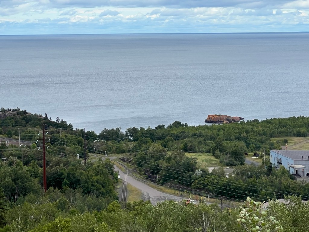
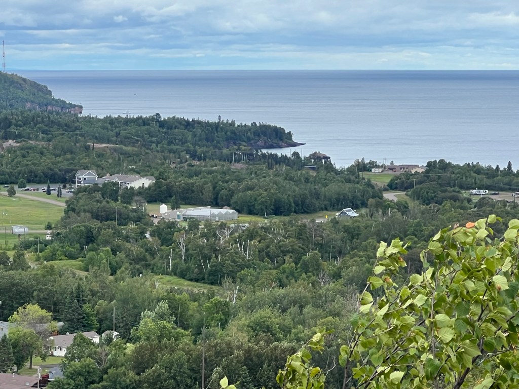
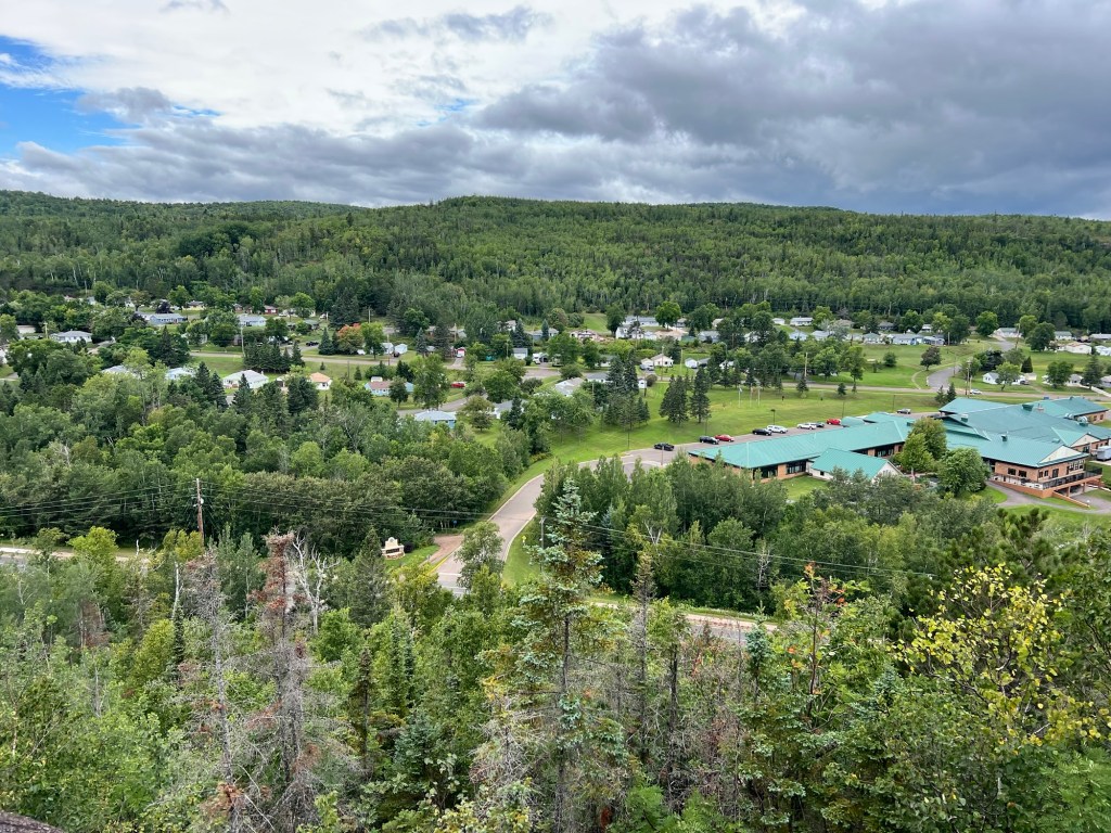
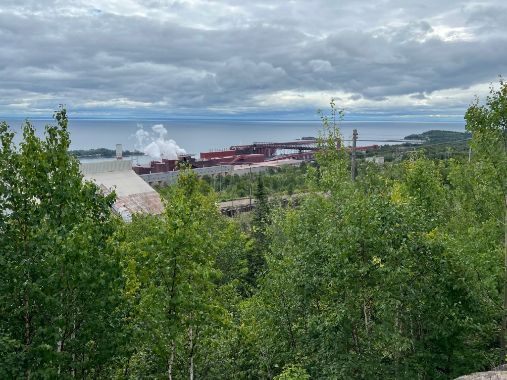
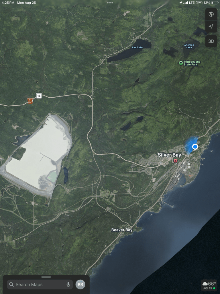
After lunch we drove around a bit. We went to 3 overlooks in the town of Silver Bay, which operates the campground. The first gave a view of Lake Superior north of town. Black Beach is in the cove to the left of that red rock island.
Our camper is just this side of the greenhouses, but the closer trees block the view.
Another overlook gave a view looking west, to the town.
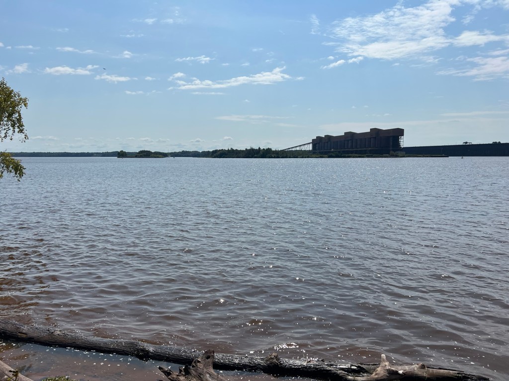
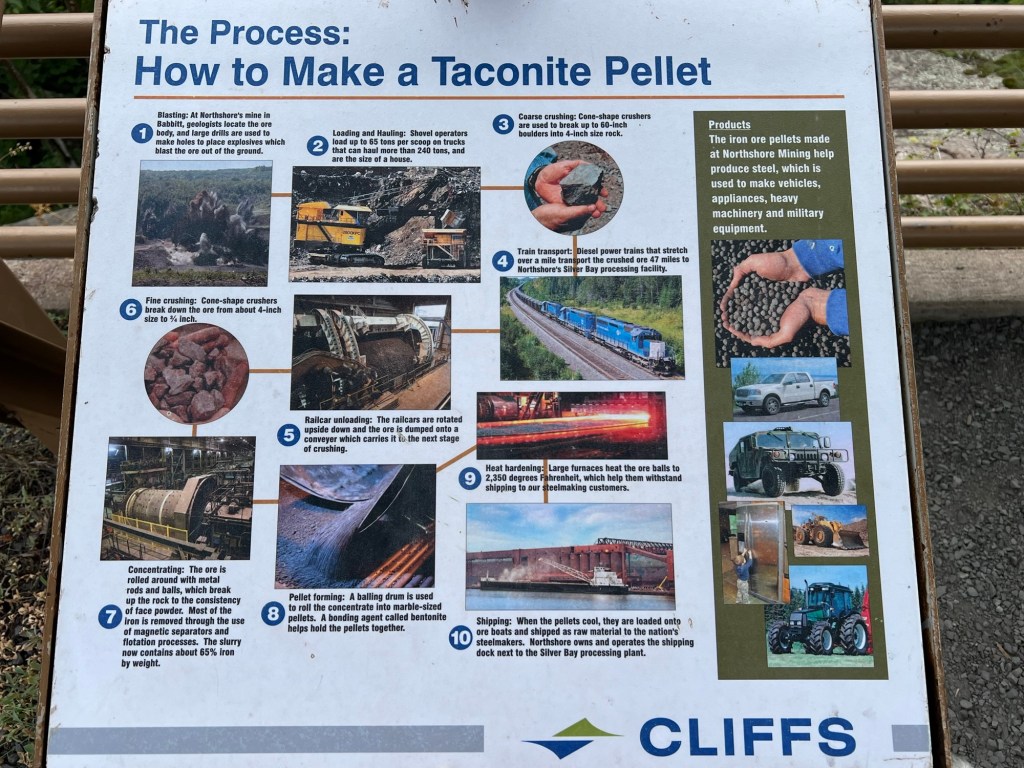
And a third gave a view more directly east, to the huge Taconite pellet facility and the lake beyond it.
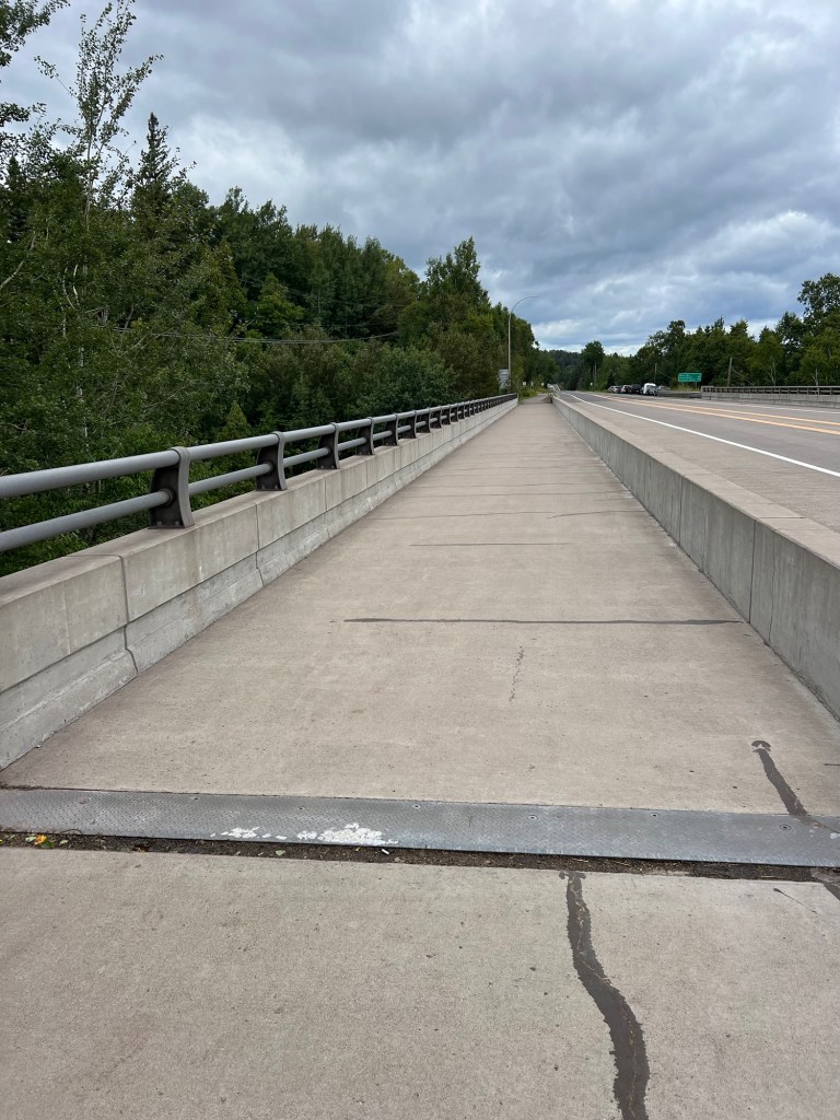
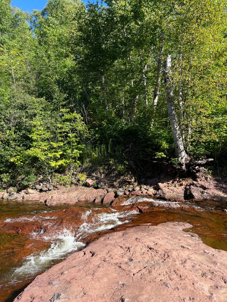
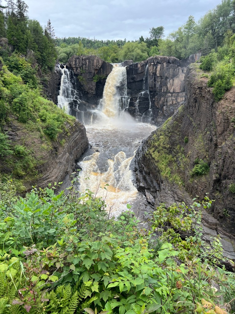
Next we went to the town of Beaver Bay where this walking/bike trail crosses the Beaver River alongside Route 61,
and gives a great view of the falls there.
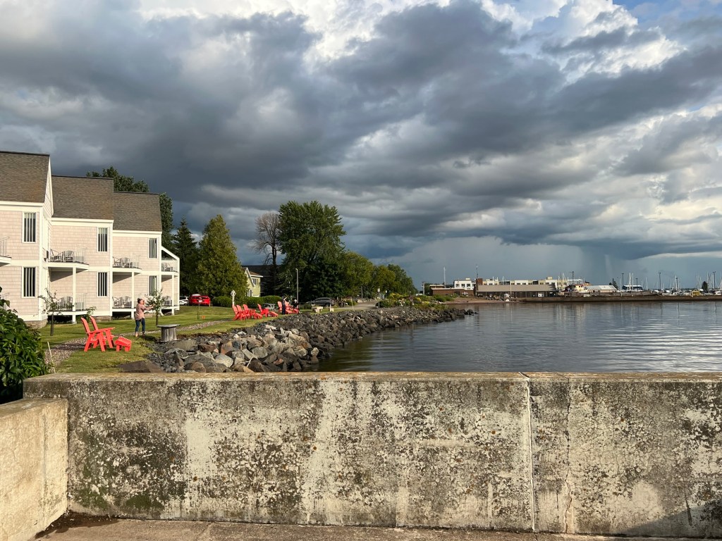
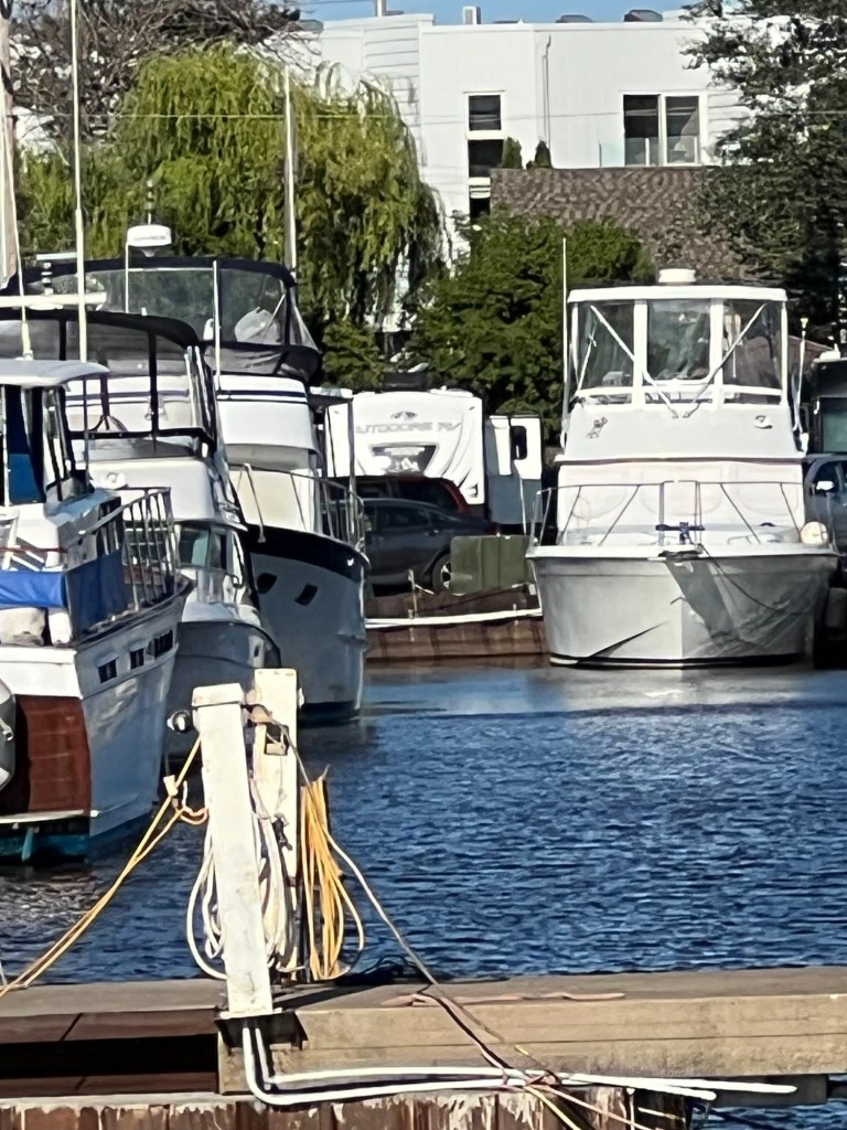
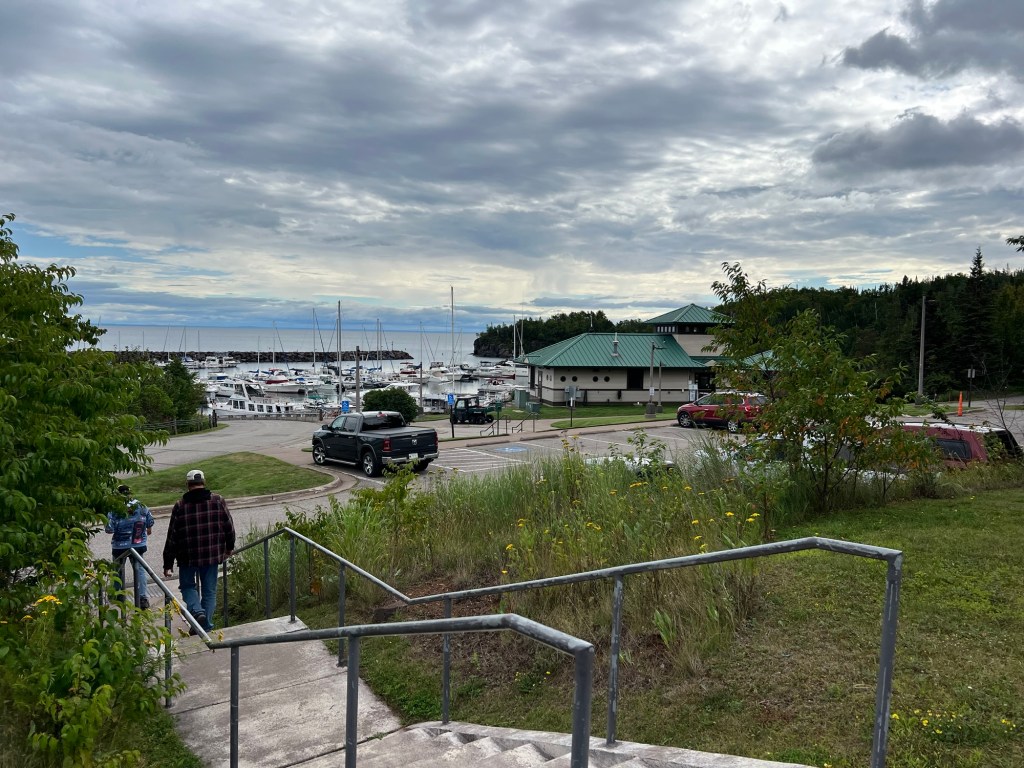
On the way back we stopped at the Silver Bay Marina. It was very nicely done, with power at the docks and a nice building. We would have liked this one, back in our boating days.
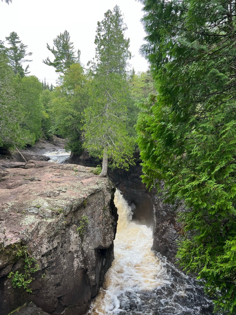
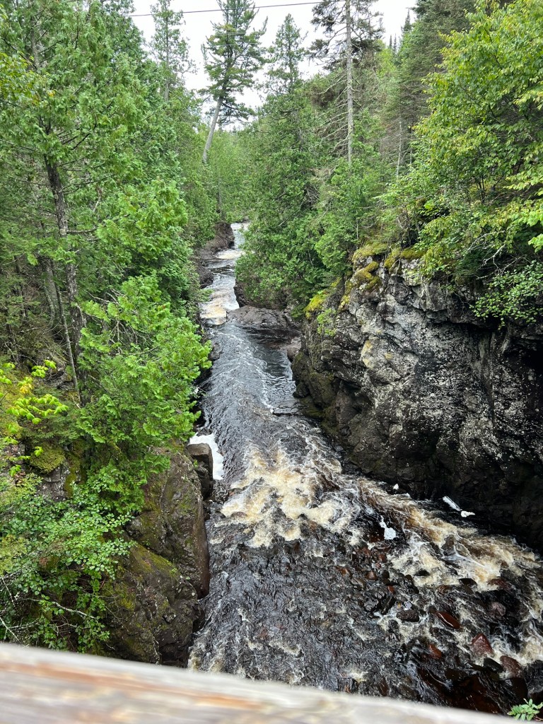
The north shore of Superior in the US has high, rocky hills that run quite close to the shore. So as you drive along this northernmost part of US 61 (the route runs through the twin cities to the Mississippi River and all the way to New Orleans) there are lots of waterfalls.
This morning we drove about 16 miles to another one on the Caribou River. The trail starts near the highway where the river is fairly flat.
Walking up the trail there are a few places you can get to the river’s edge.
I took the opportunity to take some pictures.
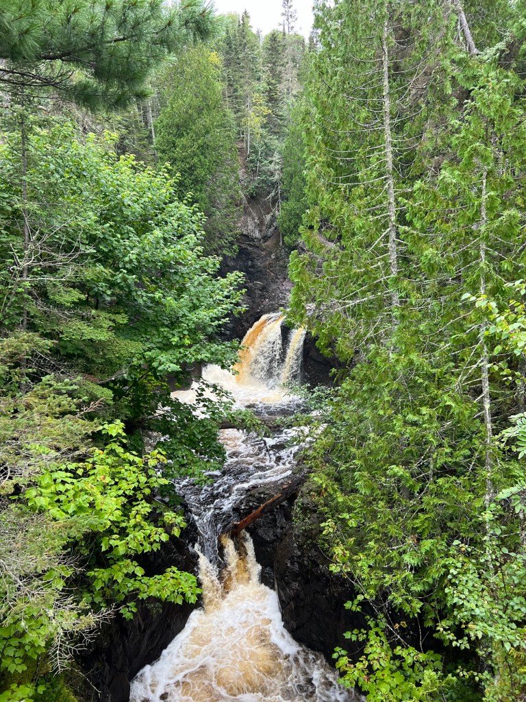
The trail gains some height…
until you are well above the little river.
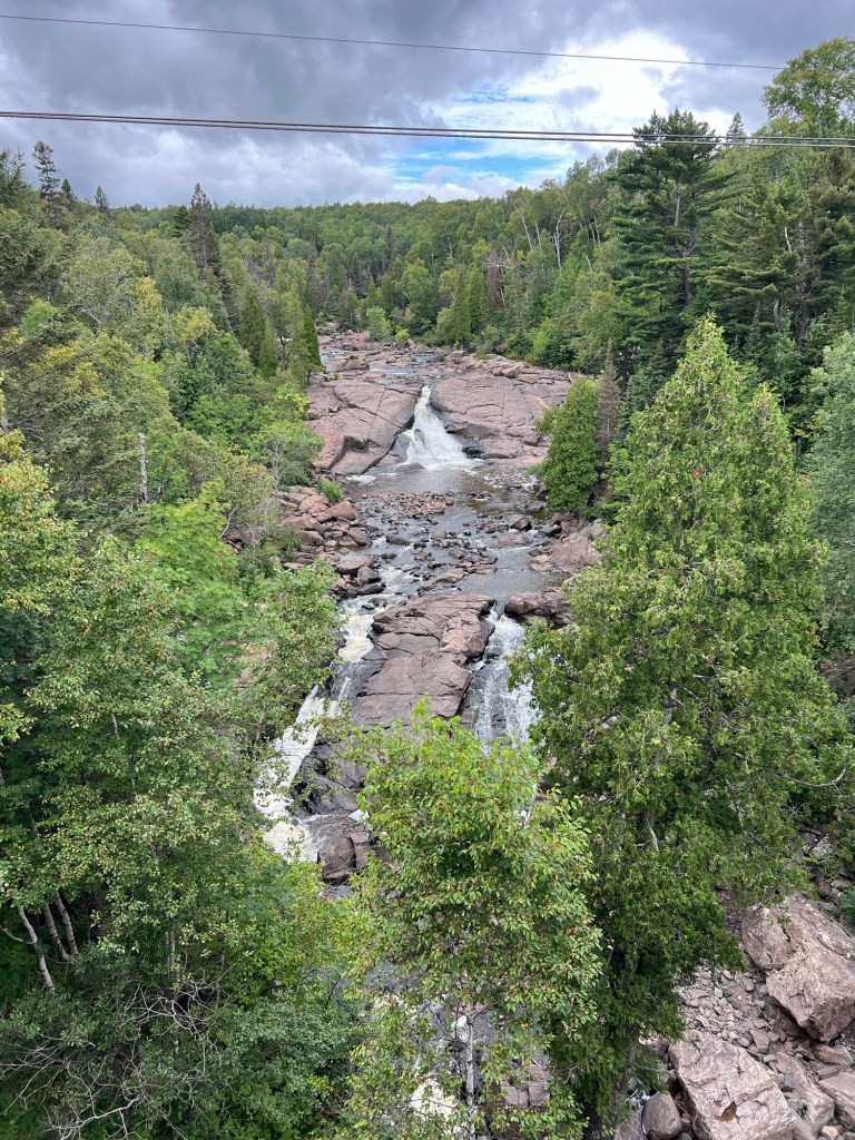
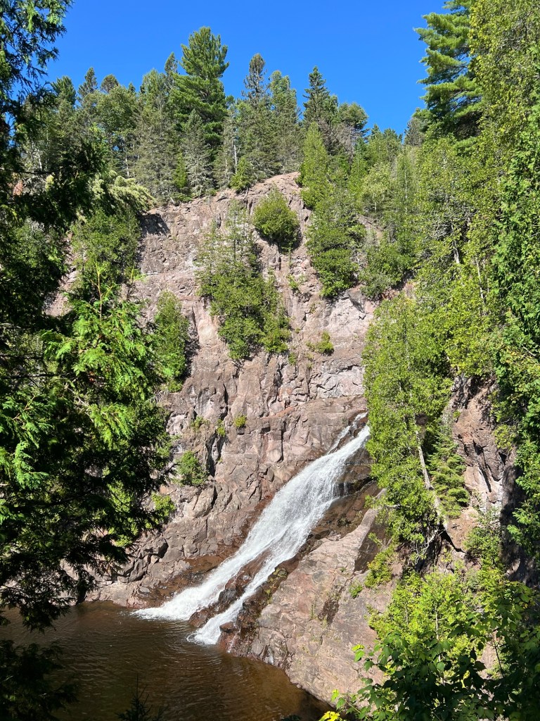
Then you come out on some stairs where you get a nice view of Caribou Falls.
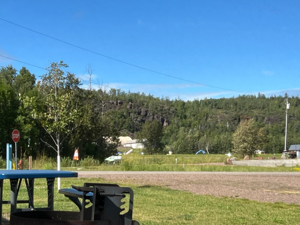
So even though the view at the campsite isn’t the greatest, there’s lots to see around us.
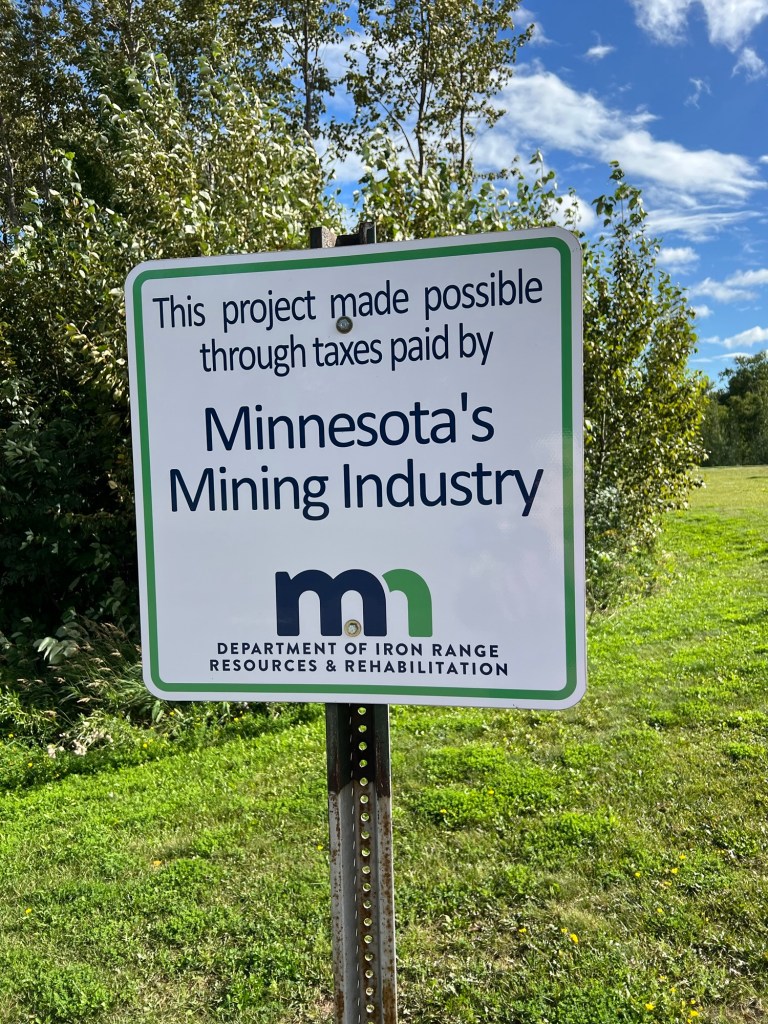
They want you to know that this nice campground is here because of the mining industry.
In all the information they give you at the overlook about the processing plant…
they don’t mention the 2,150 acre tailings “pond” that sits above Silver Bay and Beaver Bay. This is bigger than any natural lake along the 154 miles of shore from Duluth to the Canadian border. The company wants to increase its size by a third and environmental groups just won a court case to force them to file a new environmental impact assessment. They were saying the one done in 1973 when courts forced them to first build this and stop dumping their sludge directly into the lake were all they should need for the expansion. And the fun part is, this “pond” will need to be monitored for years after the company decides to shut this operation down. Hope those mining taxes have figured that in the bill.
So it’s nice here, we enjoy the good utilities, but it is far from perfect.
Monday we crossed back into the US, a total nonevent, and stopped at Grand Portage State Park, just as you enter Minnesota. This park was free, had RV and trailer parking and nice paved walkways up to High Falls on the Pigeon River, which forms the border here. Very nice.
We were stretching our legs and taking our time because we gained an hour crossing the border and check-in wasn’t until 4PM (now Central Time) at Cascade River State Park where we were headed.
We got here right at four, only to find that the office closed at four and the map on the wall didn’t show where the water fill station was. Another camper stopped behind us told us that.
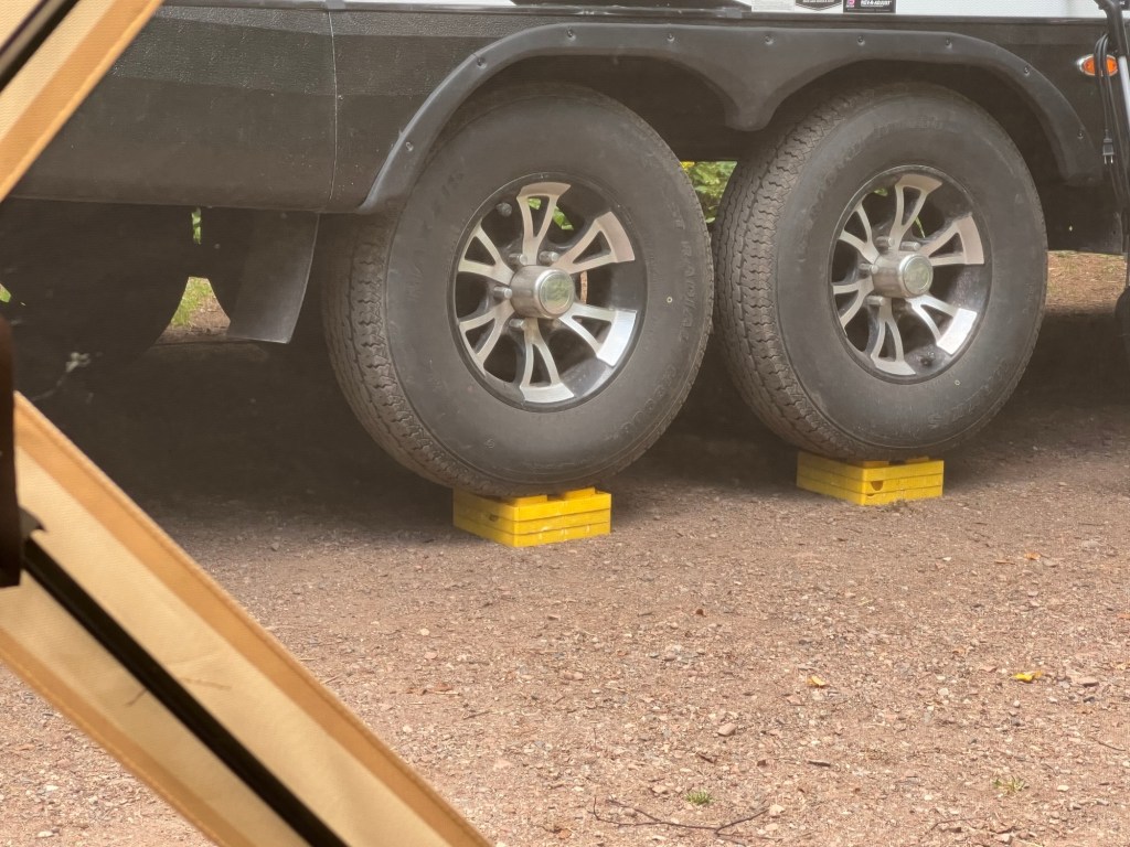
We found water and our site, but as you can see by our needing three blocks under both right side wheels, the site is not at all level.
It does have reasonable privacy and 50 Amp service, though. That’s nice, but despite having one of the most open sites in the campground, we have very little open sky and Starlink is struggling and we have inconsistent connectivity.
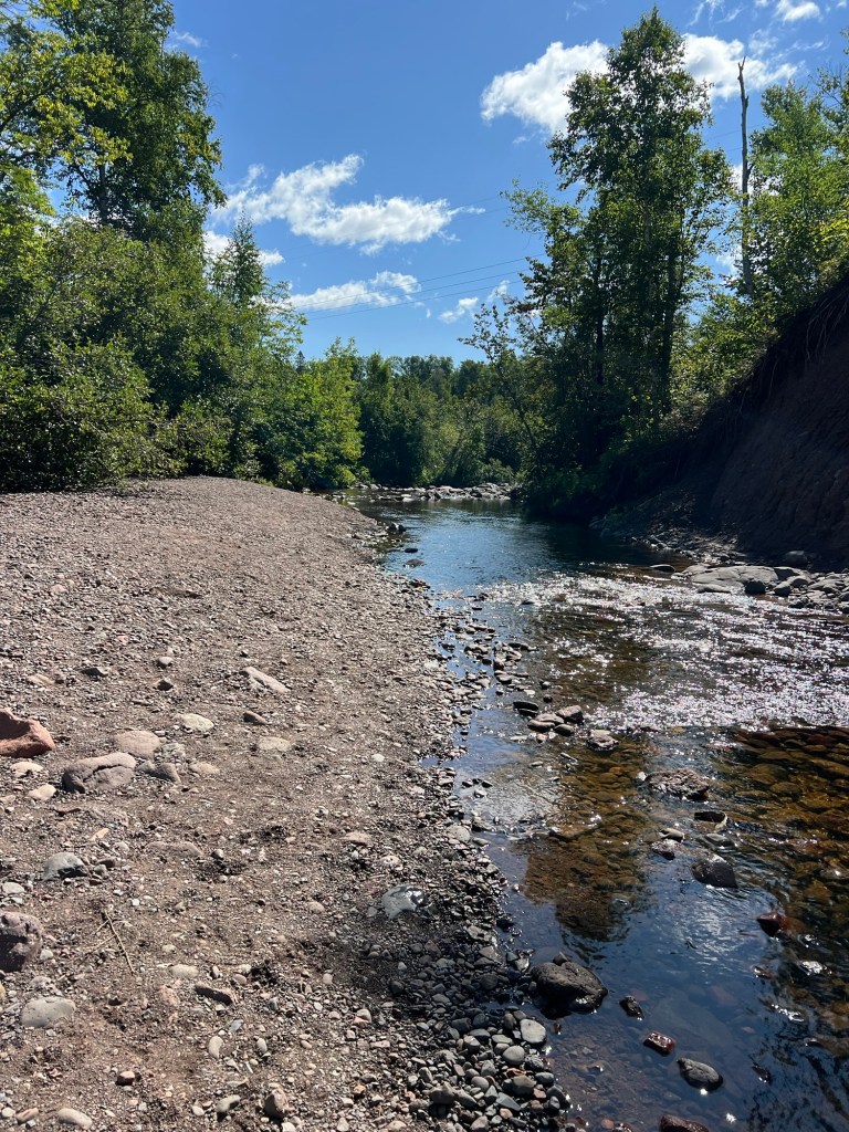
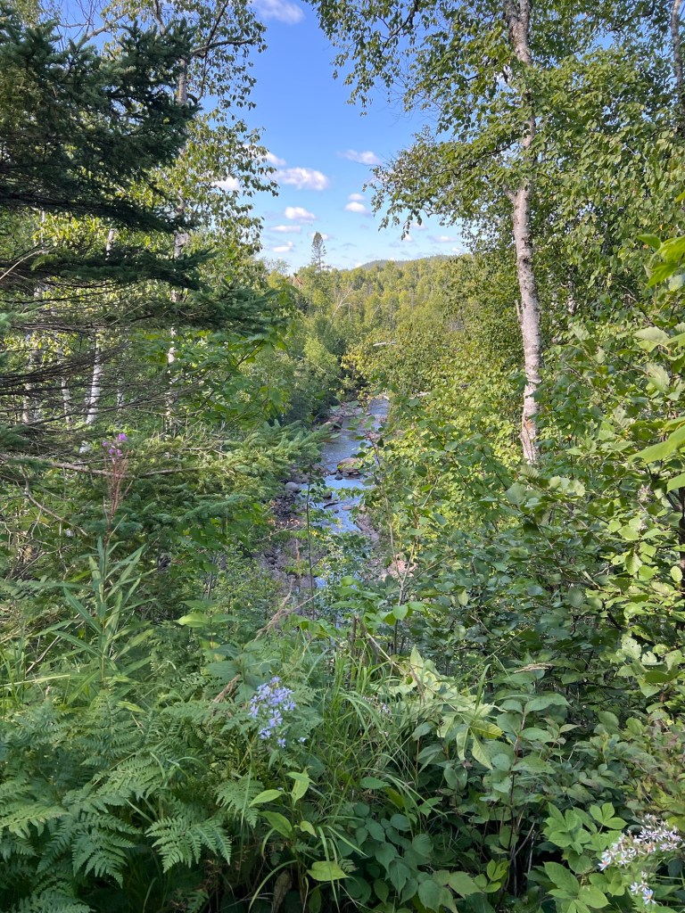
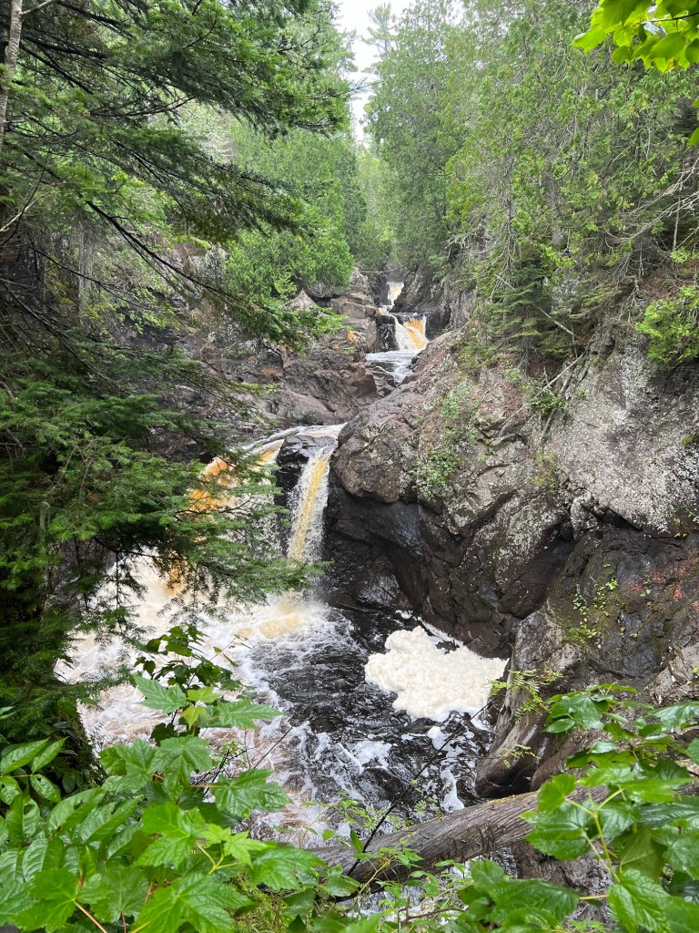
But then there is the river and the trails. This is the Cascade River. It is much smaller than the Pigeon River…
but just as pretty.
There are trails up one side, across a bridge,
and down the other, so you get plenty of opportunities to see the cascades that gave the river its name.
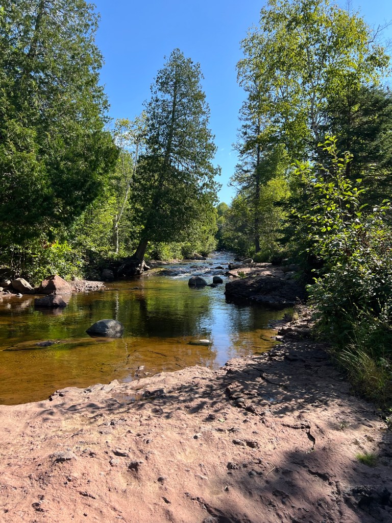
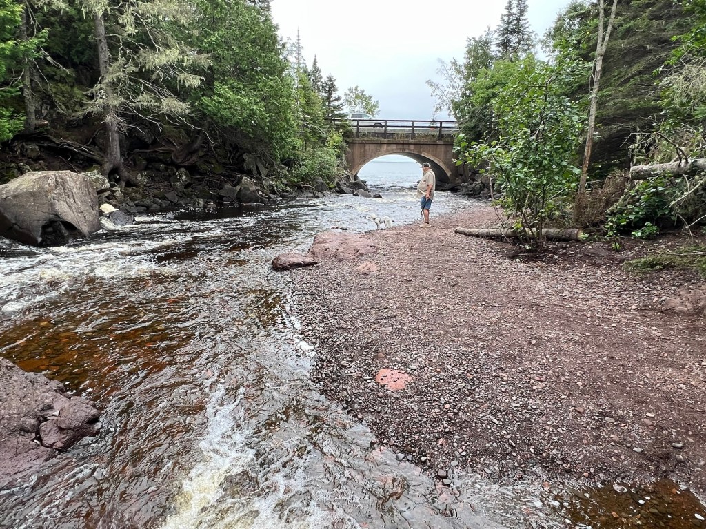
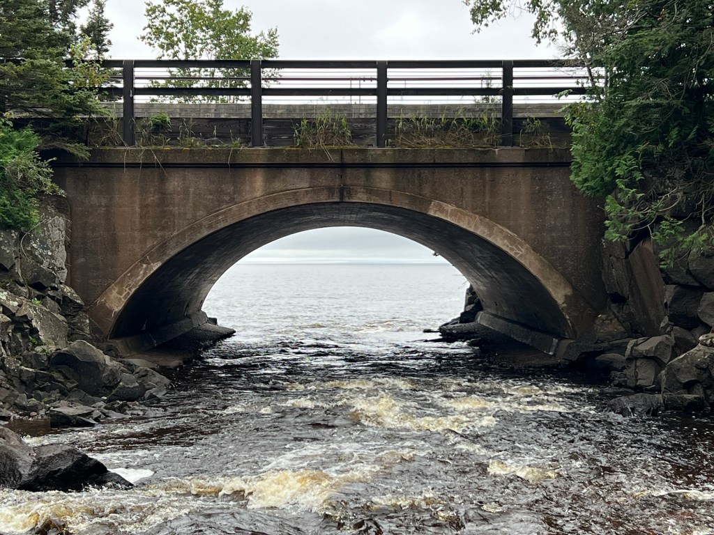
At the bottom the river flattens…
and just on the other side of the highway flows into Lake Superior.
This was our only view of the lake that day because there was construction at the lake access here.
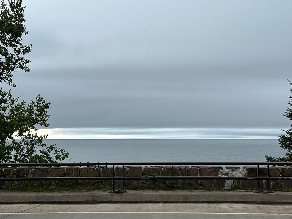
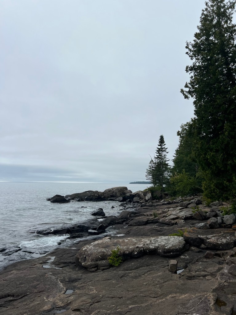
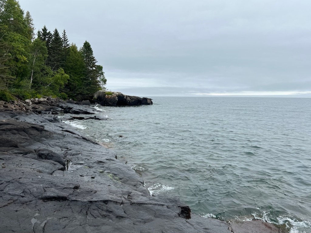
Another day we found a different trail along Lake Superior. This is still the north shore, and though not as rugged as it is east of Nipigon, in Ontario, it’s still quite beautiful.
No beaches, but nice flat rocky places to walk.
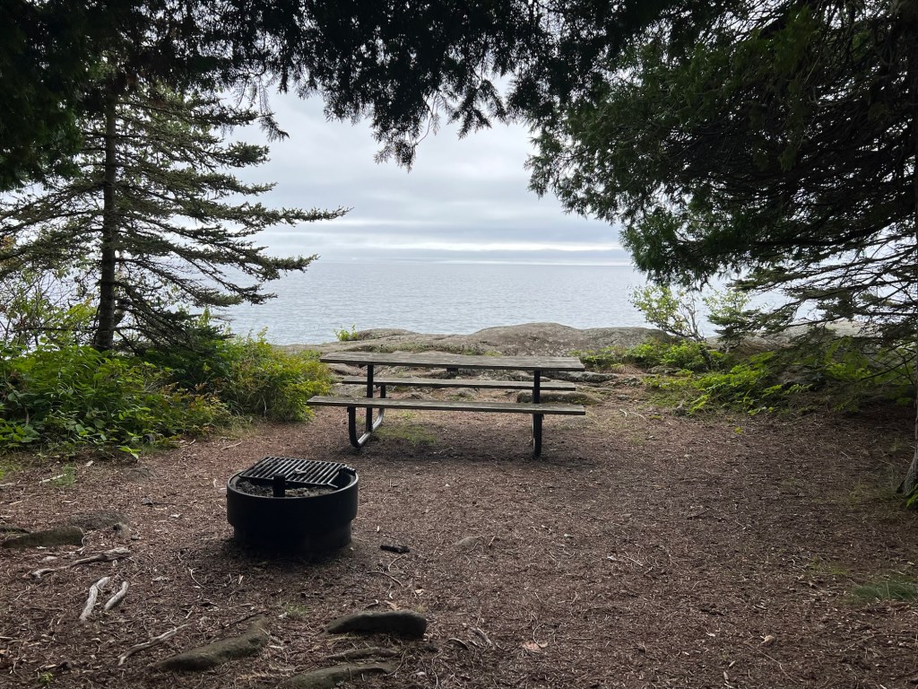
Between the highway and the lake is a picnic area. It’s part of the park, but there is no fee for stopping here.
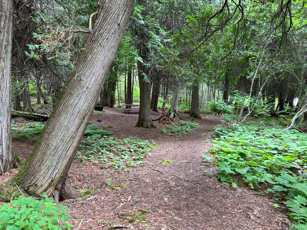
There’s a nice bit of trail…
through some very old arborvitae.
Looks like they are doing some reclamation work here, but unfortunately for us the trail disintegrated into two muddy ruts and we ended up bushwhacking a hundred feet up a thickly grown bank to get back to the highway and the campground entrance. Neither Bud nor Matey were impressed.
I’ve found a lot to like here, including this tree which might just be the gnarliest tree I’ve ever seen. But the check-in experience was not good and now we’ve found they’ve closed the trailer dump station, so we can’t drain our waste tanks when we leave. Add to that the inconsistent internet and the fact that YouTube TV just stopped working because it’s been too long since we’ve watched in our “home area”, and you can guess we’ll be happy enough to be on our way tomorrow.