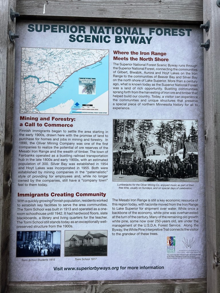
When we visited Beaver Bay and the Beaver River we saw this sign about the Superior National Forest Scenic Byway, so we thought we’d check it out. I had a bit of trouble finding information on places to see because the website referenced on the sign now gives information about the best online gambling apps. Huh?
Anyway, a lot of poking around gave me two possible sites.
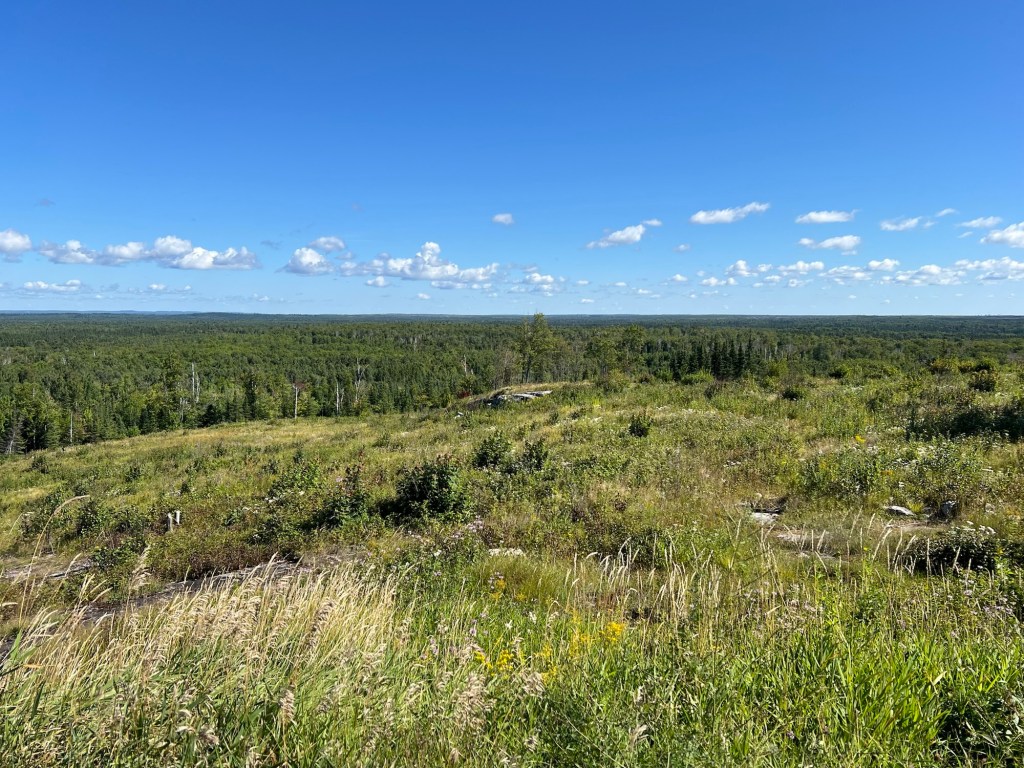
The first was the Skibo Overlook, and at 1802 feet it gave a pretty panoramic view out towards the Iron Range.
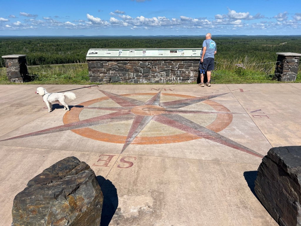
Between their compass rose on the concrete, their sign and our binoculars we identified a couple of the mining facilities out near the horizon.
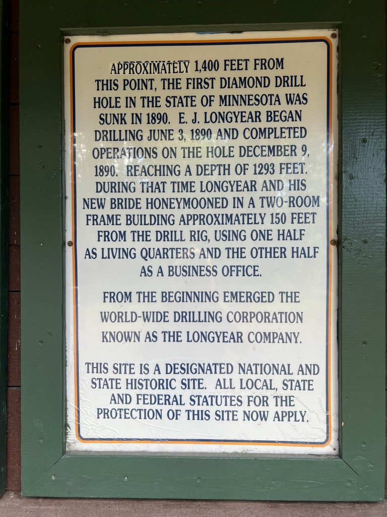
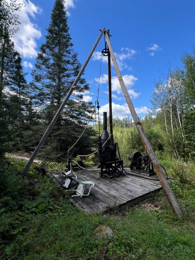
We then went on to try to find the Longyear Drill Site just outside of Hoyt Lakes. I found reference to it online, but it wasn’t a point on Apple Maps. I pinned the road from information on Google Maps. When we got to the road there was a dead end sign. We drove up and I checked Google Maps again, we were on the right road, but when you clicked on the site Google Maps listed it as permanently closed. We found a parking area and this sign.
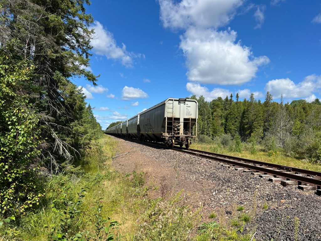
There was a dirt road leading back which soon crossed a section of railroad tracks.
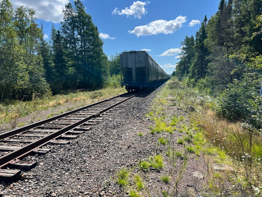
In both directions there was a long string of cars. We thought these might be cars waiting to transport the taconite to Silver Bay for processing.
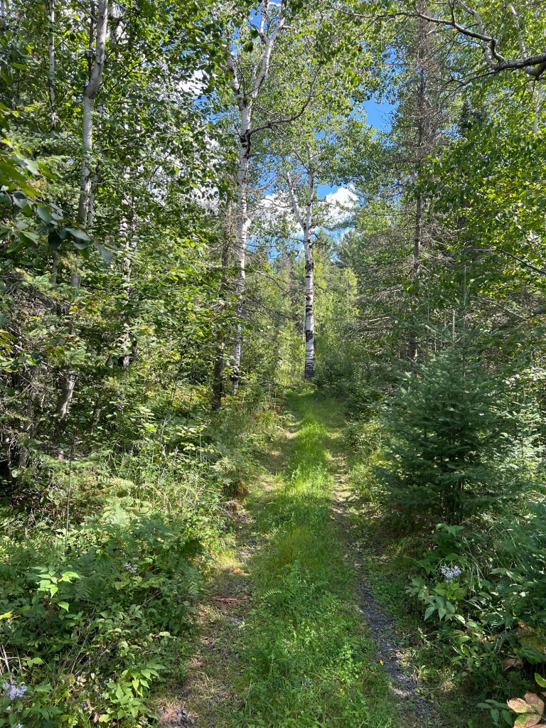
About a quarter mile back Bud lost faith and because he was being attacked by mosquitoes he turned back.
About a tenth mile further on Matey and I found the site.
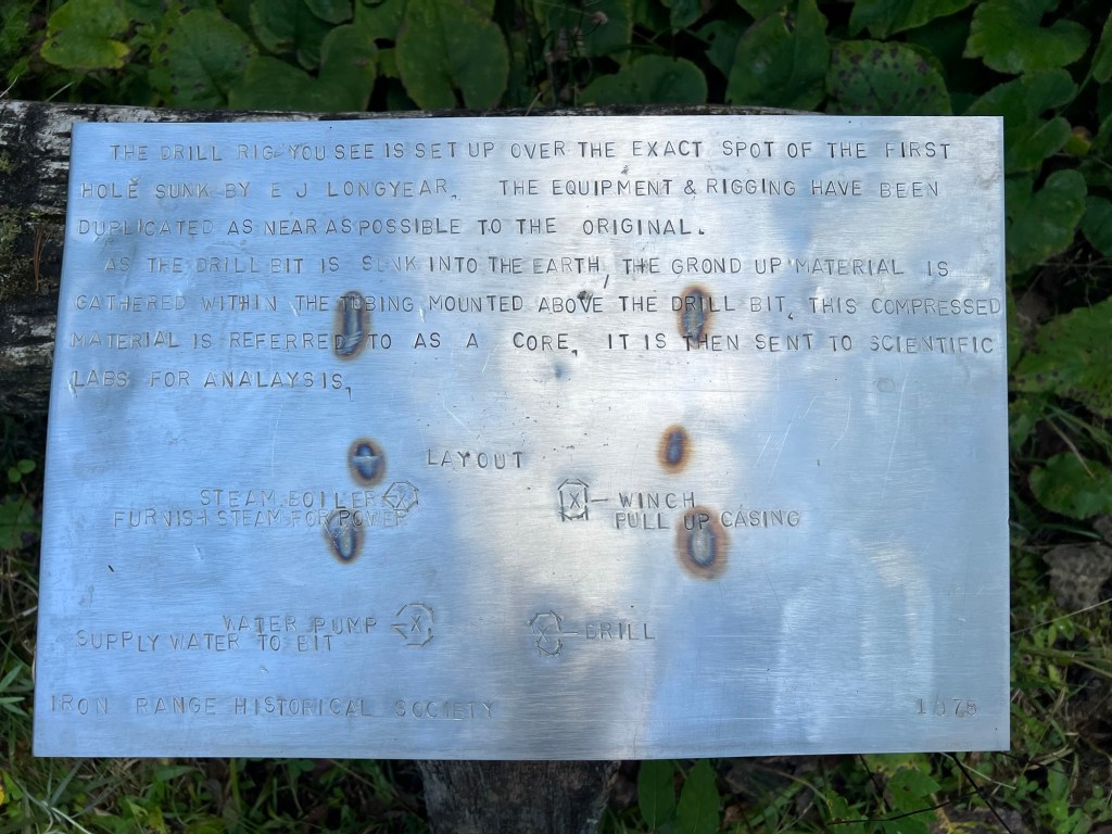
Although the sign says the equipment and rigging have been duplicated as near as possible to the original, I don’t think they’re including the plastic lawn chairs. Anyway, since rock core sampling is so common now, to all kinds of research, it was interesting to come to the place where the first core was drilled.
On the way out we had seen a sign for the White Pine Picnic area in Superior National Forest, so we bought some food to go at Hoyt Lakes and came back here.
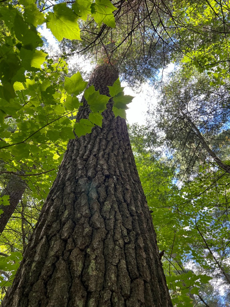
Too many mosquitoes here to eat outside but it was great to see these giants, some of which were 250 years old. Not many survived the intensive logging, but these grandparents did. It is one of my great sadnesses that we have almost wiped out the old growth forests, and I like to visit what’s left whenever I can.
That was almost our last exploring on the north shore of Superior. One of Bud’s incisors broke while he was eating that lunch (in the truck, away from the bugs) so he spent Wednesday and Thursday driving to Duluth to deal with that. Thankfully it doesn’t hurt and he did manage to get it looked at and impressions taken to start the process of getting an implant. The tooth will get pulled on September 9th. The final work can’t be done until four months later, but they will put some sort of placeholder in. He now lisps and looks like a hillbilly.
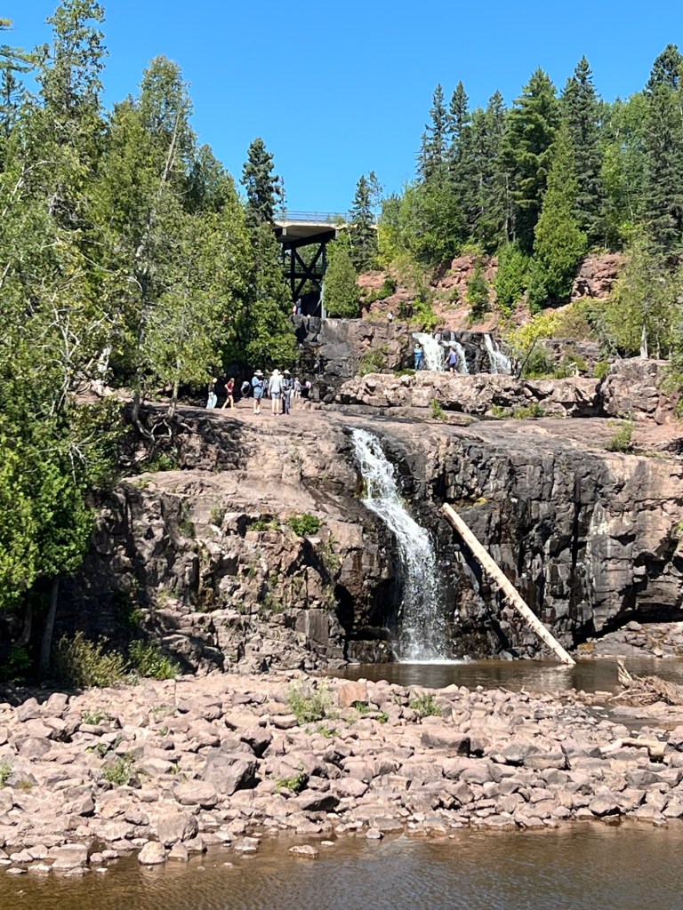
Friday we left Black Beach and Silver Bay, but we had extra time so we stopped at Gooseberry River State Park. This was another state park that charged no fee and had ample parking for campers. So we opened the camper and had lunch, then walked to the two lower falls.
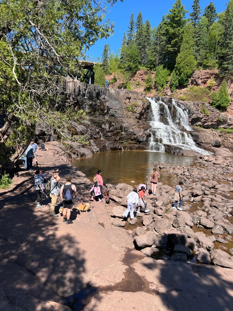
There were a lot of people there, but it was very pretty.
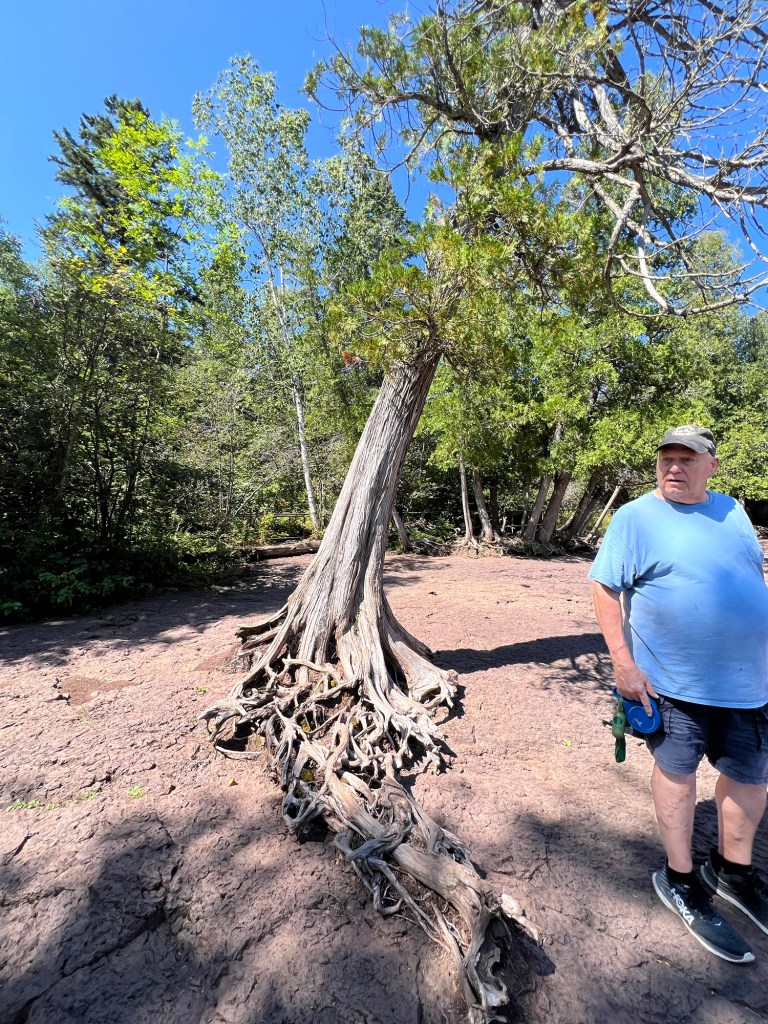
Of course I noticed the trees. This arborvitae was managing to live with its damaged roots clinging to bare rock. That is not dried red mud, it is red rock!
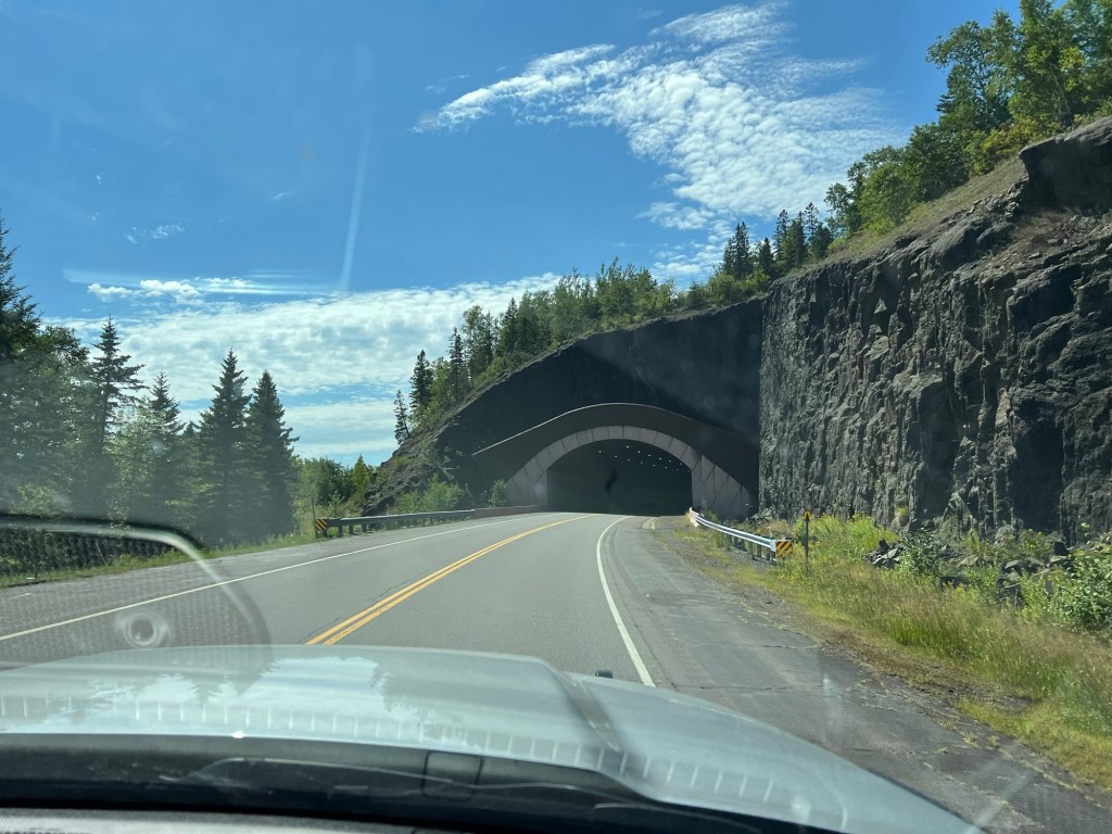
Then we headed on south on US 61 through the Lafayette Bluff Tunnel…
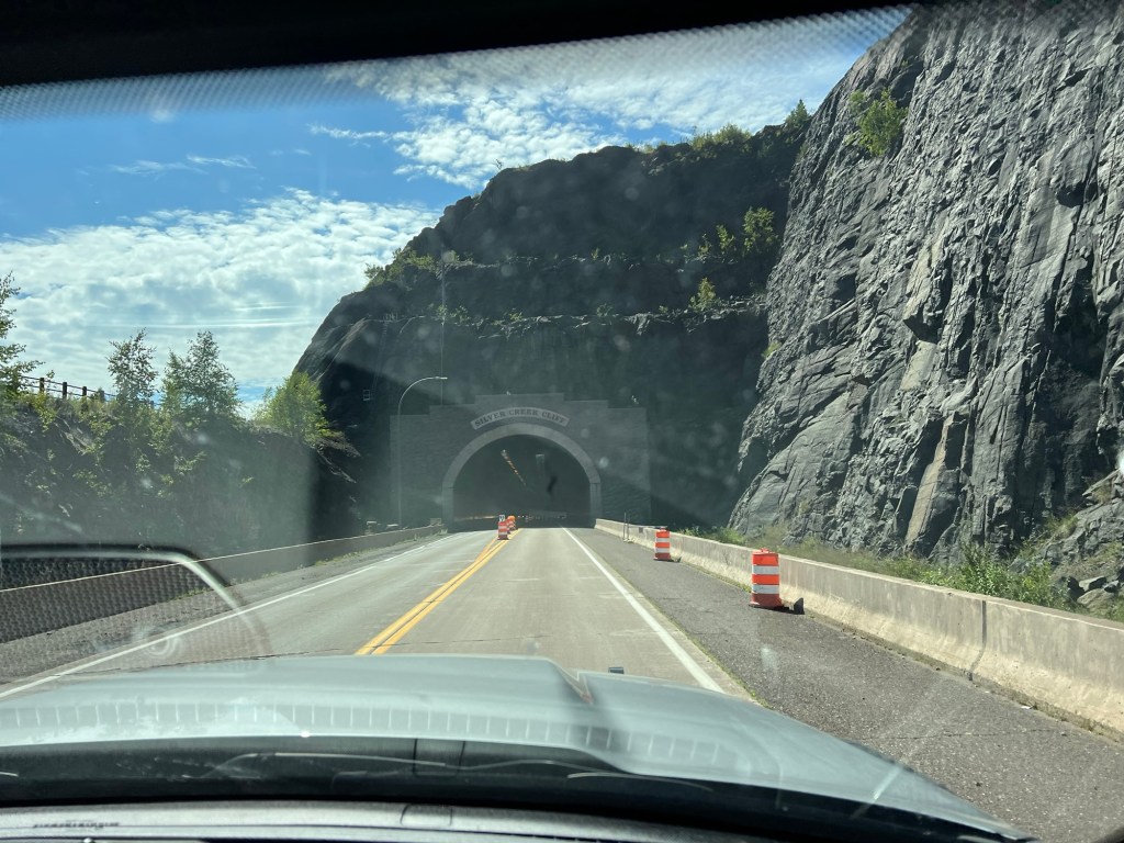
and the Silver Creek Cliff Tunnel and into Duluth, leaving the north shore behind.

Some very pretty things and some very interesting things! I can’t imagine how long it would have taken for them to carve out the road and the tunnels on that route!! How long were the tunnels?
LikeLike
Not very long, about a quarter mile or less.
LikeLike
That’s pretty long for a tunnel ! From my house to L. River Rd is only 0.1 mi.!
LikeLike