Downtown Hot Springs in the Fall

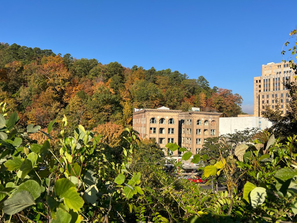
Fall is my favorite time of the year here, and downtown Hot Springs is like no other city.

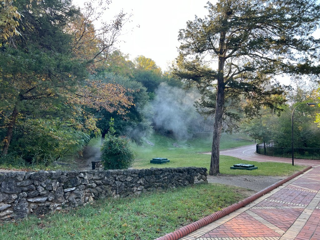
Not only does the main street lie between two hills that have been protected federal land since the early 1800’s, the slope of Hot Springs Mountain is dotted with springs that steam gently in the early morning chill.

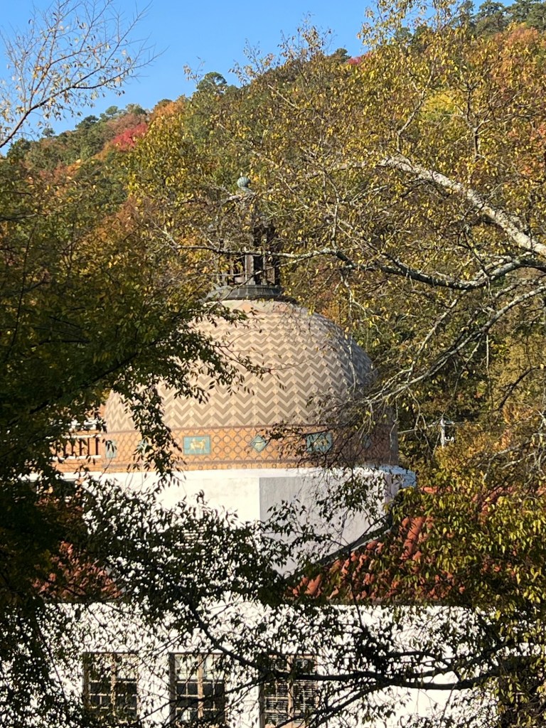
The east side of Central Avenue is lined with the historic and ornate bathhouses. These buildings are all part of the National Park and though many are leased, all are protected. Here is the dome of the Quapaw Bathhouse against the colorful backdrop of West Mountain.

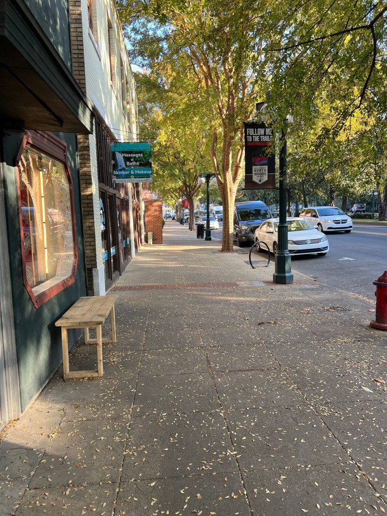
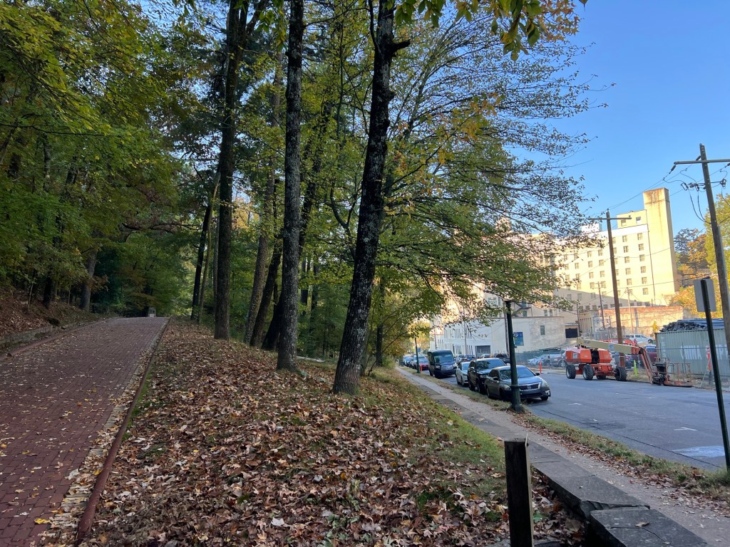
Even the commercial west side of the street is lovely and shaded.

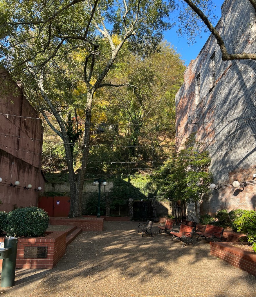
Downtown is well kept. This place where a building was torn down long ago is now a pocket park.

One of my favorite buildings is the historic Arlington Hotel.

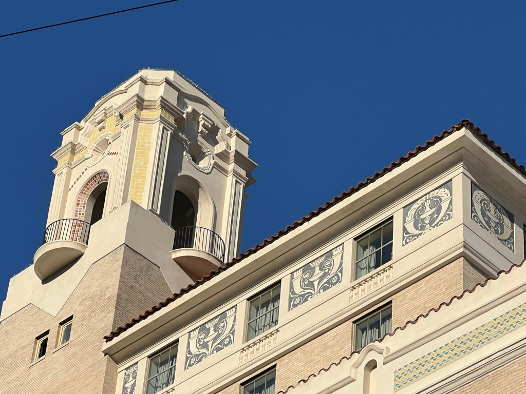
This 100 year old building has been undergoing renovations and it shows. The outside decor is now pristine.

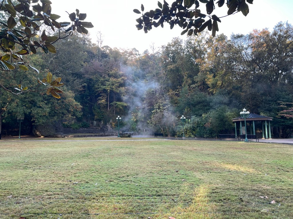
Across Fountain Street from the hotel is Arlington Lawn and the Hot Water Cascade, part of the National Park.

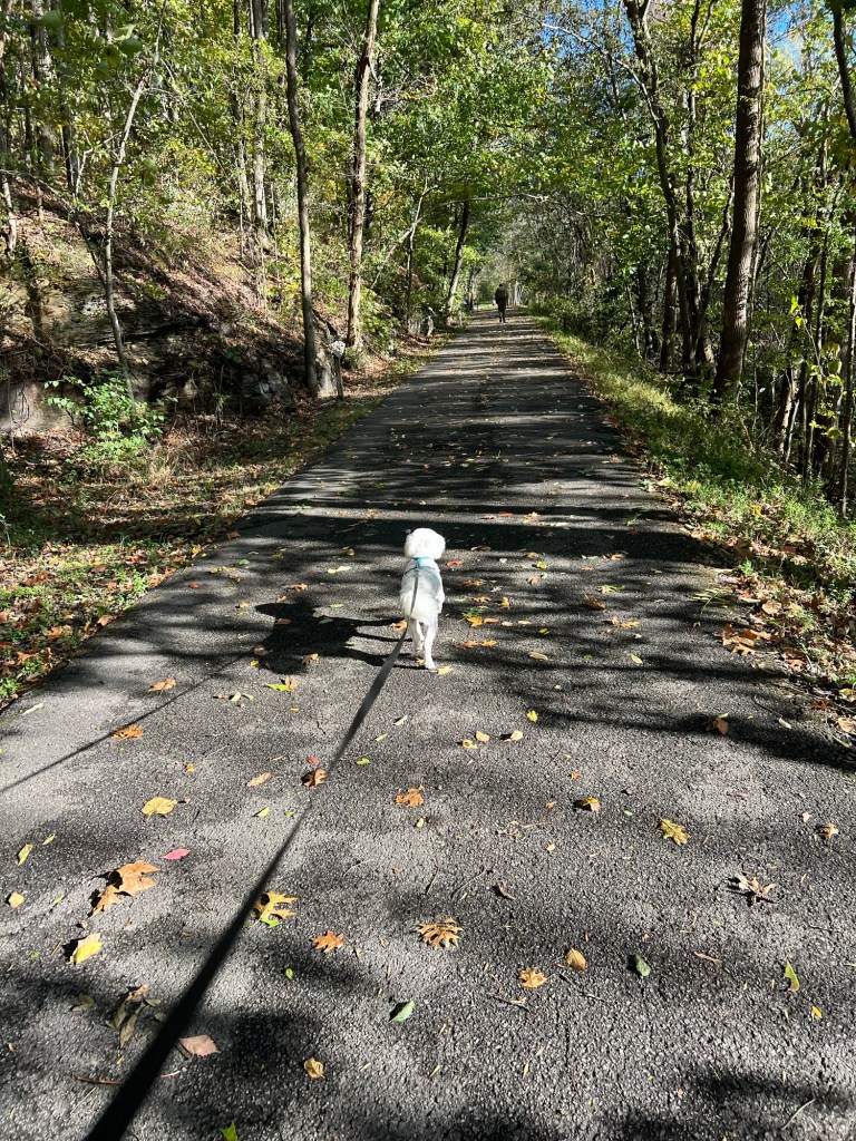
I took all of these pictures yesterday morning when Matey and I did one of my favorite walks; north along Central Avenue and Fountain Street to here, the northern end of the Grand Promenade.

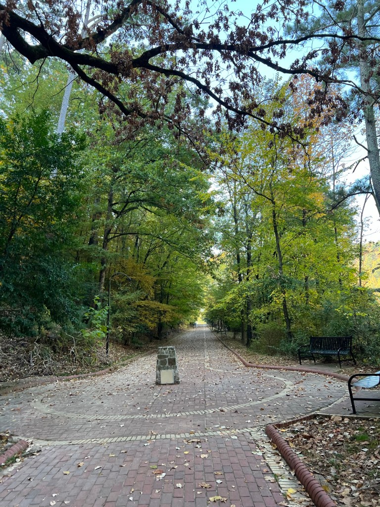
Then back along the promenade,

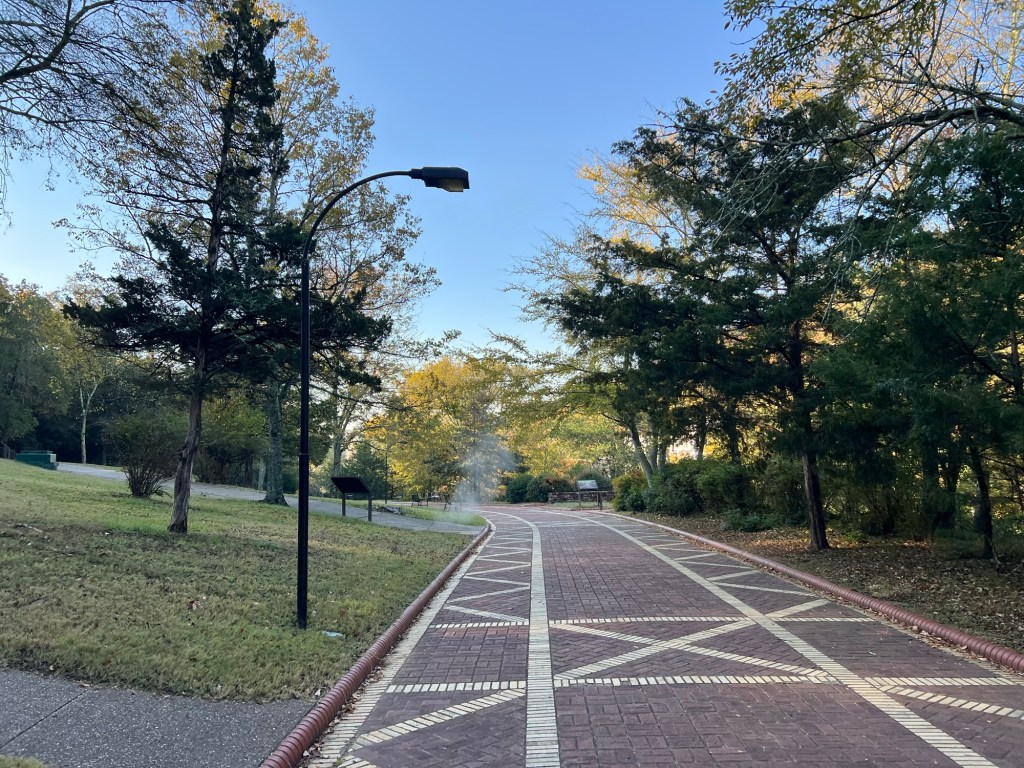
which gets wider and more ornate as it passes behind Bathhouse Row.

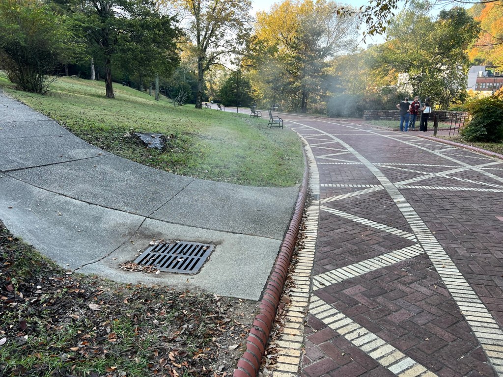
Where else do the storm sewers steam?

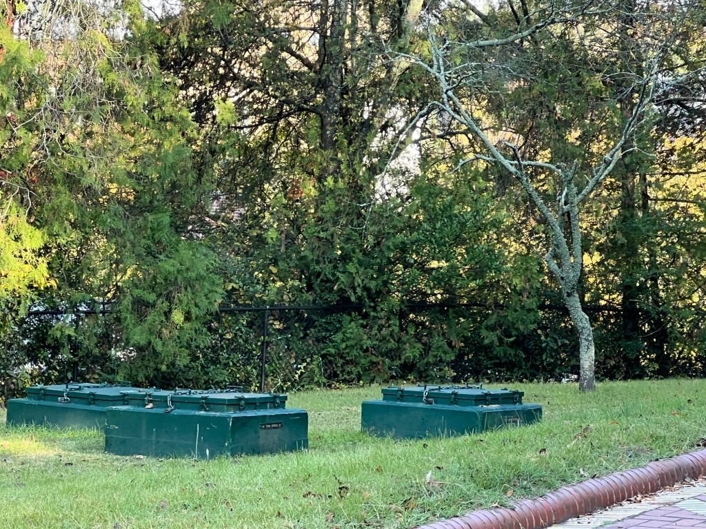
These are some of the spring boxes. Most of the springs are now piped down to the bathhouses. Park personnel test the water for rate of flow, pH and temperature through these boxes. If needed, the pipes can be shut off further up the mountain. During the current Federal shutdown only the most critical are checked.

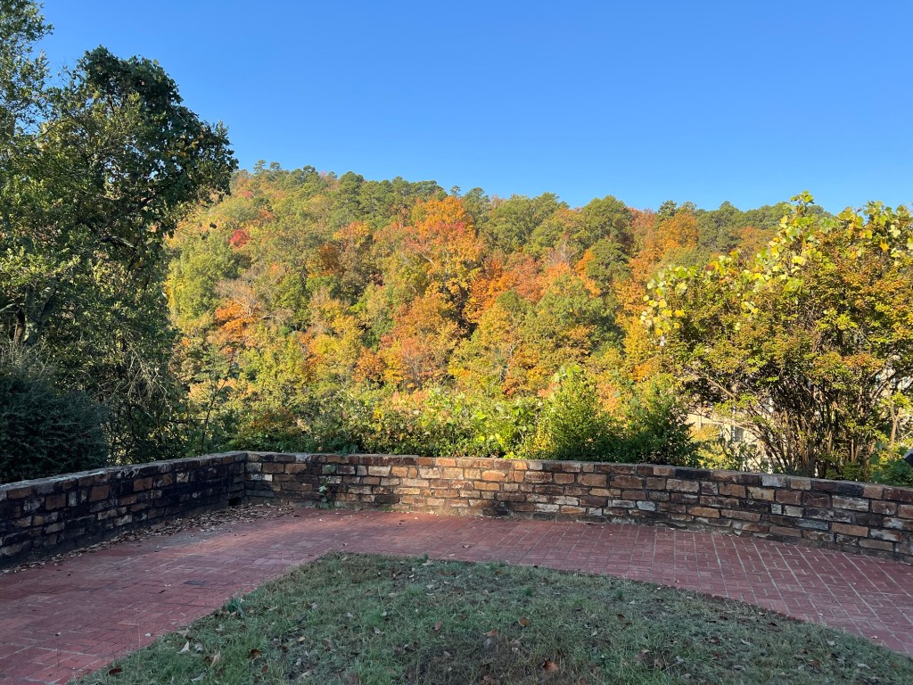
The promenade also gives some nice views of West Mountain. Central Avenue and all its buildings are tucked down below.

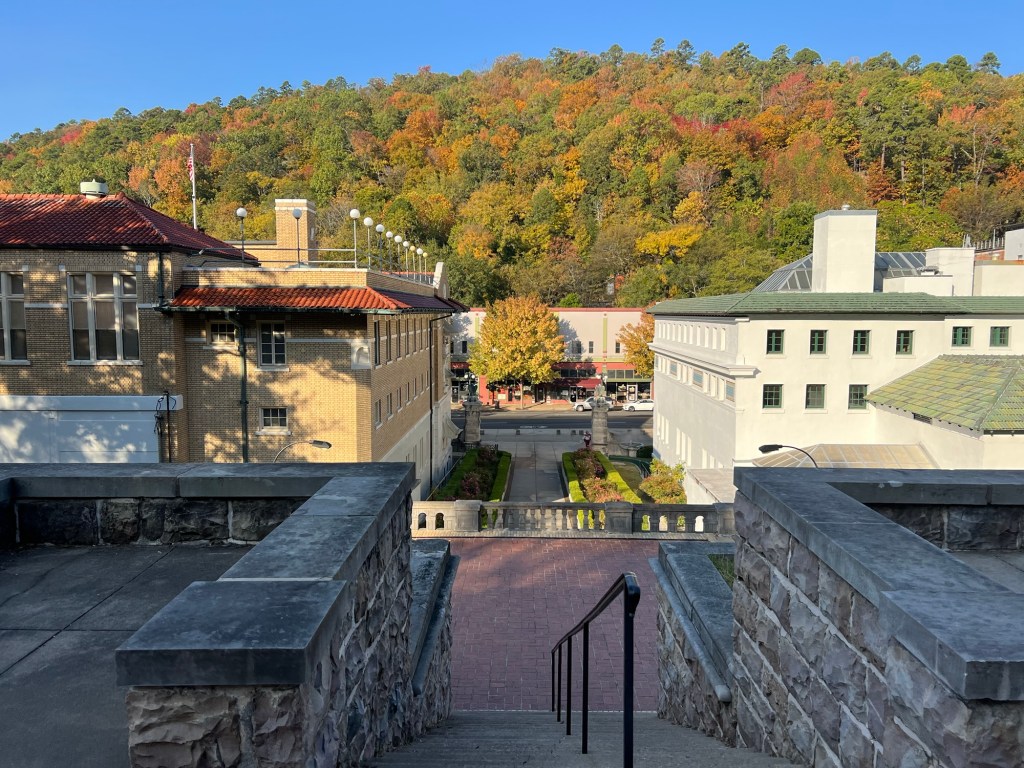
Here you can see two of the bathhouses, some of the stores and West Mountain. The building on the left is the National Park Visitors Center which is a museum. Unfortunately it is closed now, but normally there are free tours.

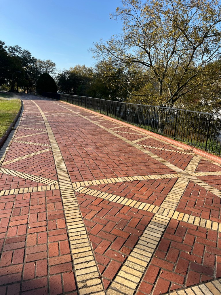
Even the walkway is beautiful in the early morning sun.

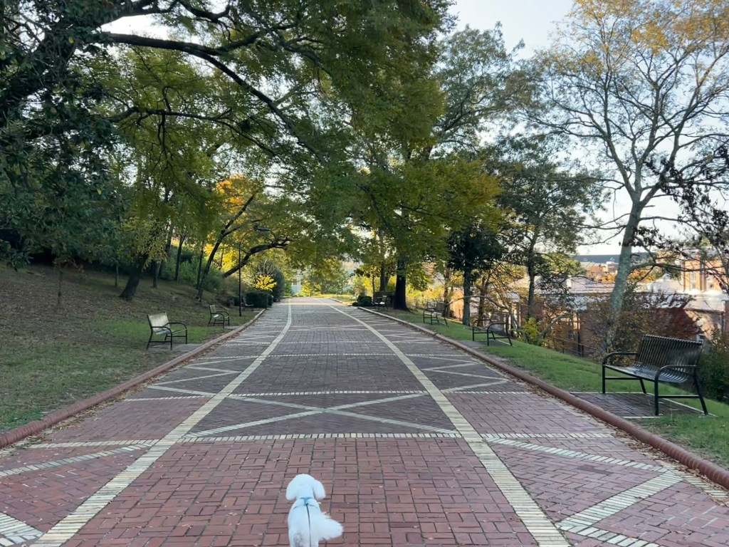
Matey and I have it all to ourselves.

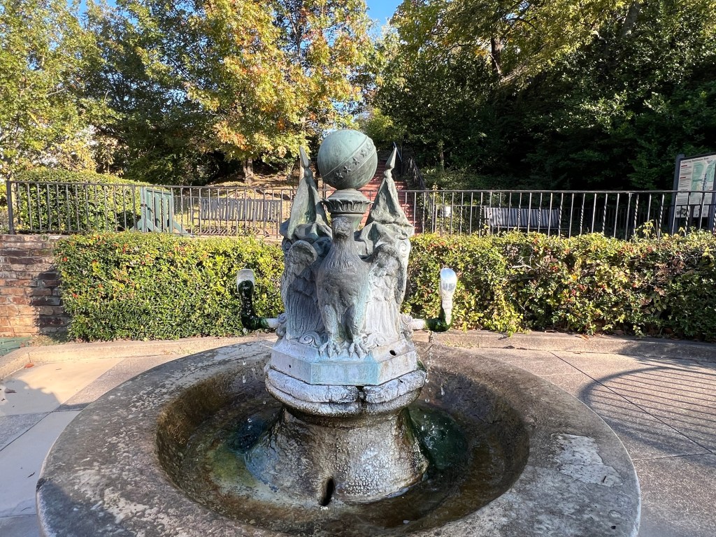
At the south end you come down to Reserve Street which has several of the fountains in the downtown area. Some are small and ornate.

This steaming fountain is in front of the park office.

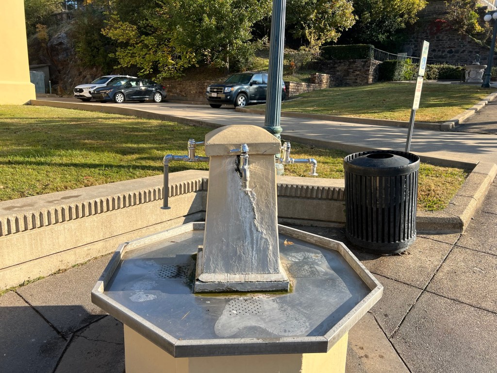
And this is one of several fill stations where people can bring their containers and get all the water they want. This station is for hot mineral water, but my favorite is on Fountain Street where you can get great tasting cold spring water. Jamie’s clinic fills their office water bottles there.

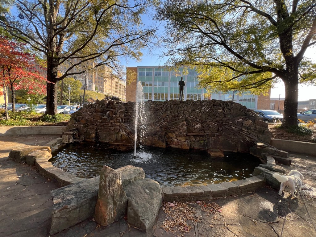
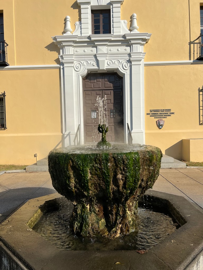
There are also decorative fountains.

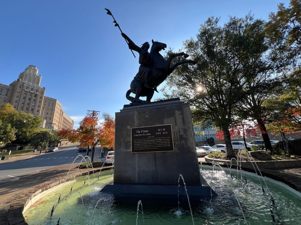
This fountain has a new statue,

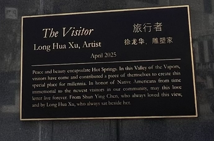
whose dedication is a fitting tribute to this unique city.

A Very Good Day

We are back at Gulpha Gorge Campgound, the campground for Hot Springs National Park.

This is a small campground with fairly tight sites and it’s always full.

But this is such a pretty valley that I don’t mind.

The oak just outside our window makes a colorful screen, even though it’s also dropping acorns on us.

And if I get to sit out in between errands there’s a lovely view as we’re on one end of the campground loop.

Today Bud and I wanted to go to Little Rock for the state marching band contest, so I wanted Matey to get a good walk as he was going to be left home by himself. I tried taking him around the flank of Hot Springs Mountain. Happily, he did well and was still full of pep after finishing the two mile walk. I was delighted to be back walking some of my favorite trails.

Then it was off to Little Rock for the competition. The band had a problem with one of their cords setting up. It was all tangled and they struggled to get one of their microphones plugged in. I think that shook them up as they had a couple of errors in their performance.

It is a very impressive show, though, with a lot of movement and complexity. Jamie is helping with props again this year, so she was down on the field and got this nice picture of Adler.

We were all nervous waiting for the awards. The four drum majors were lined up.

They did it! First place at States for the third year in a row.

The drum majors were happy.

Her, too.

The whole band was happy.

Adler was happy.

Grandma was happy.

We were all happy. (I had to call Bud with the news as he left soon after the performance to be with Matey. And Matey was fine.)

A very good day.

Two Stops Along the Way

Since we are on the road full time, everywhere we go is “along the way”, but I try to choose places that will be a destination in themselves. Some places don’t feel that way though and these last two stops have not; especially since our next stop is back in Hot Springs, as close to home as we have.

When we left Fulton and Whitten Park we went to Hurricane Landing on Sardis Lake, just north of Oxford, Mississippi. It was a nice campground and we had plenty of room.

If we’d come here to fish we would have been disappointed. This is the first boat ramp.

The road ends in water in the springtime.

But now even the second boat ramp, at the end of an extension of the road, is not near significant water.

Now it’s the season for off road vehicles.

These guys were using the end of the road to load their ATV into the bed of their truck. I walked over and put my foot on their tailgate, as the tailgate kept lifting as they tried to lift the vehicle in. They were quite grateful.

There were lots of Osage orange trees here and many of the fruits were squashed on the road. But these were more like Osage grapefruits.

I was glad none were dropping at our site on our camper.

After three nights there we crossed the Mississippi into Arkansas. I don’t know when we’ll be back east of the Mississippi, but I expect it will be a year or more.

It’s always interesting along that river.

We drove south and crossed the Arkansas River in the rain.

Our stop here is along the Arkansas River, another Army Corps of Engineers campground, this one at Pendleton Bend.

These are nice deep sites, but narrow.

Again, we have plenty of room.

The last two days were cool and rainy. But of course I’m out there walking with Matey, mostly between the showers. Yesterday morning this tug and barge were sitting along the river.

Today, in the sunshine, I got a picture of the larger of the two rice warehouses located along the Arkansas River just before the campground.

I thought the barges would be entering the Mississippi just downstream from this dam.

But what looked like it might have been a lock on the map is a power generating station.

Looking back at the map I can see there’s a canal that cuts across through Merrisach Lake to the White River and then into the Mississippi. The barges of rice must go that way.

Even when it’s just a stop there are always things to see and learn.

I Am: Not at All Likely, Somewhat Likely, [Extremely Likely], to Recommend this Campground to Others

Whitten Park campground in Fulton Mississippi gets a very high rating from me. First of all the park host switched our reservation for us from a wooded site to this one; where we have woods to the south and open sky to the north, for our Starlink. And not only did I not get charged a change fee, for some reason I got a $4 refund.

And we have this lovely area to the rear of our site for my screen tent. This is a Corps of Engineers park and though old is very nicely done. No leveling blocks needed here.

Matey and I have appreciated the trails through the woods linking the three campground loops. It looks like they were once all lit, but the lighting is gone.

All the bridges are still in good repair,

as is this pavilion…

which is a nice place to sit along the Tenn-Tom Waterway.

There is even a little beach.

This lovely stone building is part of the park and inside is a lot of information about four Federal programs and what they contribute to the area. It covers the Army Corps of Engineers, Mobile District, the National Park Service, the Tennessee Valley Authority and the USDA Natural Resources Conservation Service. There was also information about Jamie Whitten, the congressman who pushed for the Tenn-Tom Waterway and for whom the park is named.

The only information about the waterway was this sign out back. According to the sign the Tenn-Tom Waterway “was the largest earth moving project in history, moving one third more earth than the Panama Canal.”

Also out back is a path and boardwalk that leads to this fishing pier. This foggy scene greeted Matey and I on our first early morning walk.

The wisps of fog were gently blowing across the water, very ethereal.

There is a disc golf course through the woods,

and though challenging, it’s playable.

There’s also a disc golf course less than two miles away on the grounds of a community college. We played them both.

Not far past the college is the Fulton Lock and Dam.

We drove nine miles around to try to get a better look from the other side.

I was able to take these stairs…

to the bottom of the dam. I found it interesting that no water was coming past the dam. Then I remembered reading at another site how many millions of gallons of water it takes each time a boat locks through. The impoundment above the dam is the source of that water, so little water has to be let down otherwise.

This morning Bud dropped Matey, the stroller and me off at the lock on our side of the waterway.

There’s a paved and lighted walking/ bike path along the waterway.

Although it’s mostly straight and open there’s the occasional boat to see.

The path follows this creek upstream…

and eventually crosses it.

It’s very nicely done with benches and garbage cans.

The walking path ends at this pavilion right at the entrance to Whitten Park.

A three mile walk brought us right back to the park…

and our lovely site. Yes, this place gets high marks from me.

A Very Relaxing Drive

The Natchez Trace Parkway runs 444 miles from Natchez, Mississippi to Nashville, Tennessee. The entire route is a National Park. Since we were going to be in Nashville I planned this next stop so we could travel the Parkway. We entered the Parkway about 30 miles from its northern terminus and took it for a bit over 120 miles.

The whole route is like this. It’s a two lane road, no shoulders, just a grassy verge. The speed limit is 50 mph. But there are no stop signs or traffic lights, no trucks (no commercial traffic), no billboards and very little traffic. You just cruise along through the trees.

There are some open areas…

but the majority is tree lined. The route follows an Indian trail that the United States gained a right of way for in treaties with the Chickasaw and Choctaw Nations in 1801. European boatmen walked north along the route after floating goods down the Ohio and Mississippi Rivers. They would sell their goods in Natchez, including the timbers that made the flatboats they came down river on. Then they would walk the Natchez Trace back to Nashville and on to their homes.

There are plenty of places to pull over along the way and we stopped three times. The first time was right after we got on, at mile marker 412, the Water Valley Scenic Overlook. The scene was a bit marred by the power line running through, but it still made a pleasant stop.

Our second stop was at the Meriwether Lewis Burial Monument at mile marker 386. After his great expedition with Clark, Meriwether Lewis was appointed Governor of the Territory of Louisiana.

In the fall of 1809 he was journeying north on the Natchez Trace with Major James Neely, the U.S. Agent for the Chickasaw Nation. This is a portion of the original trail still visible at the site of the monument.

On October 11, 1809, they stopped for the night at the Grinder House, one of many Stands that offered accommodations to walkers along the trail. That night shots were fired and Lewis died. It is still debated whether this was suicide or murder. Lewis was in money trouble and known to drink and take drugs. His trip was to clear up claims to get reimbursements withheld from his expedition with Clark and to deliver his journals to a publisher in Boston. Perhaps he despaired of ever getting his money from these things. Perhaps he suffered, as has been suggested, from depression and PTSD. Perhaps he was one of the many victims of highwaymen along the Trace.

In any case, his body was buried in an unmarked grave in a pioneer cemetery next to the Grinder House. A year later a friend put an iron fence around the grave and in 1848 Tennessee erected his monument.

Today the grave, ruins and monument are part of the Natchez Trace National Parkway.

Our final stop was at the Tenn-Tom Waterway at mile marker 293. This was actually about a half mile past where we were supposed to turn off.

The Tennessee-Tombigbee Waterway joins the Tennessee River to the Tombigbee River creating an alternate route for barges and boats between the Gulf of Mexico and the Great Lakes. Since its completion in 1985 this has been the preferred route for pleasure boats as the lower Mississippi has so much commercial traffic and few accommodations for smaller boats.

The Natchez Trace Parkway crosses the Tenn-Tom on the Jamie R. Whitten Bridge. Jamie Whitten was a congressman who fought for funding to link the two rivers, something that had been discussed for more than a century. As the sign there said “His vision helped make possible this historic landmark, the intersection of two great avenues of transportation-one past, one present, and both for the future.”

We turned back to County Road One and went 20 miles along the Tenn-Tom to our new campground, but I have another 80 mile stretch of the Natchez Parkway planned for later in the year. It’s a great road for touring.

An Unexpected Pleasure

Saturday afternoon we picked up all our outside stuff because storms were coming through overnight. I expected Sunday to be a rainy, drizzly day. But Sunday morning the rain stopped. Bud asked if I would like him to drop Matey and me off to walk the Cumberland River Trail. I looked that up and found a trailhead that would give us a four mile walk on a paved trail, so we went there and unloaded the stroller and Bud left to go shopping.

This is a rails to trails project and this part was paved, so it was perfect for the stroller. About three-quarters of a mile along we came to this converted trestle.

The bridge crossed Sycamore Creek as it widened near where it flowed into the Cumberland River. By then the clouds had mostly cleared and it was a perfect walking day; sunny, in the low sixties with a mild breeze.

Being a converted railway the trail was mostly level and straight, but it was still pretty as it tunneled through the trees.

The trail hugged the side of the river valley, so there were some pretty rock cliffs here and there.

A second bridge…

gave nice views of a branch of the creek (that tree is a sycamore, one of many in the area).

There were benches along the way, including this lovely stone memorial.

About halfway along this section of the trail was the Turkey Junction Native Gardens and Comfort Station.

This swing was the project of an Eagle Scout,

positioned to take advantage of one of the few openings in the trees lining the trail.

There were some picnic tables,

and signs for trees…

and other perennials.

Bud walked up and joined us for the last half mile or so, which was nice because Matey finally wanted to walk. So I took Matey…

and Bud brought the stroller.

This turned out to be a much nicer day than I expected.

Harpeth River Bridge Campground; Not as Advertised, but It Worked Out

My original plan was to spend two weekends in Nashville, so a twelve day stay. I was looking for a site with full hook-ups, and RV Parky, the app I use for planning, had Harpeth River Bridge listed with full hook-ups.

So I went to the recreation.gov website and based on this photo of a spacious site right on the river, chose site 14.

When we pulled in, we thought site 14 was occupied, as there was a C-class Motorhome in the driveway. It turns out that this site has a shared driveway, not as spacious as I thought. And there was no sewer hook- up. How did I get that wrong? I checked RV Parky and sure enough, they listed sewer. I sent them an edit.

Then I went back and checked the recreation.gov site. Under Full Hookup it says 50, which would make you think it has full hookups with 50 amp electric. So it wasn’t me, but now we were here without sewer. But happily I had cut out one weekend to be in Memphis and we are only here for 8 days, and not having a sewer hookup is easily manageable.

It does have the river, seen here from my seat under our awning.

And it does have the bridge.

And although there’s not a lot of room for walking Matey I was able to get him both a grooming appointment and a vet appointment in the area (both of those scheduled months ago).

I even took the time to put up my Halloween decorations. I’ve been carrying them around for four years and decided I should either put them up or get rid of them.

I took Matey down to a nearby boat ramp at the confluence of the Harpeth and Cumberland Rivers. It was a pretty spot but there wasn’t really anywhere to walk there either.

There is a nearby disc golf course, so Matey has gotten some exercise while we played.

We drove over to the Cheatham Lock and Dam on the Cumberland River and watched this tug coming out of the lock…

pushing its string of barges. There were fifteen barges in the group, three wide and five long.

I tried to get a photo of the whole array, but it hardly fit in the frame!

Down river we saw another tug with 9 barges…

and four pleasure boats waiting to lock through.

We were surprised that they had the pleasure boats come up…

and cut in front of the tug and barges. They locked them through first. Having traversed the Welland Canal twice with pleasure boats we know that would never happen there. Commercial traffic has precedence and you can wait for hours for your turn in the locks.

So despite this not being what we expected, we are enjoying the area, and the turtles…

and the birds.

Harpeth River Bridge Campgound has turned out to be fine.

Fort Pillow State Historic Park

While I went down to Memphis Bud and Matey stayed at Fort Pillow State Historic Park about an hour and a half north. Our site turned out to be pretty nice. There is no one on the far side of our camper giving us quite a bit of privacy.

The campground loop was long enough to give Matey a decent walk.

On Sunday, when I got back, we drove up to explore the historic fort. Like at Columbus-Belmont there seems to be nothing left but earthworks. These were less obvious and were now pretty indistinguishable from the woods.

There were some nice trees, maybe growing here since not long after the Civil War.

There was an overlook with an interesting view. In the far distance on the left you can just catch a glimpse of the Mississippi River. A bit closer on the right you might think that is also the river.

But it’s not anymore. It’s called The Chute and it is an oxbow lake now cut off from the river. You’ll notice the state line between Tennessee and Arkansas follows what was the river. And Fort Pillow now guards this oxbow lake, and not the Mississippi at all.

Before we left on Monday Matey and I took a walk on the Chickasaw Bluff Trail.

We walked as far as the primitive campsite which was on a bluff,

and had a partially obscured view of a valley, but I couldn’t find either the river or the lake.

While we were a bit disappointed with the fort, this was a nice park and a very nice campground.

Memphis Regional Marching Band Competition

As usual I did not get many pictures of this past weekend. For one thing, it’s not easy to capture the whole scene with an iPhone. This is the Lake Hamilton band in preliminary competition, close to the end of their show.

I met Jamie and Sean in the parking lot just before 11AM. We walked over to where the band was…

and Jamie helped with the props. The show is called The Visionary and is themed on Leonardo DaVinci. The props include screens with drawings of four of his inventions and life sized models of them.

Sean and I went to the stands and Jamie stayed with the band to help them get all those props into the stadium and onto the field. I think they only get three or four minutes to move everything in place, which includes time to set up amplifiers and microphones.

This is close to the beginning of the performance, Adler is on the right, holding his tenor saxophone.

In front, on the sidelines, is the pit, xylophones and symbols and other percussionists, as well as the electronics they use.

The show starts with the screens in front of the props and turned so the drawings show. Here the screens have been turned to solid blue and are back drops to the actual devices.

The band made finals and this is the only shot I got of their finals performance. I did manage to catch Adler actually playing.

Here are all the finals bands lined up for awards.

Lake Hamilton ended up in eighth place, third in their class. They were happy with that result and I was happy to share the weekend with Jamie, Sean and Adler.

Everything We Need

Yesterday we crossed the Ohio River not far from its confluence with the Mississippi. This is not our original route. I had planned to stay two weeks near Nashville, hoping to meet Jamie at the airport and drive with her to watch Adler compete in Johnson City in eastern Tennessee. But after two years where they did compete there, the band is not going this year.

So instead we came to Columbus-Belmont State Park on the Mississippi River in Kentucky. We are on our way south to a park north of Memphis and I will drive down and meet Jamie and Sean to watch Adler and the band compete in Memphis.

We had been here in November of 2022 and although this year I couldn’t get one of these sites with their river sunsets,

Matey and I can still walk the bluffs above the Mississippi.

The park is mostly the same as I remember it but I do see that erosion of these bluffs continues.

With all that vegetation you’d think these slopes would be protected. I guess not as you can see a small gully working its way back into the grassy bluff.

Otherwise the place is as pretty as I remember.

Everything looks in great shape. They were finishing up some grooming this morning.

Turns out this weekend there is going to be a civil war reenactment here.

The whole park is full of entrenchments, dug by the Confederates but only held by them for a year.

They were put here to guard against Northern invasion down the Mississippi, but when Kentucky fell to the Union this position was taken over by the North to aid in that invasion.

I wonder what battle they will reenact, as no battles were fought here.

As for us, we’re just here for one day and I needed to get wash done. There are two washers and two dryers,

just steps from our camper. And Bud found an auto parts store 10 miles from here where he got a replacement taillight bulb.

Wash done, repairs done, and lovely places to walk; we’re all set.