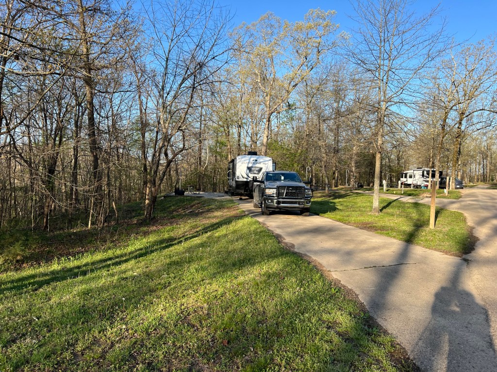
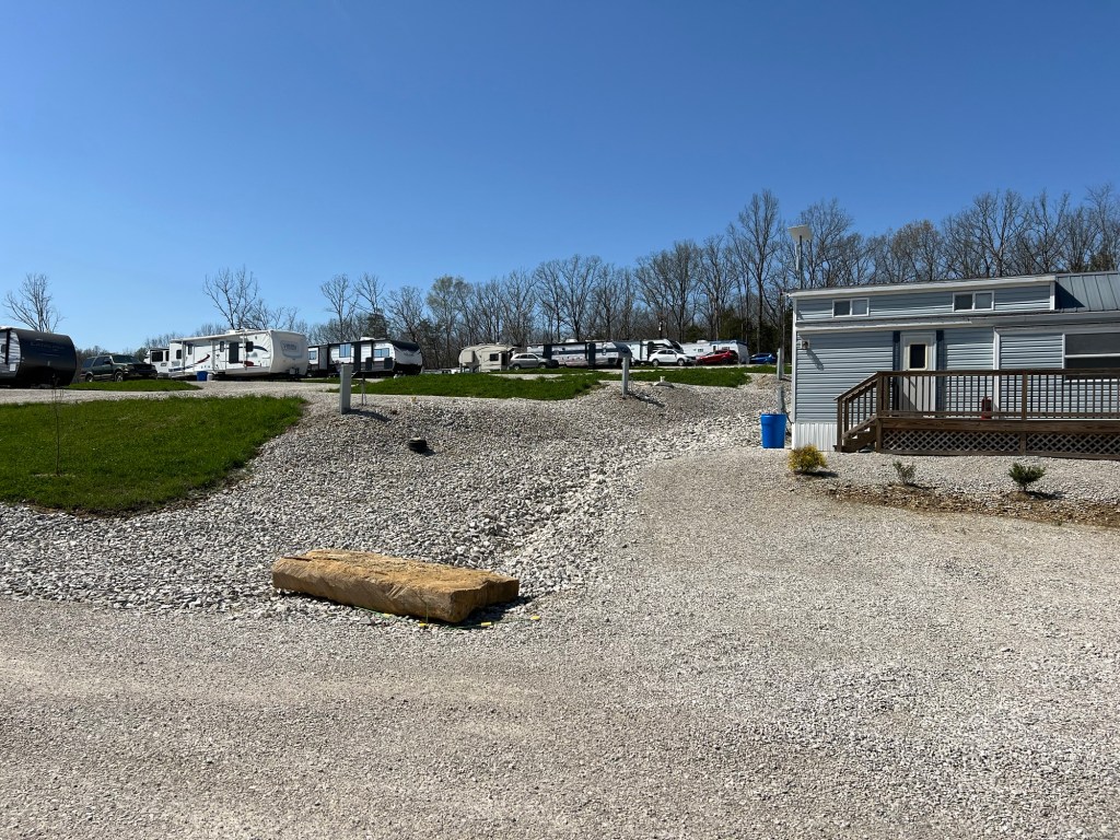
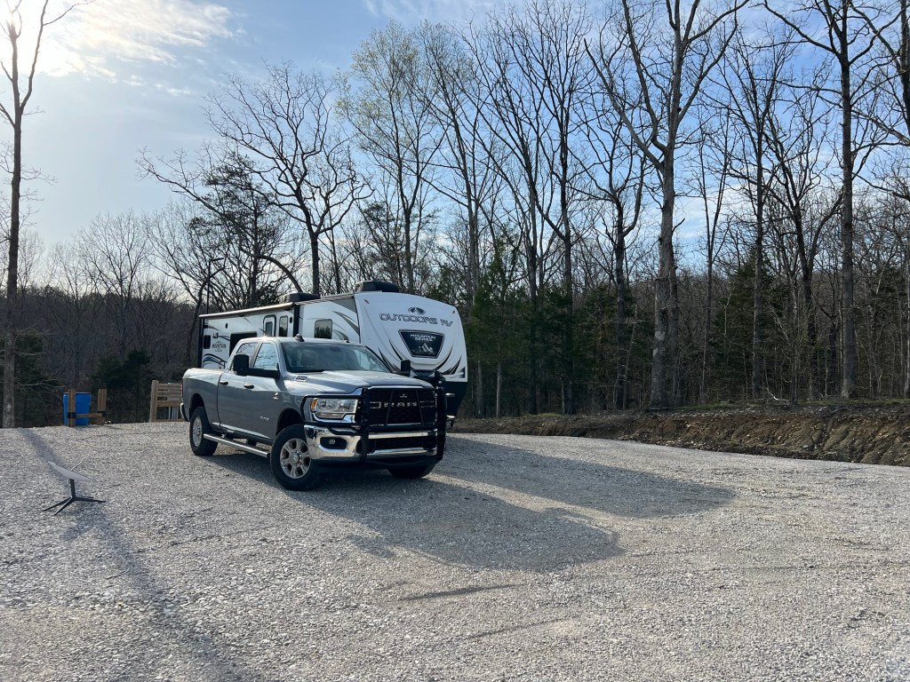
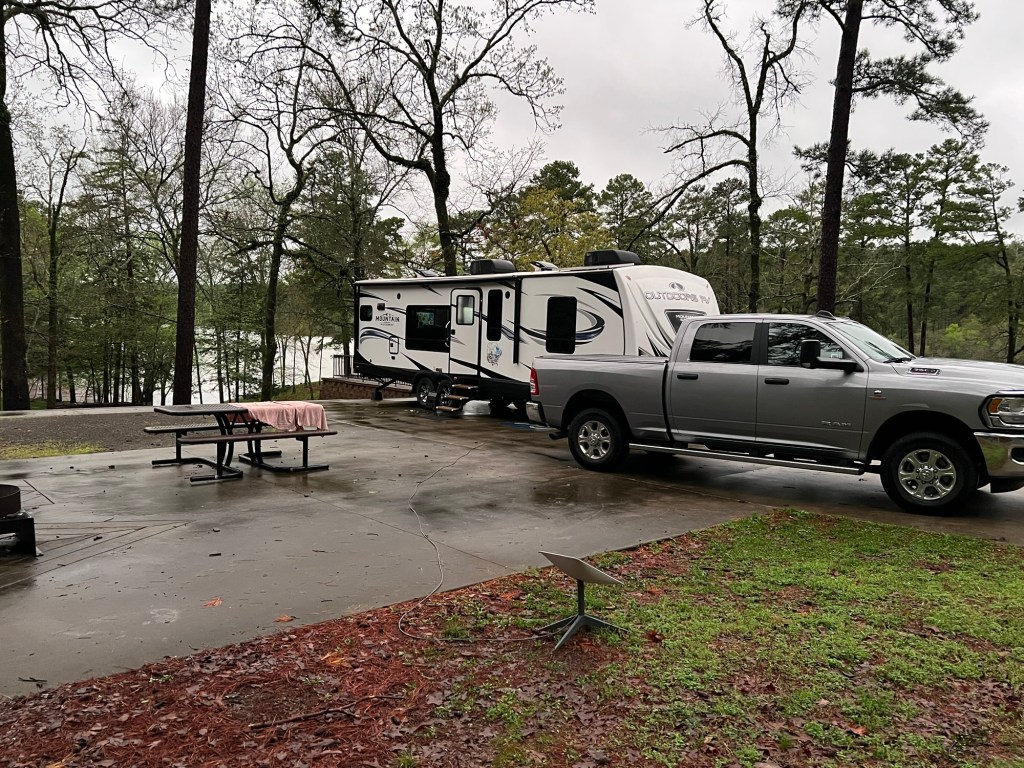
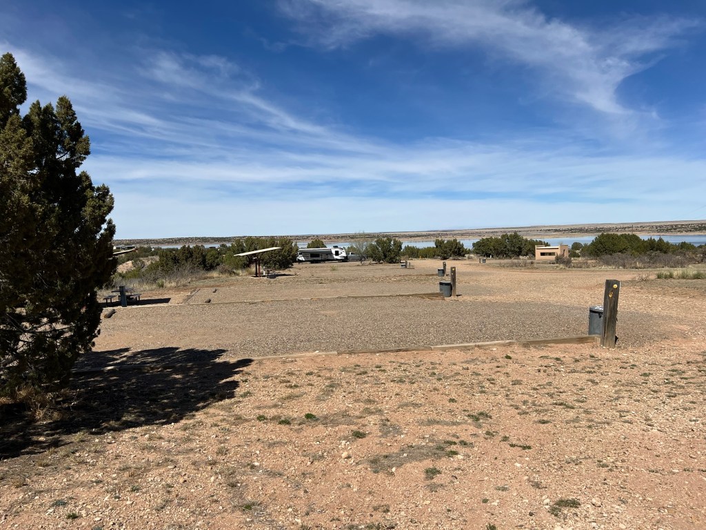
We came to Hot Springs and Lake Ouachita State Park on Tuesday. Like most Arkansas State Parks the sites are very well done, and we have full hook-ups.
The forecast was for rain, lots of rain. Wednesday we ran errands all day and the rain held off.
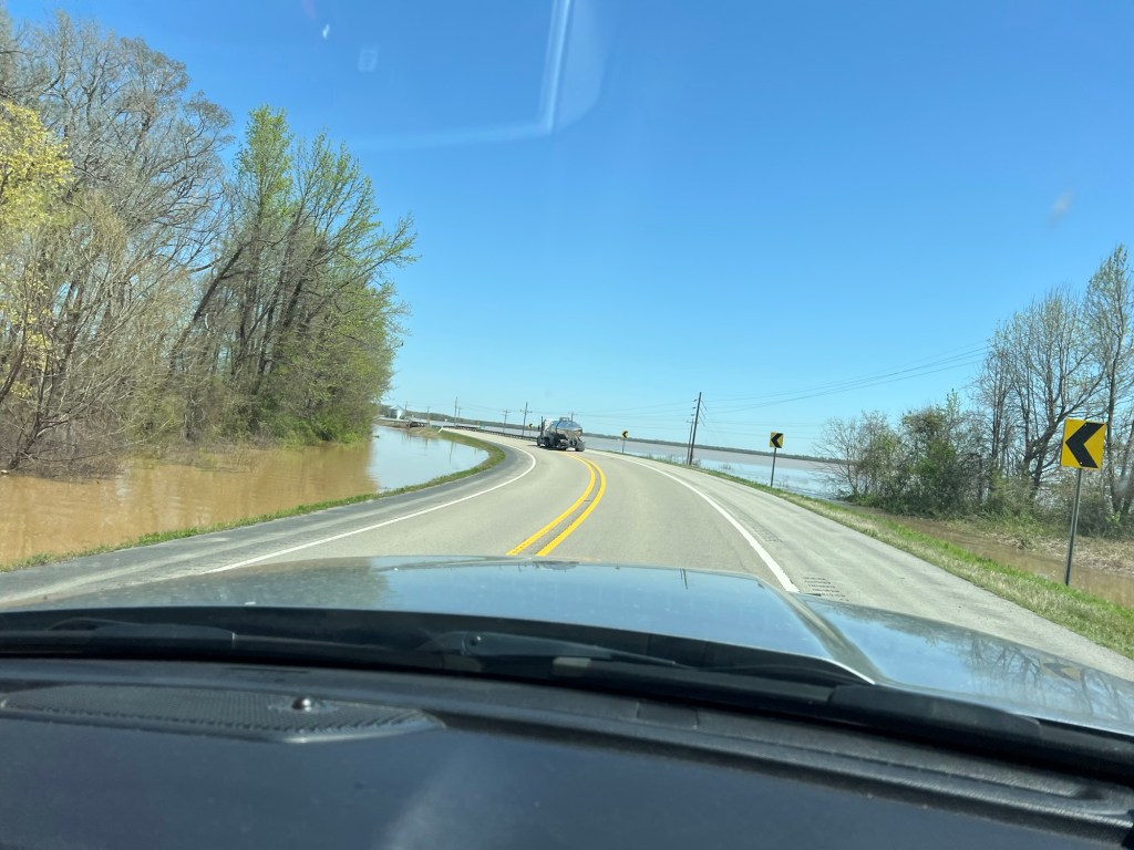
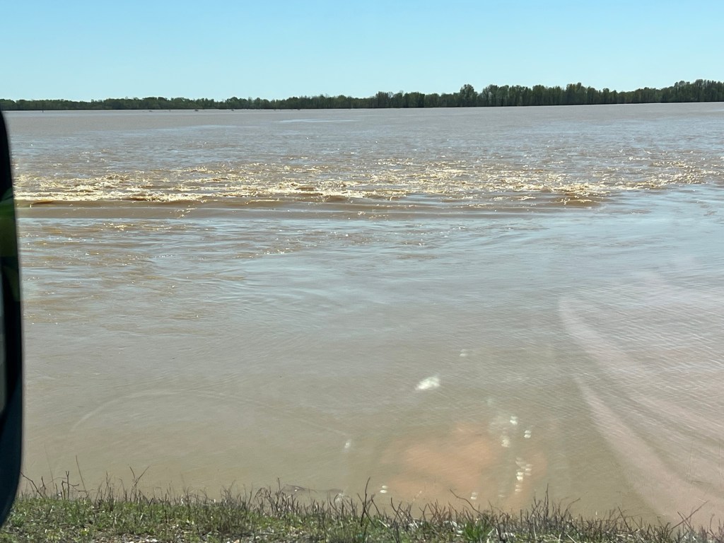
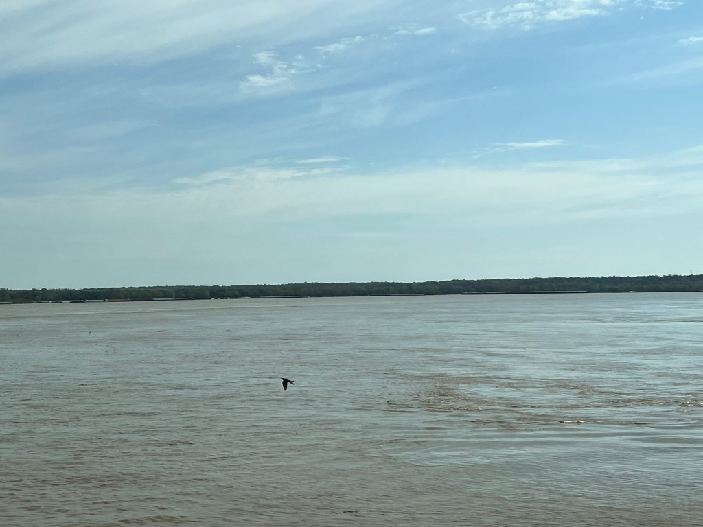
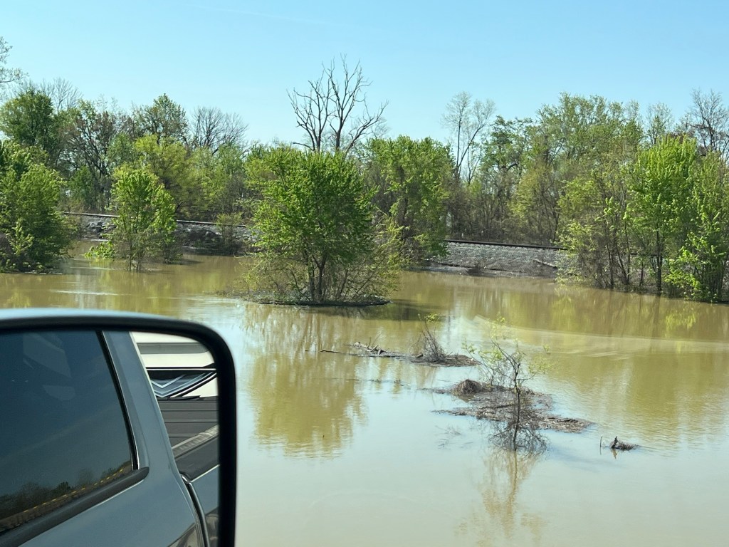
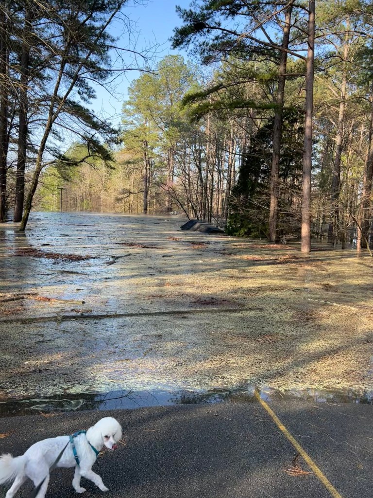
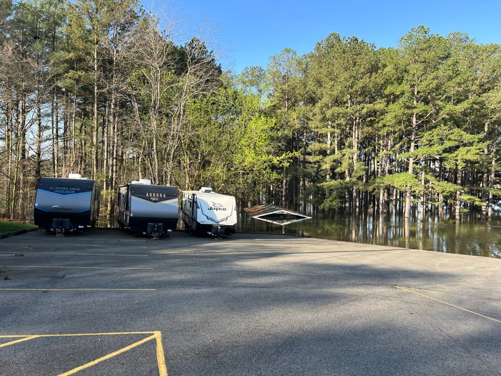
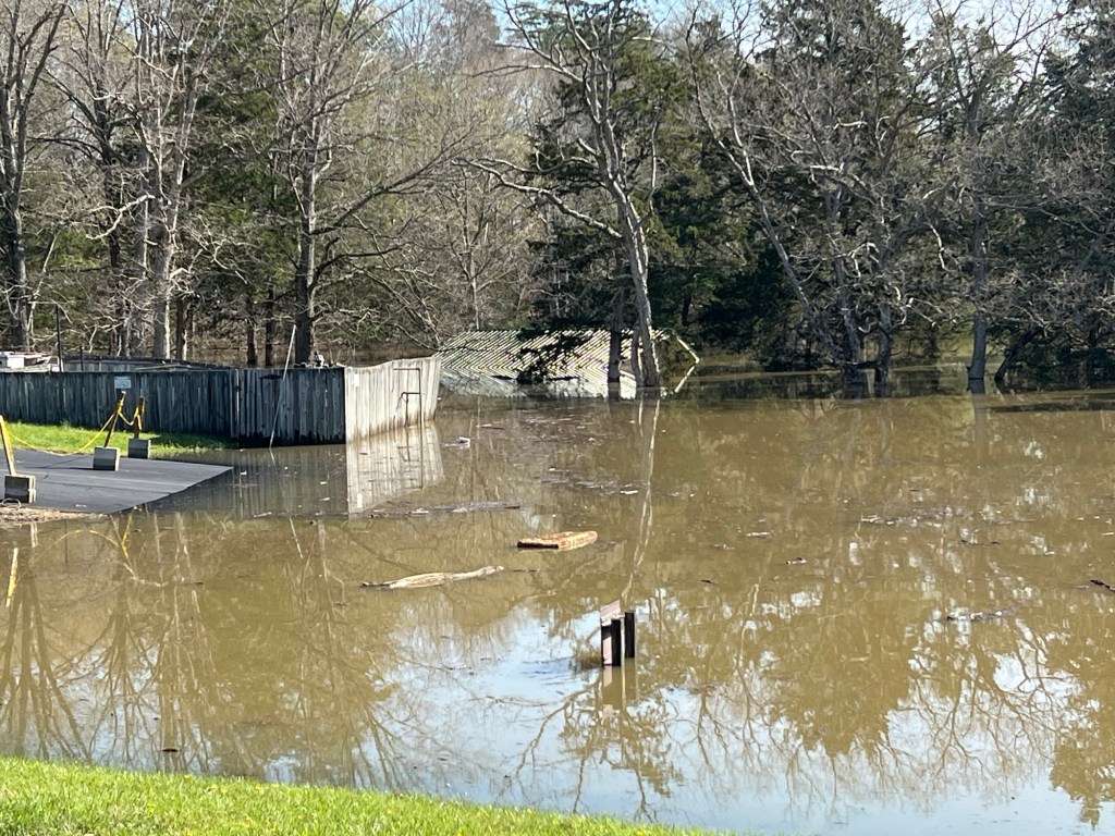
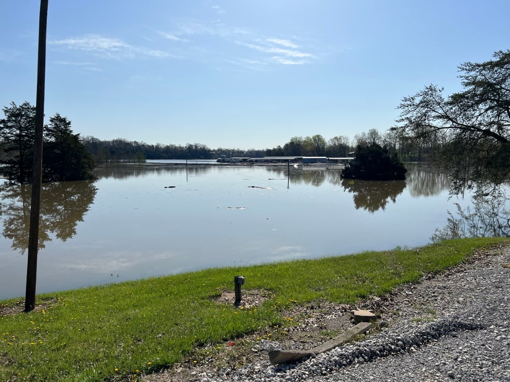
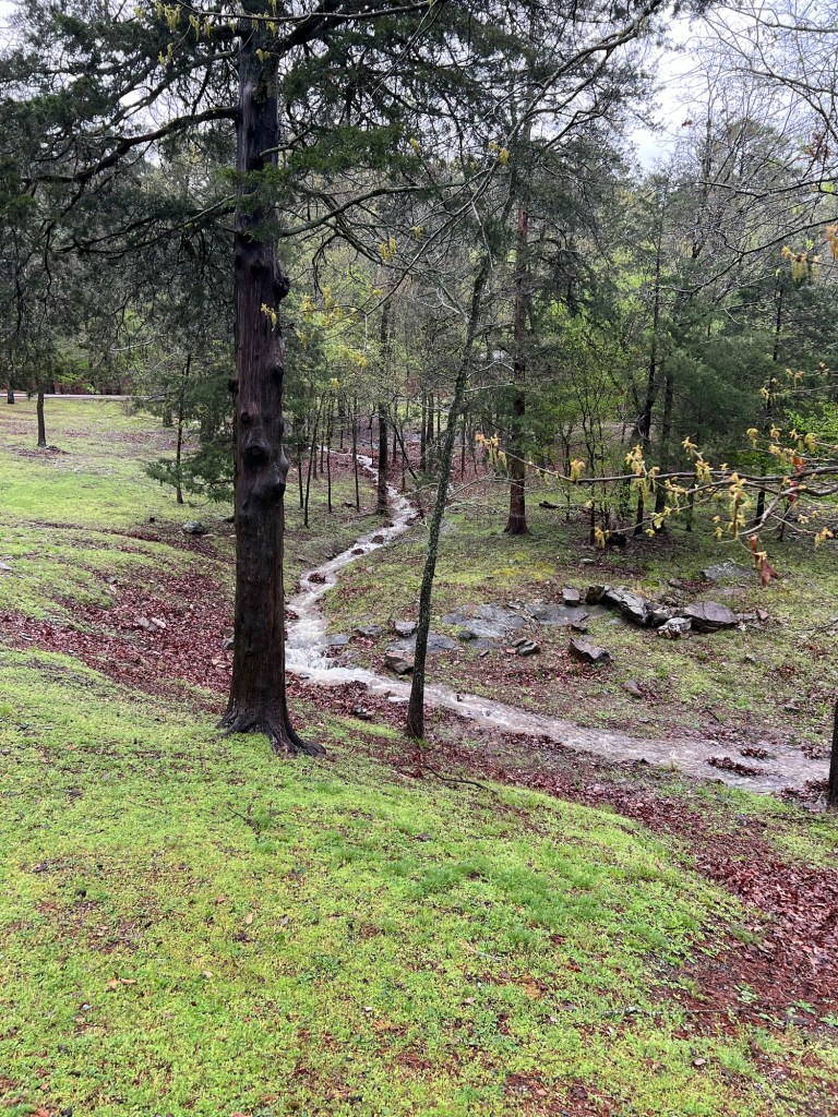
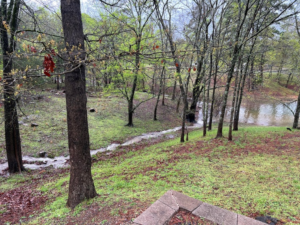
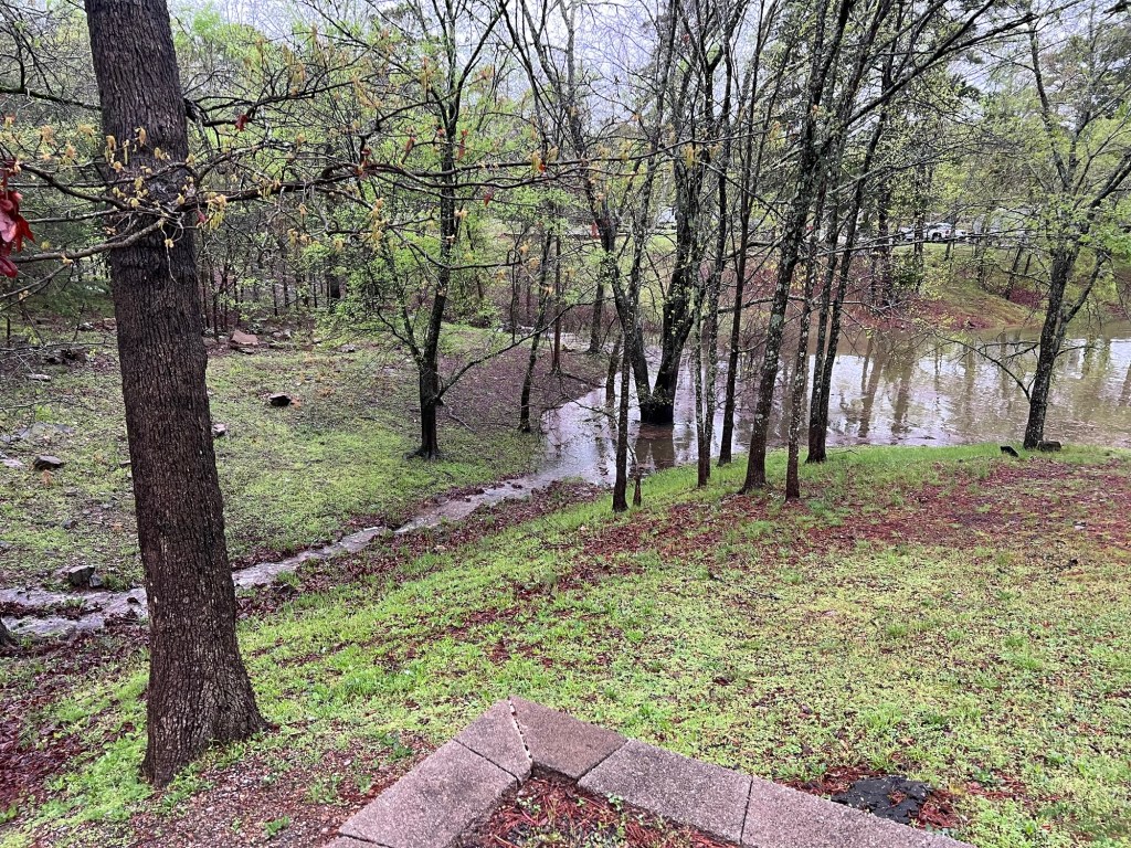
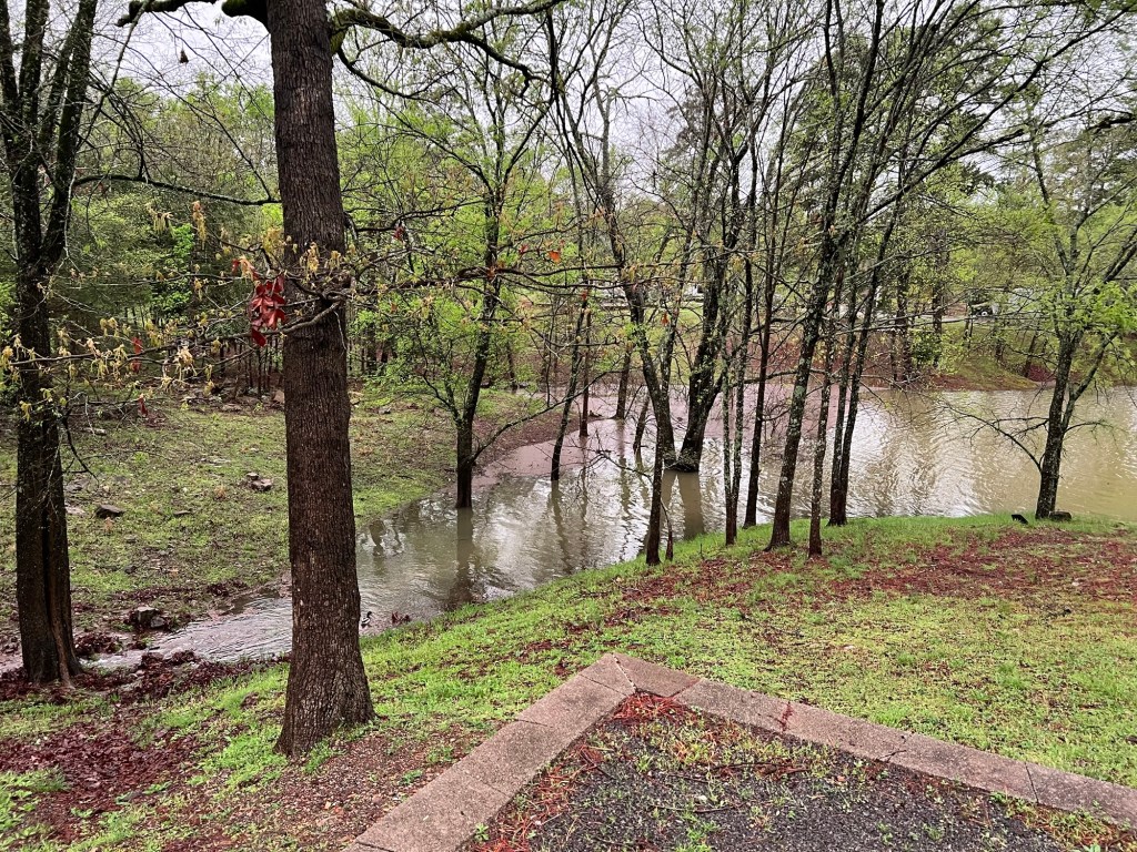
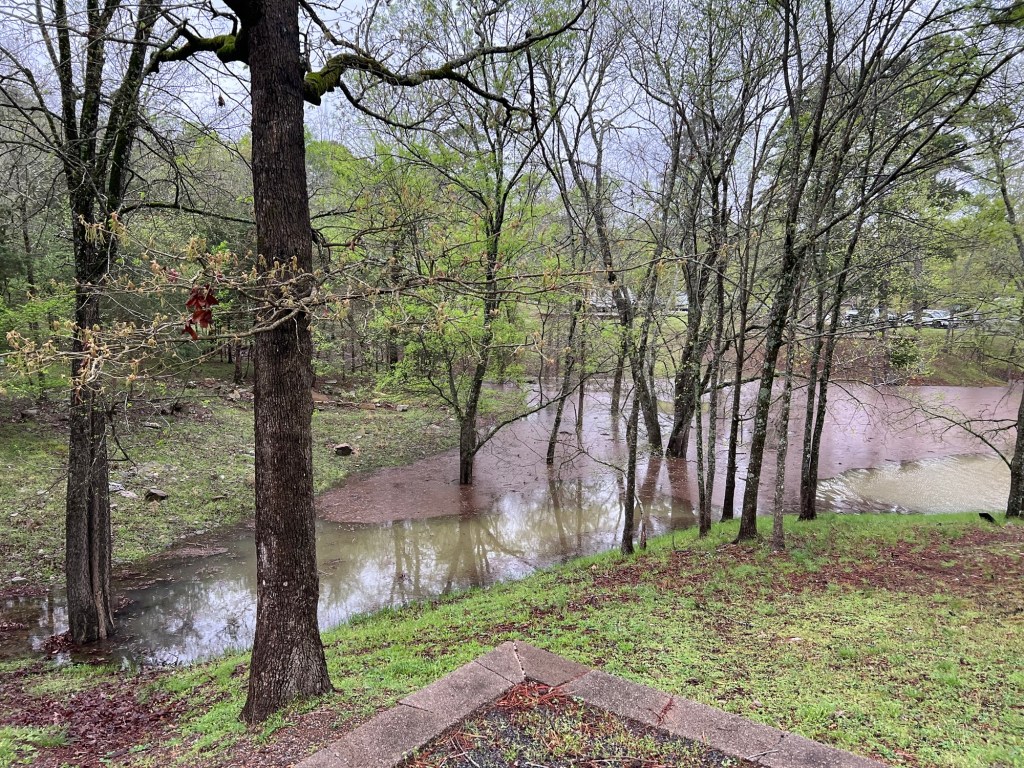
But it started raining Wednesday evening and rained all day Thursday. Water was running down the hills through all the little channels that are normally dry.
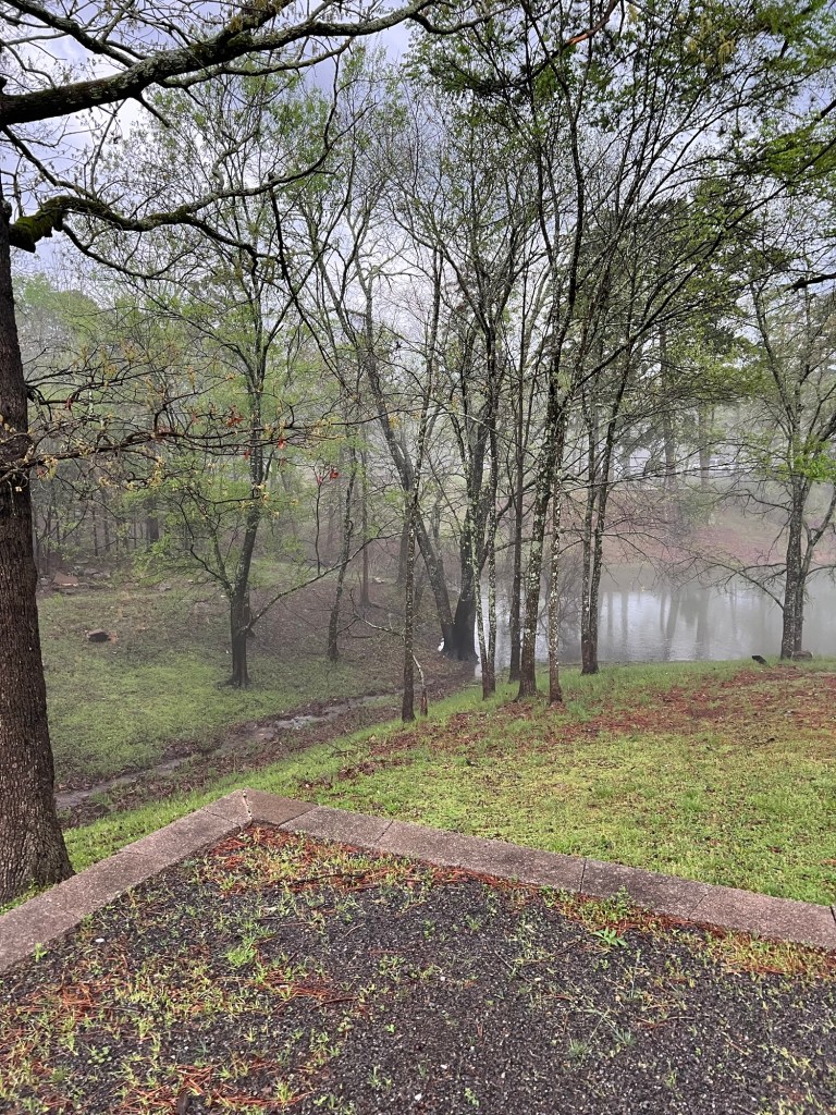
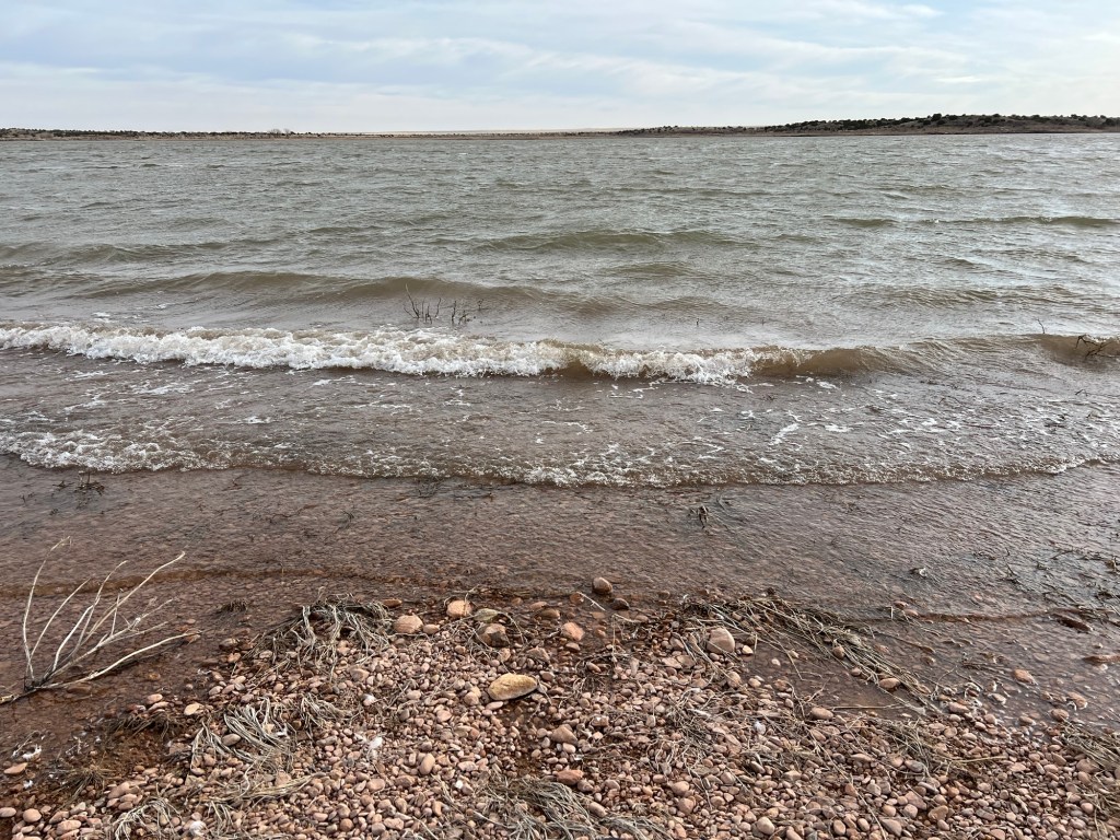
By the end of the day Thursday the lake was so high that I took a picture.
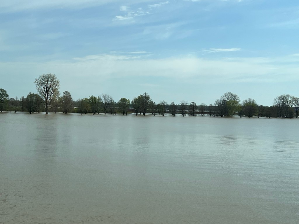
But it kept raining.
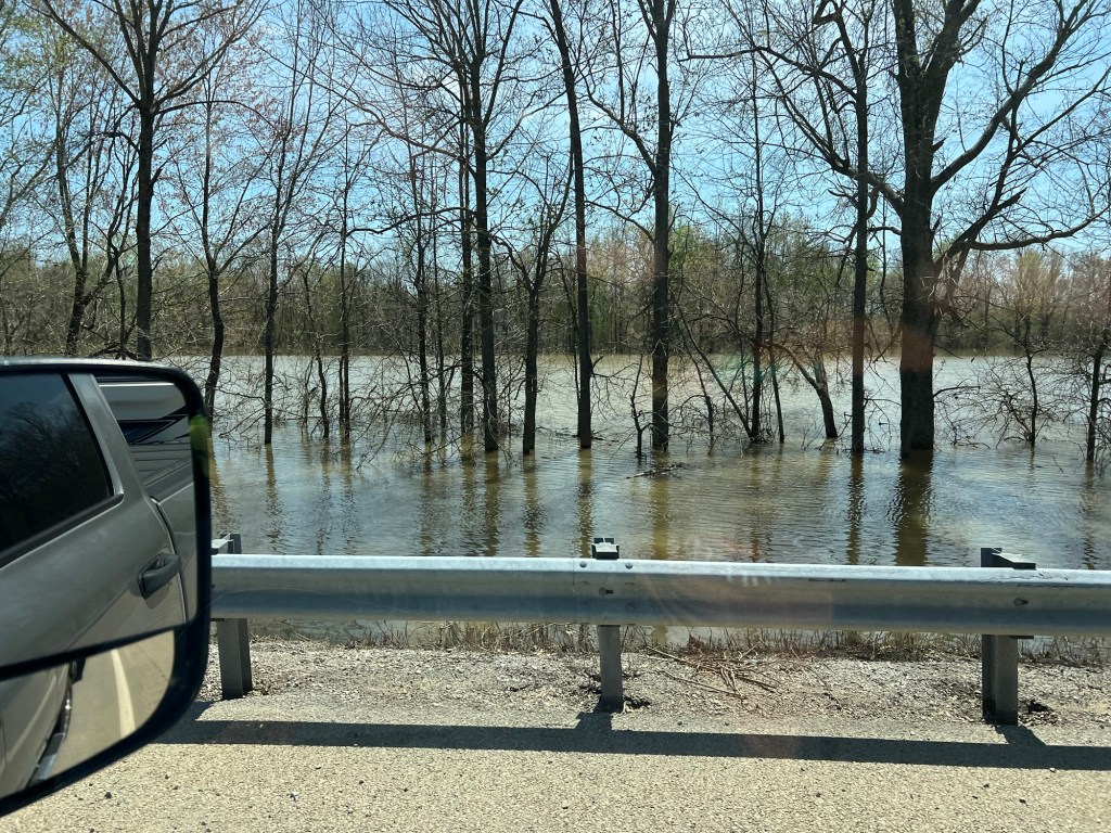
Off and on Friday.
Pretty much all night Friday night.
All day Saturday.
And all night Saturday night.
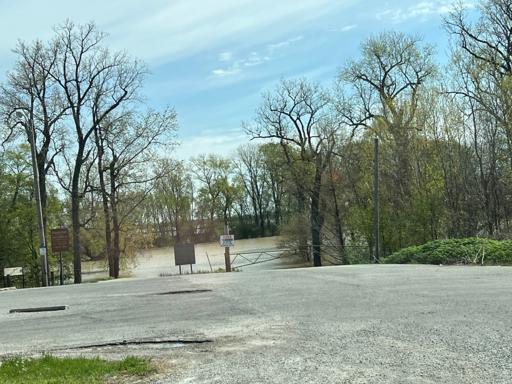
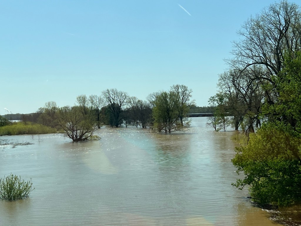
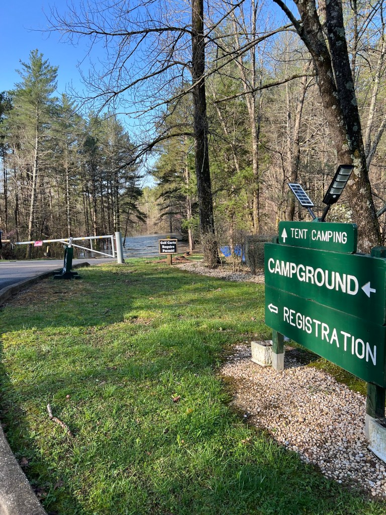
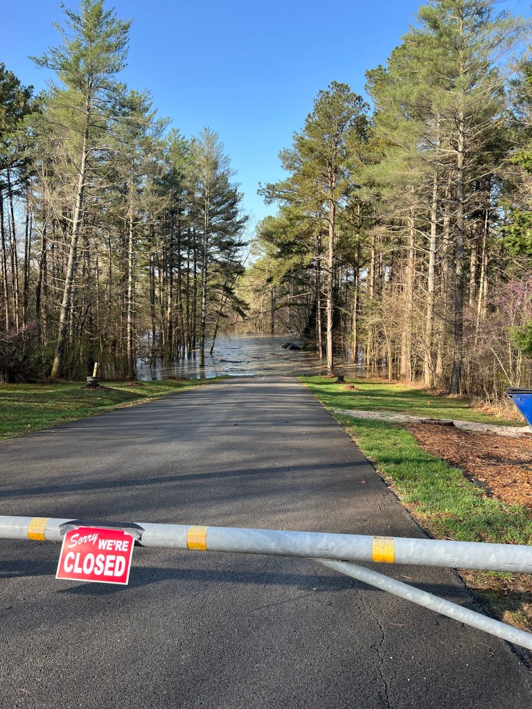
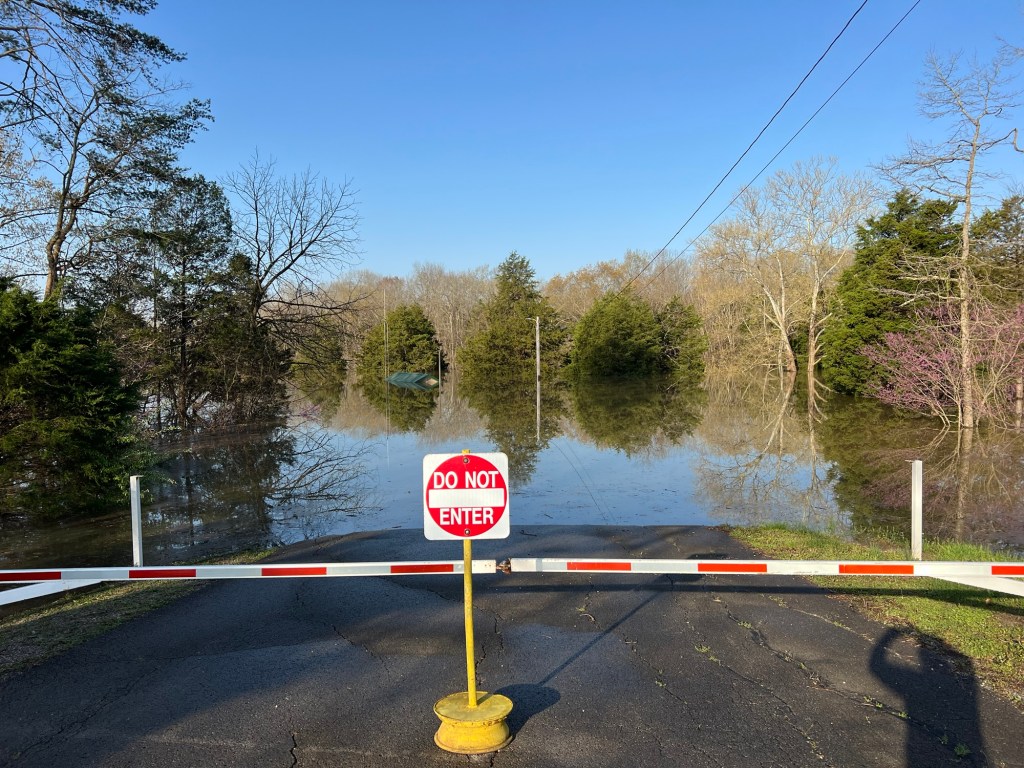
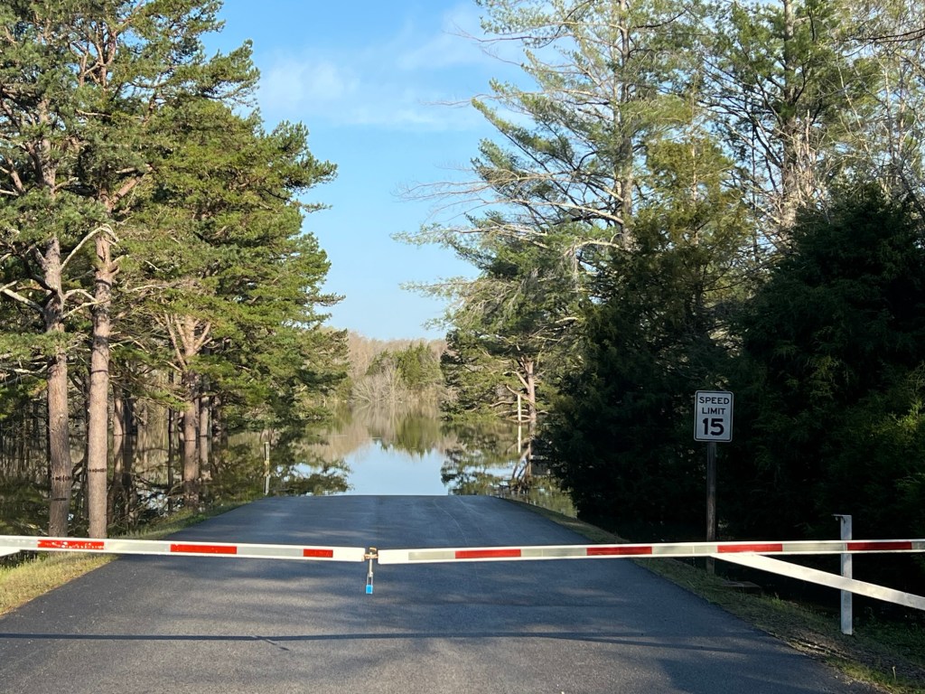
We were lucky that we were camped on high ground and that none of the roads closed between us and town.
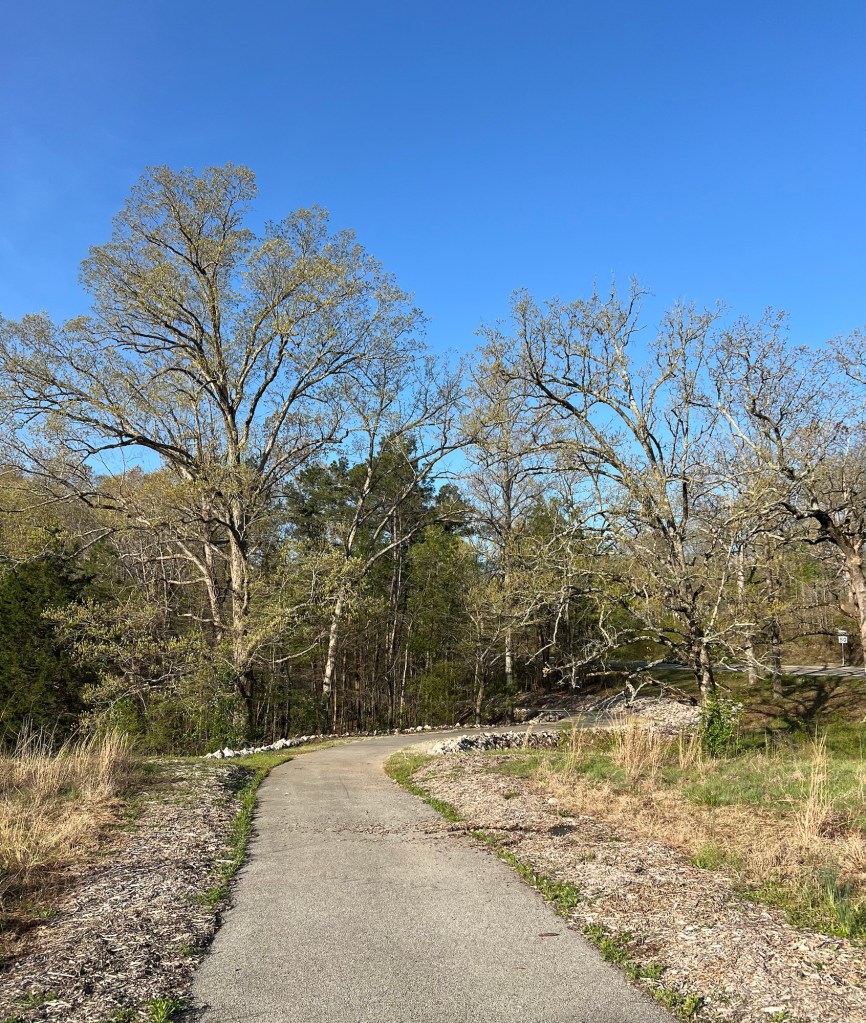
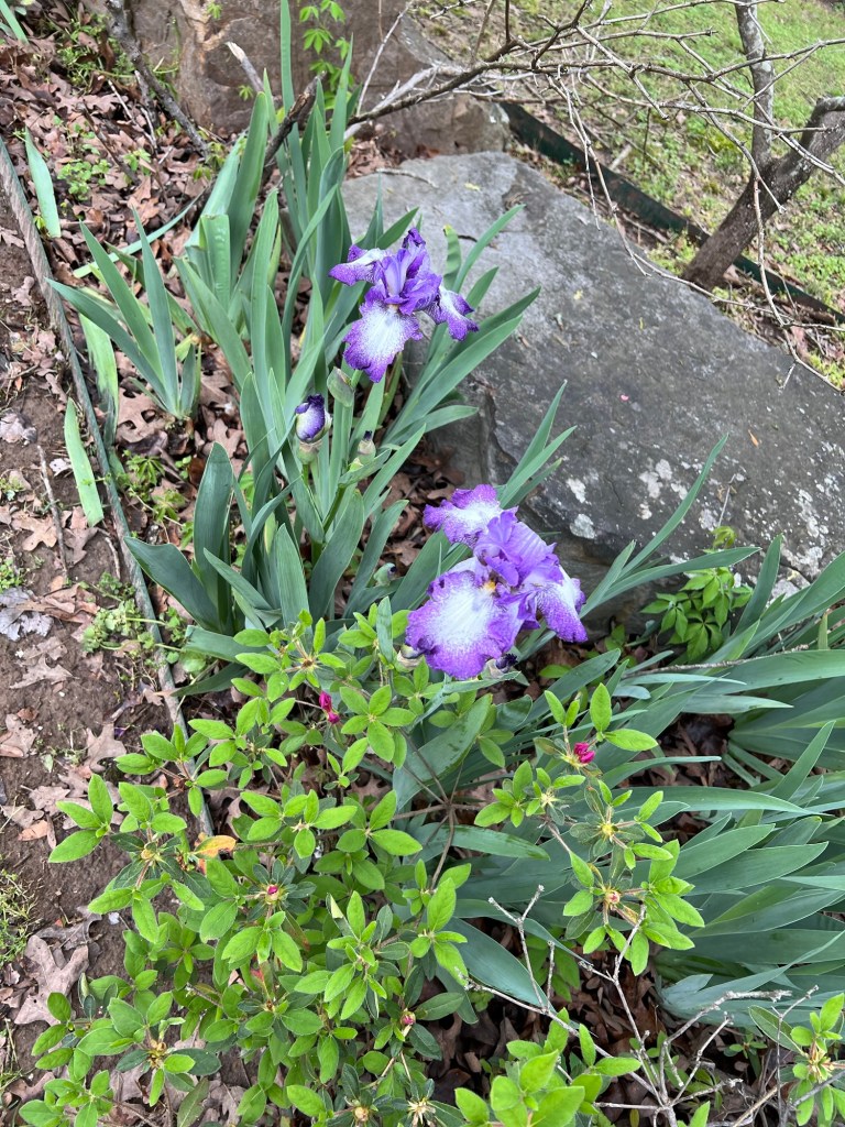
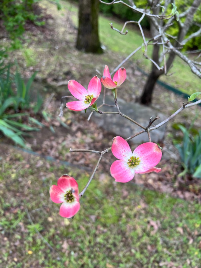
Today it quit raining and we went back over to Jamie’s, but it was too damp and cold to do much. Things are green…
and the flowers are out.
Tomorrow we leave and it’s supposed to be sunny, and all next week it should be sunny and warm.
Oh well, at least we were only under severe thunderstorm warnings and a tornado watch. We never got a tornado warning although there was a cell aimed at us that was developing a twist, but it dissipated.
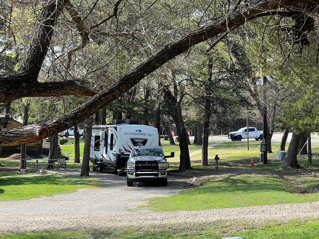
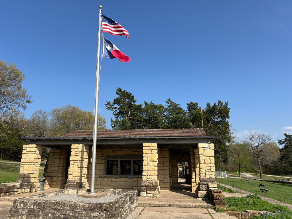
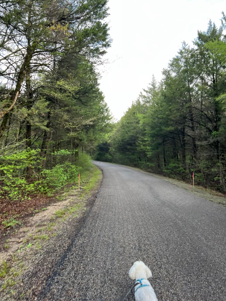
There are two full hookup sites at Bonham State Park, we have one of them.
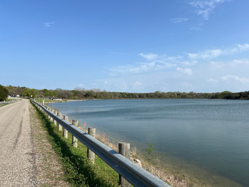
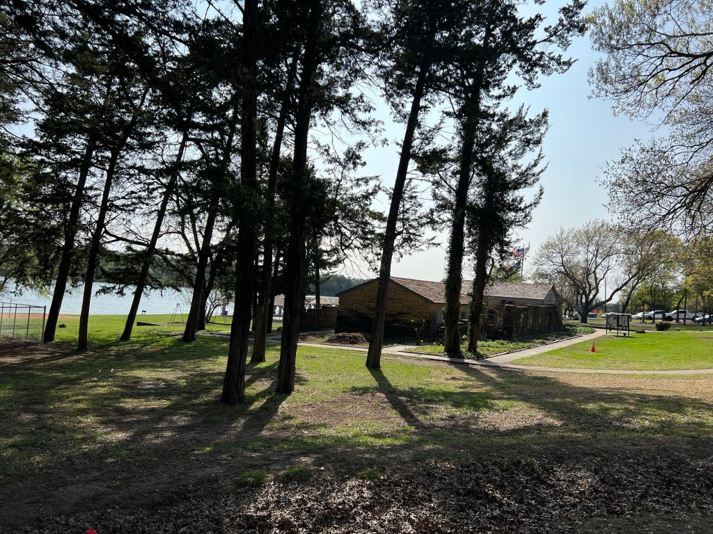
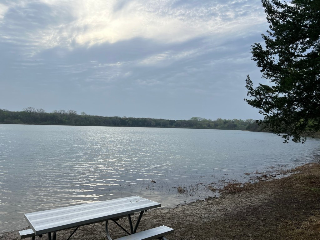
It’s a pleasant small park centered on a lake dammed by the CCC.
The main building was also made by the CCC…
and faces the lake and a nice beach area.
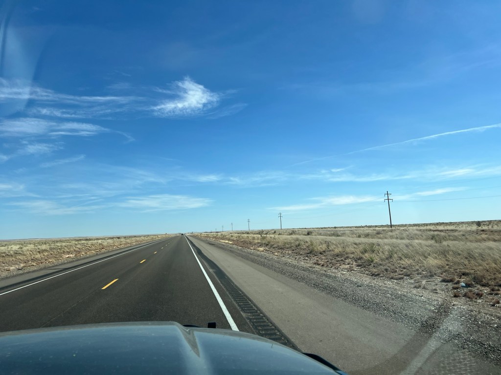
You’ll notice we’re not in the desert anymore. We’re 65 miles northeast of Dallas and there is actual mud here.
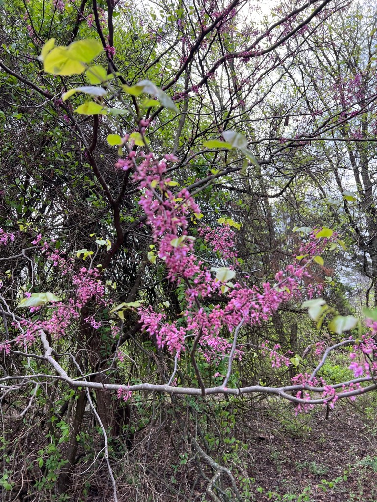
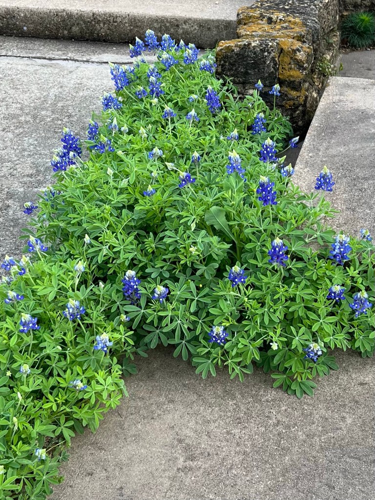
We have found spring.
Those are Texas Bluebells.
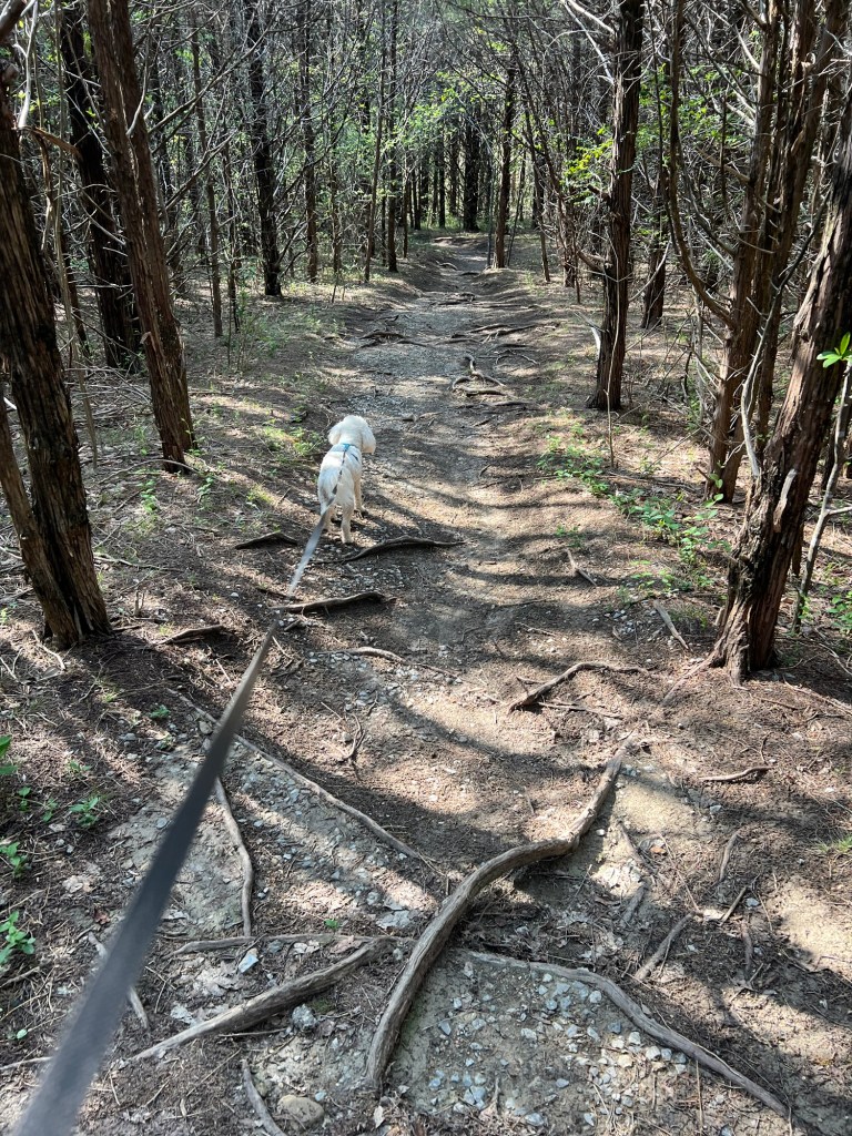
Matey and I took a nice walk around the lake.
We also walked the aptly named Gnarly Root Trail.
It’s a pleasant enough stop. It’s also 5 miles from Bonham, a small town just big enough to have a Walmart, a Brookshires and a laundromat; so the shopping and laundry got done. Works for me!
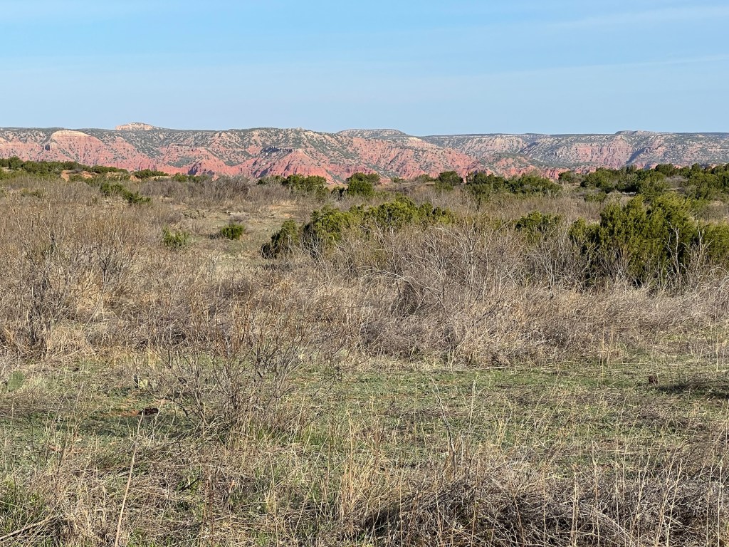
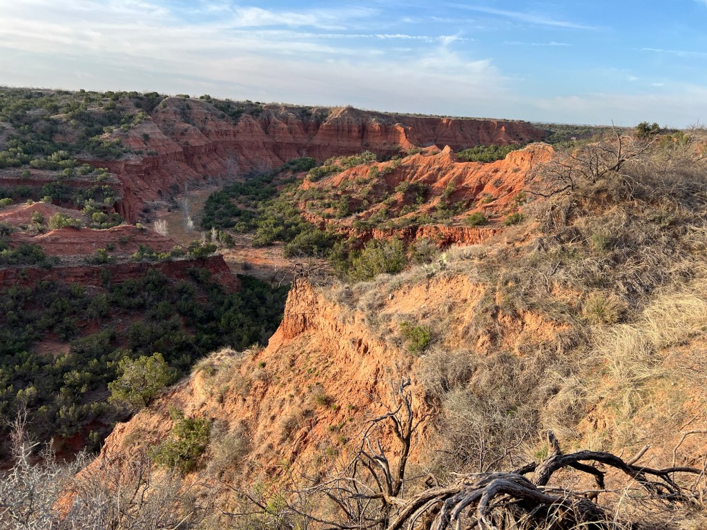
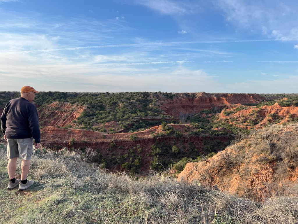
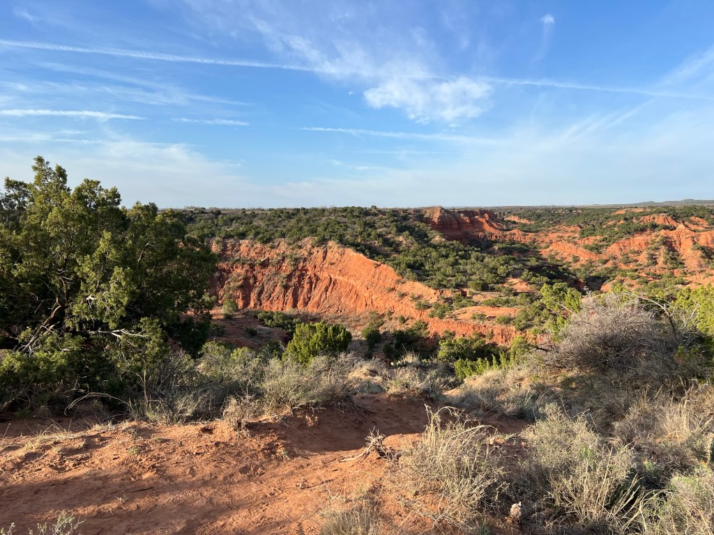
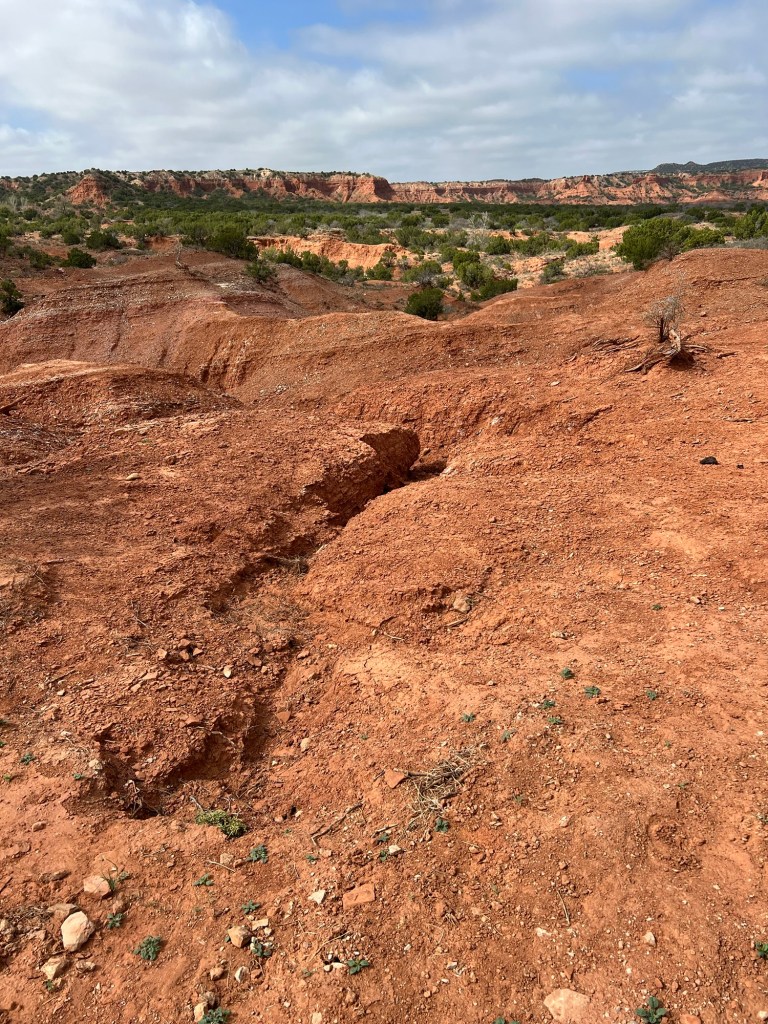
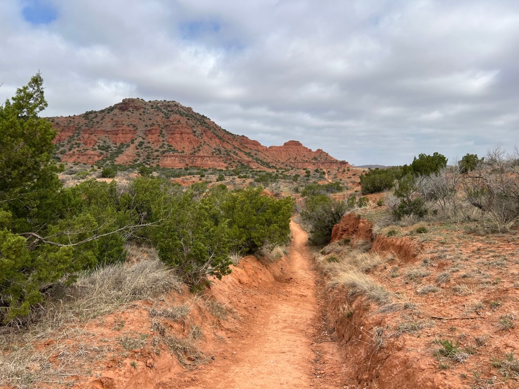
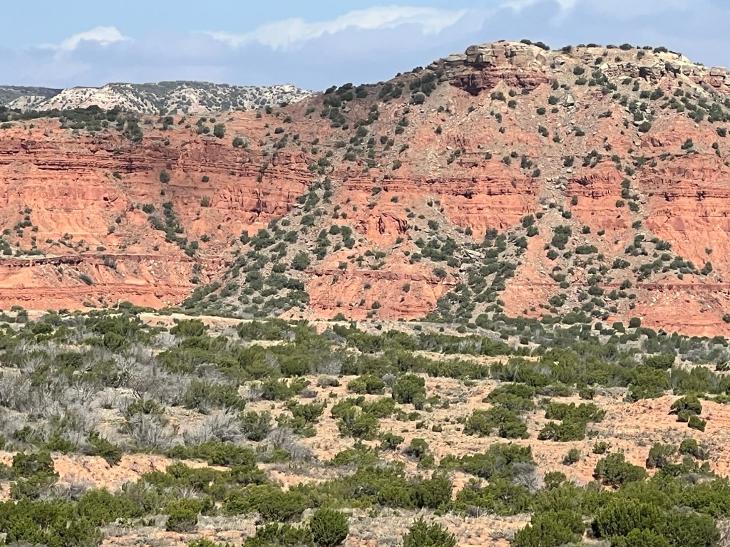
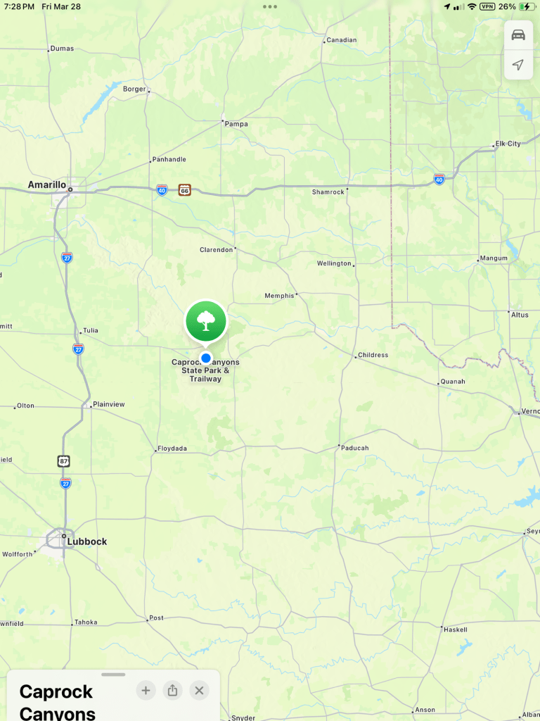
First of all, you’ve got to like this landscape. We’re camped on Honey Flats and the view from the flats is an array of red rock canyons. The distant hills are capped with a white calcite rock resistant to erosion.
But where the cap is broken the red rocks below are eroded into deep canyons.
Pillars and cliffs abound…
creating beautiful vistas everywhere.
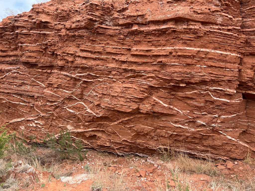
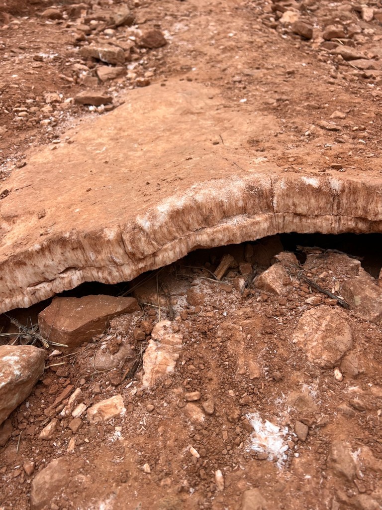
Added to this are twisting veins of gypsum.
adding special interest to the trails.
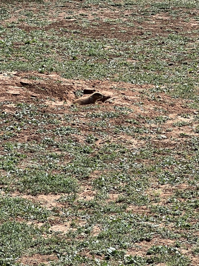
Then there is the wildlife. There is a prairie dog town right next to the campground.
Their sentries raise the alarm every time you walk by.
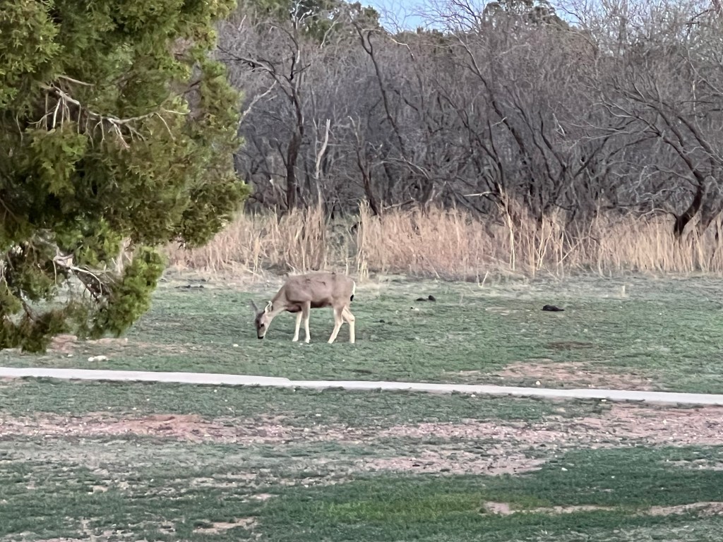
There were two mule deer right in the campground,
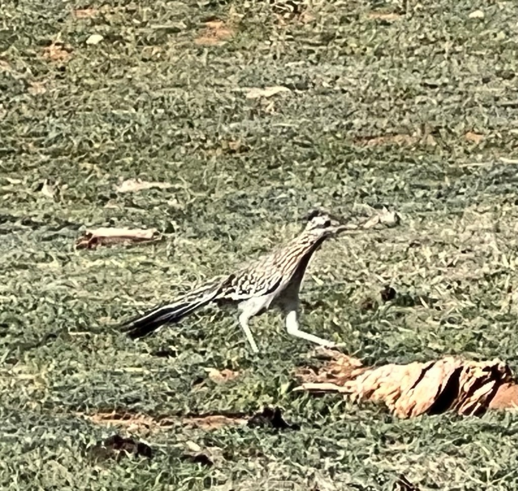
I saw a couple of my favorite birds, roadrunners,
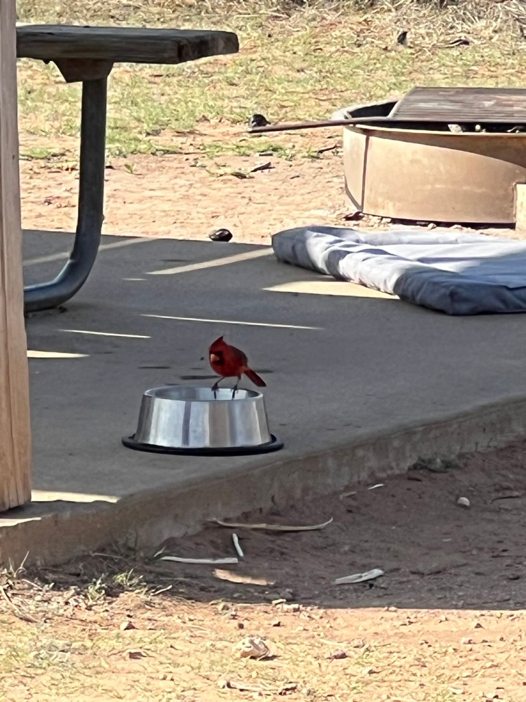
and Matey even had a cardinal share his water bowl.
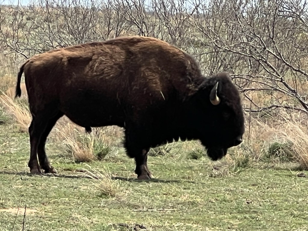
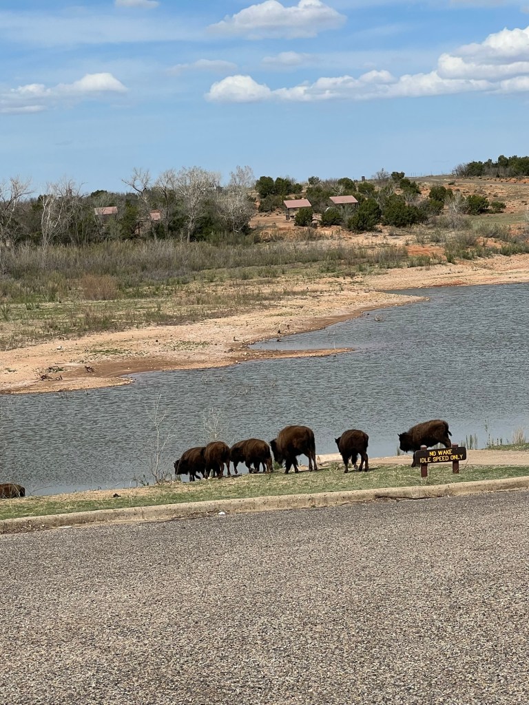
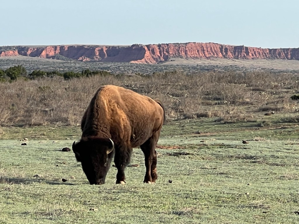
But the stars of the park are the bison.
The official Texas State Bison Herd lives here. These animals are the descendants of some orphaned calves rescued at the end of the great bison slaughter in 1878 by Charles Goodnight at the urging of his wife, Mary Ann.
Eventually they had a herd of 200 on their JA Ranch. On their death the herd dwindled until 1997, when the remaining 32 were moved here. It was found that these were the only remaining genetically unique southern plains strain.
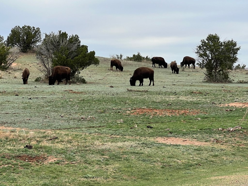
Today there are around 300 and this is their home first. They hang around the trails,
wander the roads,
and go swimming at the boat ramp. There was one in a campsite when we arrived (happily not ours).
The grazing of the bison is helping to restore the prairie, favoring the deep rooted grasses and suppressing the cactus and juniper. The park also uses controlled burns to clear the brush so the grasses can get established.
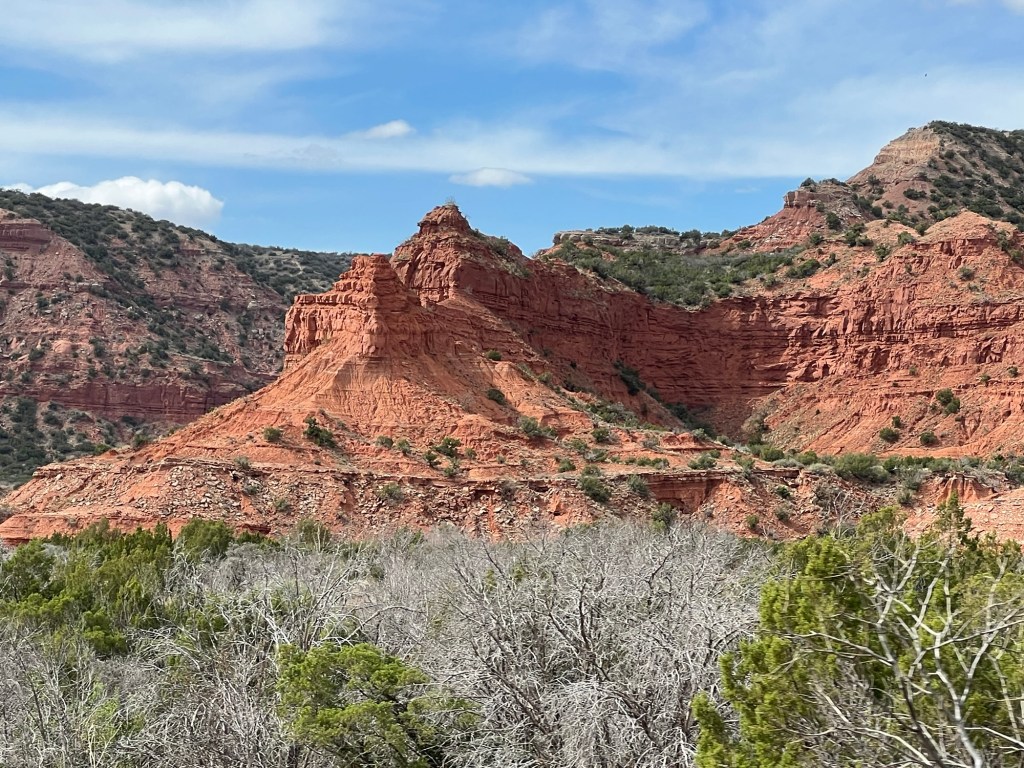
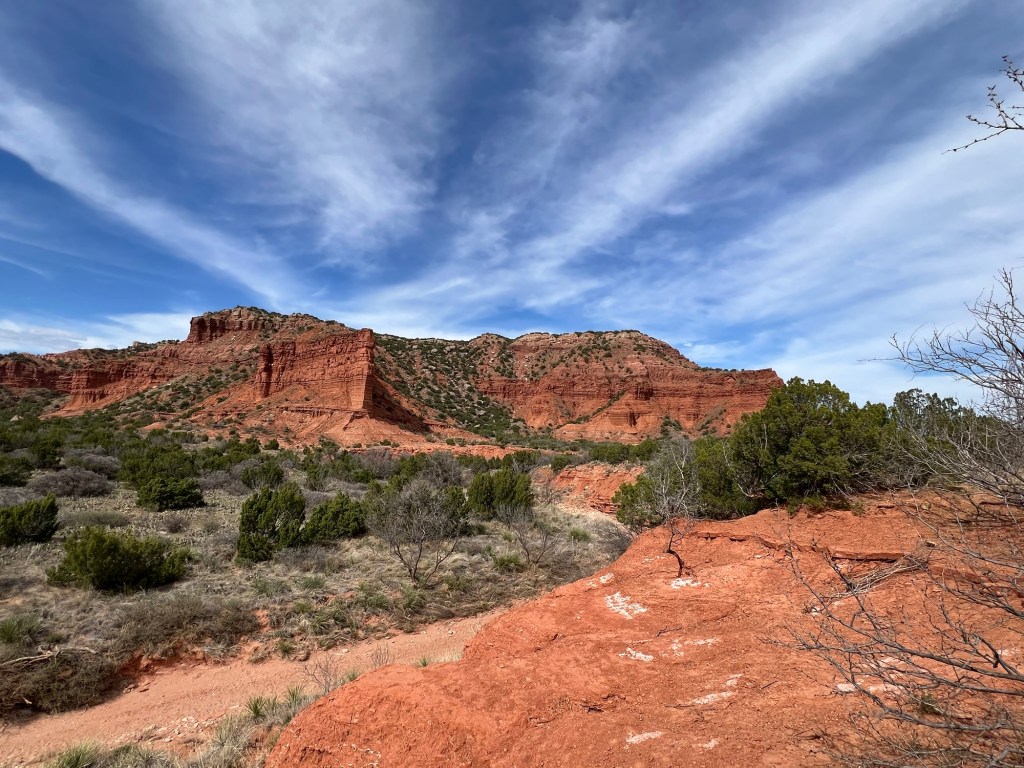
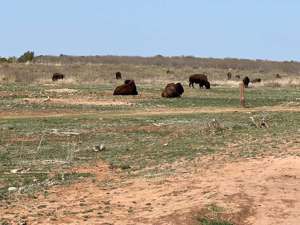
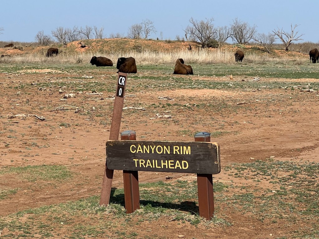
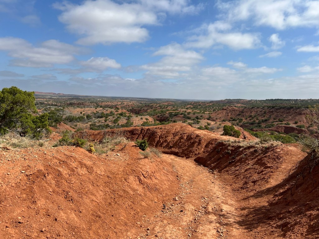
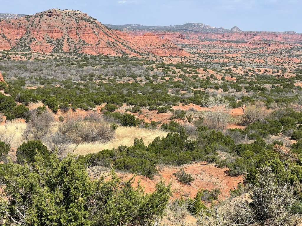
This park also has great trails. Yesterday we walked the Canyon Rim Trail, a two mile loop right next to the campground.
There were plenty of beautiful views,
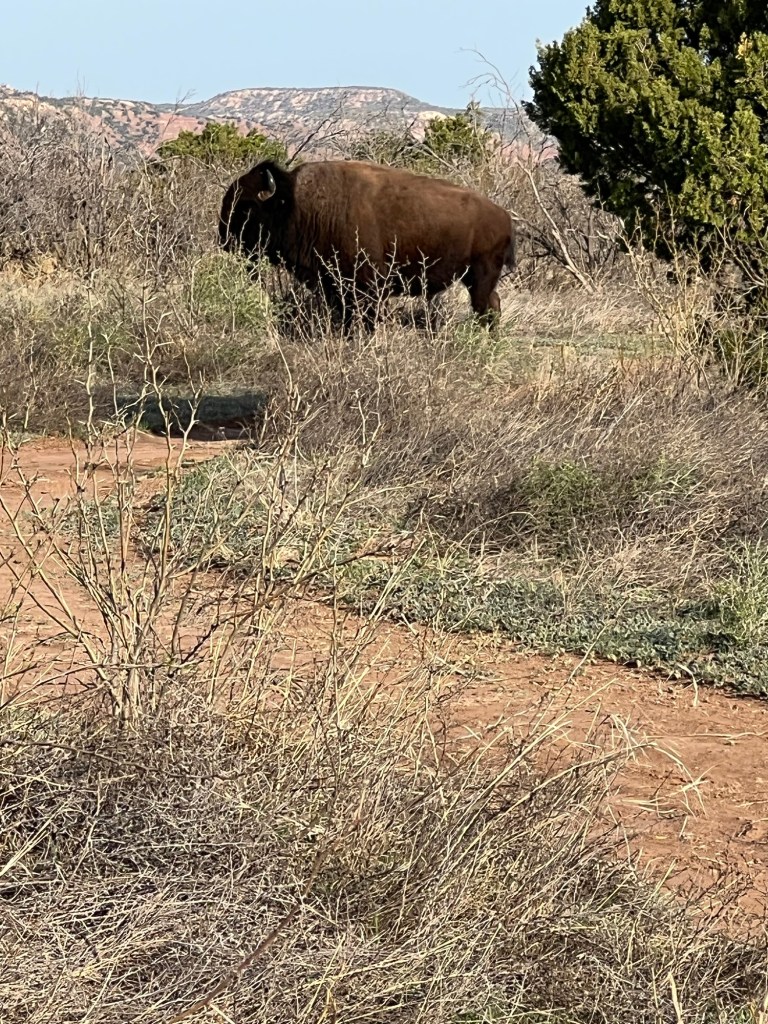
and bison.
You’re supposed to stay about 50 yards away from the bison, but sometimes it’s not possible. This big guy stepped out of the brush about 50 feet in front of Matey and I. I backed up a few paces and then we walked back to where Bud was and waited for him to go back in the bushes. We still walked by about 100 feet from him, but at least he was back in the bushes and not looking at us anymore.
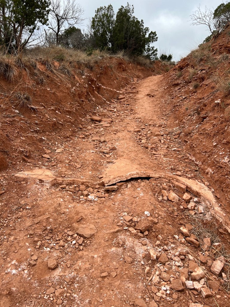
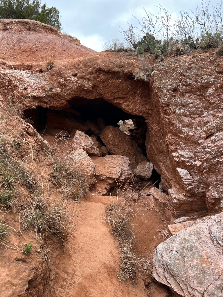
This morning Bud and Matey and I drove to the far trailhead of Eagle Point Trail.
We all walked as far as the natural bridge, where there was a tunnel eroded under the trail. Bud and Matey walked about a quarter mile back to the truck and I walked back to the campground, about two miles on the trail and another three quarters of a mile back to our site.
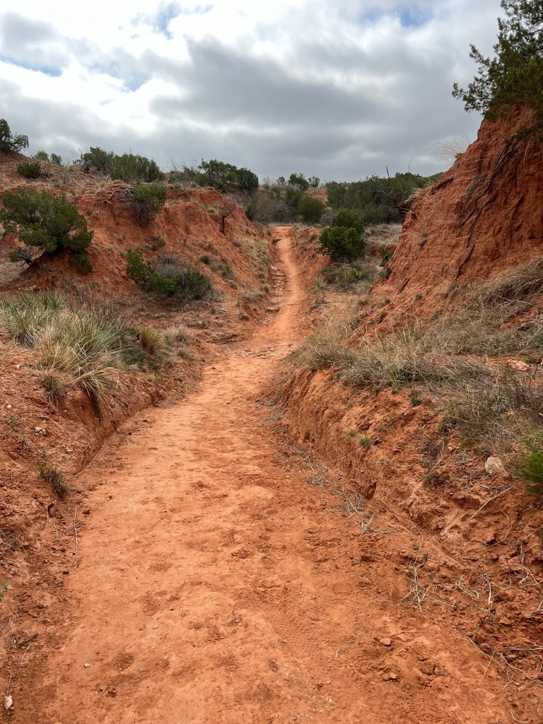
This is one of nicest trails I’ve walked on. It was very well made.
It went through some rugged areas, but the trail was always pretty smooth.
And the scenery was spectacular.
Usually when I’m hiking alone I’m kind of glad to get to the end of the trail,
but not with this one.
I hated to leave this beauty behind.
Happily the walk back still afforded some great views.
I’m leaving you with a map of where this is, just southeast of Amarillo and the junction of I-40 and I-27, because if you ever come camping in this part of the country you should come here.
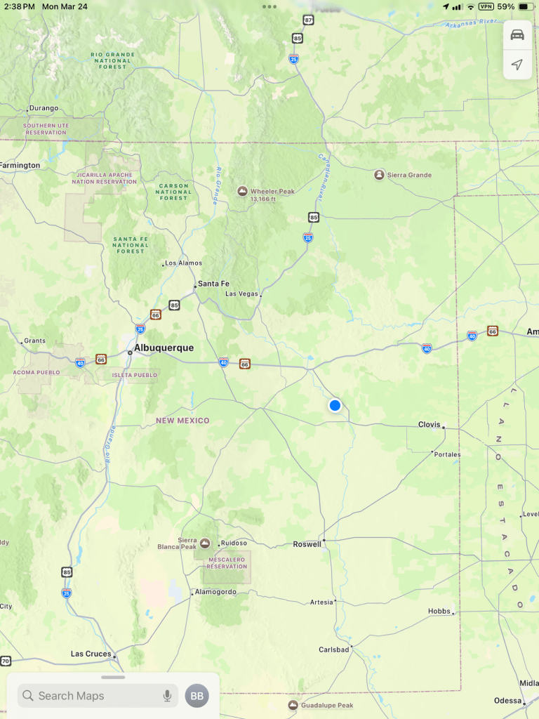
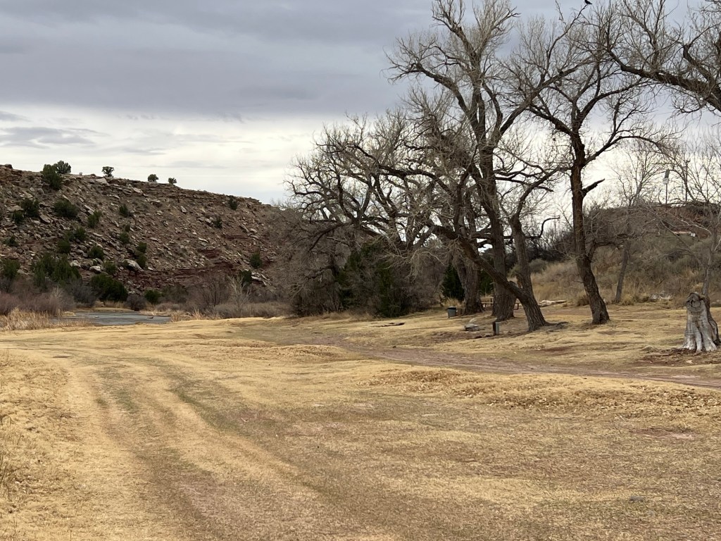
We finally left I-40 and came southeast to the middle of nowhere…
in east-central New Mexico.
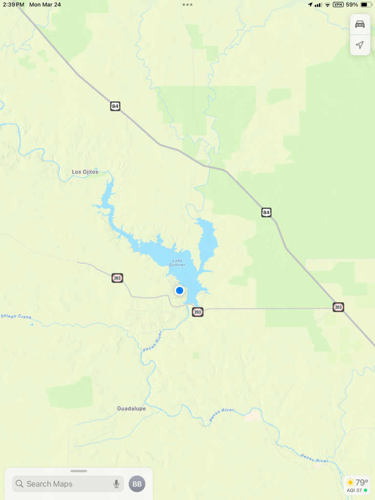
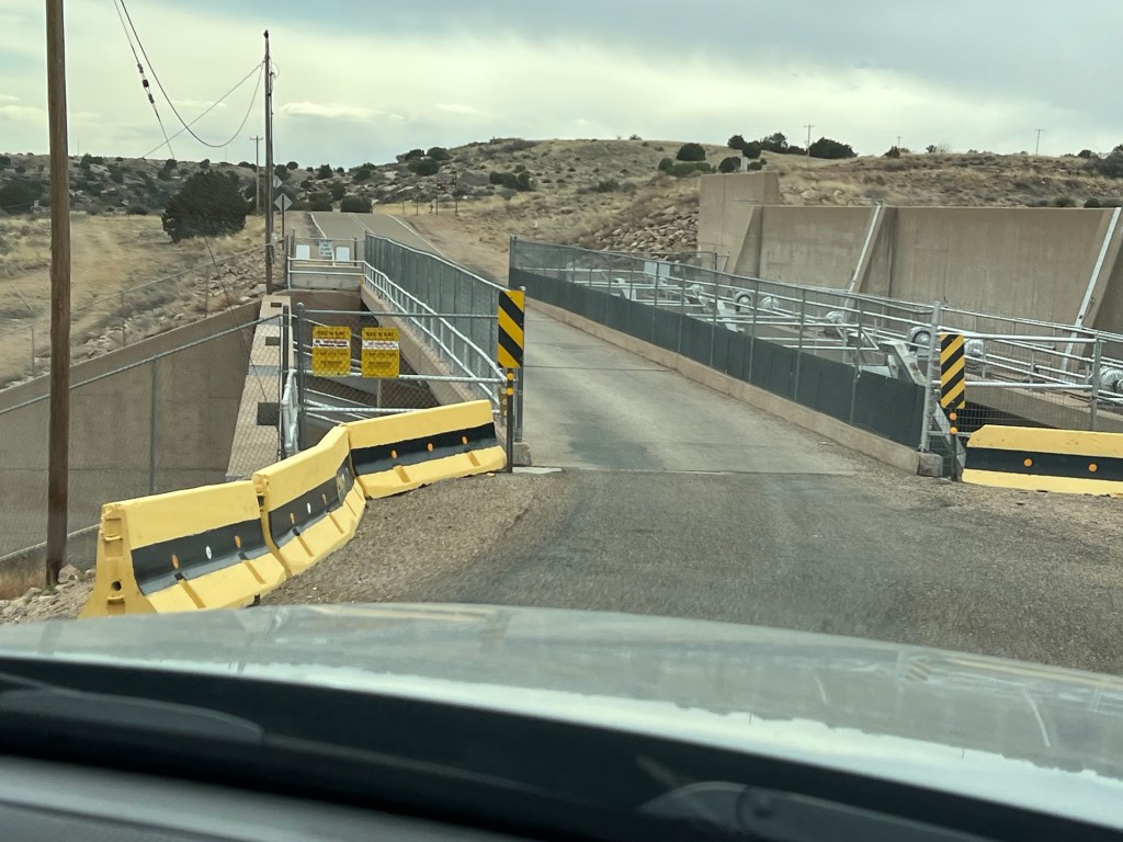
But when you look a little closer…
you find a dam…
on the Pecos River…
and Lake Sumner.
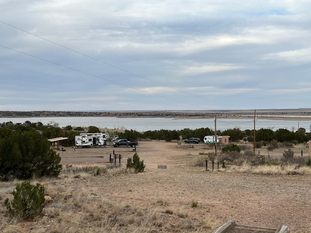
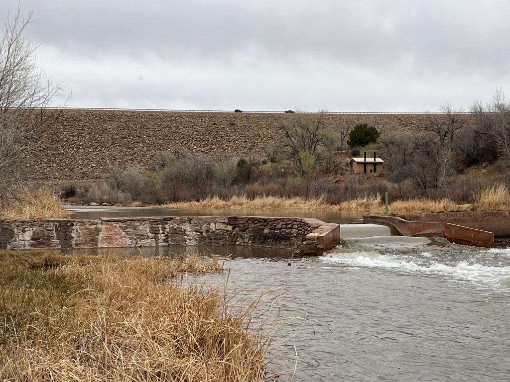
The state park has a couple of campgrounds on the lake with water and electricity, the one on the east side is closed for the winter. There are also primitive campsites,
including some very pretty ones below the dam among the cottonwoods lining the river.
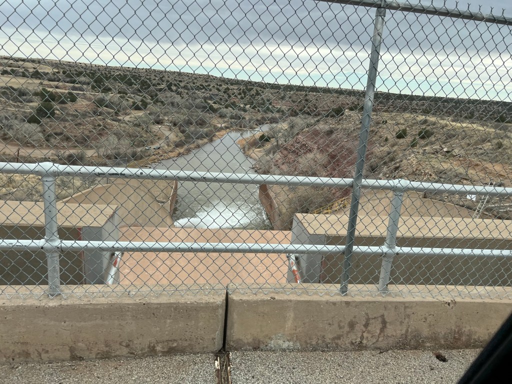
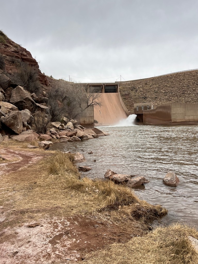
It’s a pretty big dam, part concrete…
with a larger rock wall.
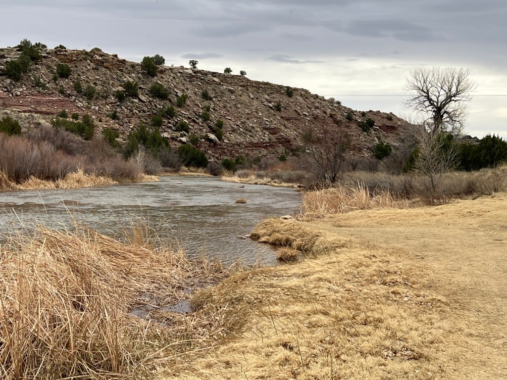
The river and valley below the dam are lovely.
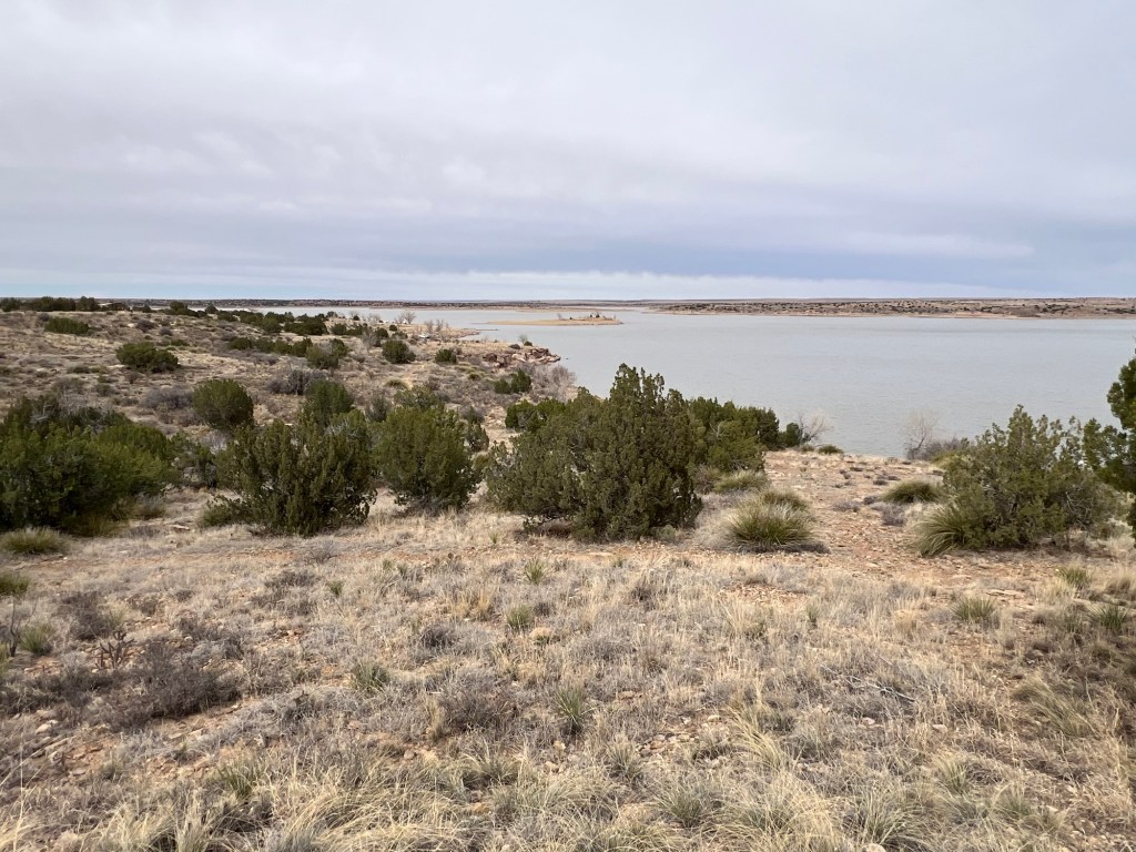
It’s a decent sized lake.
Our campsite sits quite a ways above the lake, but I get a glimpse of it from the shade of the cabana behind our site.
We are miles from a road of any size,
and today, Monday, we have the place mostly to ourselves.
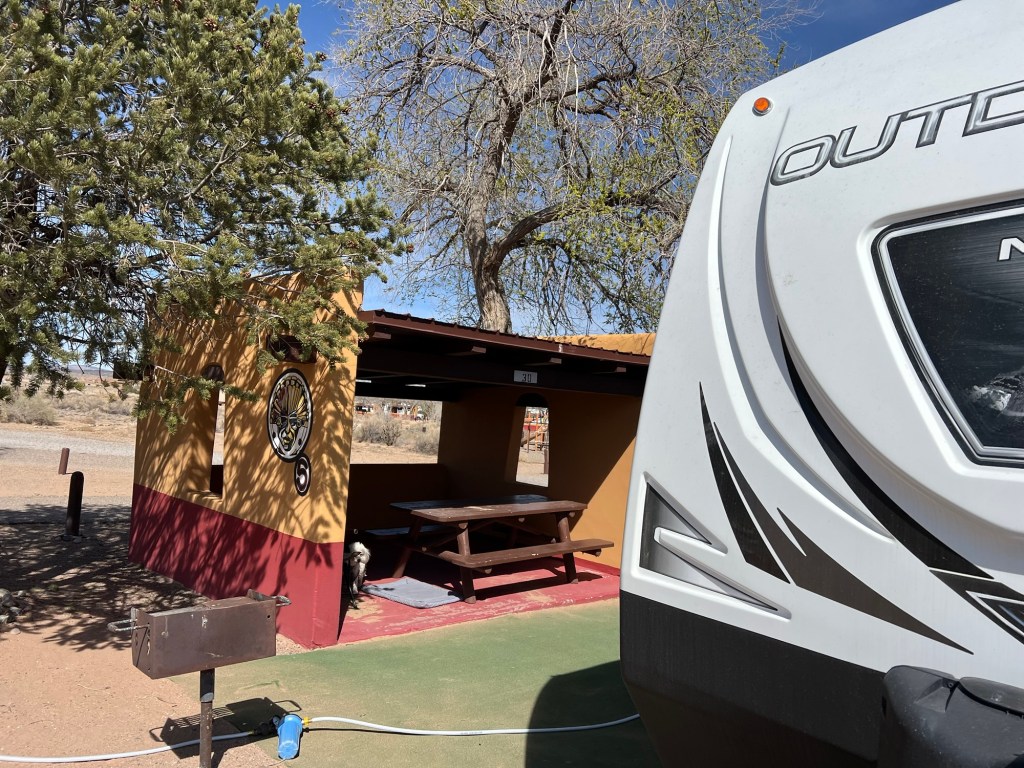
I joined Bud Wednesday at Coronado Campground in Bernalillo, NM, a northern suburb of Albuquerque. We stayed here once before, it used to be a state park but the city took it over. There is an interesting historic site here and the campsites are nicely done.
But the city has grown up to it and this is the road just outside the park. We changed our itinerary when I left Bud again. He went from Homol’ovi in Winslow to a commercial RV park in Gallup to here. They were straightforward drives with very little navigation required, but certainly not scenic; right along I-40.
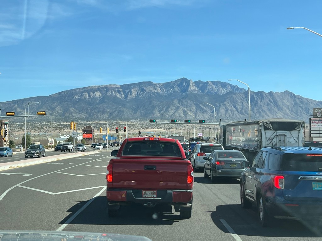
The view here isn’t great, as we face the commercial buildings along the road.
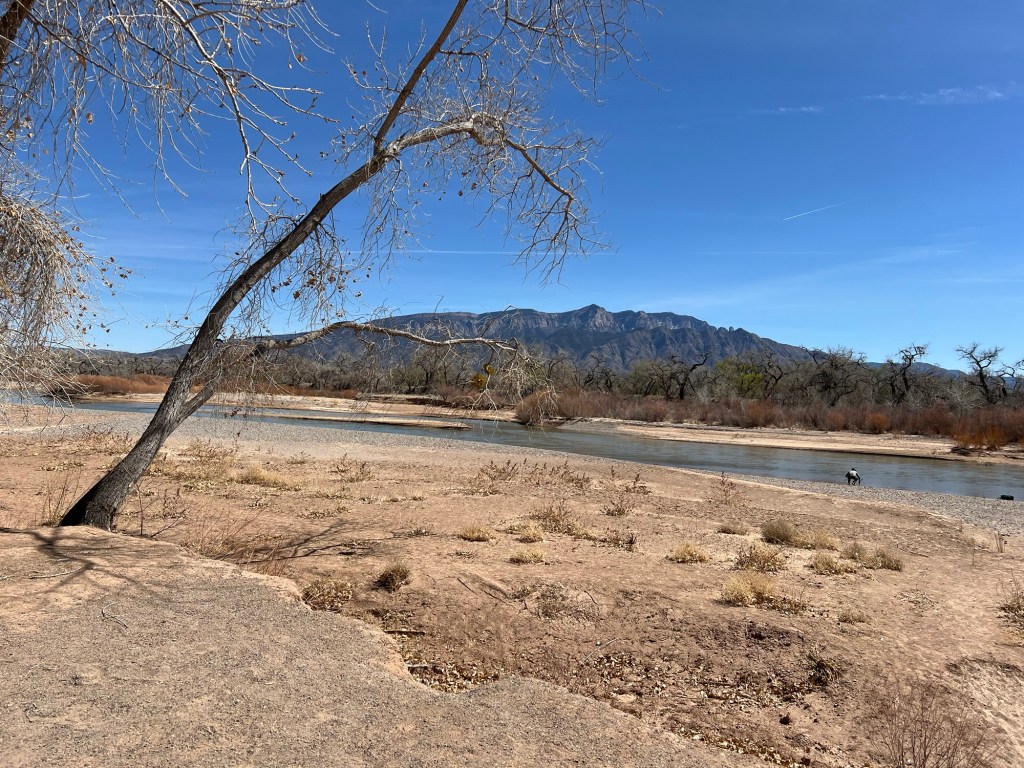
You can look over at the Sandia Mountains, but Tuesday Bud said there were 50 mph winds with 70 mph gusts and the dust was so thick it obscured the view.
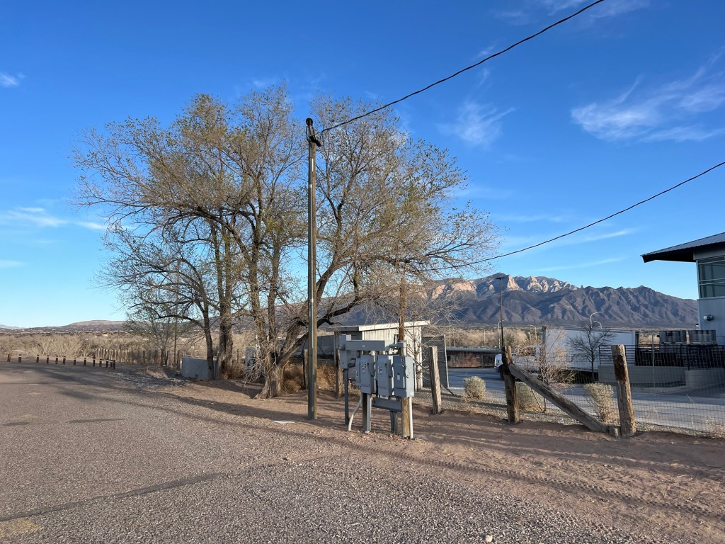
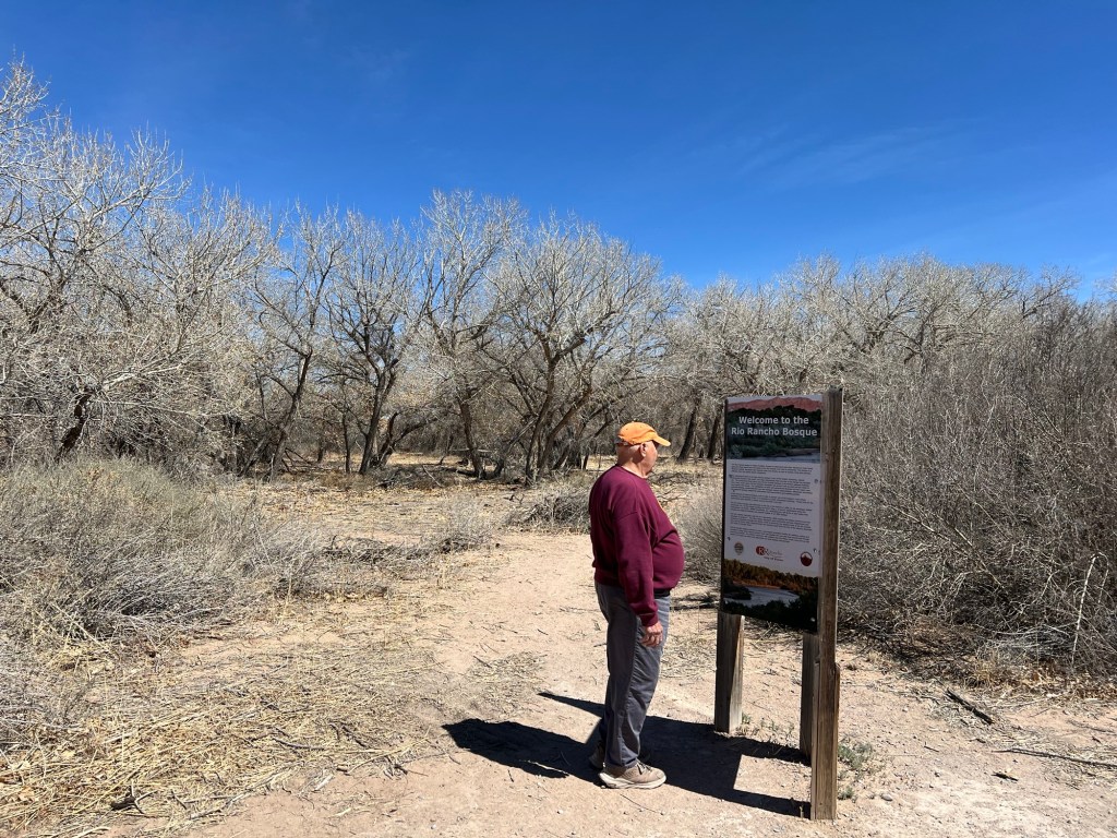
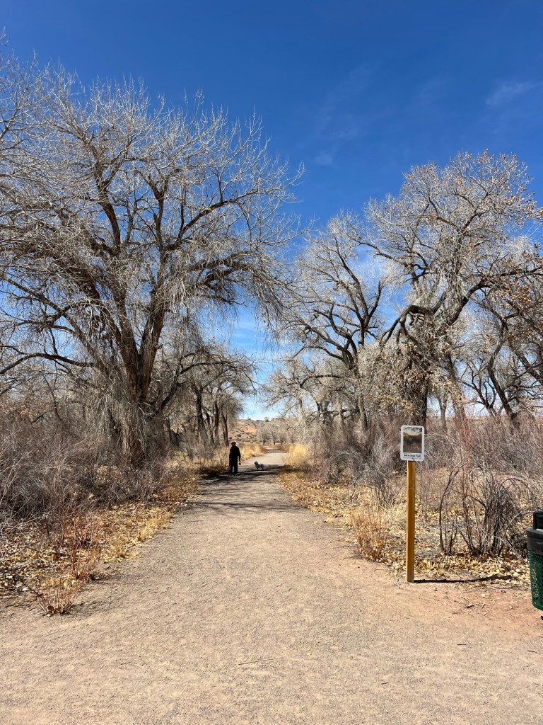
Today we took a walk in a nearby park along the Rio Grande.
That was a nice walk among the cottonwoods…
and there were good views of the river and mountains.
Still this last couple of weeks has not been much fun for Bud. I am so grateful that he again took over moving the trailer and caring for Matey so I could have a last visit with Judy and spend time with her family.
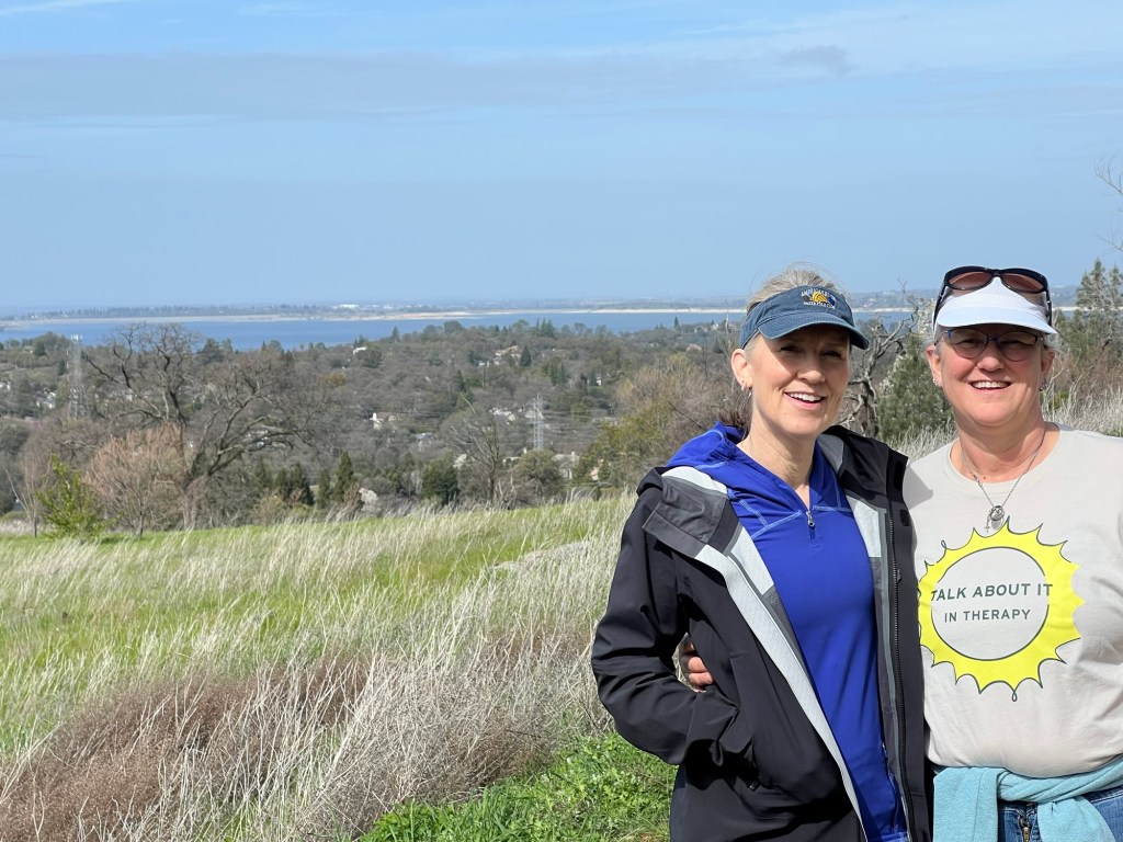
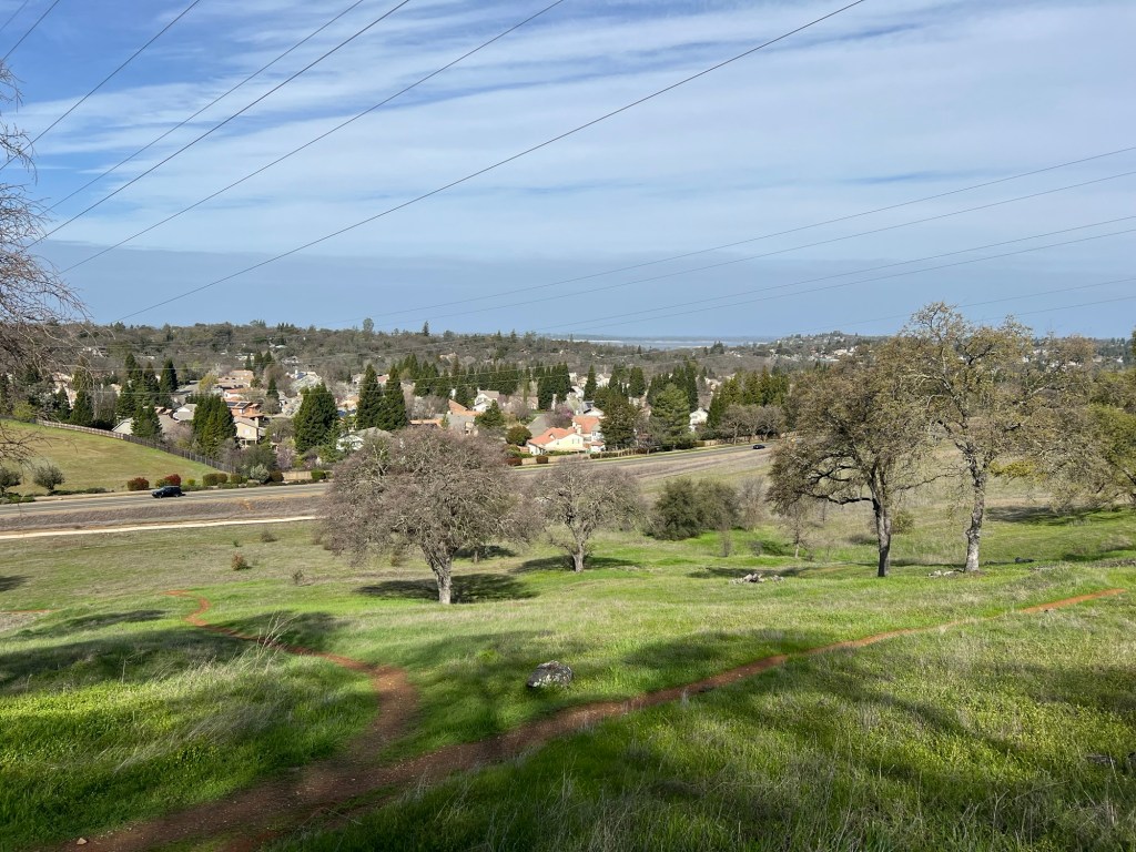
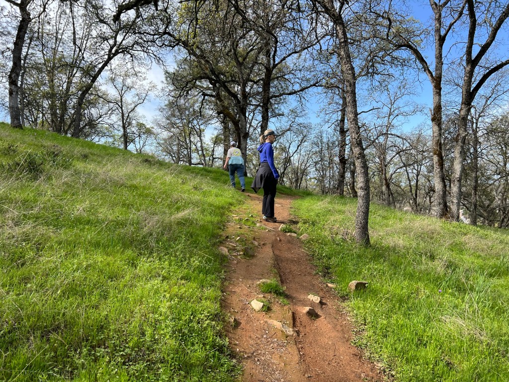
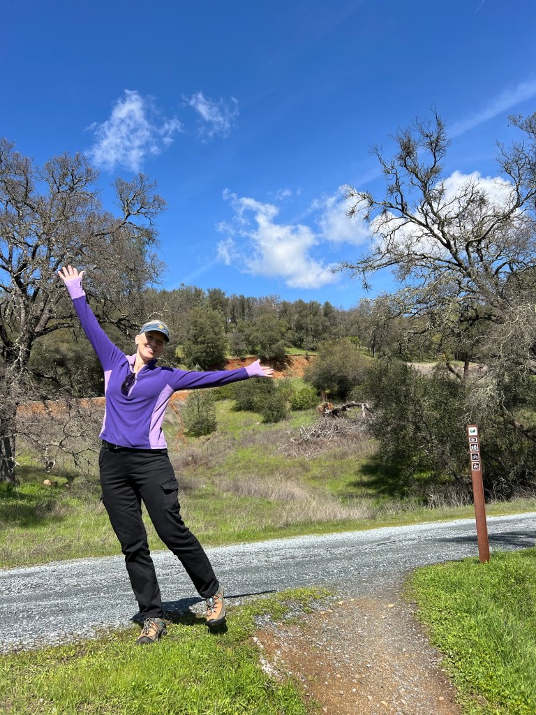
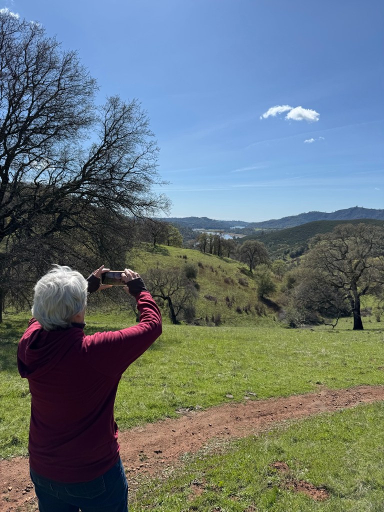
I am just leaving California today, so I was able to explore a bit of the area with my nieces. Here Michelle, Jeanie and I are walking in the hills near where Jeanie lives on the southeast side of Folsom Lake.
It’s a very pretty area…
with lots of trails. Jeanie usually bikes these on her mountain bike, but since she fell and broke her clavicle she’s walking.
And Michelle and I were happy to walk with her.
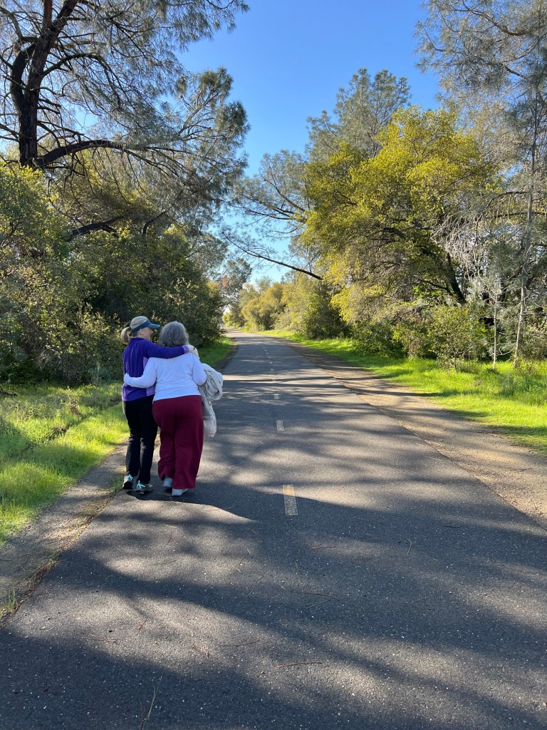
Yesterday morning we took a stroll on the walking path Judy used every day she could. She lived on the southwest side of Folsom Lake and Michelle has been staying there. Cheryl, Chayse and I joined her there.
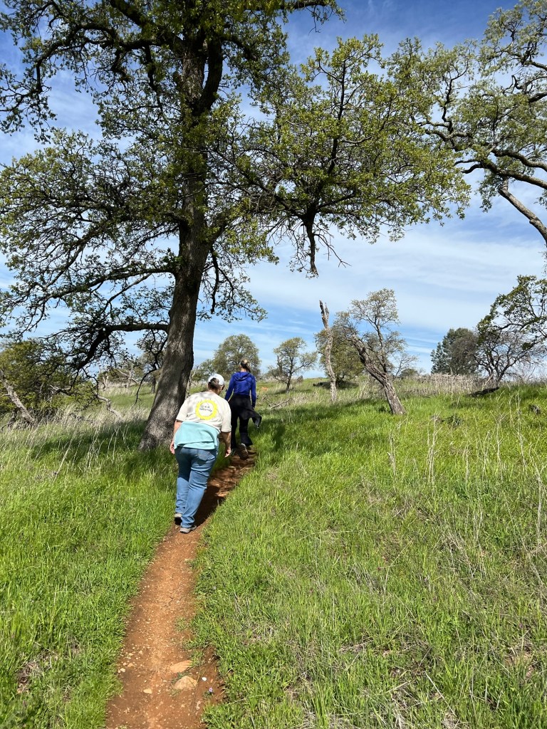
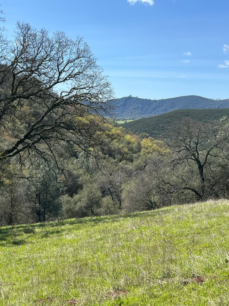
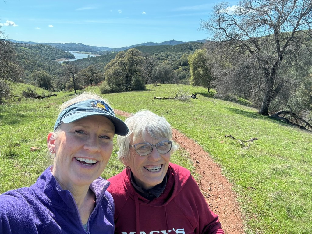
In the afternoon I had a real treat as Jeanie took me to the Acorn Trailhead and we walked some of her and Scott’s favorite biking trails.
What beautiful country, and there’s been rain lately so everything is green; not the norm here.
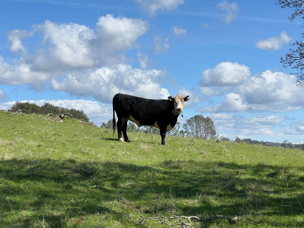
This area is on the northeast side of the lake. It’s hills and pasture…
with some very large cows.
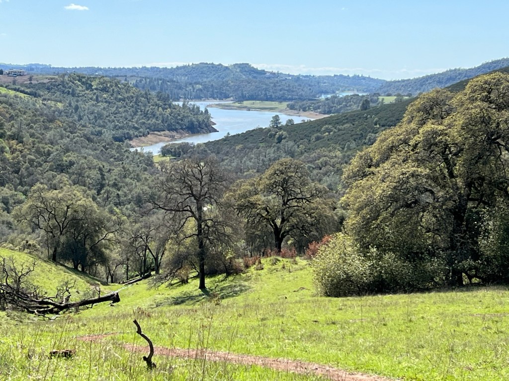
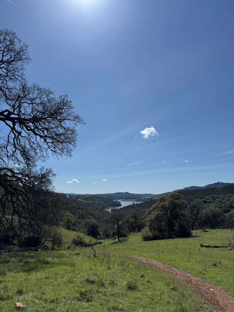
I took my usual landscape shots…
and because Jeanie was along we got some selfies.
Thank you Michele, Jeanie and Cheryl for being such wonderful hosts. You are your mother’s daughters, to be sure.
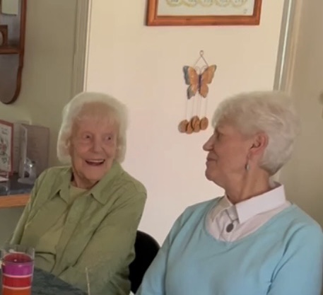
Four days after I got back from helping my oldest sister with Mom’s stuff I got a call from my sister, Judy in California. “Judy”, I said, “it’s great to hear your voice.” We had been talking regularly but Judy often was out of breath or coughing because she was in the hospital fighting pneumonia but this time her voice sounded clear and strong. But she did not have good news. The doctor had just come in and told her they had nothing else they could do for her. “I’m not going to make it,” she said.
So the next day, last Saturday, I left Bud with the dog and the trailer again and flew to Sacramento. I got to spend four wonderful days with my sister, crying and laughing and saying goodbye. It is a tribute to her that the nurses in the ICU unit where she had been did not want her moved to a hospice room. She would make quips and give them heartfelt thank you’s every time they came in to poke or prod her.
She was asleep more than she was awake in the last days, but she always smiled when she woke. And the most frequent words said were “I love you.”
In three weeks I lost my mom and my sister and this loss is huge.
She left me her three beautiful daughters, and though they have thanked me for coming I truly feel I was the one who owed them the thanks.
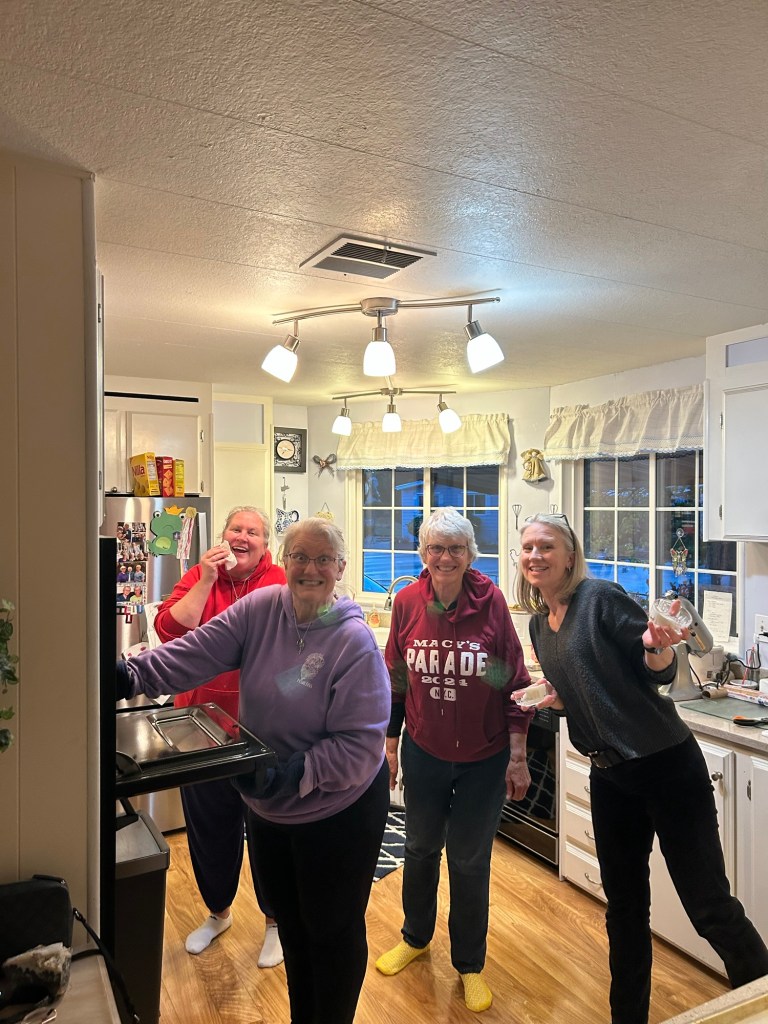
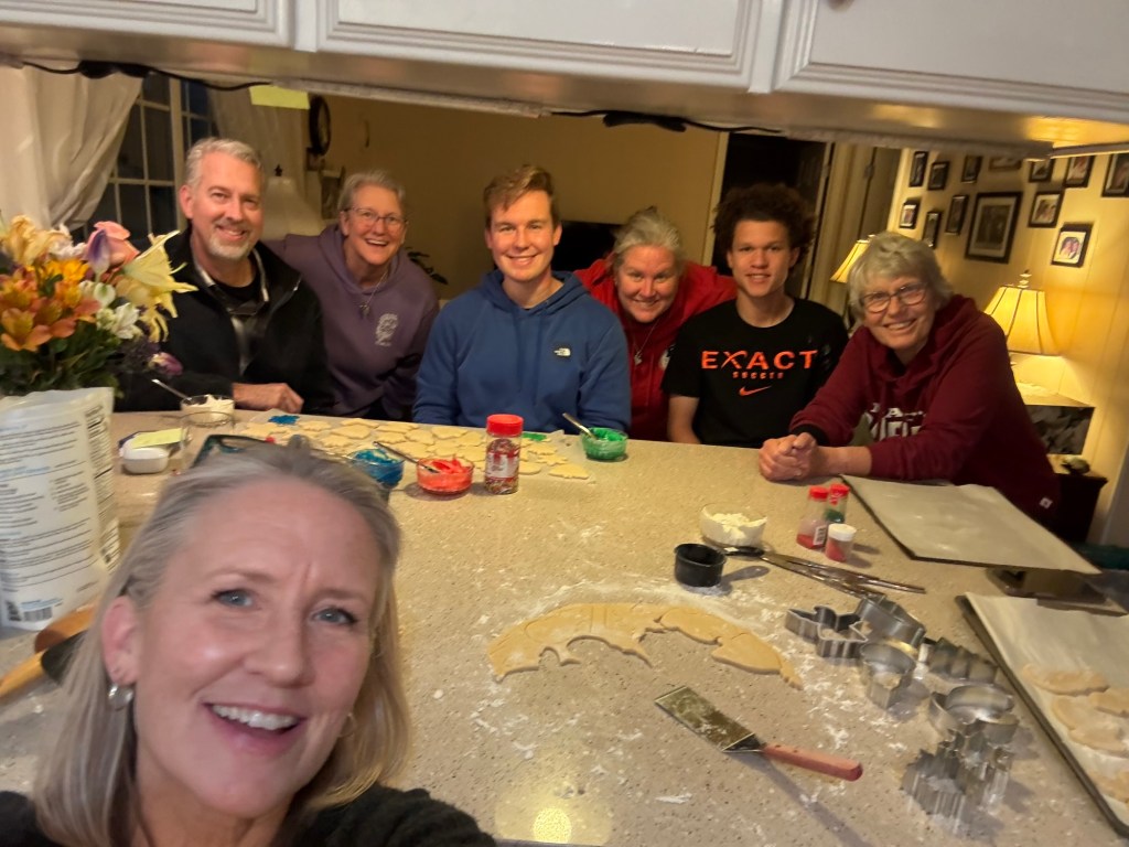
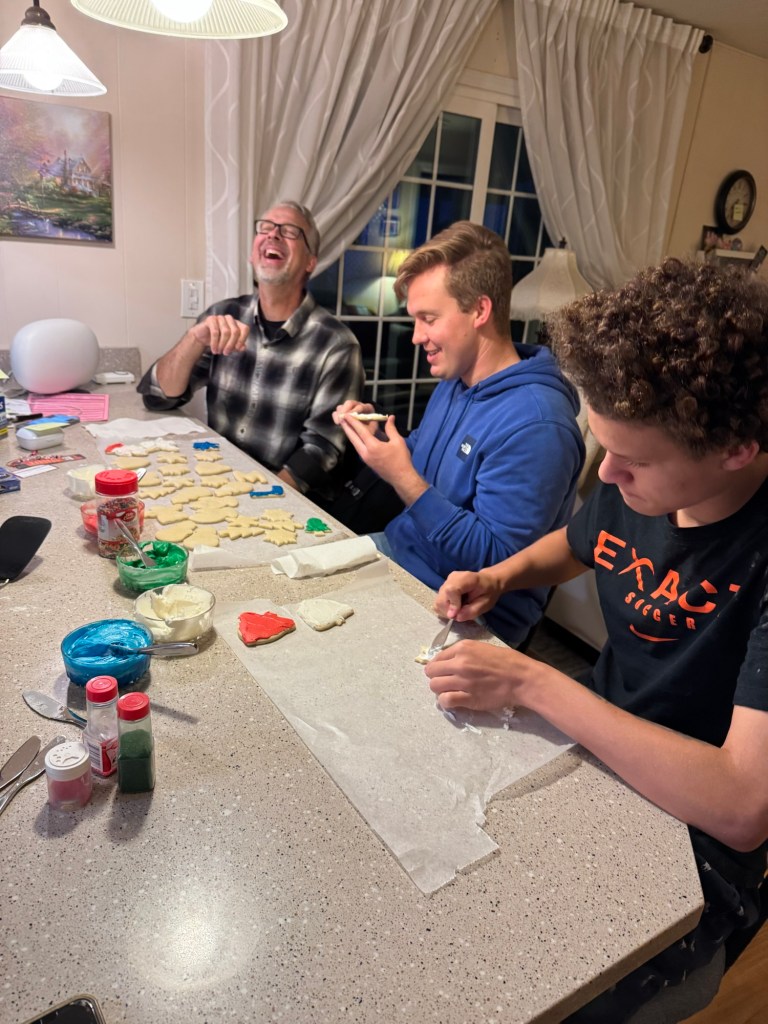
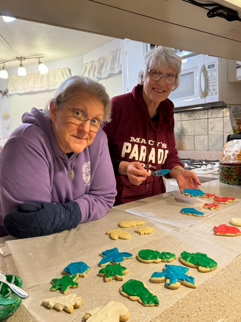
This is the support crew having a memorial Christmas cookie bake in March, because that was a favorite thing in our family. That’s Jeanie in front, then Scott, Michelle, Luke, Cheryl, Chayse and me.
Lots of laughter, lots of tears.
I am blessed to have a family that in tough times pulls closer and loves harder.
The most prominent thing about this park are the wide open spaces.
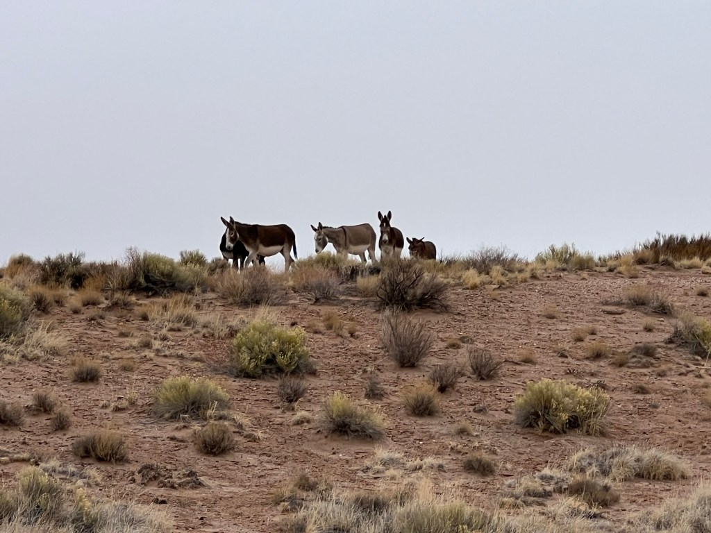
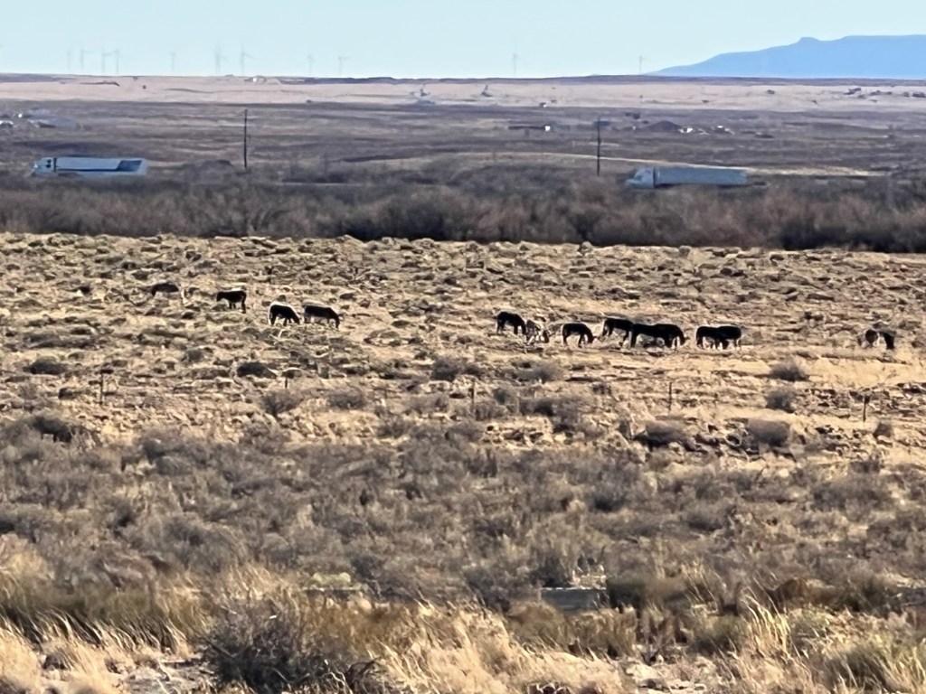
But there is a lot hidden in plain sight, like the herd of wild burros we see one place or another each day.
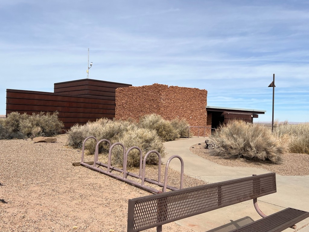
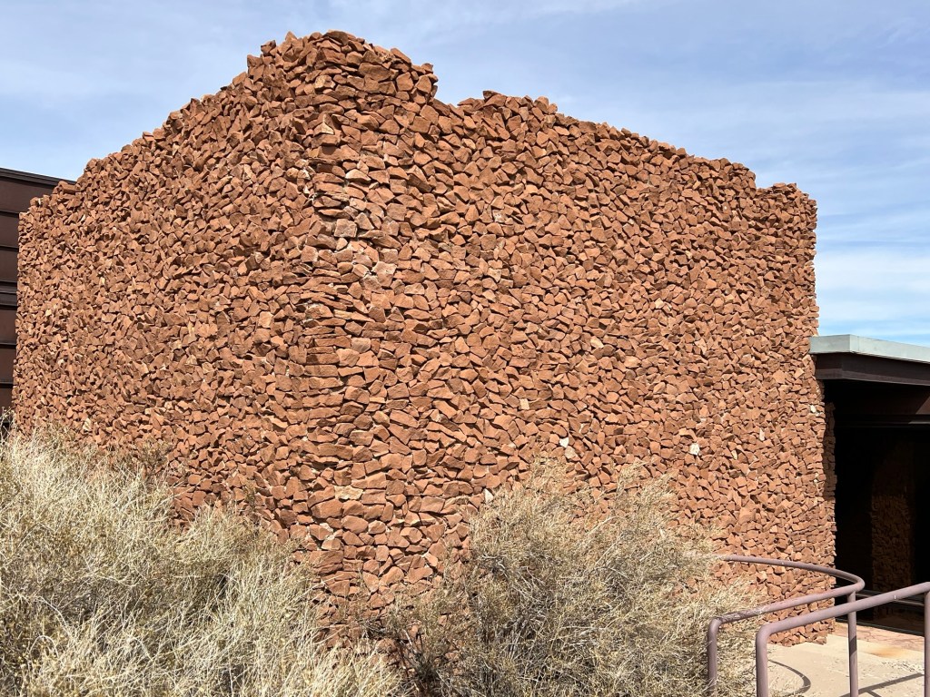
And this rather beautiful Visitors’ Center…
with these stunning stone walls.
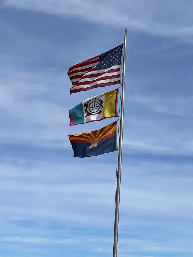
There are also two ancient villages of the Hisat’sinom people that you can visit. These are the ancestors of the Hopi people that still live at Second Mesa, sixty miles north of here.
The park was developed with the cooperation of the Hopi’s to preserve the sacred places. The flags are the US flag, the Hopi flag and the Arizona flag.
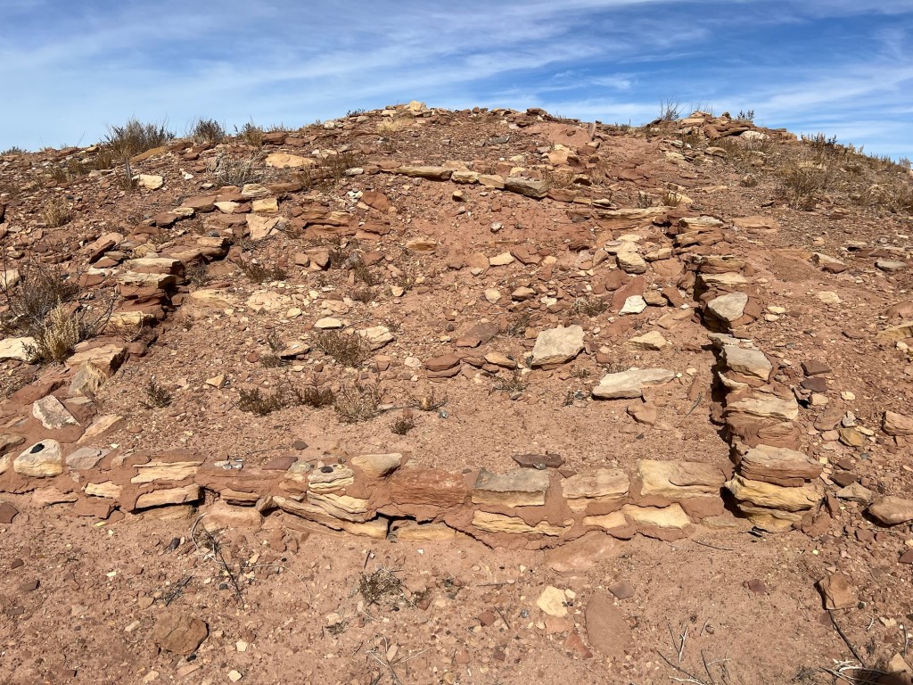
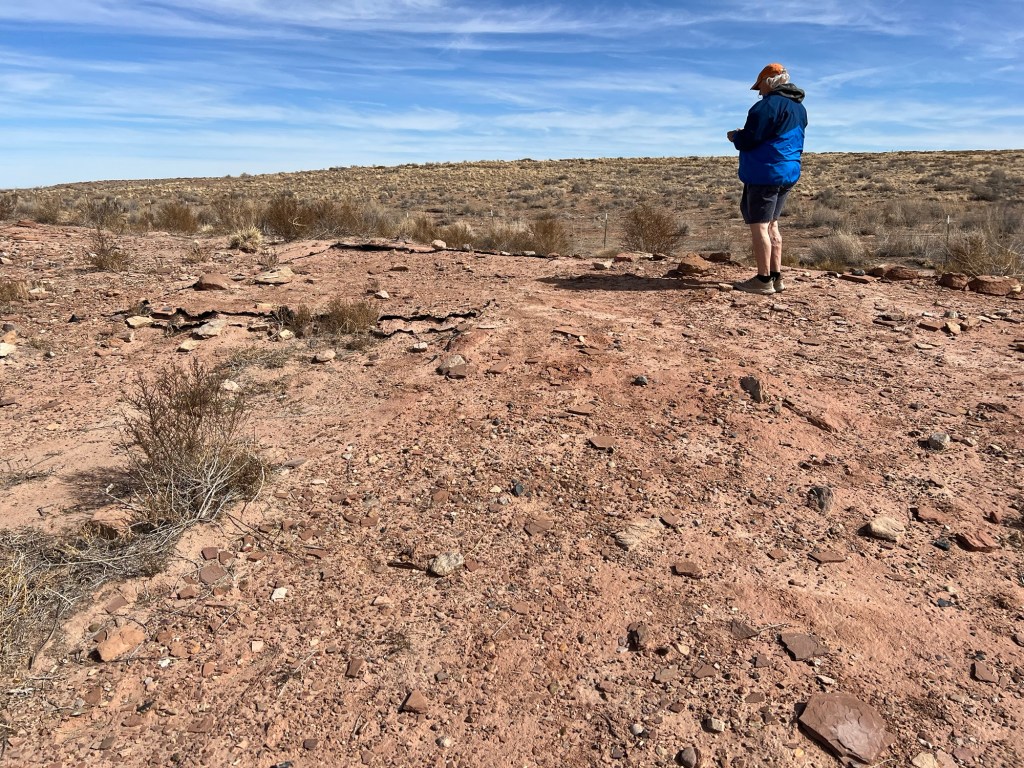
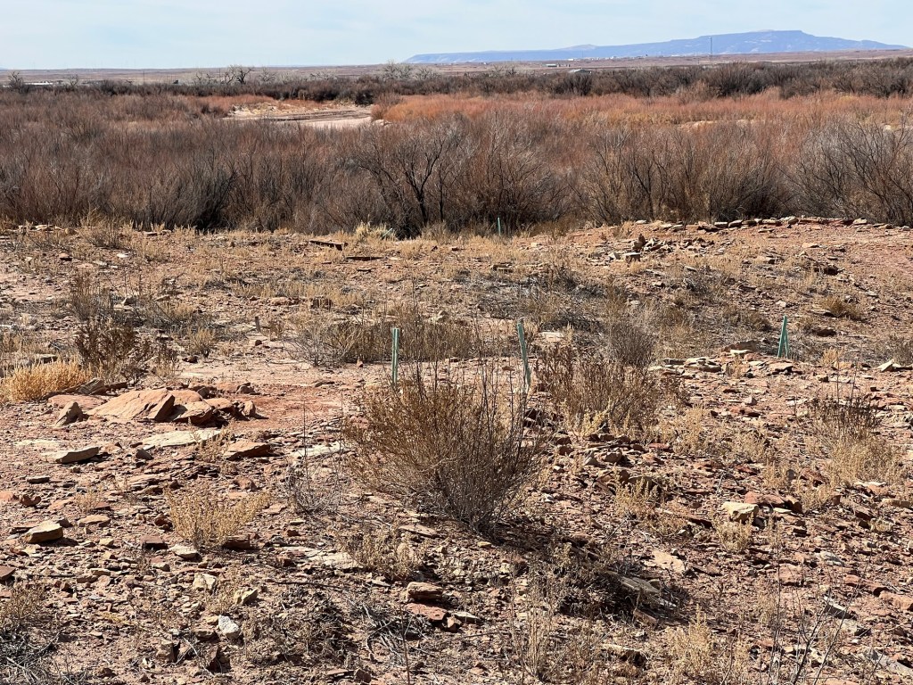
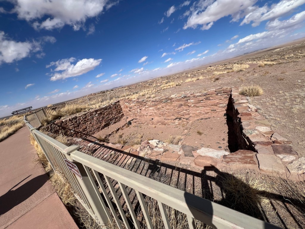
There are few remaining walls at Homol’ovi I, but you are allowed to wander the site…
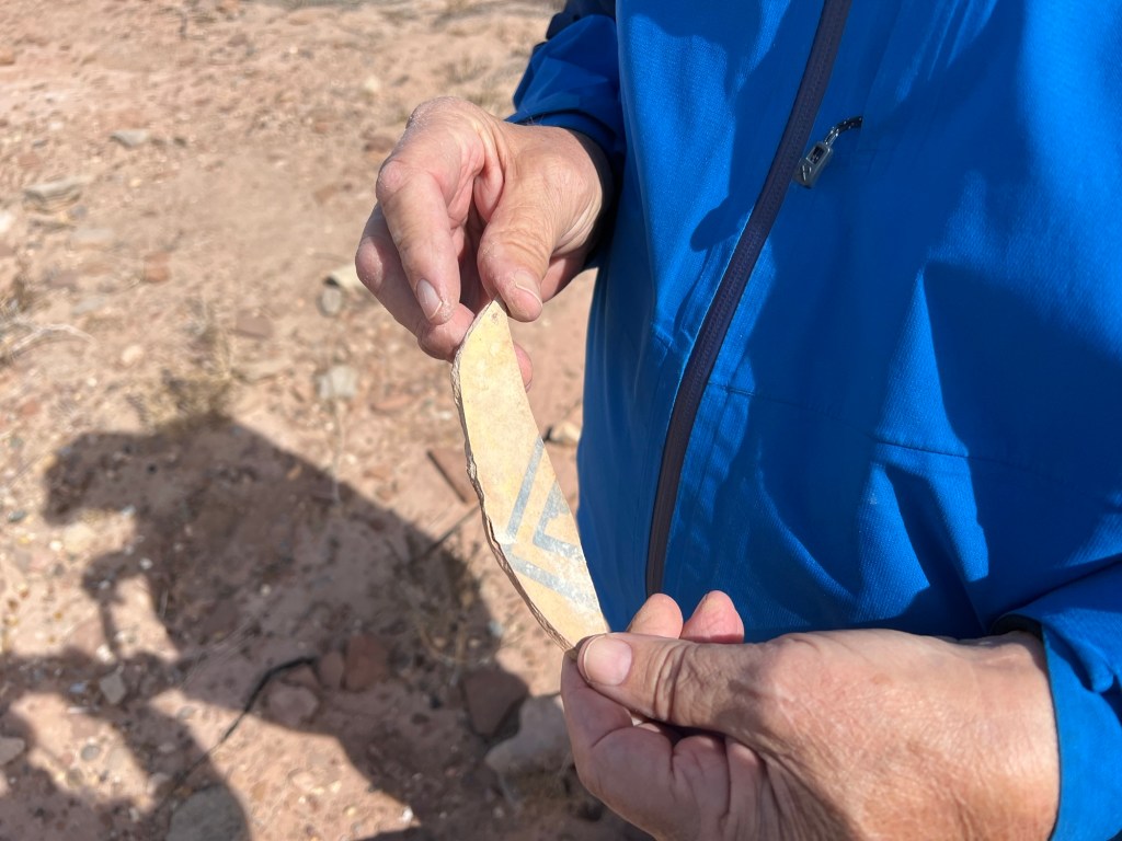
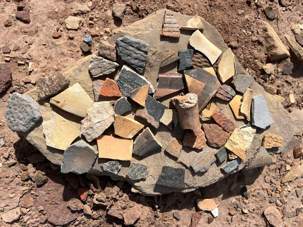
where shards of pottery are everywhere.
You are not allowed to take anything and people seem to cooperate, instead placing their finds on flat rocks where others can see them.
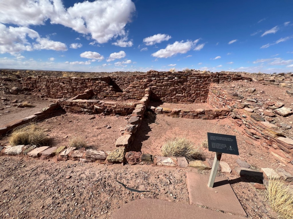
This site was settled in the thirteenth century and had about 1100 rooms. It was abandoned by 1400,
possibly due to frequent flooding by the Little Colorado River, which drew the people here in the first place.
Besides pottery we found stones that appear to have been worked.
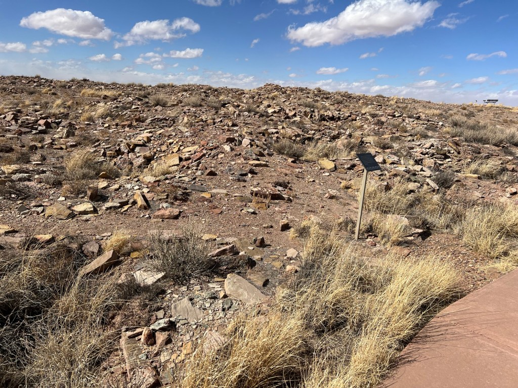
We also visited Homol’ovi II. This site had more of the old walls showing,
including this kiva.
But here you are restricted to the sidewalks.
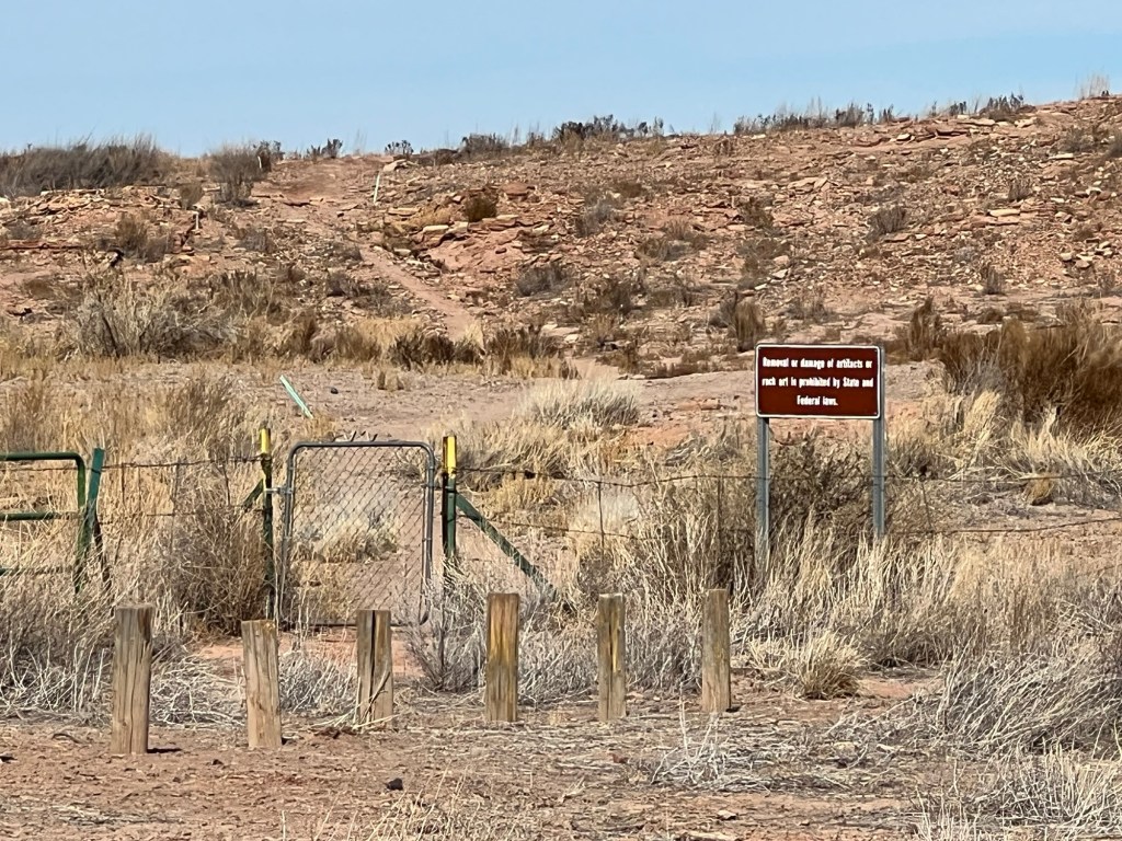
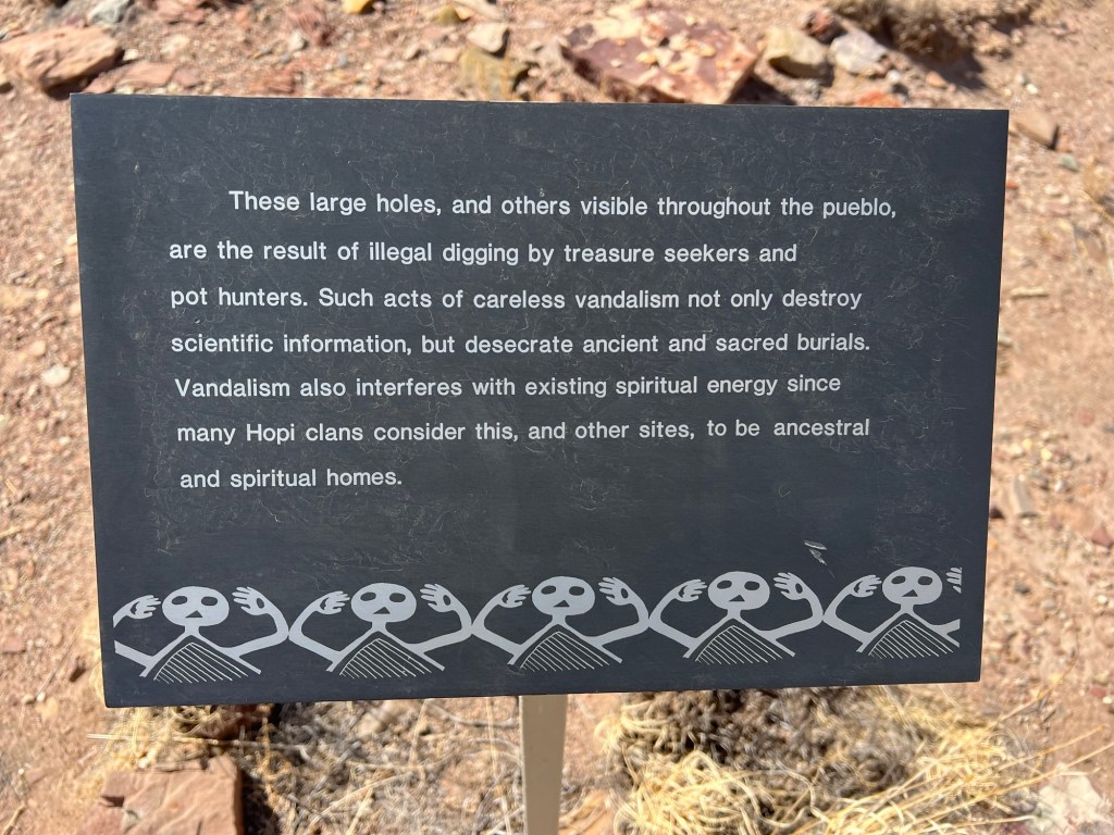
The site was extensively vandalized before the creation of the park.
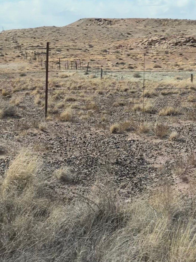
Both sites are fenced…
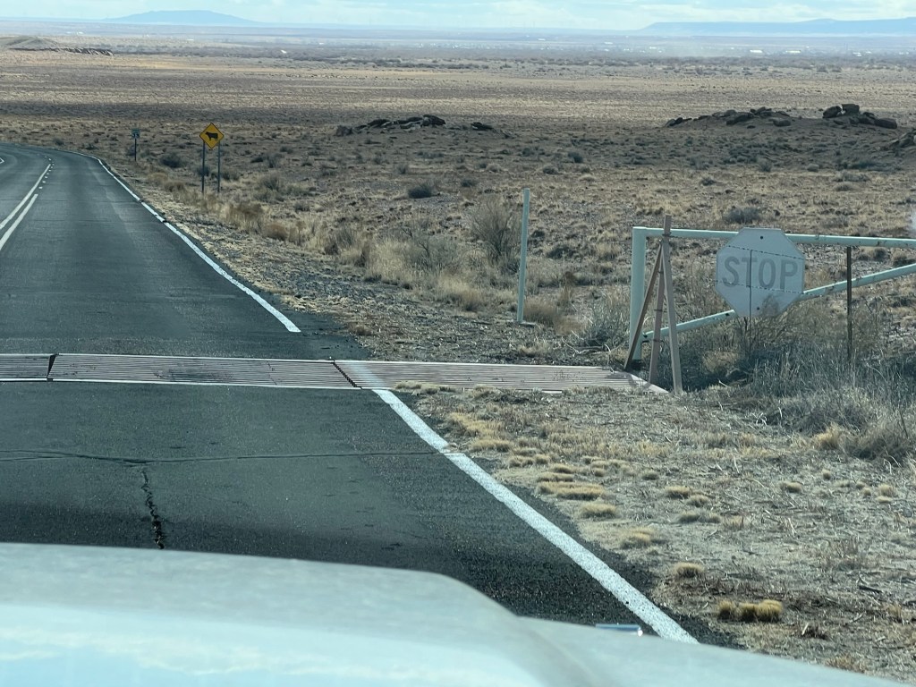
and have cattle guards at their entrances to protect them from the wandering burros.
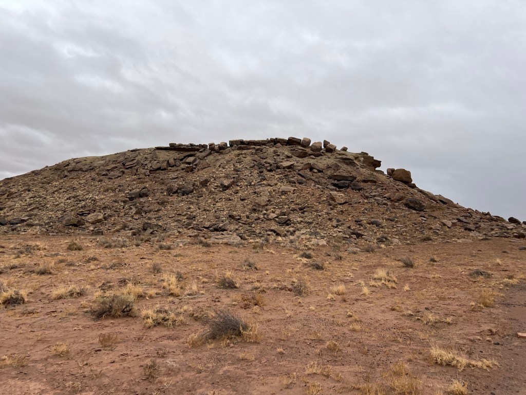
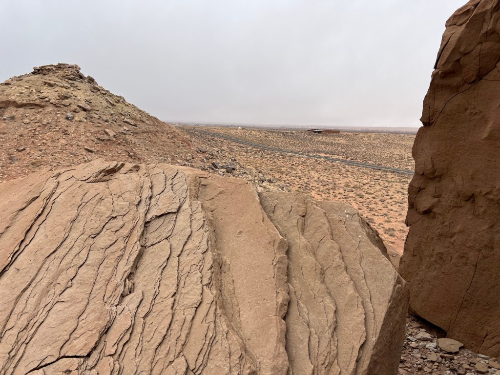
Our third exploration was on the Tso’vo Trail. The name means path of the rattlesnakes.
The stony hill we walked on looked like a very snakey place, but it’s still very cold here, so no snakes are out.
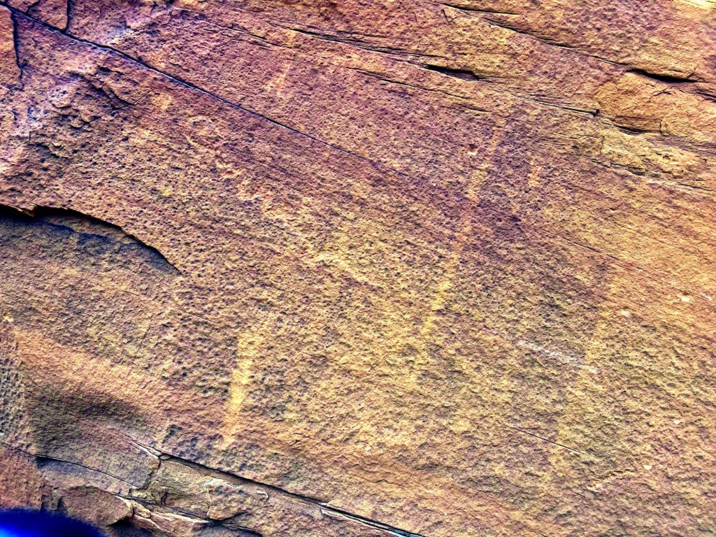
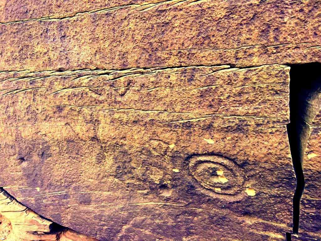
We did find some faded petroglyphs, which are faint even with enhancement.
This was the clearest one.
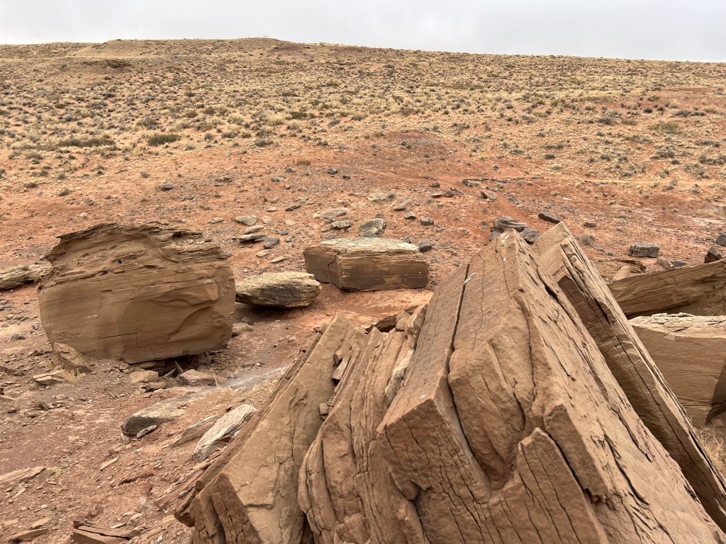
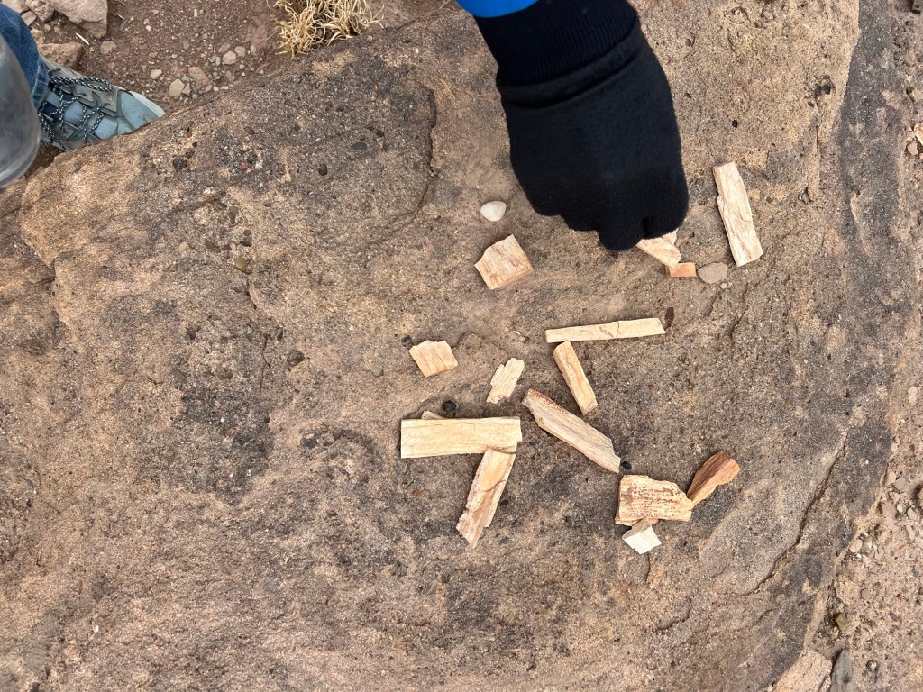
We also found these shards strewn down the side of the hill. We think they might be petrified wood.
We’ve enjoyed wandering about here, despite the cold.
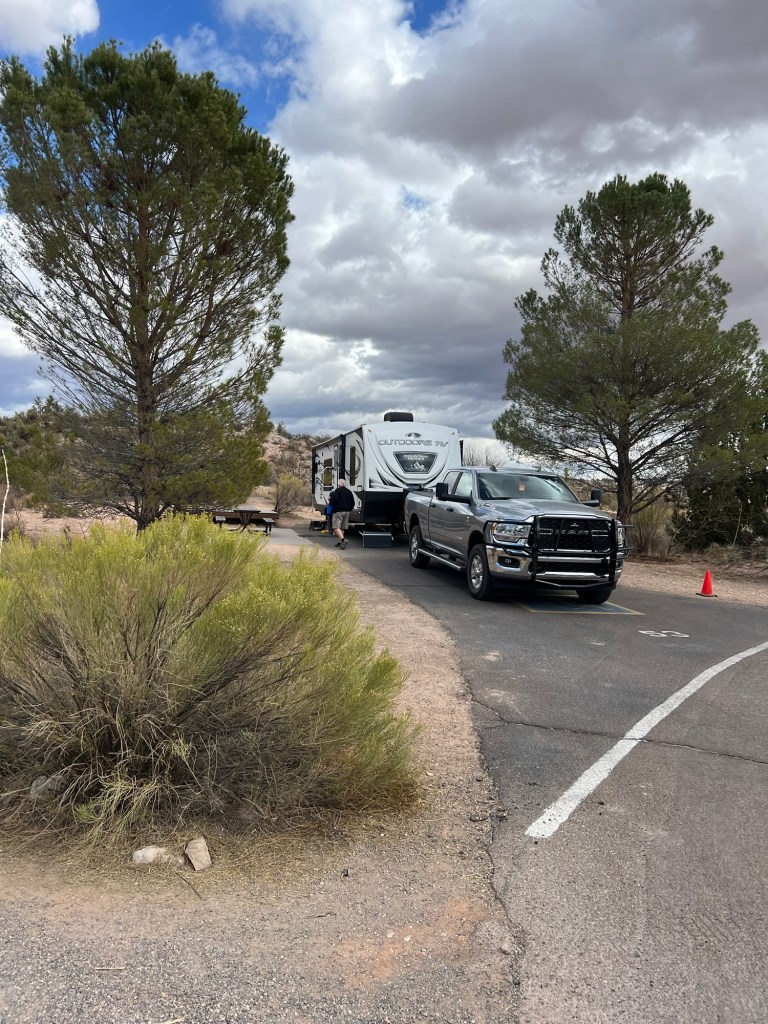
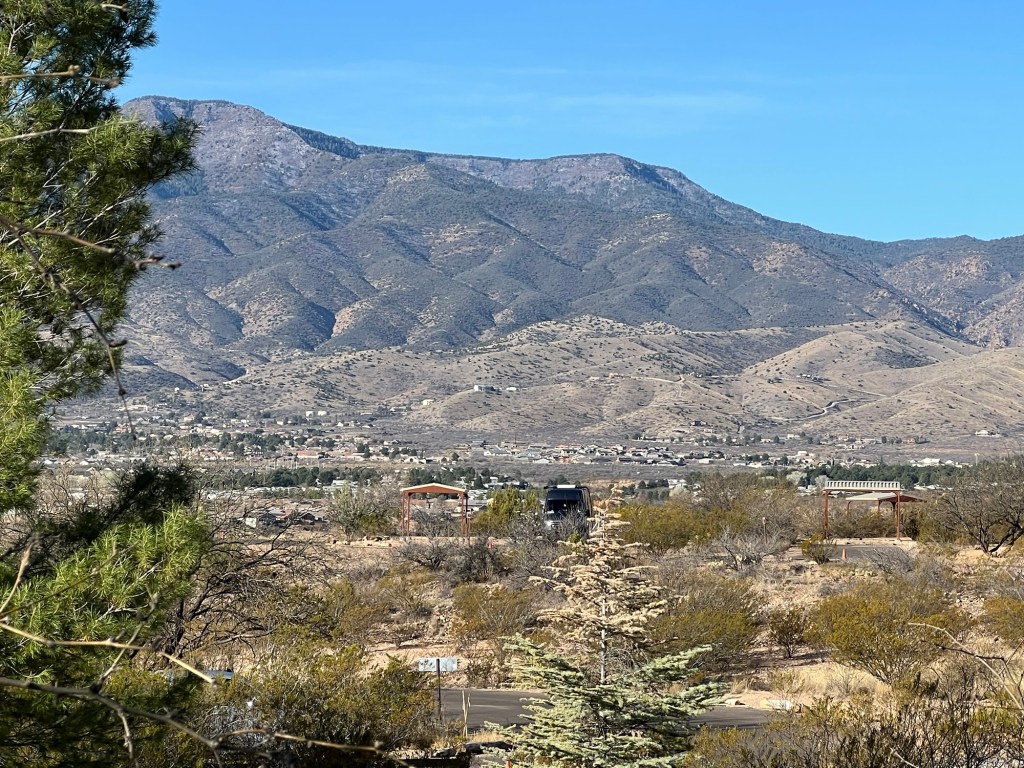
Yesterday I flew to Phoenix. Bud and Matey came to the airport and we drove back to the mountainous area of Cottonwood, AZ.
Bud had moved the trailer to Dead Horse Ranch State Park.
When I arrived it was cloudy and chilly with some ominous clouds over the mountains.
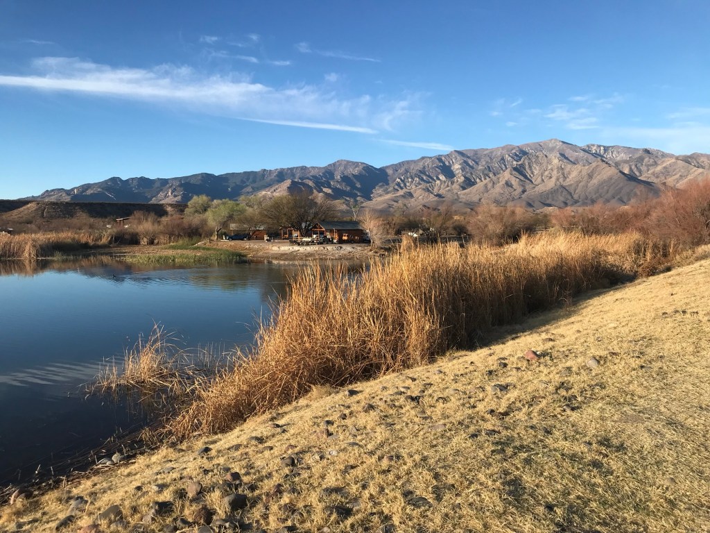
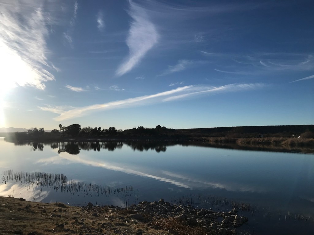
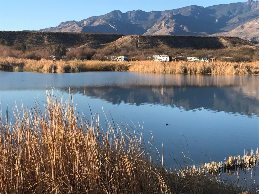
While I was in New York Bud and Matey had spent four days at Roper Lake State Park, just northeast of Tucson. Bud took some pictures for me.
It looked like a beautiful spot…
with camping right along the lake.
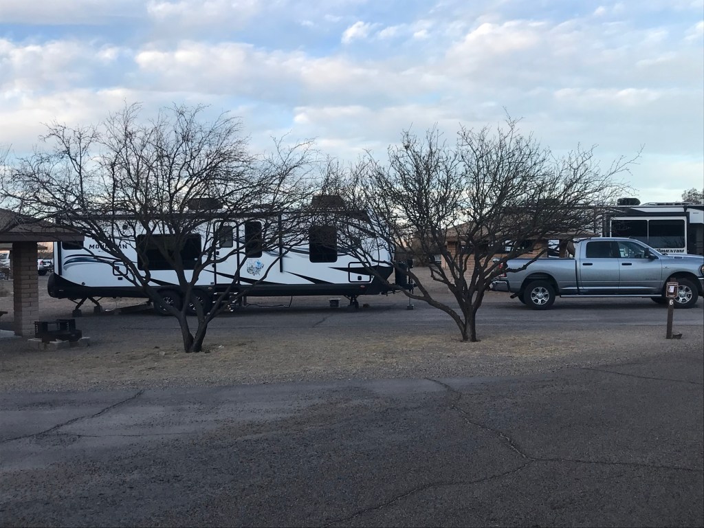
That looks like a pretty nice site…
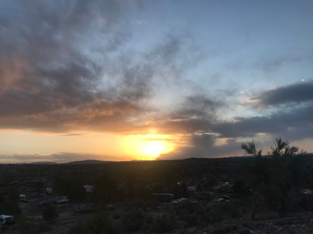
and a gorgeous sunset.
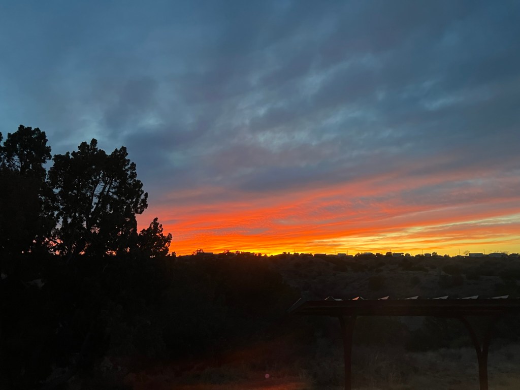
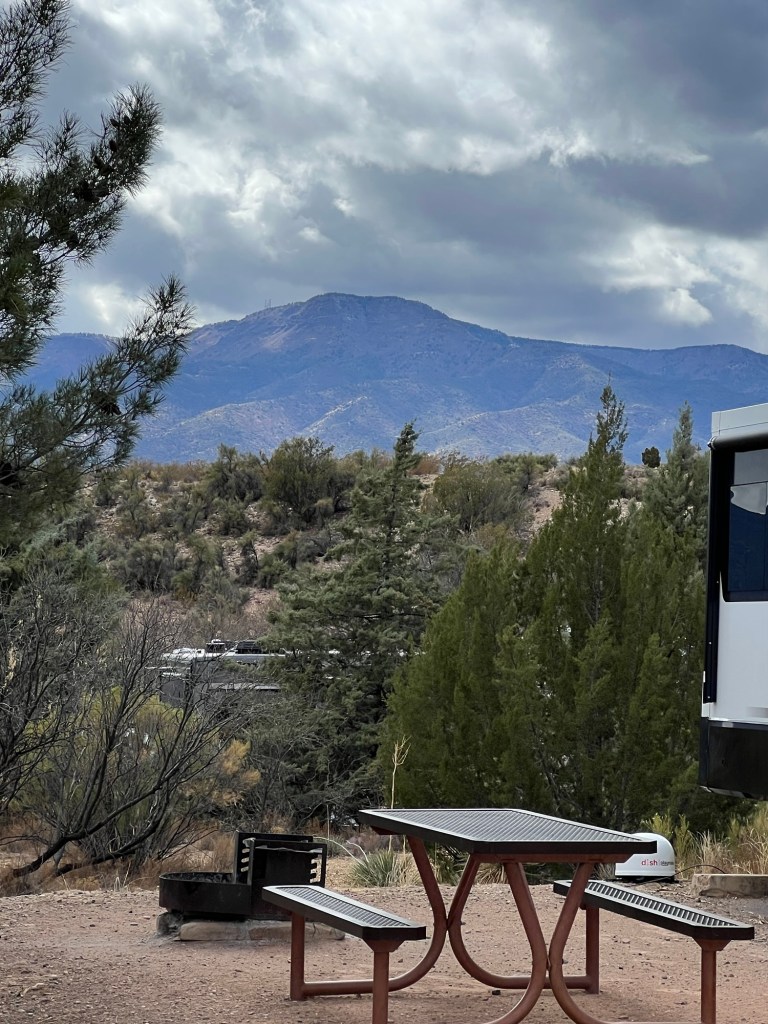
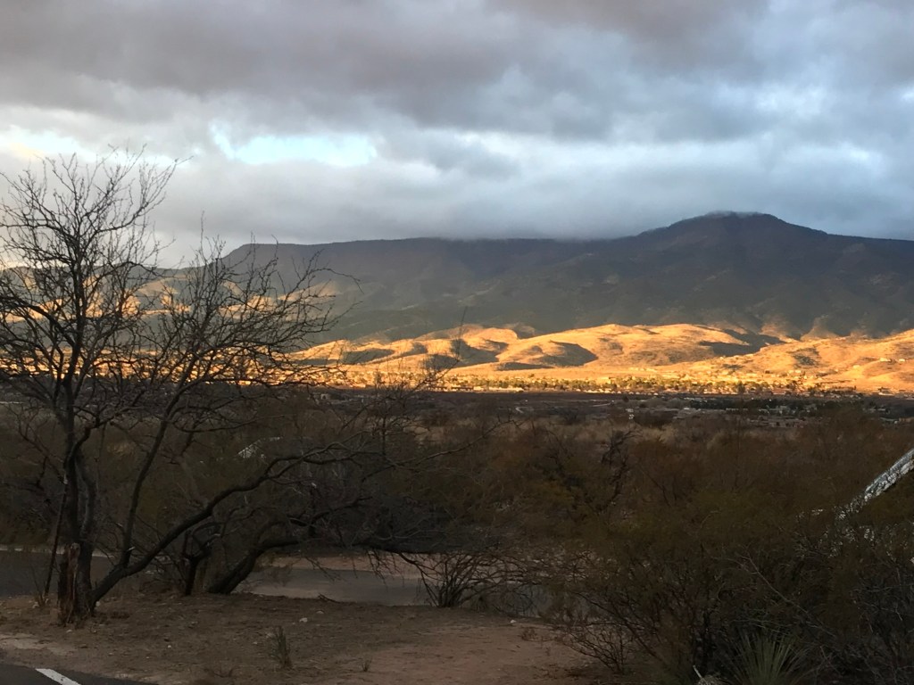
They then moved on to Dead Horse Ranch State Park where he caught the nearby mountain in this dramatic lighting.
This morning Matey and I got to walk in sunshine enjoying the distant mountains.
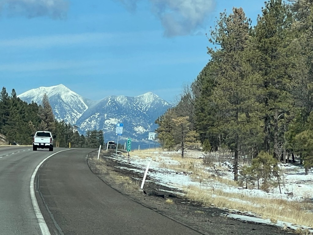
We then headed north on I-17 over the snowy mountains towards Flagstaff and then east on I-40. We don’t usually take the interstates, but the alternatives through these mountains looked like a challenge for the truck and camper.
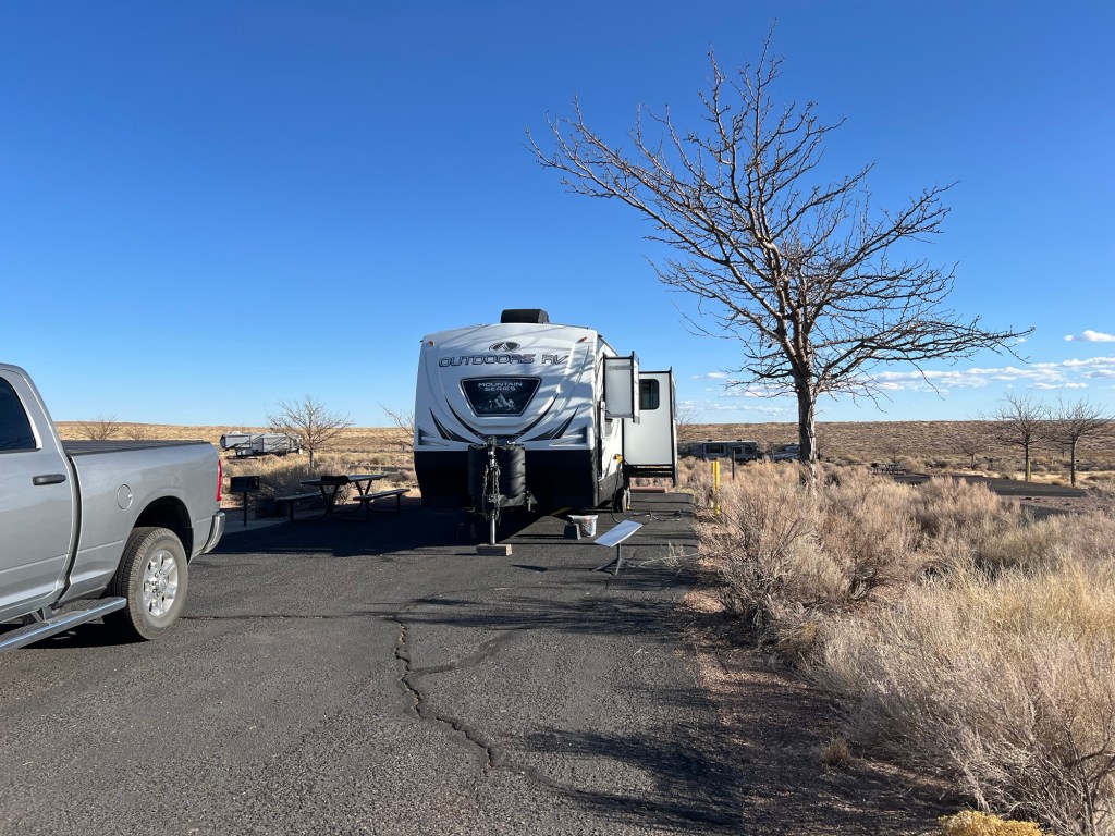
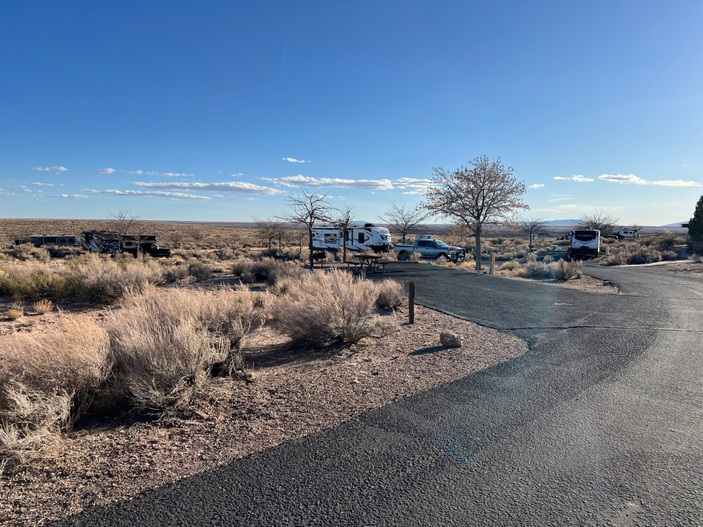
I was happy to find when we reached Homolovi State Park outside of Winslow that it was lower and warmer, though the scenery isn’t as dramatic.
There is plenty of space here, and herds of wild horses and burros.
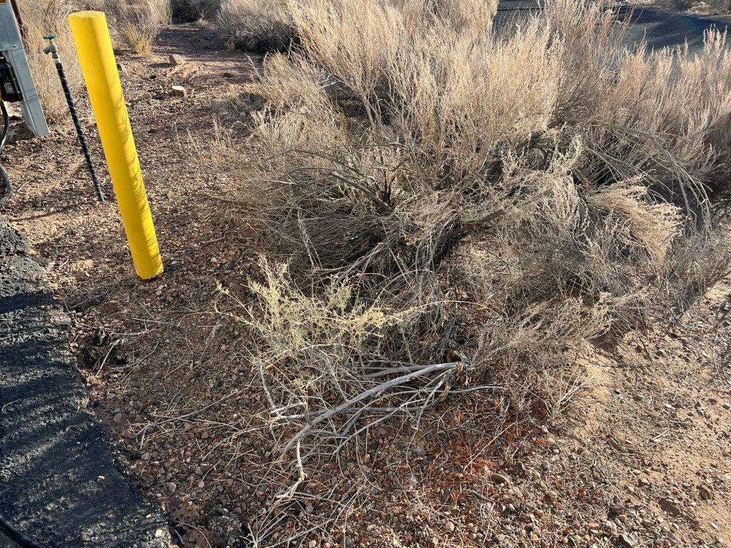
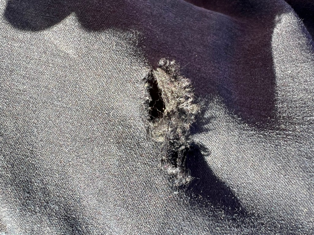
I had an altercation with this bush when we were setting up. I slipped off the edge of the paved pad and fell into it. Happily it didn’t have thorns but Bud had to haul me out of it.
The bush won as I got a hole in my favorite pair of jeans (and a smaller hole in my leg).
Still, I think I will enjoy it here.
And I will try to keep posting, even though every time I take a picture I think about how my Mom loved to see the posts and read the blog. She had an iPad and knew how to get to her email and find the notices when I posted. She never typed a reply, but we talked about the photos when I called her.