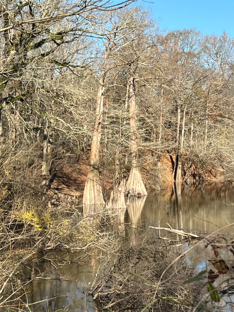
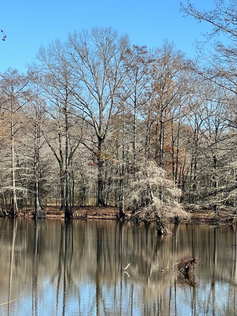
I’ve been wanting to do a post on some of the wonderful trees I’ve encountered in our travels. Today’s walk back to some old growth cypresses has inspired me to try.
The star of the walk was the “castle tree”, that giant furthest out in the water. Bud has a cold and didn’t want to walk in the 33 degree weather, so I pressed Matey into service to give some sense of the size of these monsters.
Since my favorite wildlife is trees, I am almost always among them…
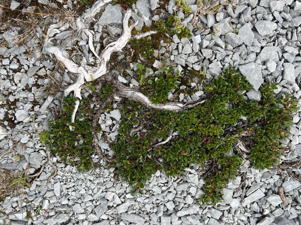
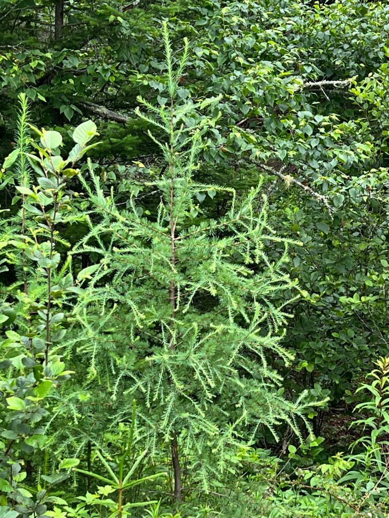
even if they are only a few inches tall, like this specimen at the Burnt Cape Ecological Preserve in Newfoundland.
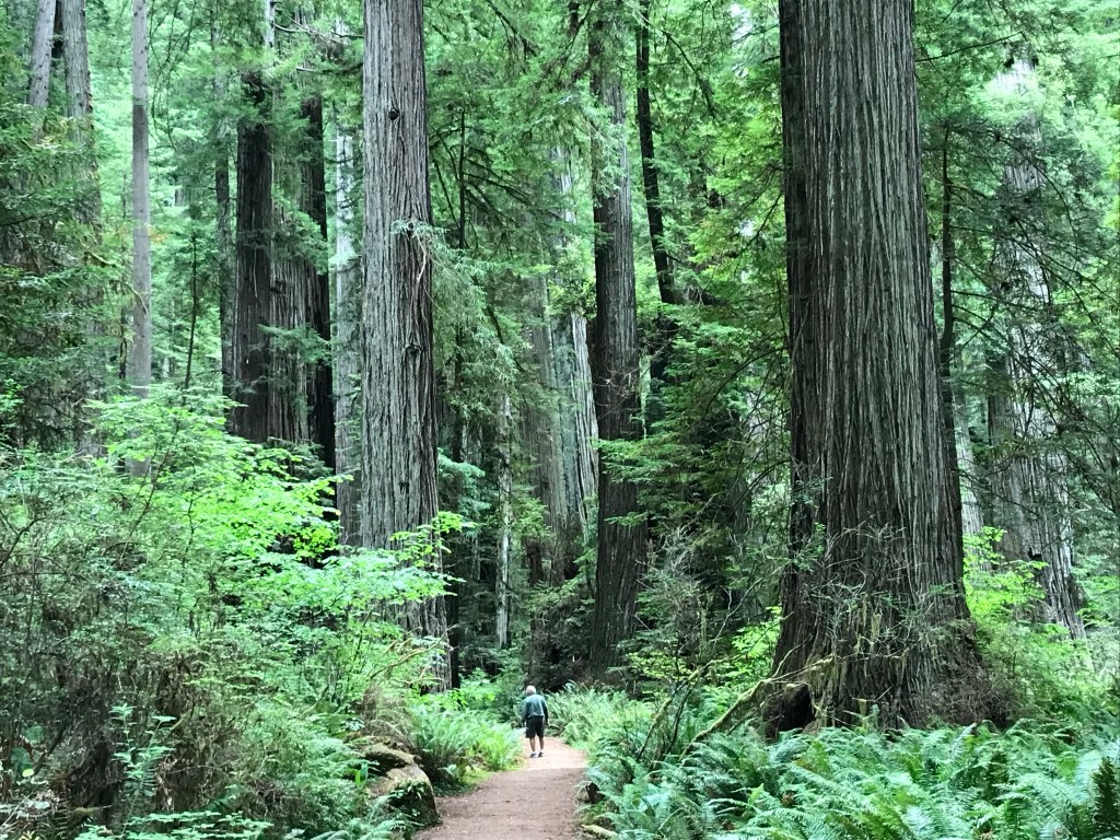
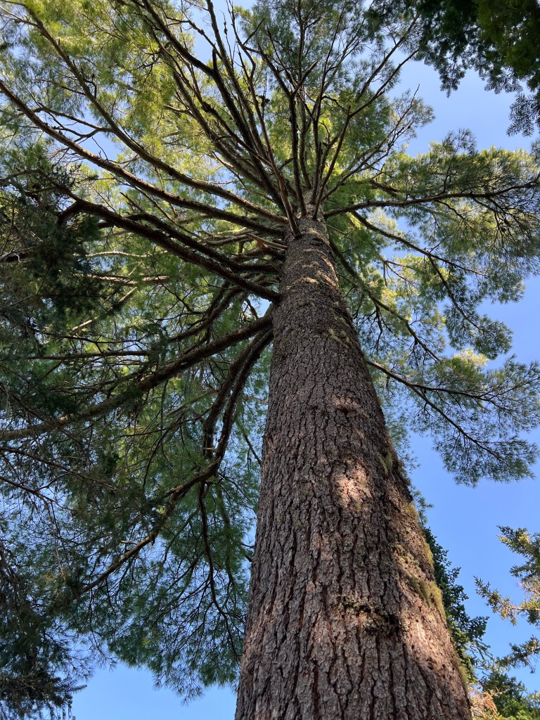
One of the most sacred places I have ever been is amidst the giant redwoods in California.
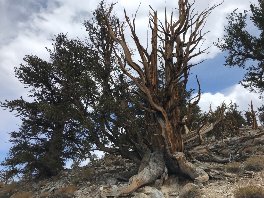
We visited them not long after seeing these amazing bristlecone pines. They are growing above 10,000 feet in altitude and are thousands of years old.
Trees don’t move on a time scale that we can see, yet they manage to adapt to the place where they are growing, even when the ground beneath them changes.
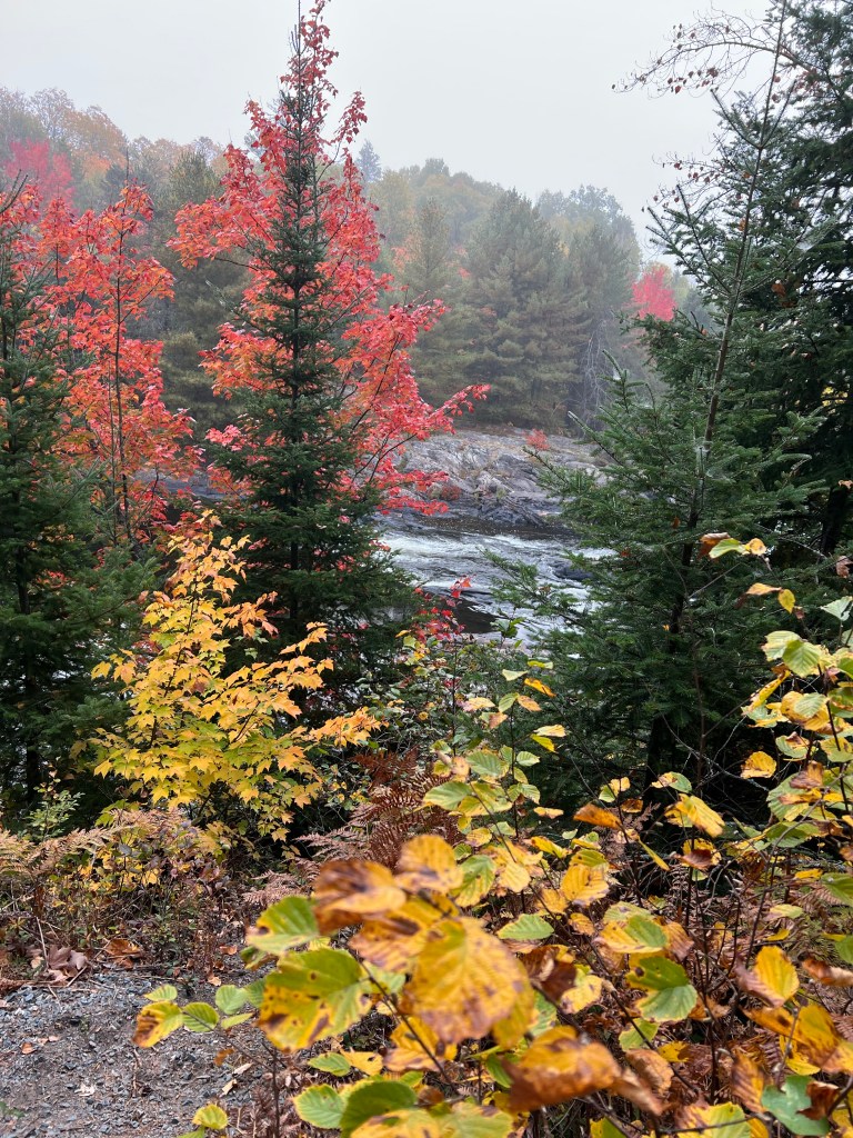
Some trees are majestic…
and some are whimsical…
and all of them add so much beauty.
They hold the soil in place…
and give us oxygen.
Though I have met many wonderful trees…
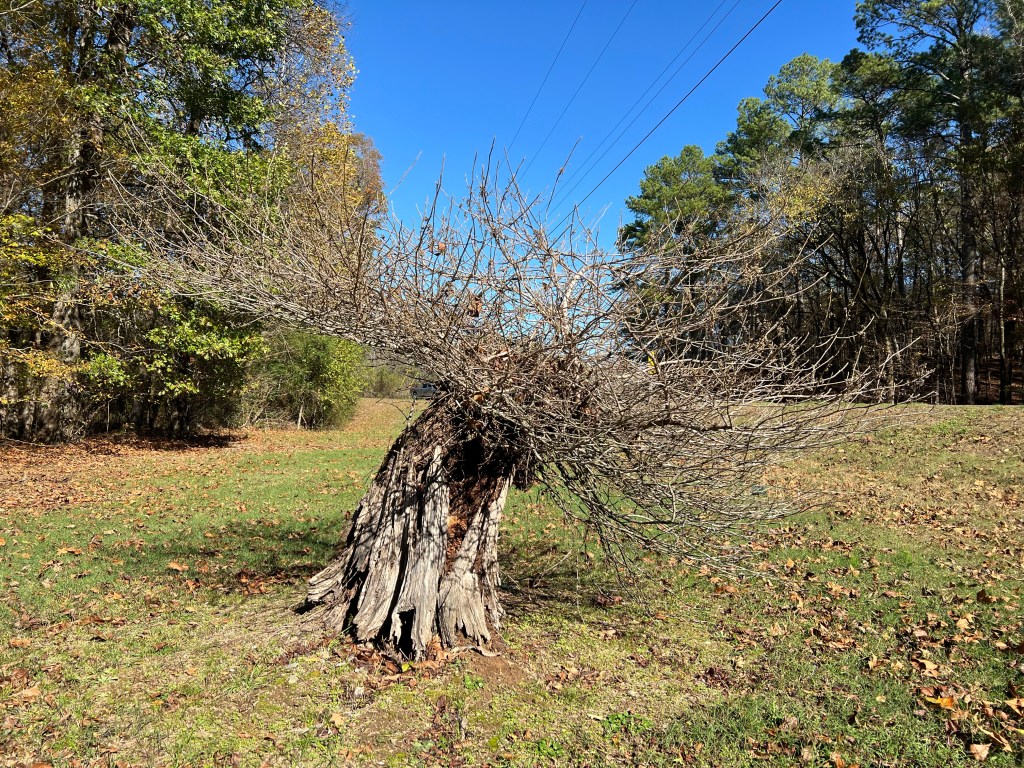
this poor thing growing beside the road into Lake Catherine State Park remains one of my favorites because to me it represents hope. No matter what we humans manage to do the trees will go on.
We’ve moved north about a hundred miles to Chemin-a-Haut State Park in northern Louisiana. Chemin-a-Haut means high road and is on another ancient trail like Natchez Trace.
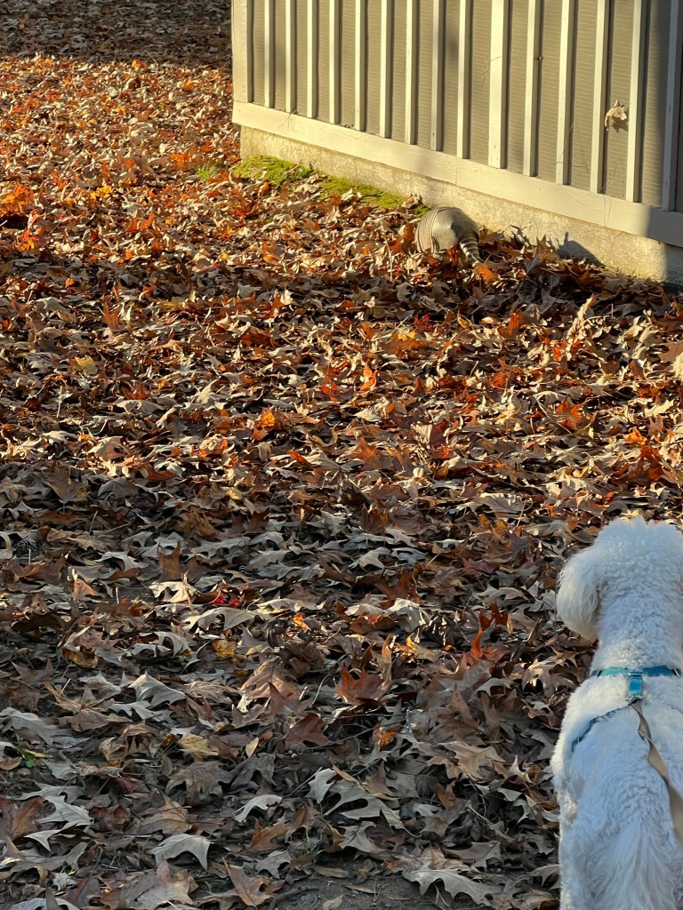
Matey likes this place because there are armadillos here.
We did a bit of exploring today.
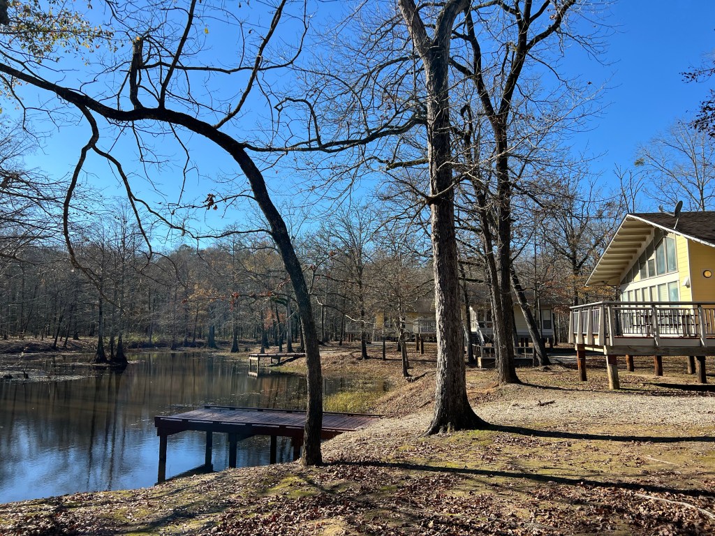
They have some really nice cabins here.
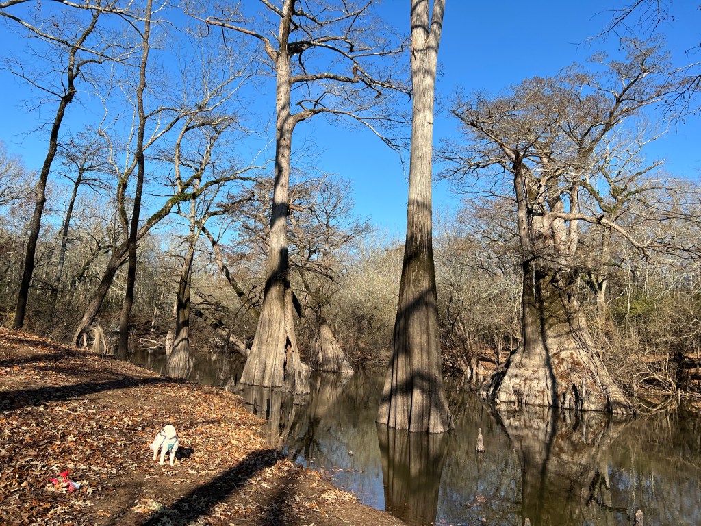
I love the cypress circled by their “knees”.
It is such a privilege to spend my days amid so much beauty. What a wonderful way to celebrate 75 years. (And Bud made me a birthday pumpkin pie.) Lucky, lucky me.
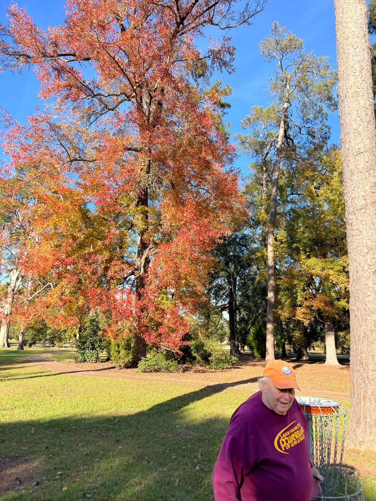
The truck is fixed but our plans to move were cancelled, so we had a few days to just relax and hang out. We played disc golf in Natchez.
We played disc golf at the park. Bud’s throw went a bit astray here, but thankfully not into the lake.
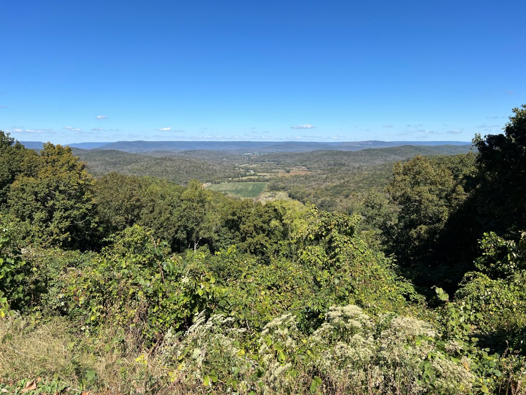
The town course had beautiful old trees in a park setting around a ball golf course.
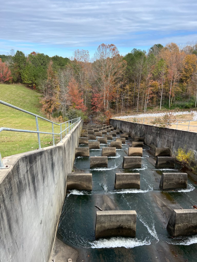
The park course was around the dam. This is the unusual spillway.
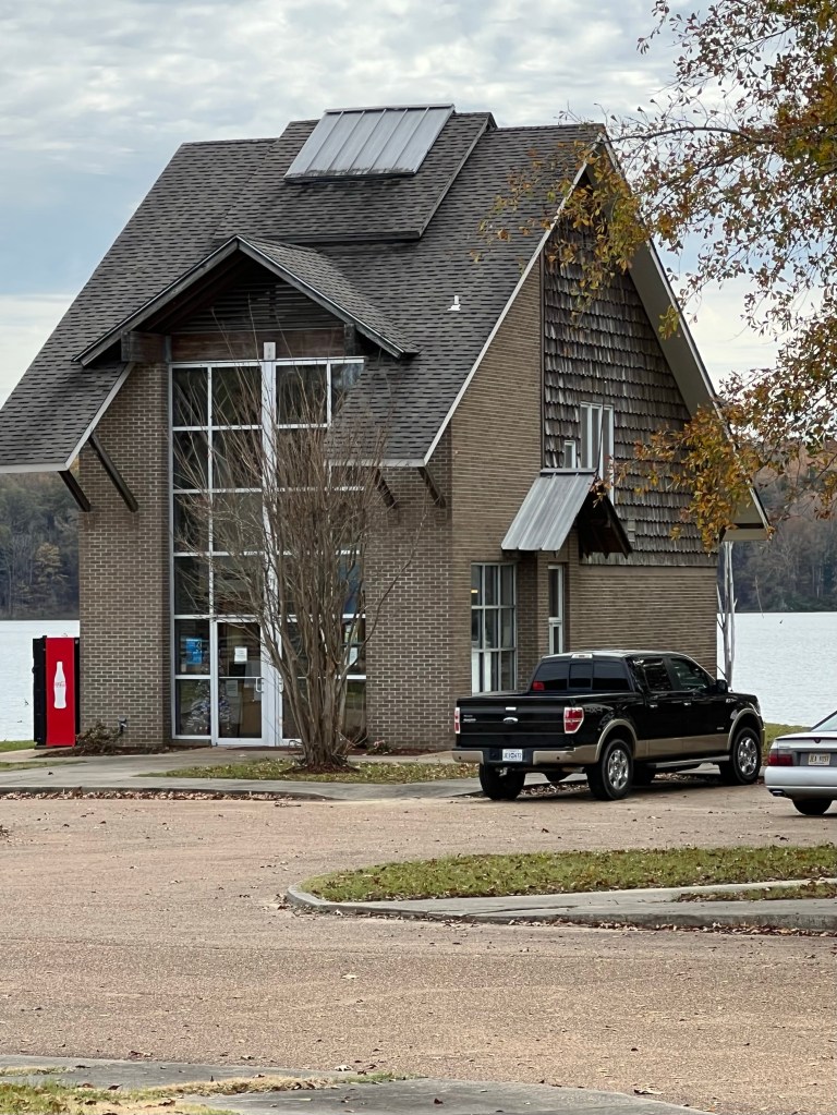
And this is their unusual little park office.
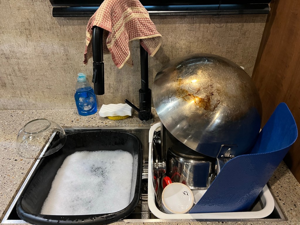
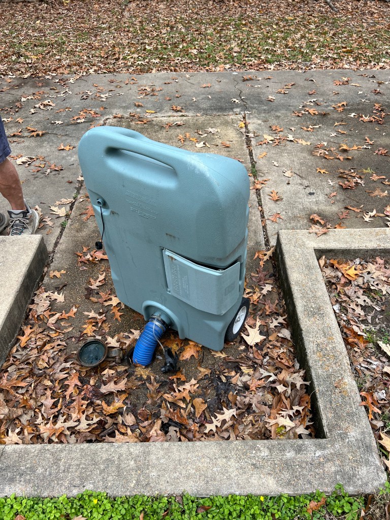
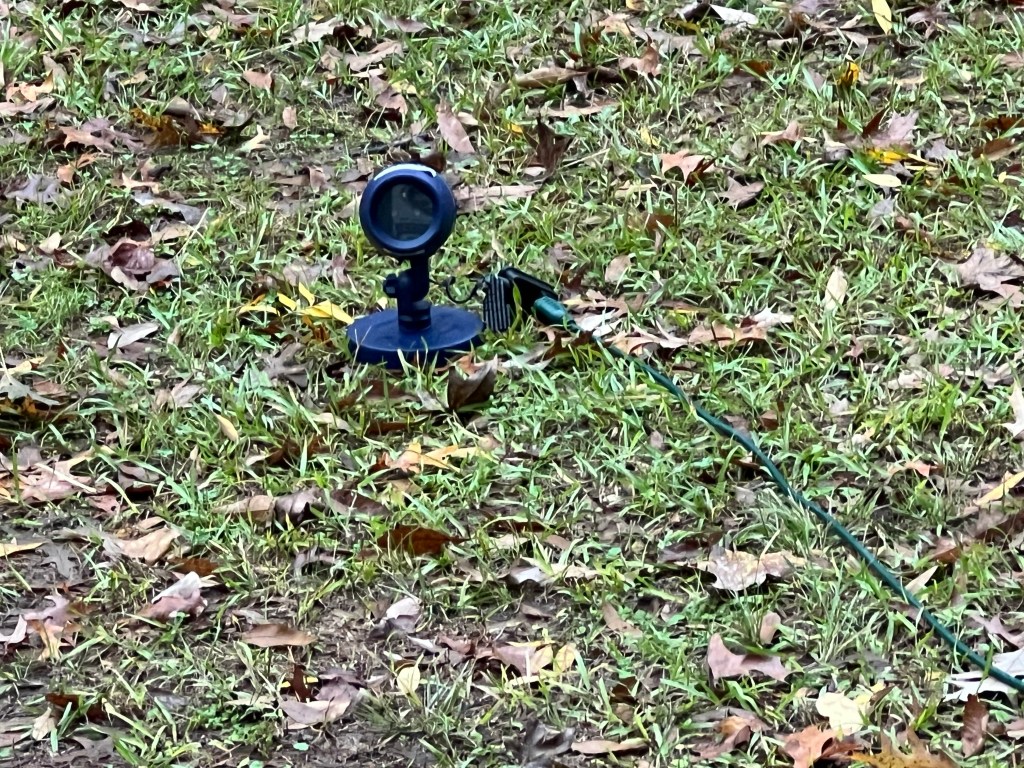
Staying 10 more days without sewer involved a bit of water management. Here’s a day’s worth of dishes washed and rinsed with a bit over a gallon of water.
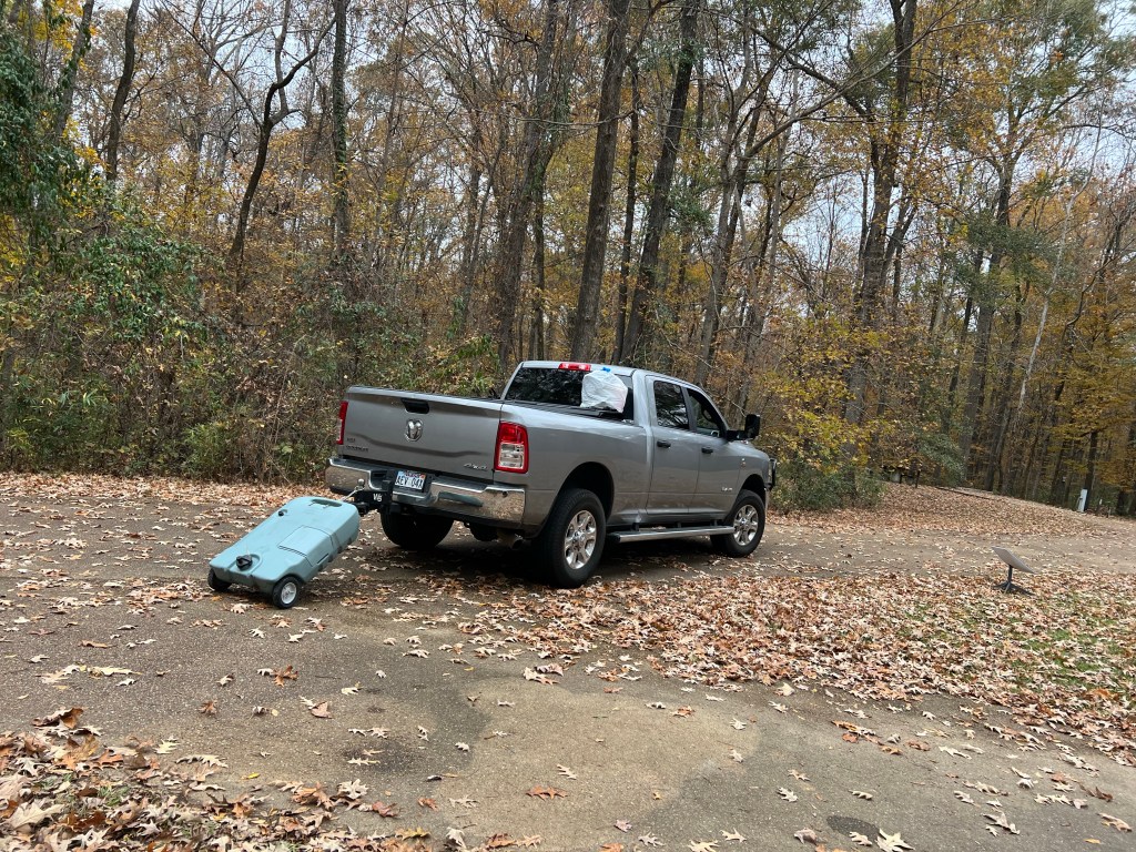
Here we are taking a portable tank full of of shower water…
up to the trailer dump station.
We only had to do that once. Otherwise we just tried to enjoy the beauty…
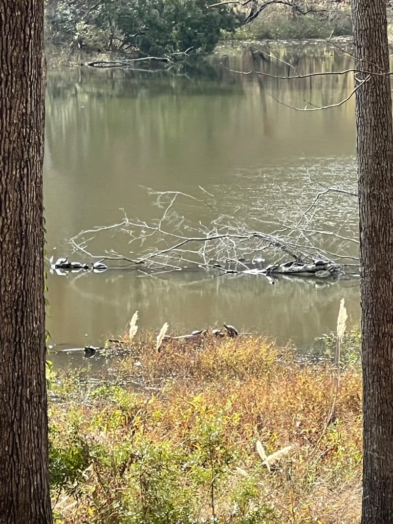
and like these turtles, take advantage of the sunshine when it came.
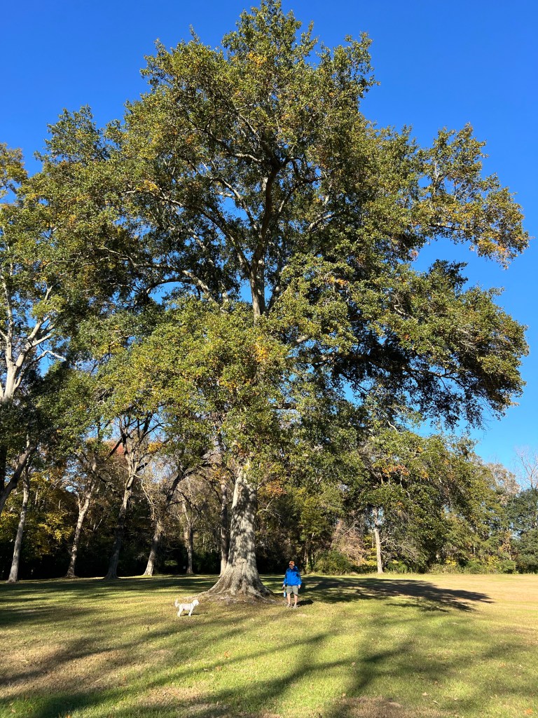
The other day we went to Natchez to visit the museum and grounds of the Grand Village of the Natchez, a sacred center in use by the Natchez people at the time of contact with the French.
It was interesting and beautiful. My favorite was this immense water oak tree. I love the huge old trees in this part of Mississippi.
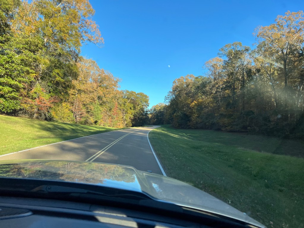
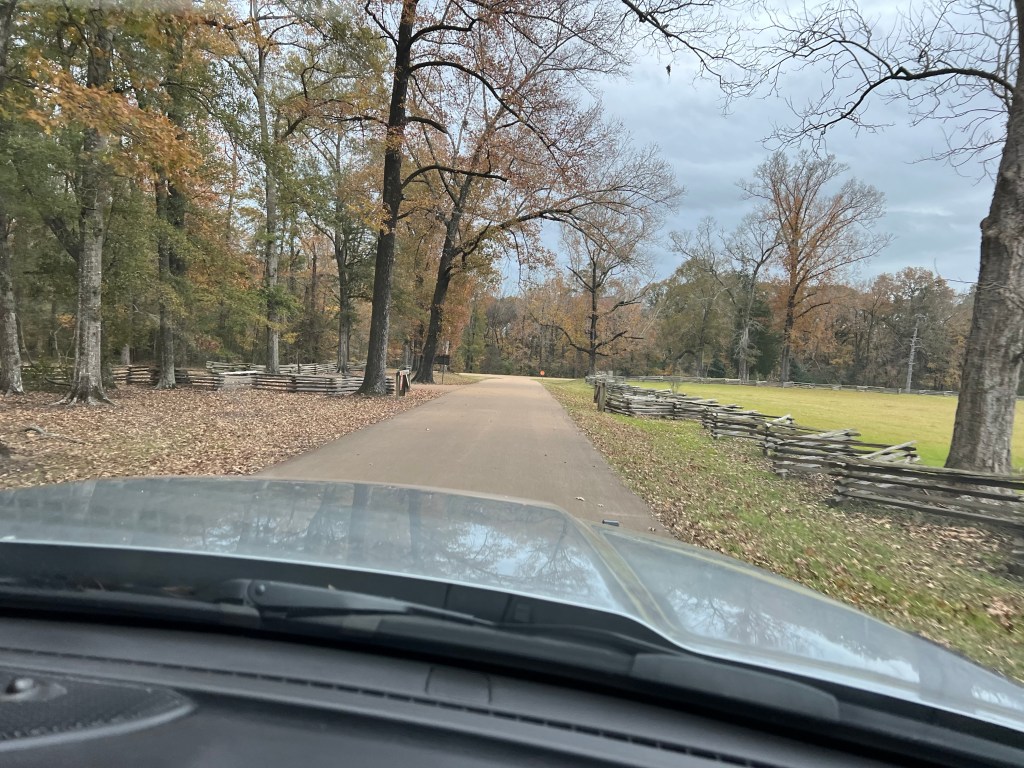
On the way back we decided to try driving the Natchez Trace Parkway rather than our usual route up U.S.61.
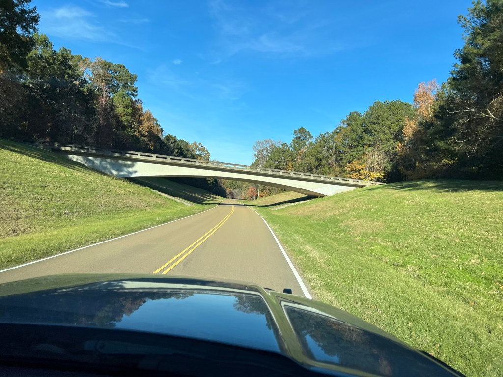
What a beautiful road! We have since learned a bit about it. The Parkway is part of the National Park system and runs for 444 miles from Natchez, MS to Nashville, TN. It follows near the old Natchez Trace; this natural corridor was used by natives for centuries. In the late 1700’s and early 1800’s it was used extensively by people from the Kentucky/Tennessee region. They would float their goods down the Ohio and Mississippi rivers on flatboats. When they got to Natchez they would sell the goods, disassemble the flatboats and sell them for lumber and walk the 450 miles back to Nashville and then to their homes. The Natchez Trace was the route they took.
The Parkway was just completed in 2005 and has some beautiful bridges. It is closed to commercial traffic and though the speed limit is just 50 mph the part we have driven has no stops and no traffic making it a great alternative.
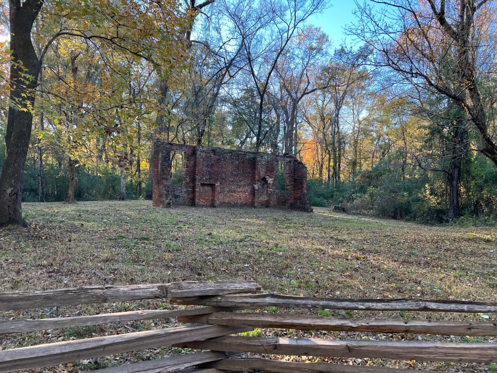
On the way back to camp we stopped at the site of the Elizabeth Women’s Academy. This is all that’s left of the first female institute of higher learning for women in Mississippi, built in 1818. Mileage on the Parkway is counted from the southern end, this was at mile 5.1. Natchez State Park, where we’re staying, is near mile 10.
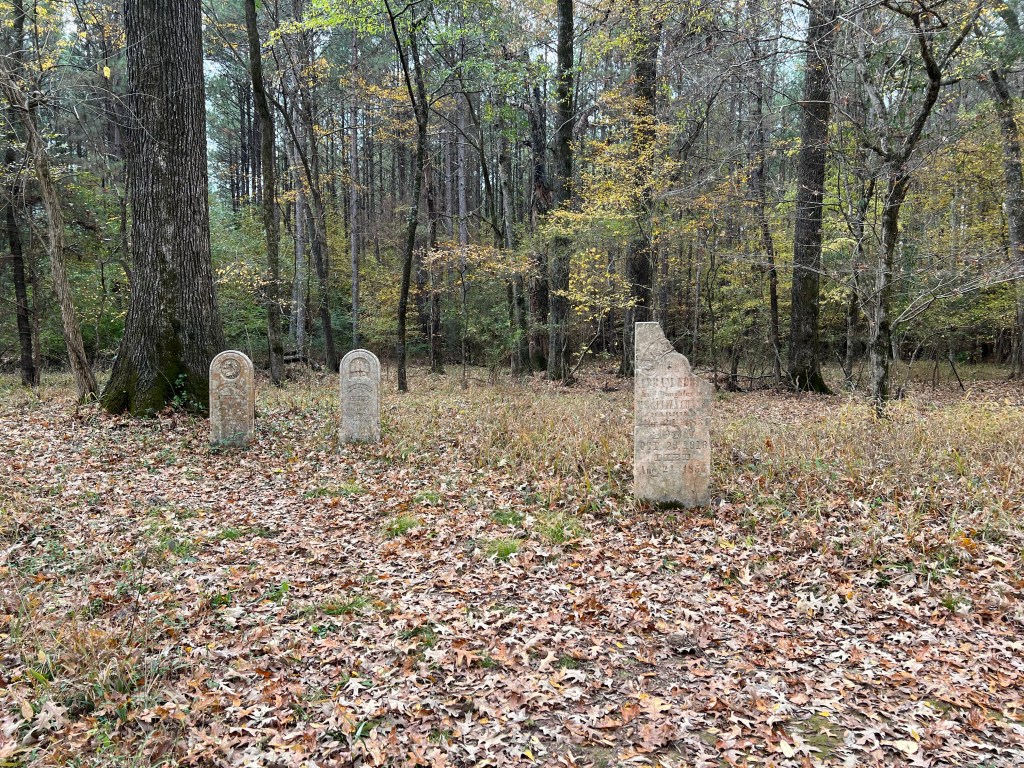
Today we drove as far as mile 45.7 where we stopped to see the Grindstone Ford and Mangum Mound. The path to the ford led past these old tombstones from the middle 1800’s.
This is the original trail leading down to the ford. In the flats near the ford the trail became indiscernible, probably from flooding. It was interesting to note that in the early 1800’s this was the northern edge of European settlement.
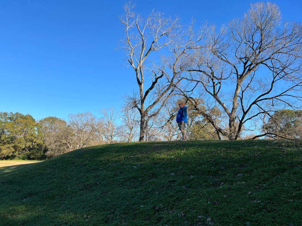
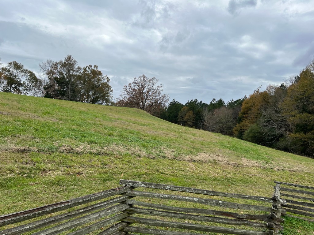
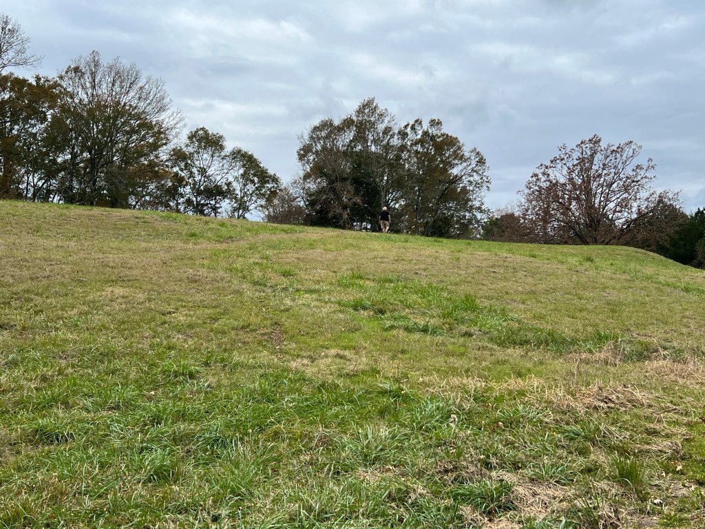
On the other side of the road was Mangum Mound, This was a burial place used between 1350 and 1500.
It was a pretty large earthwork. You can just about see Bud on top in front of the largest trees. There were remnants of silk flowers on top, reminding us that this site is still sacred to the descendants of those buried here.
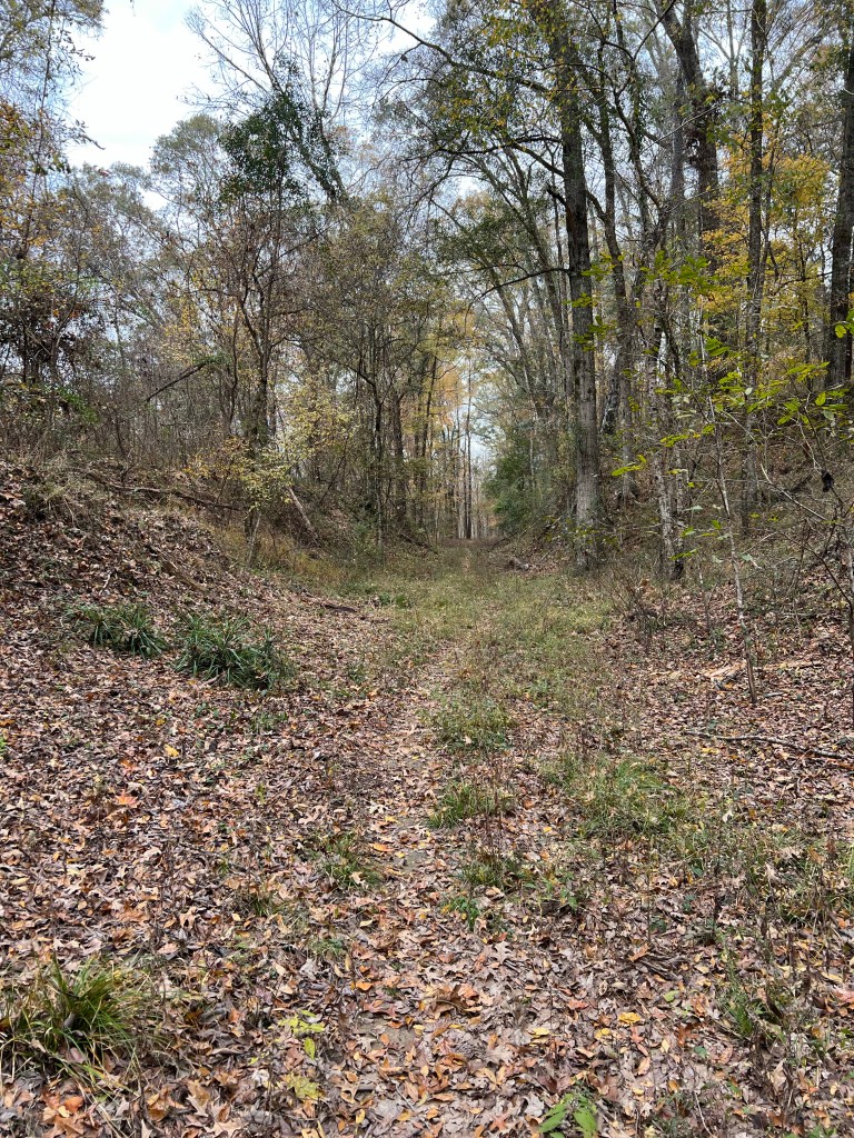
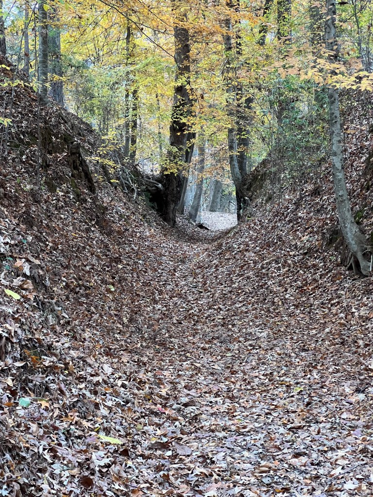
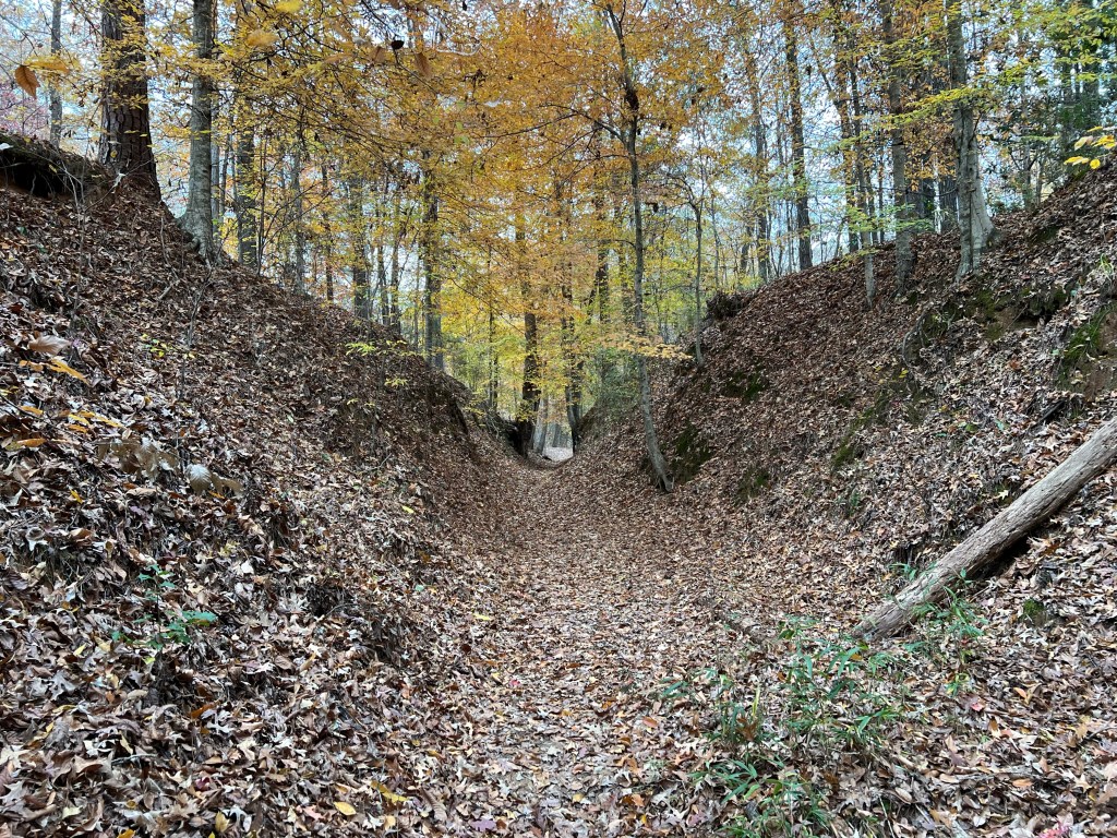
On the way back we stopped at mile 41.5 where there is a section of the original Trace that over the years has been worn below the surrounding forest.
This “Sunken Trace” was at least 20 feet below the surface. It was a bit eerie to walk this path that thousands of footsteps had worn into the the forest floor.
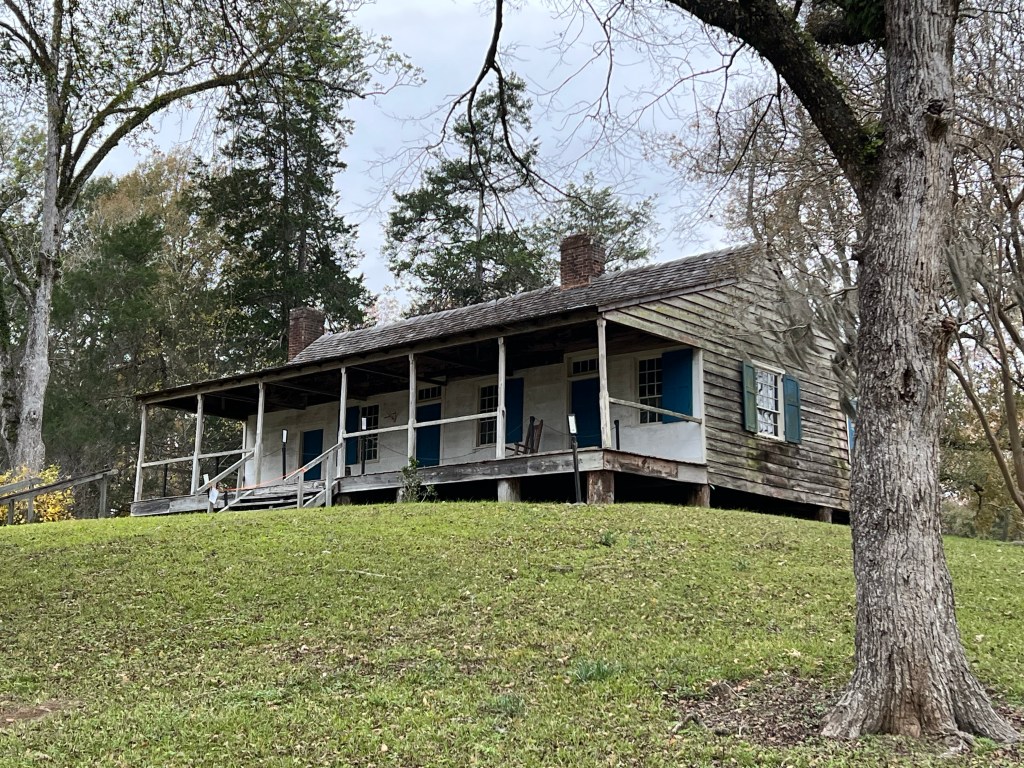
Our last stop of the day was at Mount Locust at mile 15.5. There is an interpretive center there that at 3:40 PM was already closed. A ranger told us we could walk around, but the whole site was closing at 4:00. This place was built in 1785 and was used as a “Stand”, an inn for travelers walking the Trace. For $.25 you got a meal and a safe place to sleep on the porches or grounds,
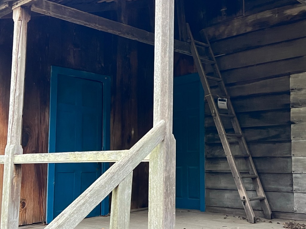
This is the back porch. I would have loved to have more time here, even though you can’t go inside. The building has been declared structurally unsound. I hope it can be stabilized.
If we would have had more time I would have peered into the windows.
This sidewalk went all around the building, it looks quite old, but I doubt it is original.
This is the original Natchez Trace which runs right in front of Mount Locust.
All of the sites have this beautiful fencing and along with the Parkway itself, are very well maintained. We’ve seen only a tenth of the Parkway; in future travel I will try to take us along more of this fascinating roadway.
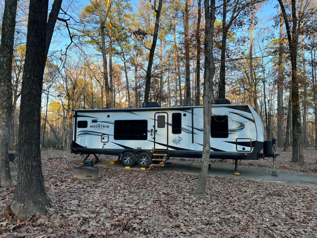
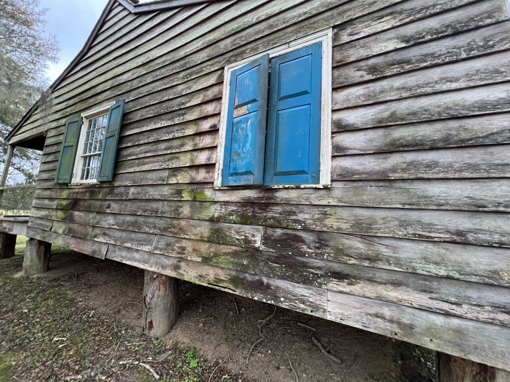
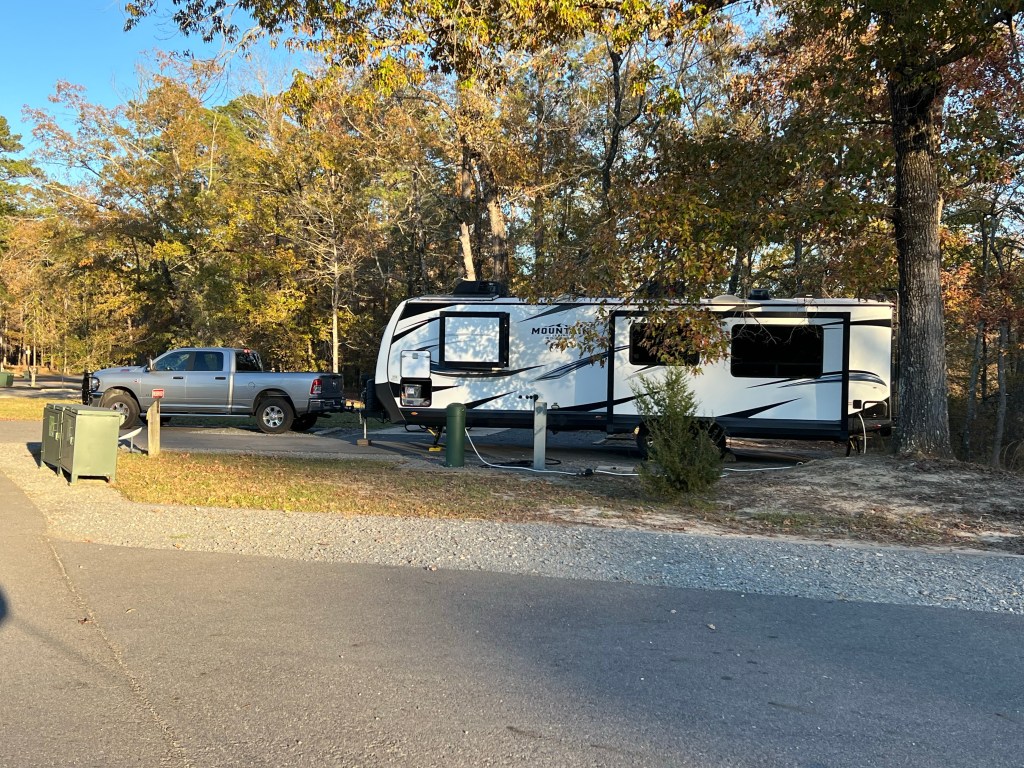
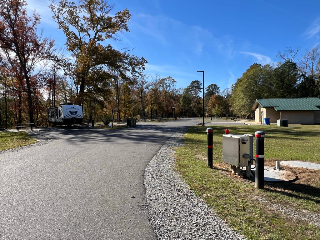
On Friday we came to Natchez State Park, near Natchez, Mississippi for what was to have been a five night stay. And we were supposed to have been in one of six full hookup sites. But those were not Starlink friendly so we came here, water and electric only, but a strip of sky to the north. And, even over the weekend, very few campers.
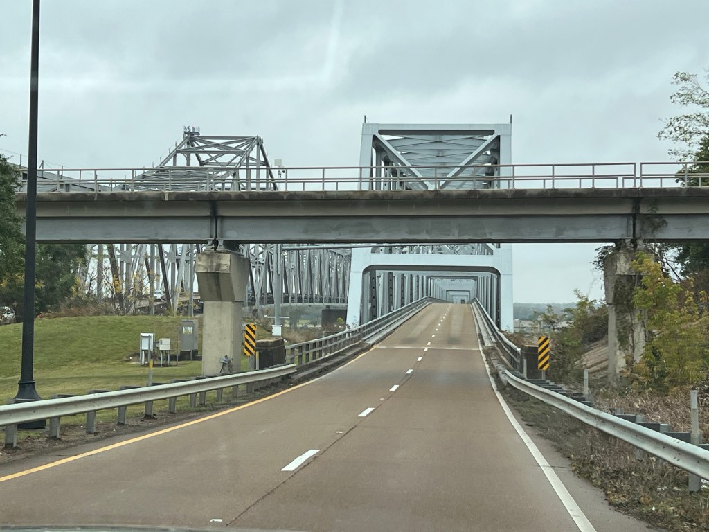
We’re east of the Mississippi River again, but yesterday we went back across to Louisiana for $2.89/gallon diesel. As we started out I heard a clunking under the truck that sounded louder than it should. Bud waited while I ran into Walmart for a couple of things. While I was gone he went under the truck but saw nothing amiss. When I came back he had me listen near the rear end while he shifted into reverse and drive. Uh-oh. I don’t think it should make a clang. I had him listen while I did it. Nope, not right.
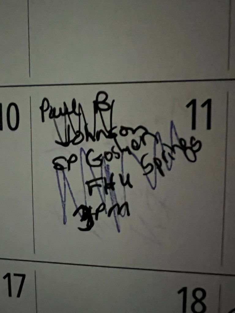
So he got an appointment today, the 10th, at the Dodge dealership. And we decided we’d better not plan to leave tomorrow, the 11th. Our plans had already been changed because about a month ago Paul B. Johnson State Park called to say they were doing renovations and had to cancel our stay. I found an alternative at Goshen Springs. Now we had to cancel that!
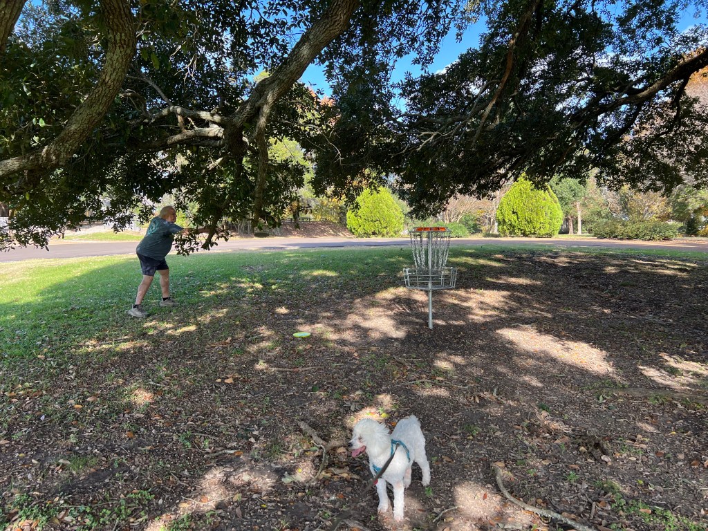
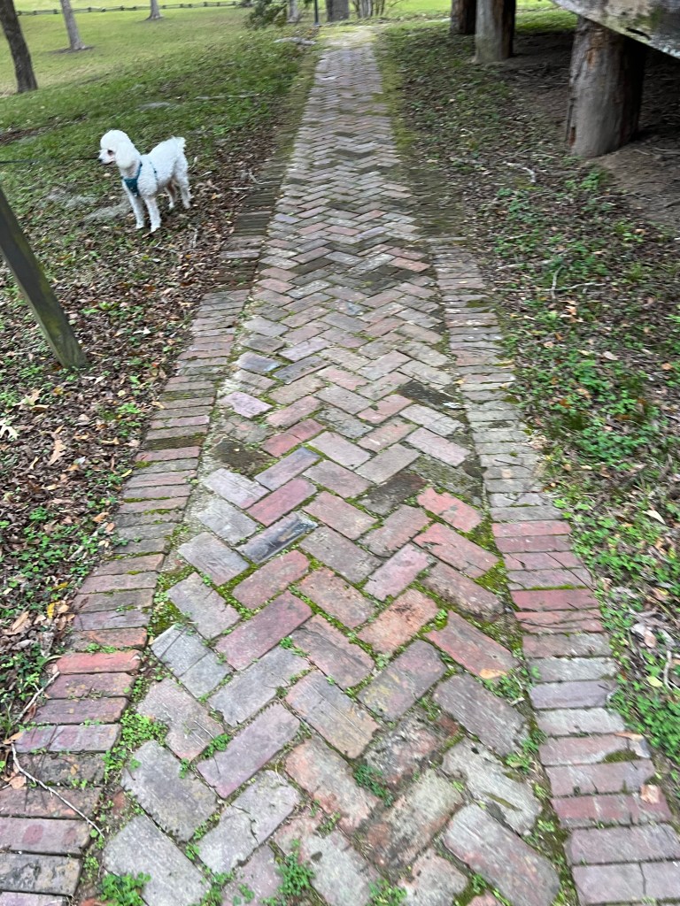
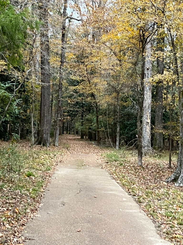
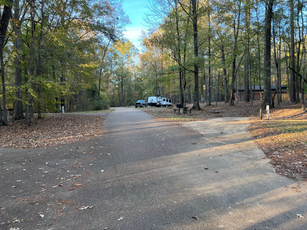
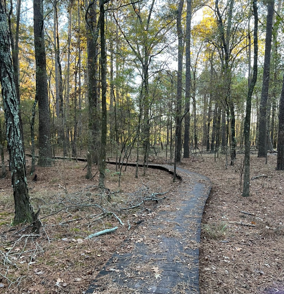
We decided to just stay where we were until the 19th. It’s a nice enough park.
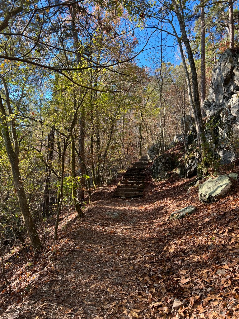
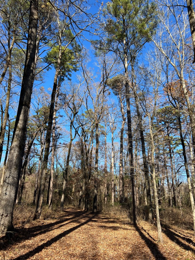
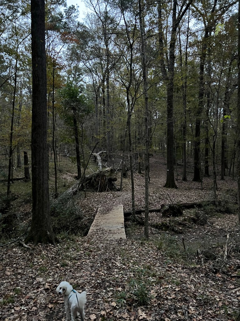
There are a couple of trails…
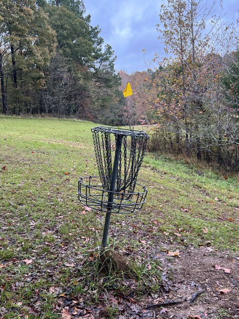
and a quirky little disc golf course. But since we’re in a site without sewer and we weren’t sure how many days we’d be without the truck, we hitched up yesterday and towed up to the dump station and emptied all our wastewater tanks. Now we can make it the rest of the stay just using our portable tank to empty the shower tank.
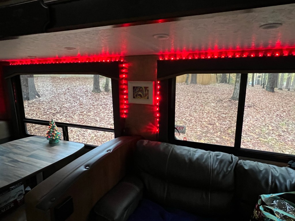
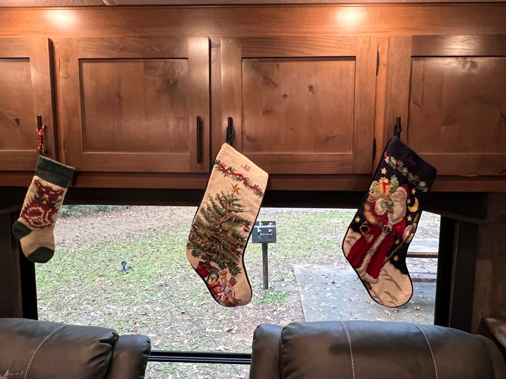
Bud just called from the dealer. The problem was loose bolts on the u-joints, they had almost come apart, but thankfully hadn’t. That was from the transmission leak repair that Riser Dodge in Hot Springs did a year ago. The one that took them three weeks to do less than six hours of work. Oh, and the transmission is leaking. Riser has to be just about the worst dealer out there! Anyway, they thought they would have the truck fixed in about an hour, since we caught it before any damage was done. But our next site is already cancelled so we’re staying put. So I put the Christmas stuff out.
We’re moving a bit south for a few weeks to try to stay warm until Christmas.
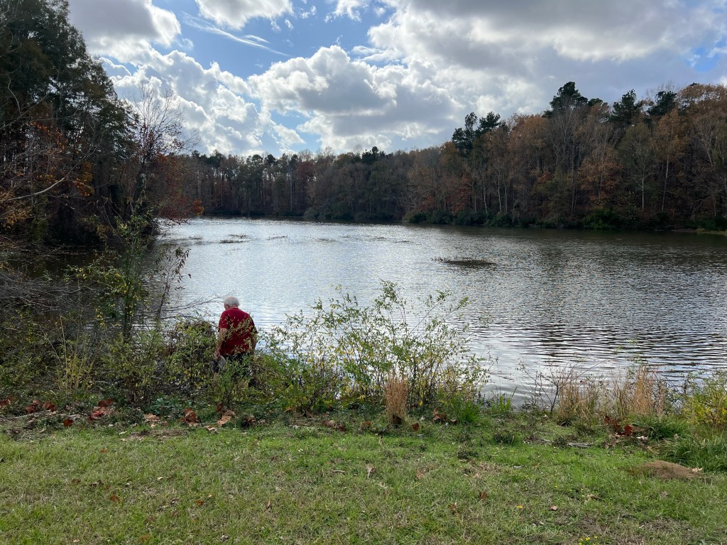
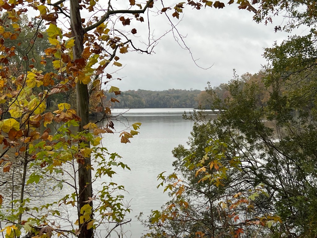
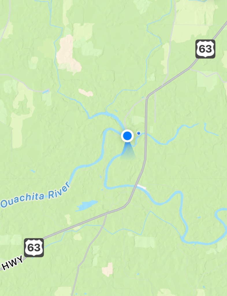
We’re now at Moro Bay State Park about a hundred miles south of Hot Springs and still on the Ouachita River. The park lies between Moro Bay to the west and Raymond Lake to the east and there is only a small bit that’s along the river where those two bodies of water join it.
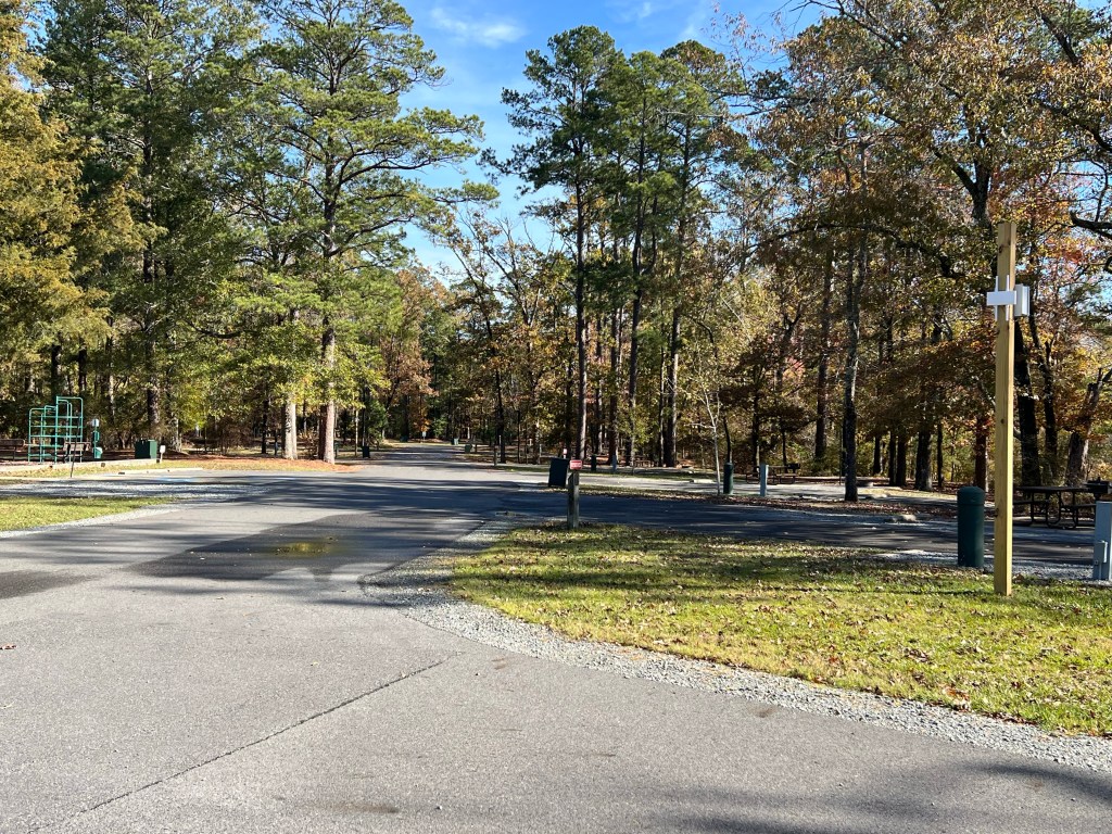
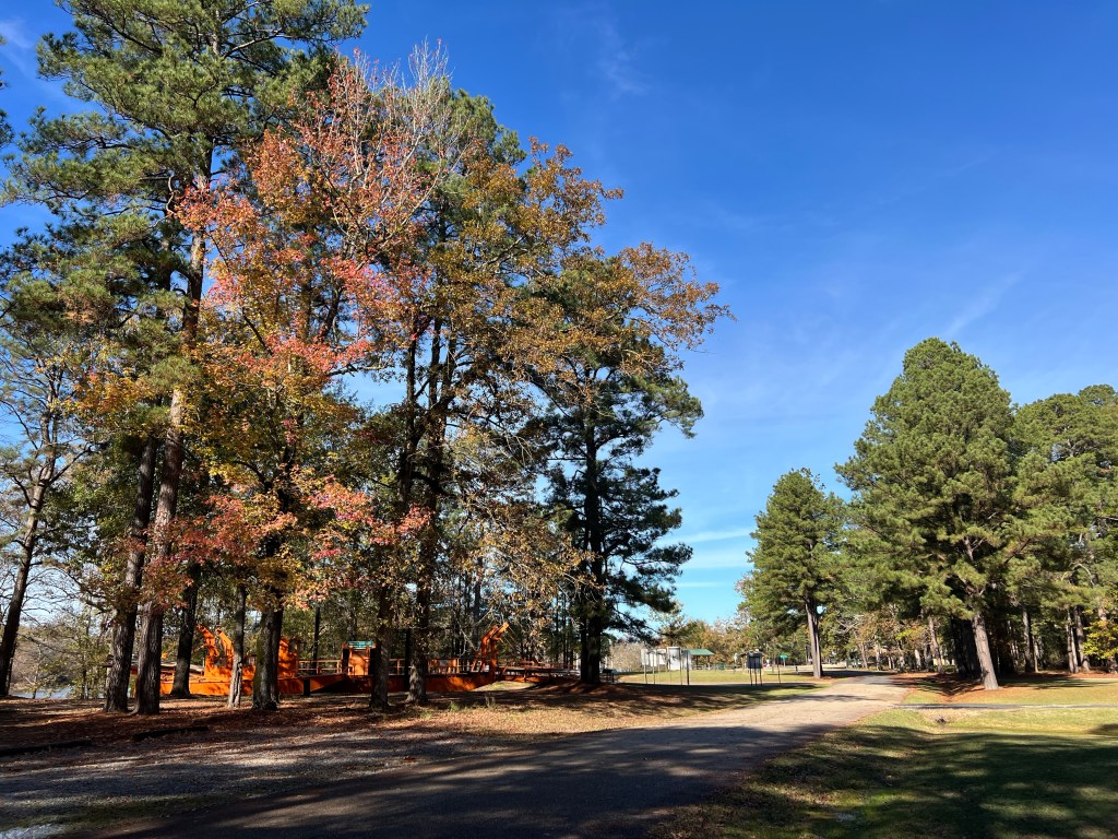
There are just 23 campsites and today…
we are the only campers here; a perk of winter camping.
Small though it is, it has a couple of nice little trails…
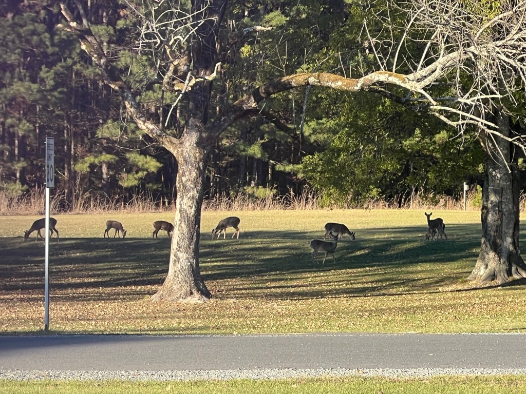
and its own herd of deer that are not at all shy.
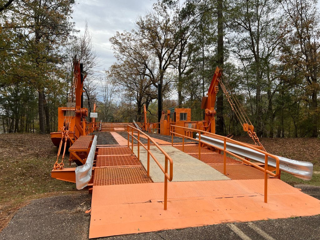
It also has the old ferry that used to cross the river here.
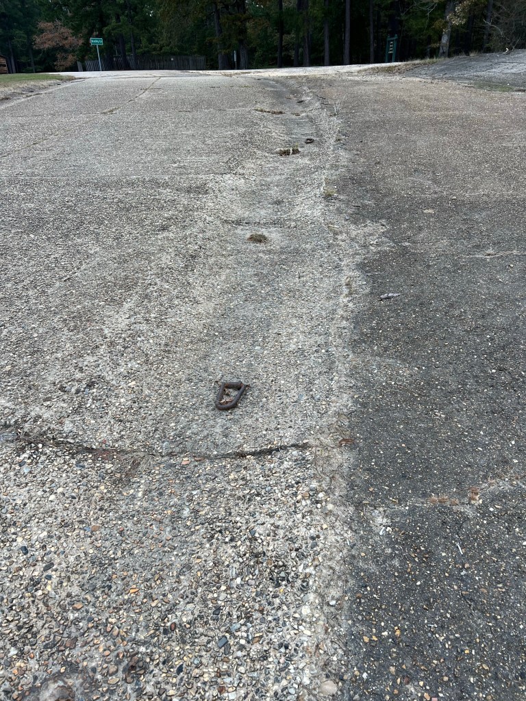
There is evidence that the water here is not always well behaved. Notice how far up along the old ferry approach the tie off rings go.
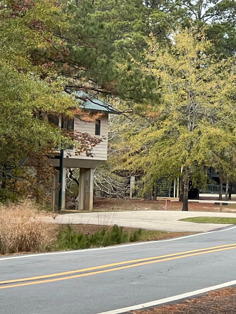
These cabins sit well above the water, but they are still up on stilts.
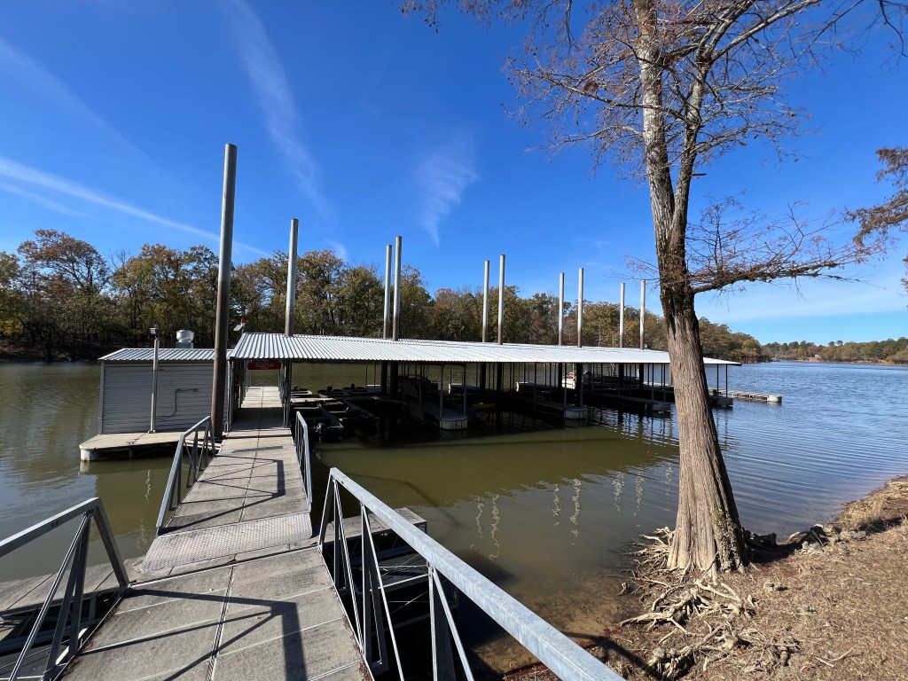
And the pilings anchoring the floating marina are certainly ready for much deeper water.
This is a pretty and tranquil place now, I wonder what it’s like when the river is in flood.
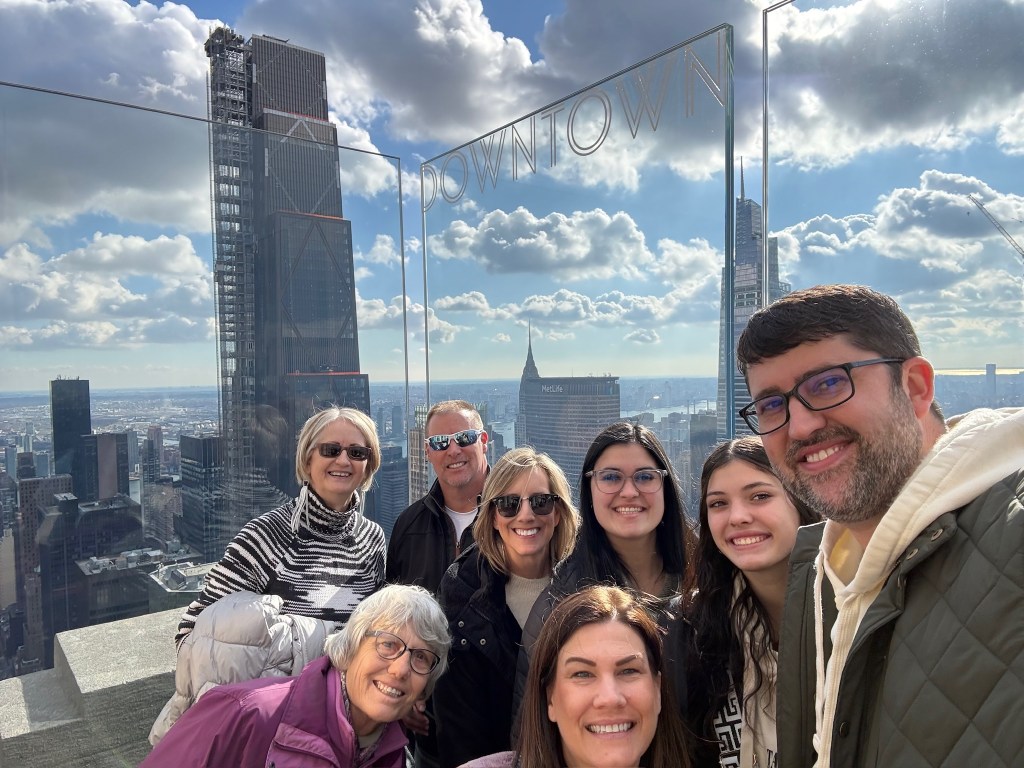
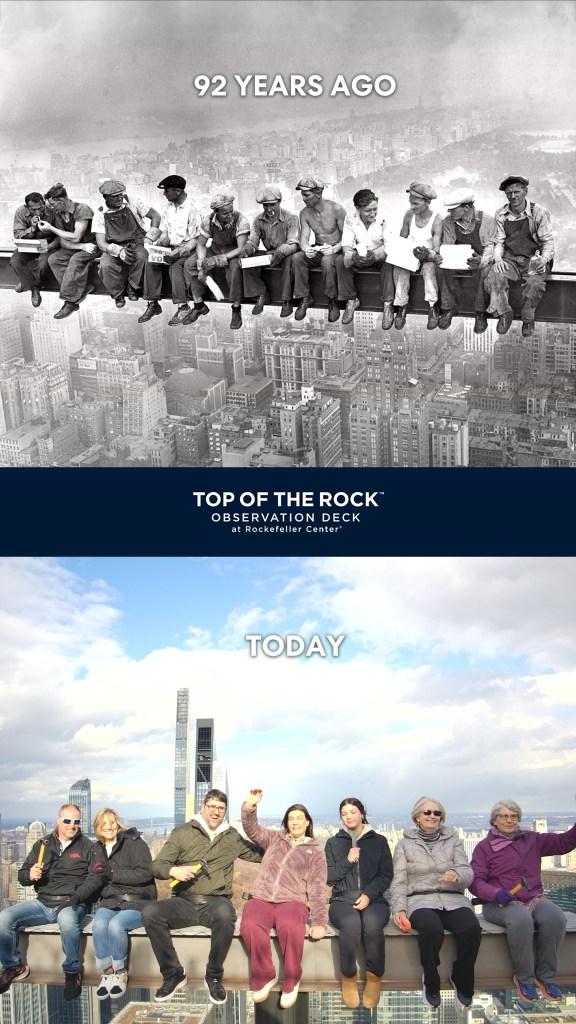
Friday was our last day in New York City, and it was about the busiest. We started by walking over to Rockefeller Center and going to “The Top of the Rock”, 70 floors up. Here we are, clockwise from the bottom, Jamie, me, Terry, David, Renee, Tia, Jacey and Sean.
The views were spectacular. This is looking north across Central Park.
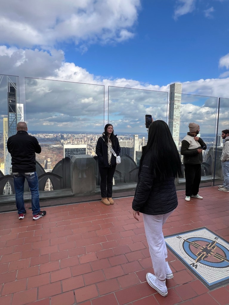
A great photo op.
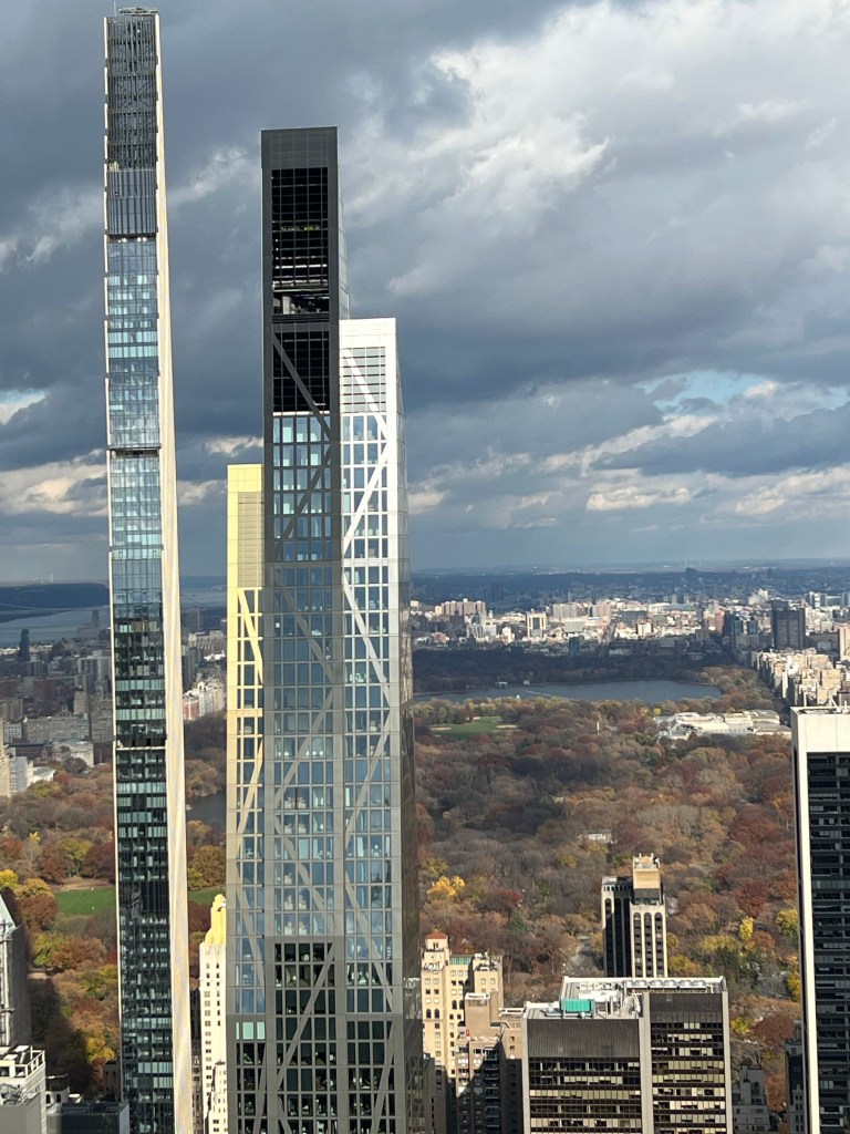
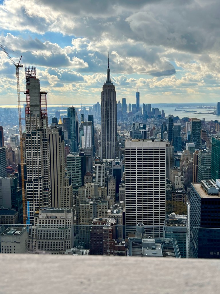
The winter sun made it hard to get a good picture towards the south. The density of buildings in central and lower Manhattan is staggering. That’s the Empire State Building with the tall spire.
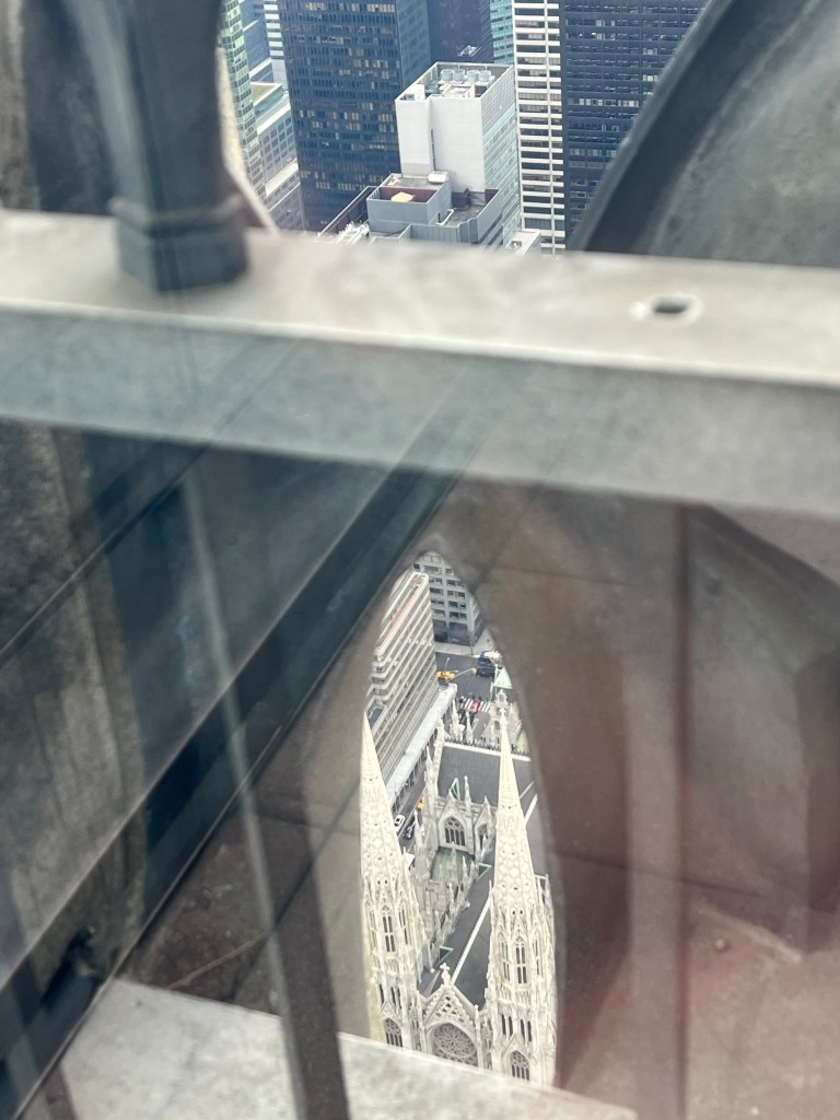
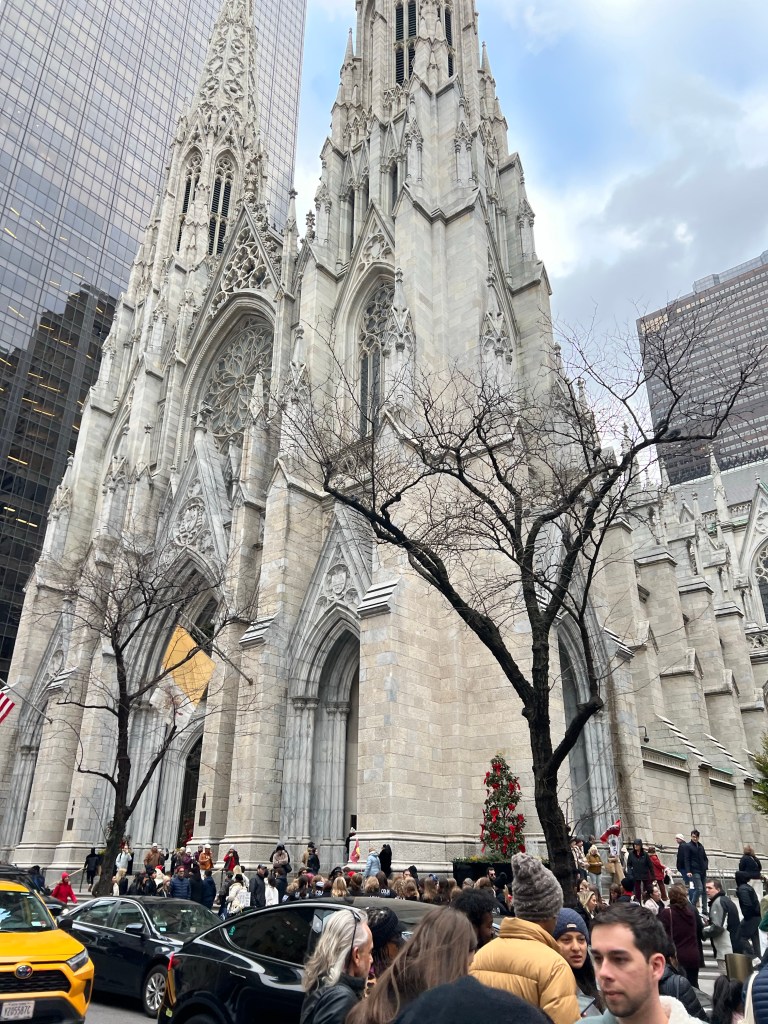
I tried to find St. Patrick’s Cathedral; there it is, visible through the Art Deco fretwork on the edge of the observation deck.
Here we are recreating one of the most iconic photos taken during the construction of the Rockefeller Center. Except those guys didn’t have little hidden back rests, safety belts, or an over width beam. And they really were dangling over nothing and not 15 feet above the deck.
Tia, tough as she is, does not like heights. Since the beam will only hold seven people she volunteered to video our photo session.
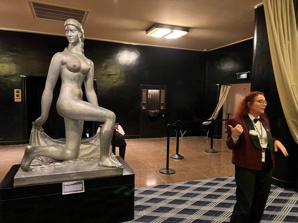
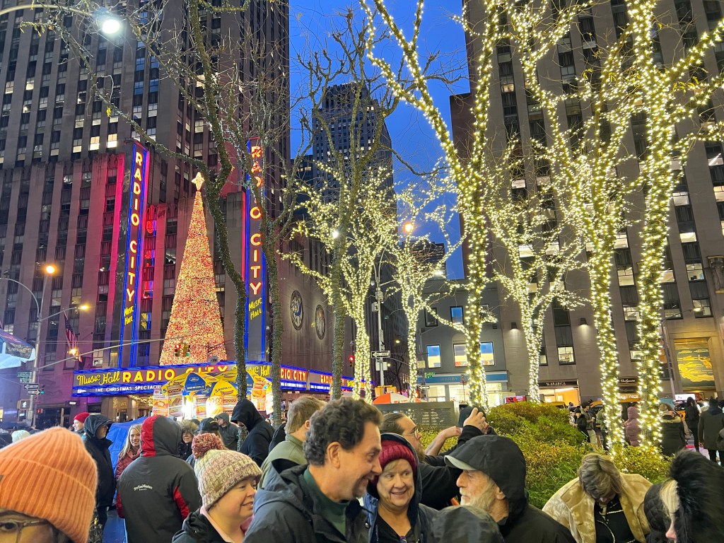
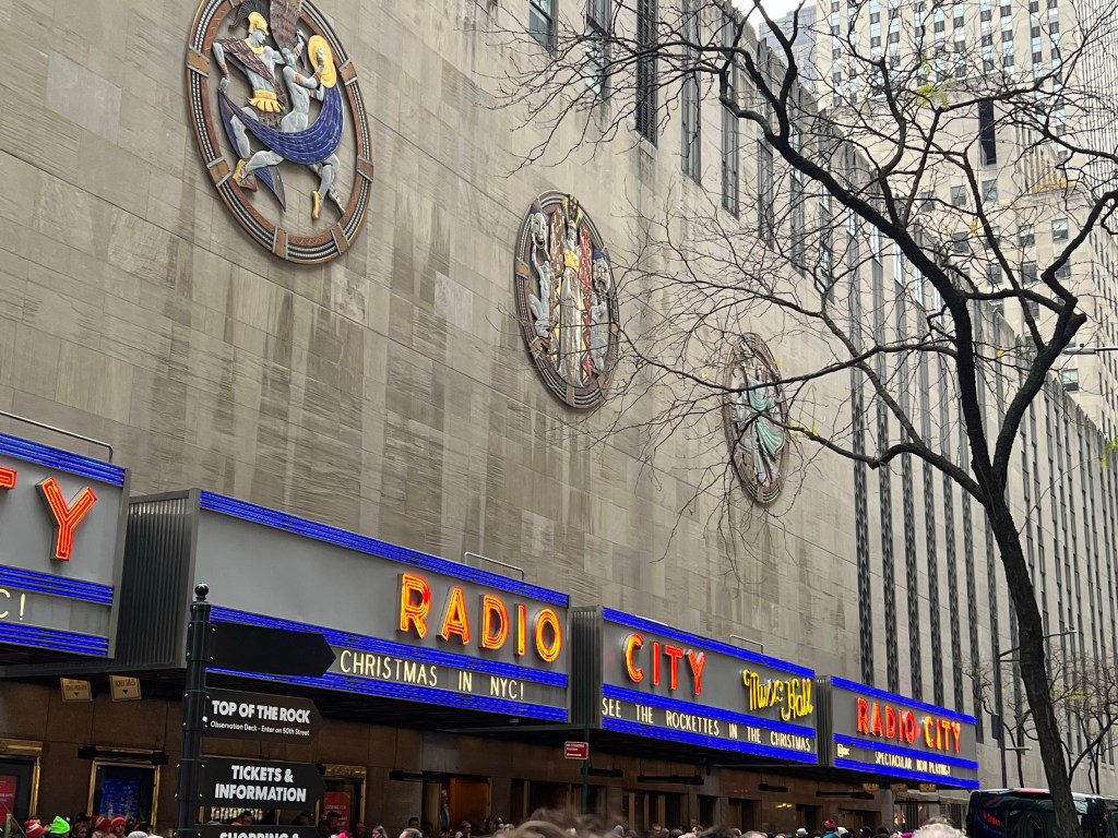
After that we had no time for lunch; instead we hurried over to Radio City Music Hall and our backstage tour. Our tour guide was from Texas and on learning that this was a group from Arkansas let loose with plenty of “y’all”s. She was fun and the tour was, too.
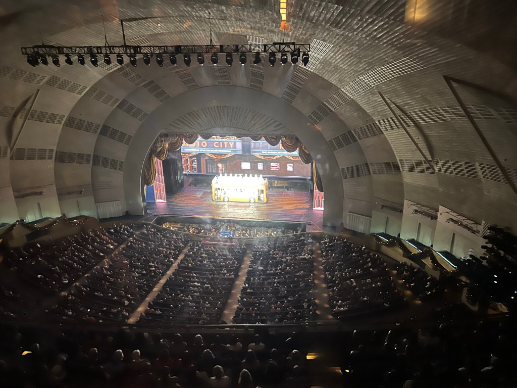
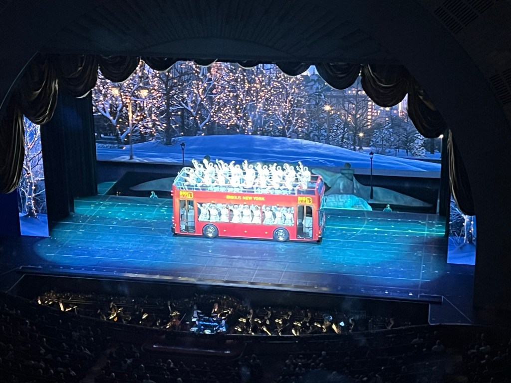
My favorite part was going up into a private viewing room. That stage is a city block wide. They’ve had a full sized basketball court in there. The theater is built so there are no pillars to block the view.
That is a real bus the Rockettes are in, and before it made its entrance in the show it was hanging in the wings. Many parts of the stage can be raised or lowered for effect, including the orchestra pit, which when I took this photo was lowered. The stage is moved with a hydraulic system, still the original built in the 30’s and still in good working order. In WW II the navy studied it and used the same technology to lift planes to the fight decks on aircraft carriers.
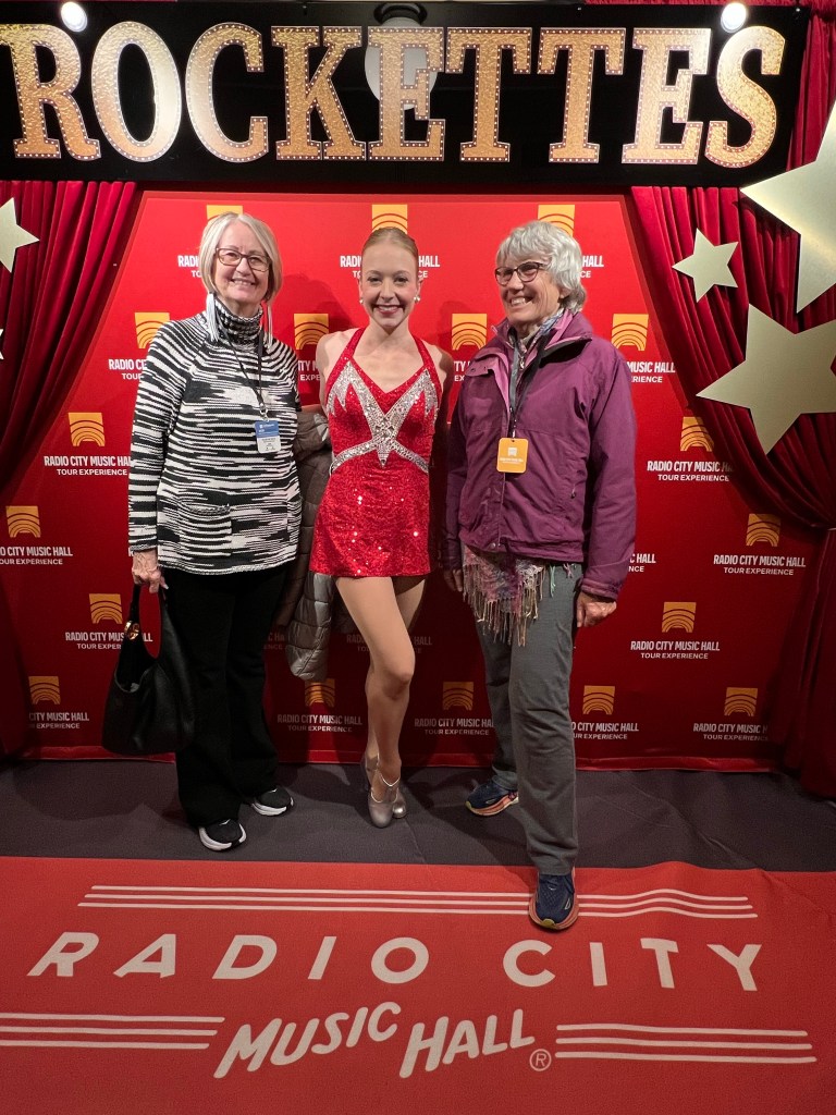
I also enjoyed learning about the Rockettes. This is Ellen, who talked to our group and then posed for pictures with us. Terry and I fit right in the dance line, ha, ha, ha.
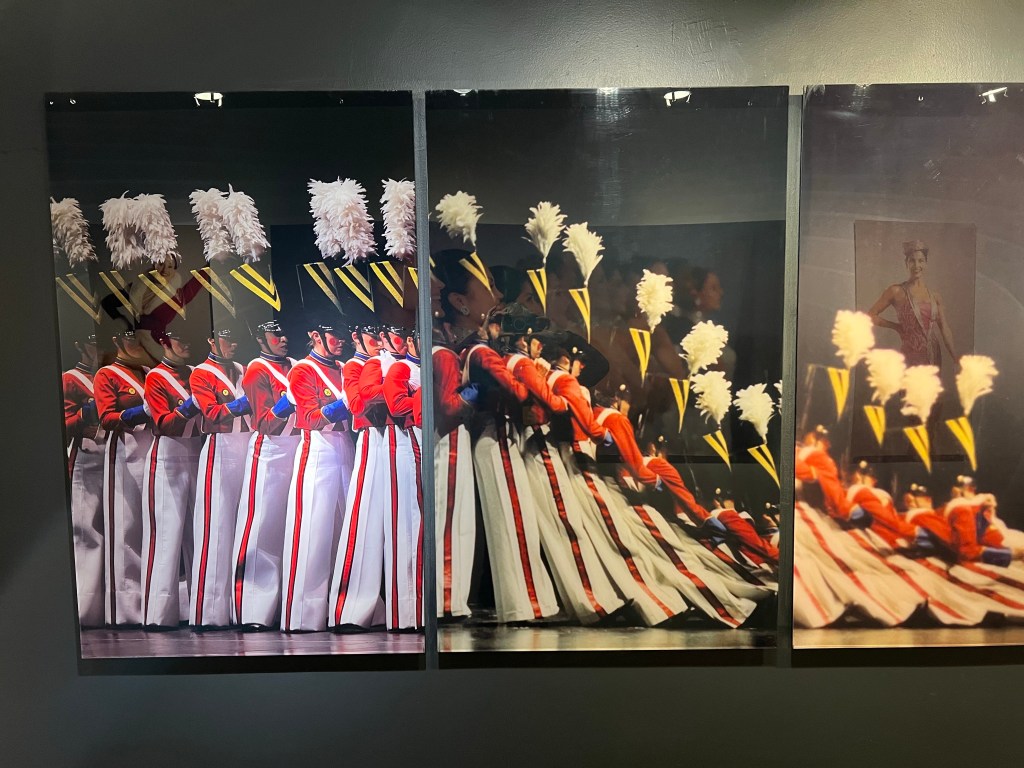
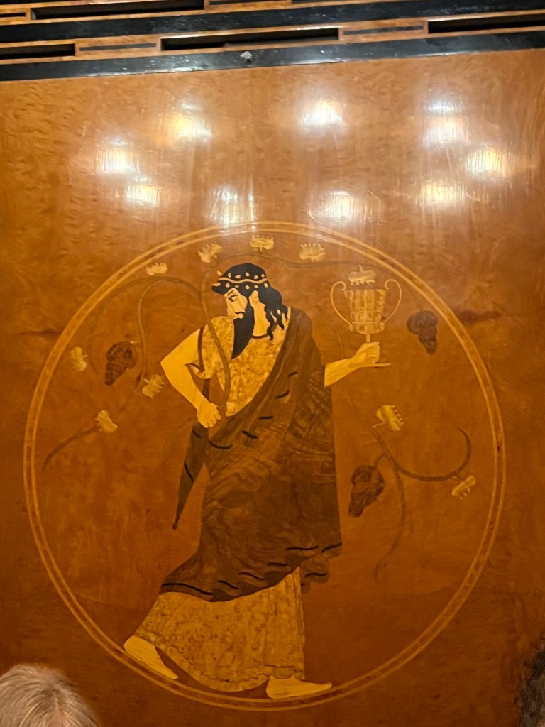
The Rockettes, as a dance troupe, predate Radio City. Some of their routines are as old as the original Christmas Extravaganza. This wall mural is a composite of photos taken decades apart, but the routine and the costumes remain identical.
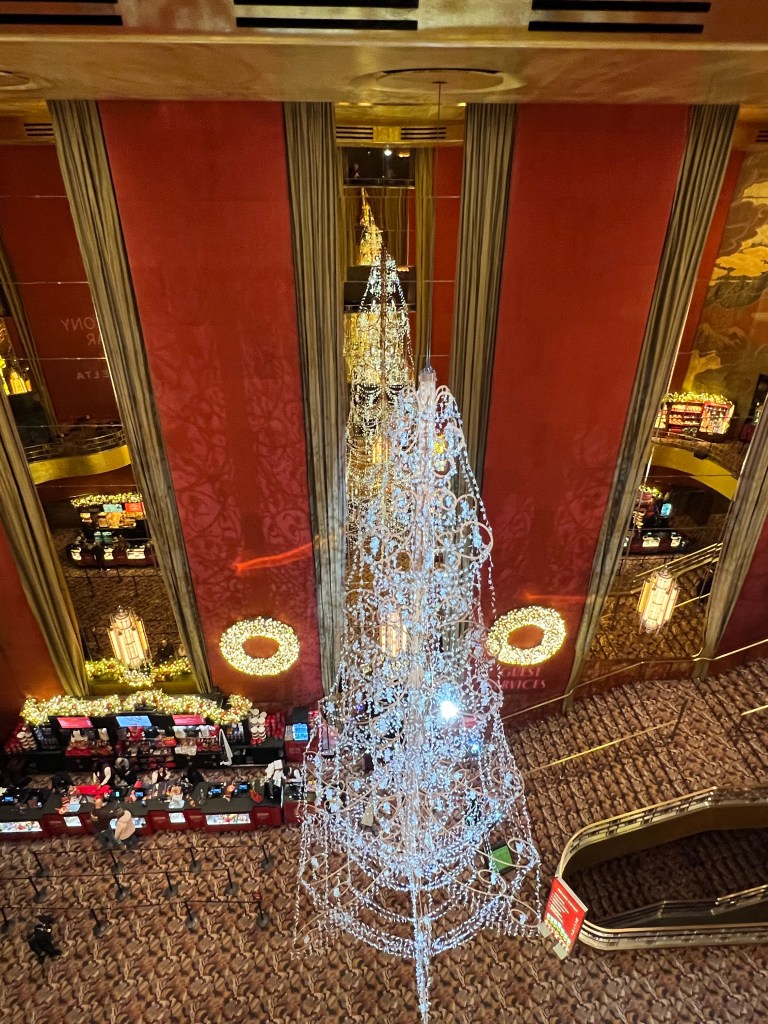
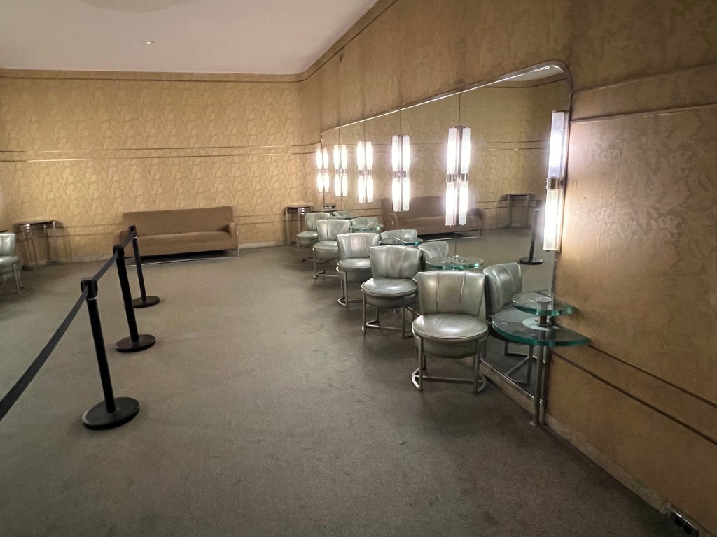
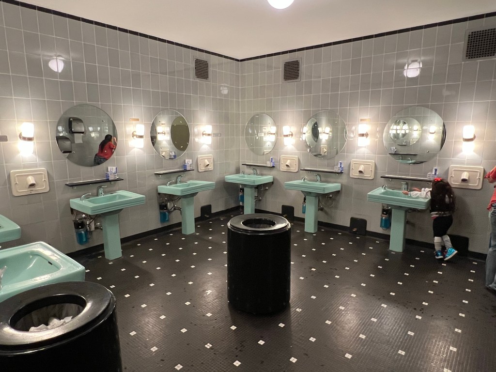
Everything about Radio City Music Hall is elegant, from the hanging Christmas tree made of Swarovski crystals,
to the wood veneer friezes in the elevators,
to the chairs…
tile floors, and turquoise sinks in the Ladies Lounge. All of this was restored in 1999 following original plans and matching the original colors and fabrics.
Radio City Music Hall embodies the spirit of New York City at Christmas.
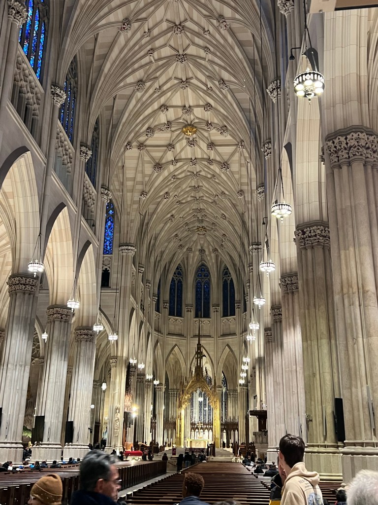
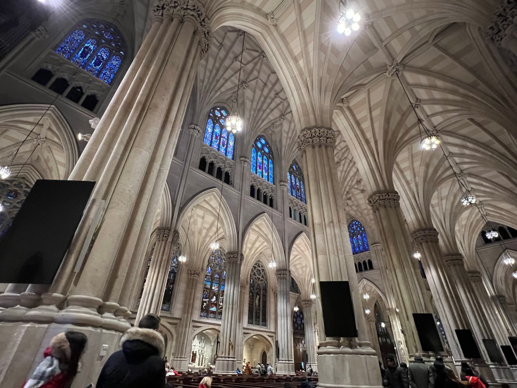
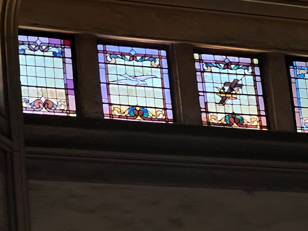
We grabbed a bite to eat from the food carts and then headed over to St. Patrick’s Cathedral.
A huge and beautiful space.
There was just about enough light on this cloudy day to show off the stained glass windows.
We came out of the relative hush of the cathedral into the Black Friday mob of shoppers and a pro-Palestinian protest.
Shopping along 5th Avenue on Black Friday is not for the faint of heart!
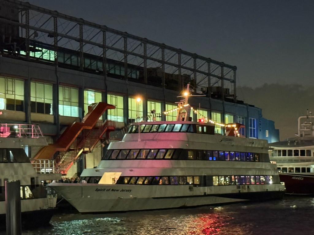
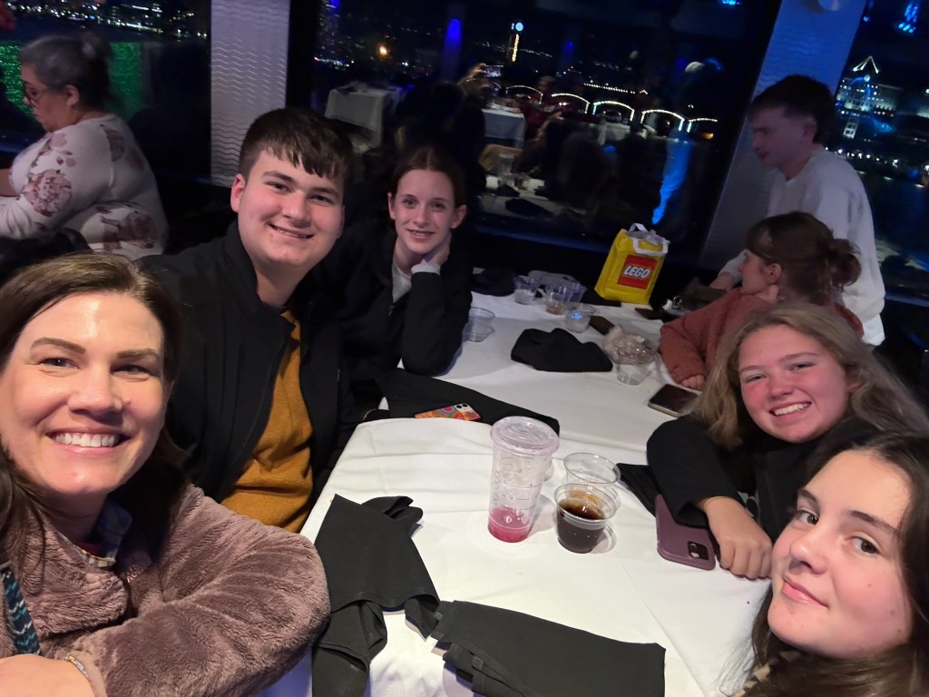
Our day was far from over. Next up was a dinner cruise for all the members of the band, the directors, the chaperones and the friends and family group. We had the whole boat, The Spirit of New Jersey.
Adler said he tried to save a table for us, but his friends just came and sat down. You’ll notice in this picture with Jamie that the friends are all girls. Not sure how hard he tried to keep the seats for us.
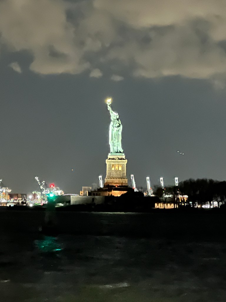
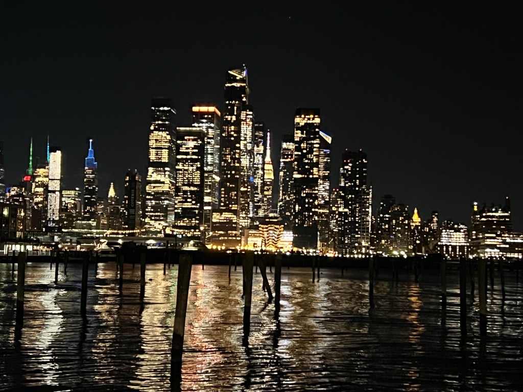
In any case, it was a beautiful cruise. We saw Lady Liberty at night,
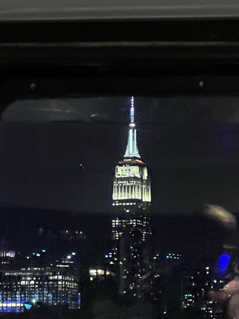
The Empire State Building,
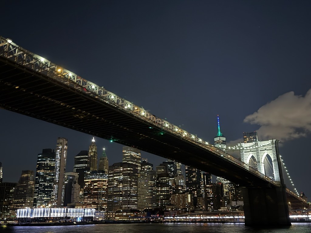
and the Brooklyn Bridge.
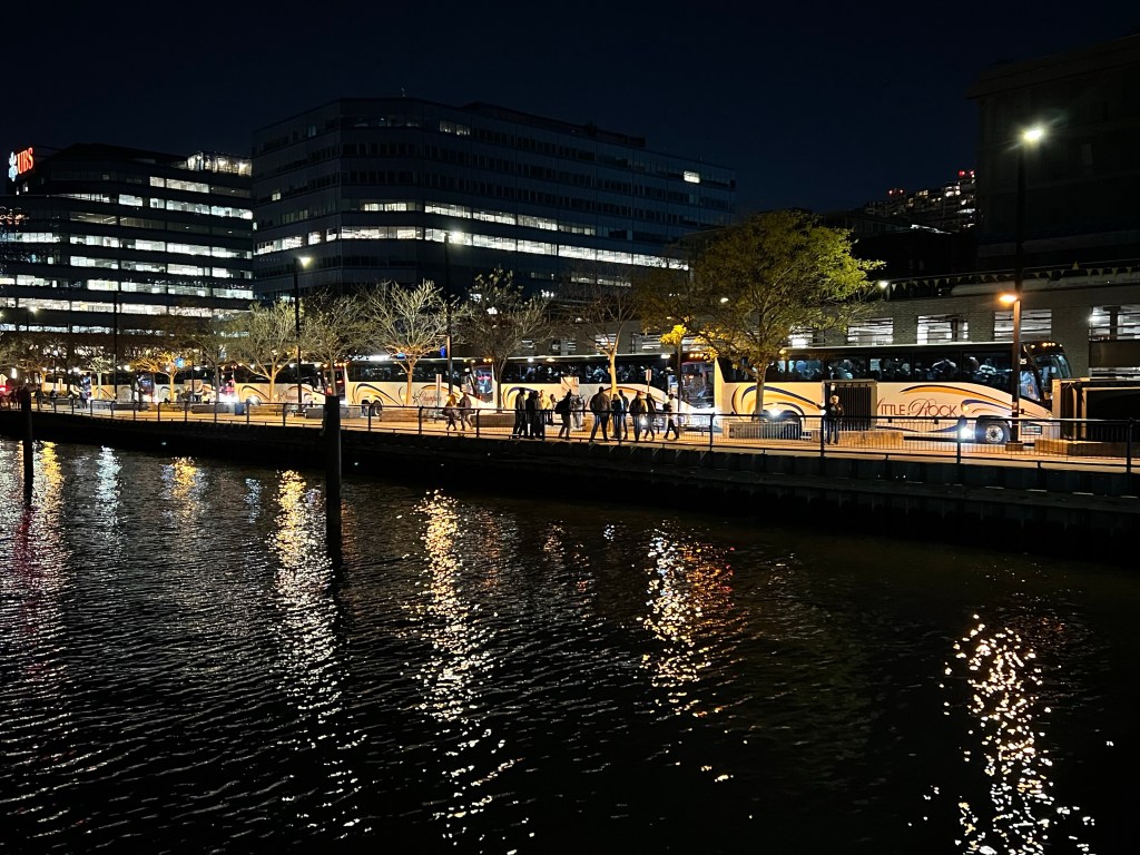
The cruise ended across the Hudson River in New Jersey where the seven tour buses were waiting for us.
One last look at Manhattan and we were off.
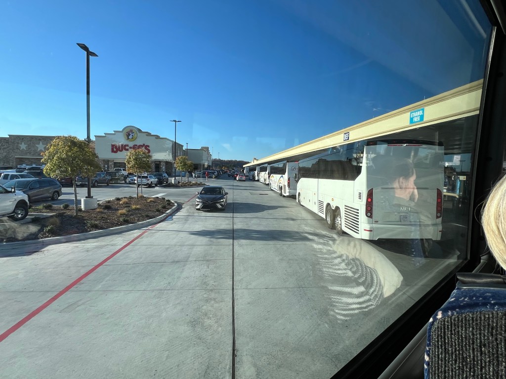
We drove all night and all the next day. We only stopped to get off the buses twice. Can you imagine what the other folks at Buc-ees thought when seven buses rolled in? The place swallowed us up with barely a blip. A typical Buc-ees is a hundred gas pumps with a convenience store the size of a Walmart and bathrooms the size of most convenience stores. Their food is pretty good, but no tables at which to eat.
We finally got back to the High School at 10 PM Saturday. That was one long day. I spent the rest of the night on Jamie’s couch.
On Sunday Bud came to get me. Now I’m back at Lake Catherine State Park, and happy to be where the ratio of trees to people is pretty much flipped from New York City. It was a great trip, but I prefer traveling at a slower pace to quieter places.
The band will not be doing that parade again while Adler is a member and he and I are both fine with that.
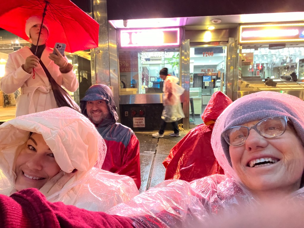
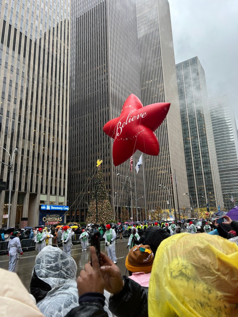
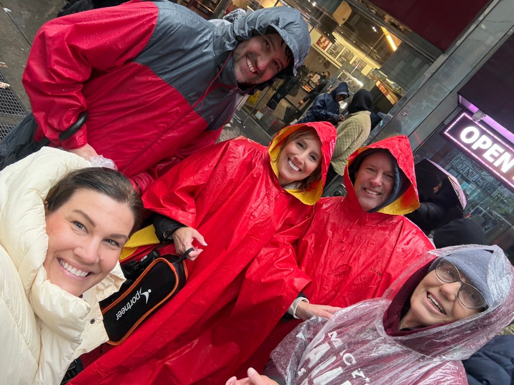
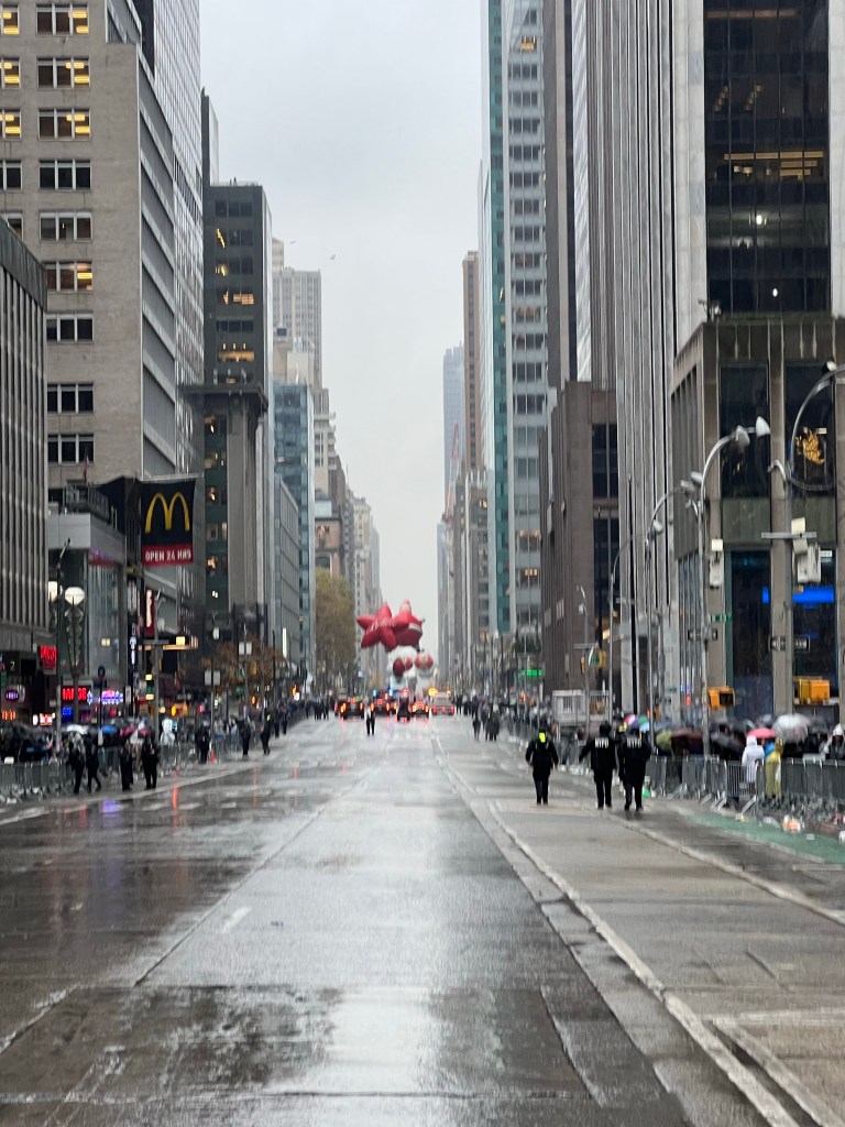
By 6:30 AM the advance crew, Jamie, Sean, David (orange poncho, no face showing) and I had our place staked out. Even at that hour our 6 little folding camp chairs were in the second tier. It was a long cold wait. We learned that the folks in front of us were from Fort Smith, Arkansas, here to watch their dance team march by. There were also a couple of Mom’s of University of South Carolina Marching Band players just behind us. Of course this morning it was in the forties and raining off and on hard enough to count.
David’s wife, Renee, came later after walking quite a ways to get across to the other side of 6th Avenue, where we were.
Terry, Tia and Jacey came down at eight o’clock. They could not find a place to cross and so set up opposite us. Unfortunately, we had all the camp chairs and Jamie had the clear rain ponchos.
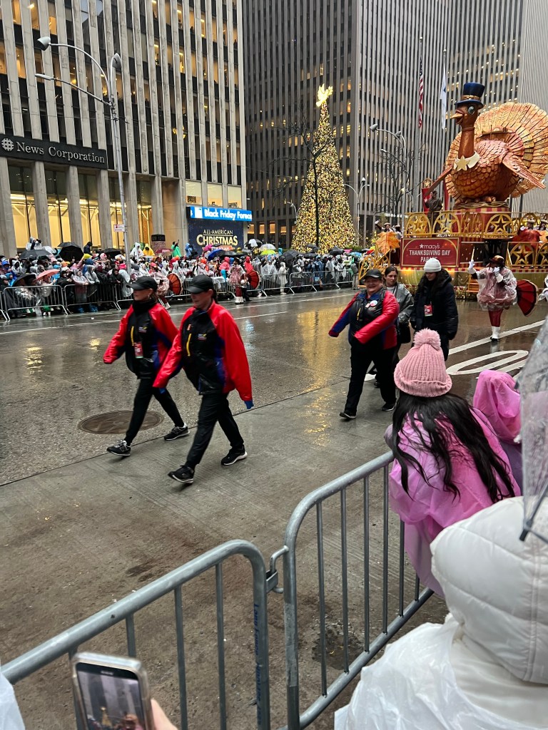
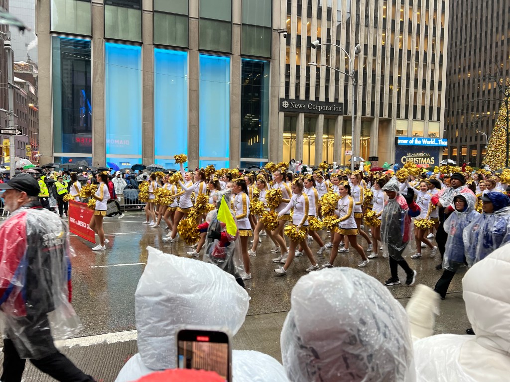
Finally, at just after 9, the parade made it to us. We cheered deliriously…for everything!
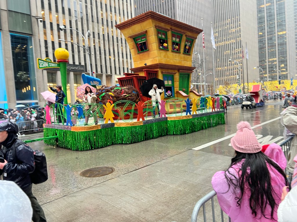
We cheered the floats.
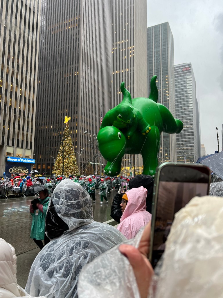
We cheered the balloons.
We cheered the dance teams, cold and wet in their skimpy outfits.
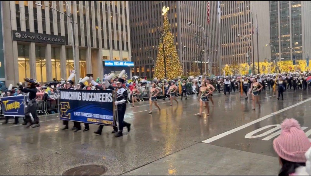
We cheered the bands, especially the bands. This is the East Tennessee University Band that played for us at the Regional Band Competition in Johnson City. When the University of South Carolina band came by we let those mom’s in front of us.
We cheered the mounted police. We even cheered the sanitation workers who came along behind with shovels and waste bins on wheels to pick up the horse poop…and they deserved it.
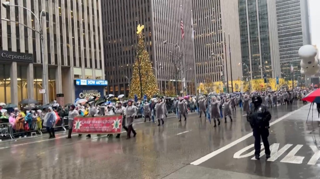
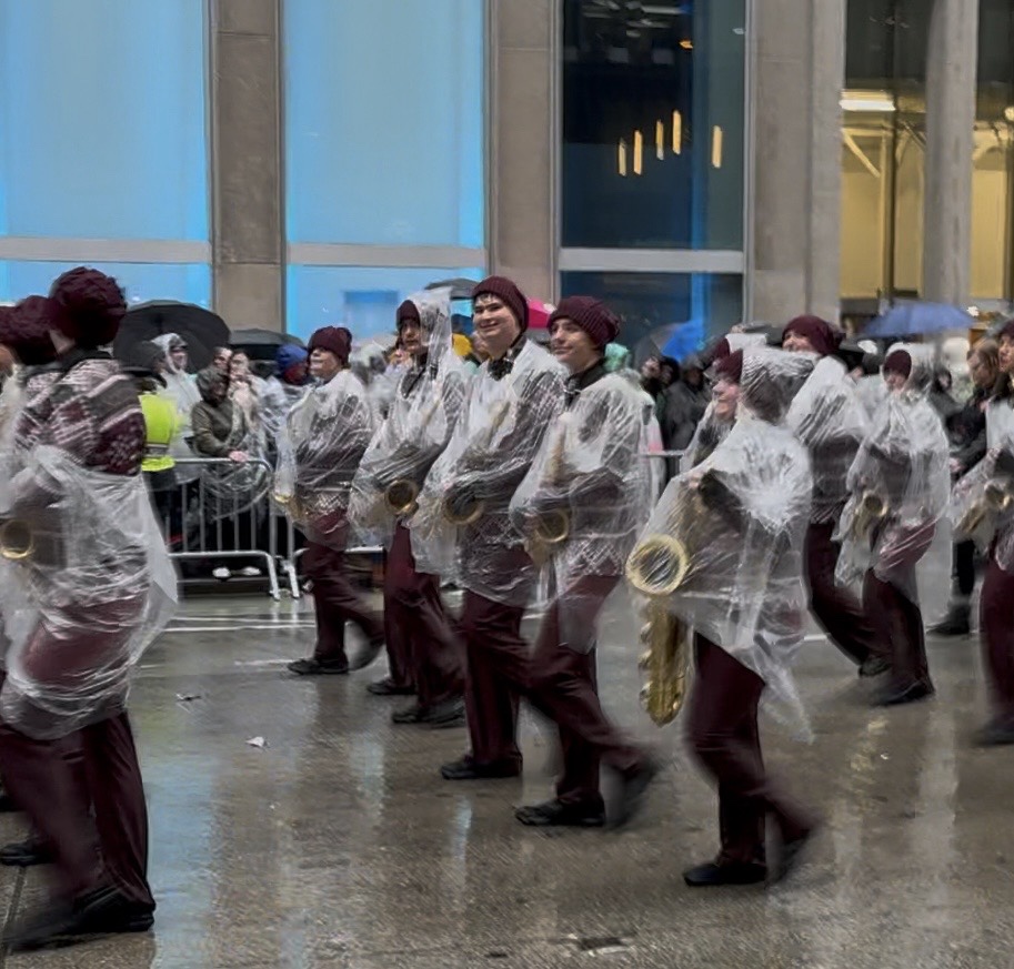
And then, finally, at 10:45, the second to the last band, along came Lake Hamilton. The folks from Fort Smith, having already cheered their cold wet dancers, let Jamie and I up into the front row. There was a pause in the parade, maybe because of the protest we heard happened, but in any case, they played in front of us for six minutes.
Here’s one minute I took from that. I will try to send the full video Jamie took via email to anyone who wants it.
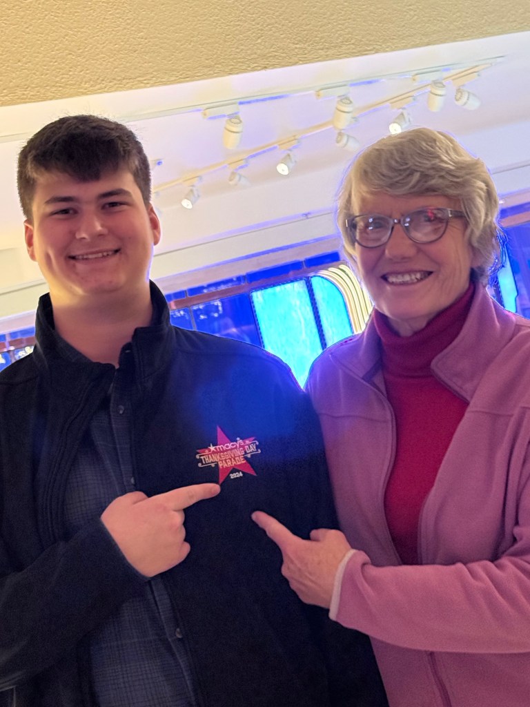
We couldn’t see Adler while they were playing because the reeds walk behind the horns and drums, but as they marched past we called him and got this smile. I asked him afterwards if he’d heard us cheering earlier. “Oh yes,” he said “you have a loud voice.” The kid next to him asked who that was cheering, “That’s my Gramma.” He may have been a bit embarrassed, but he was also very pleased.
Fifteen minutes later it was all over.
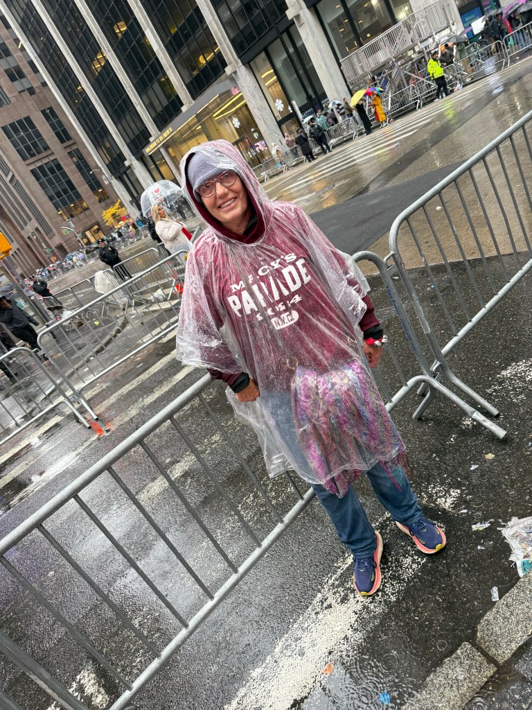
And there we were, soggy but happy.
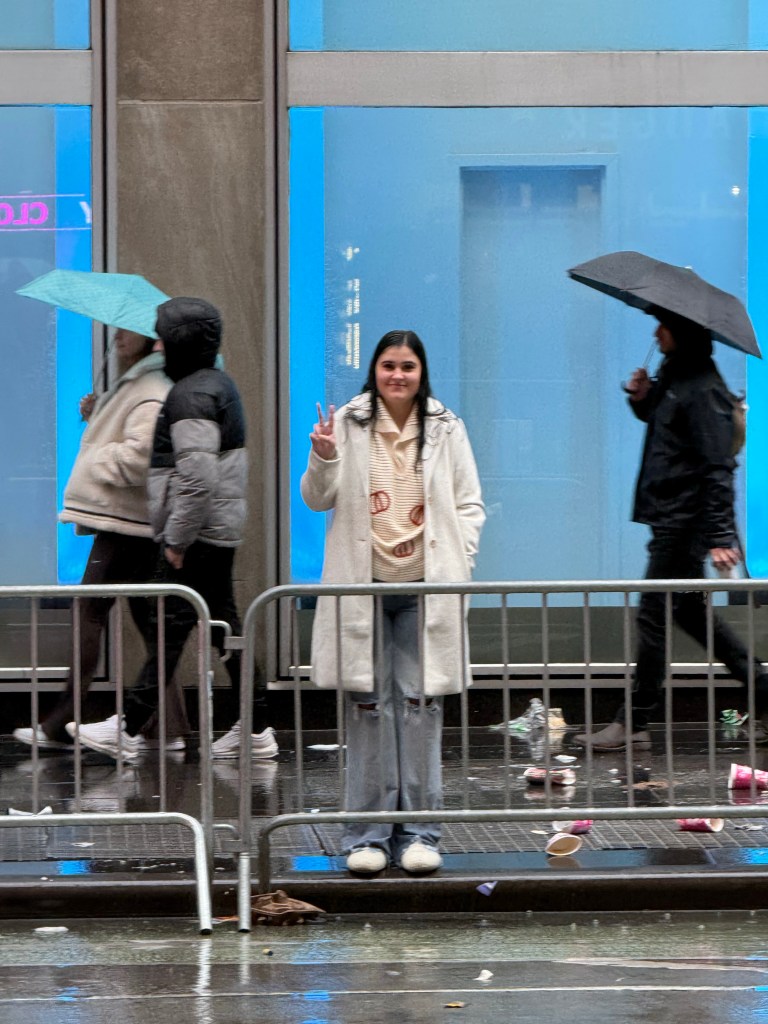
And there was Tia, completely soaked and all alone on the other side. Terry and Jacey had gone back to the hotel about an hour into it, not being able to manage without a poncho or chair, but Tia stuck it out. “It was the whole reason for the trip,” she said. She gets the Toughest Fan award.
As soon as we could we started back…
as we crossed 6th Avenue we saw the parade marching away from us.
Jacey and Terry had it on the TV in the room and just as Tia and I got our soggy bodies back Lake Hamilton came on, so we saw their performance, too.
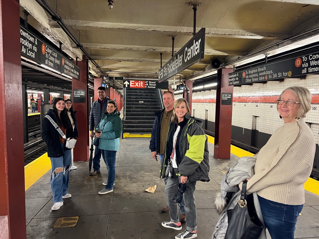
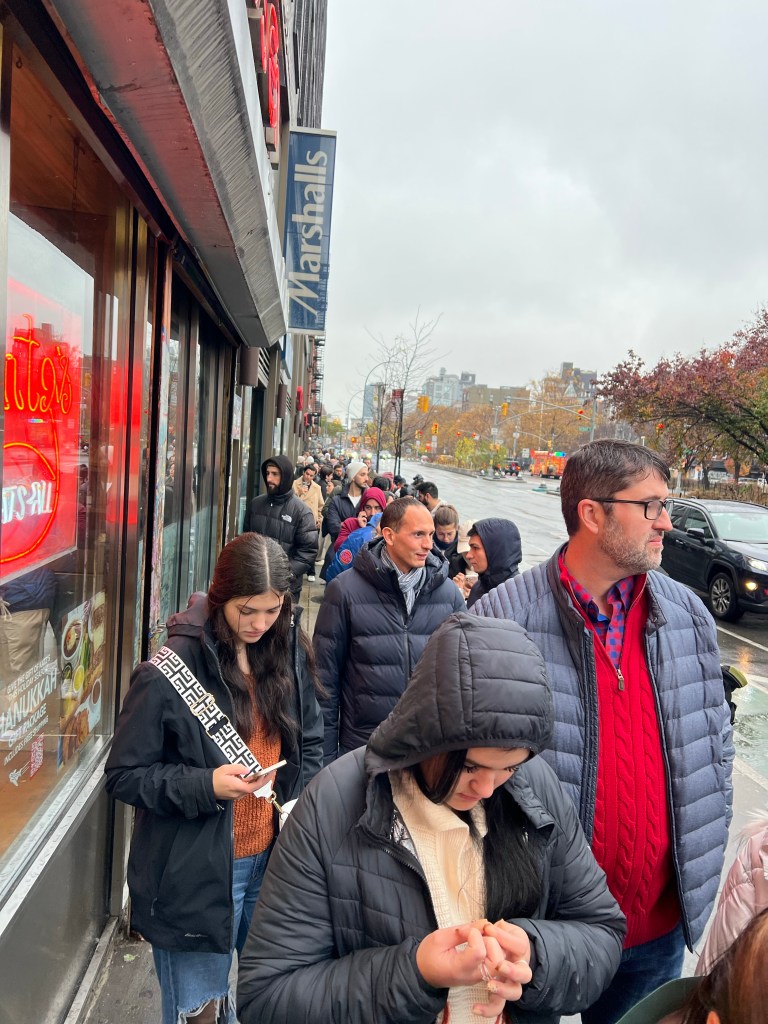
After we got warm and dry we took the subway down to Lower Manhattan.
We waited in a block long line…
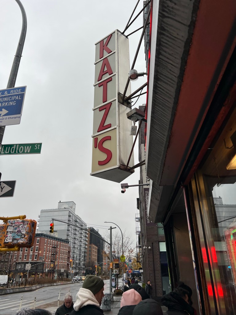
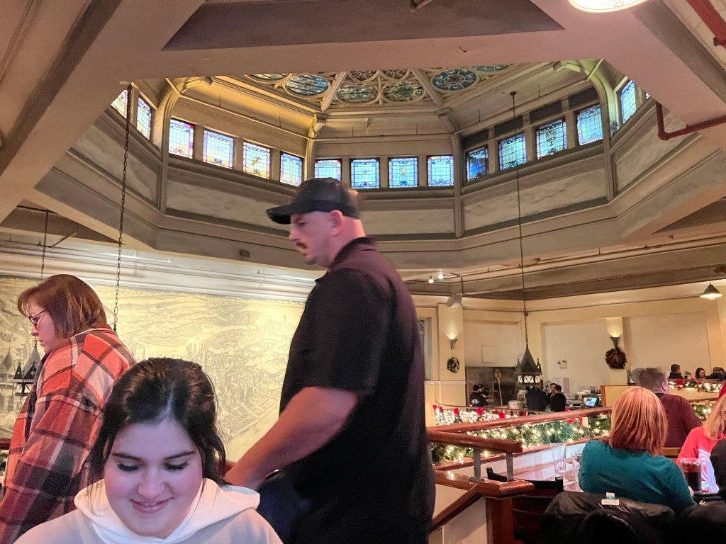
to have lunch at Katz’s.
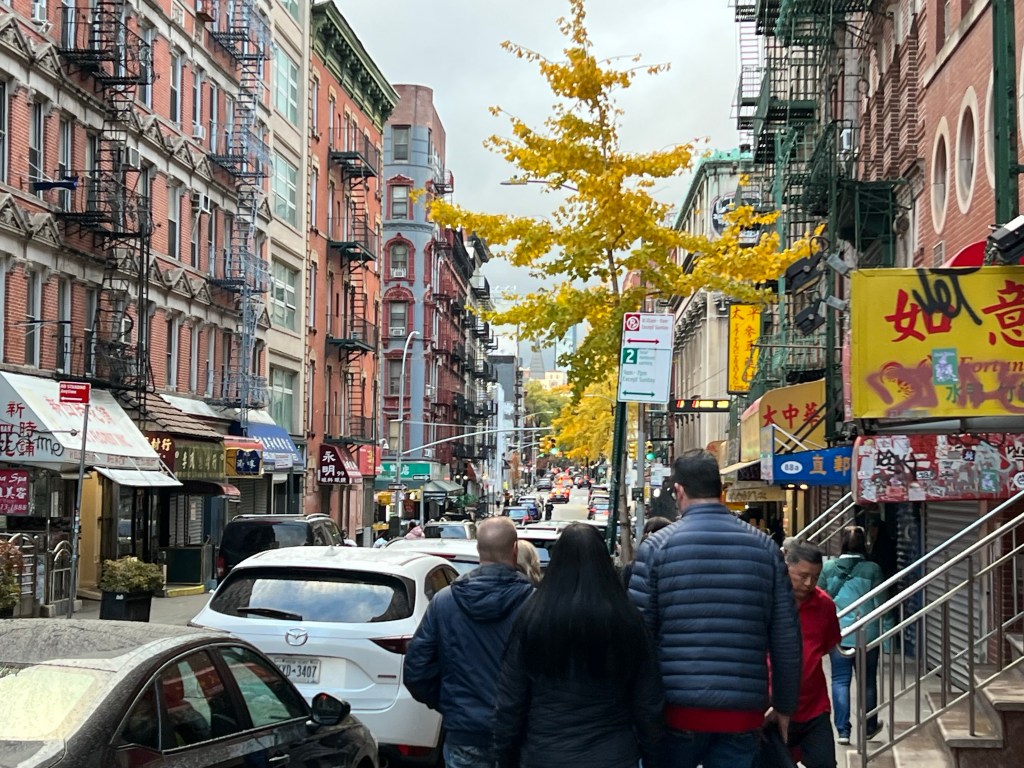
We walked over to Chinatown and took the subway back from there.
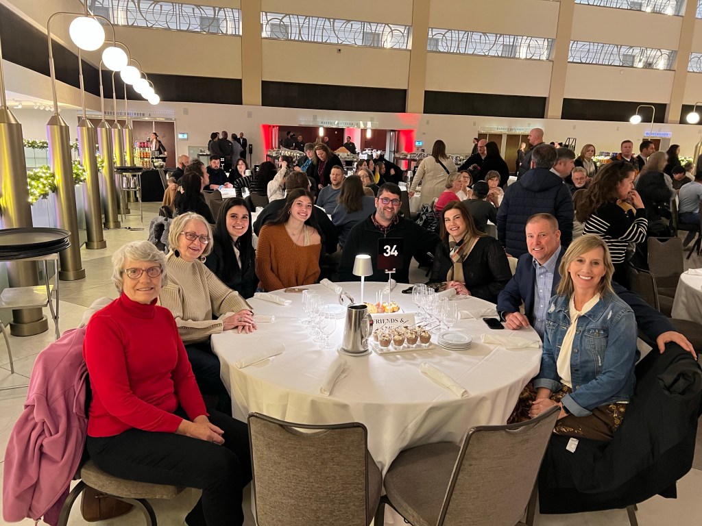
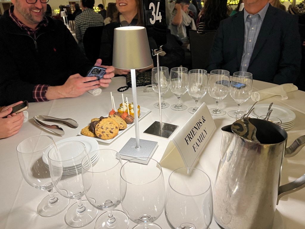
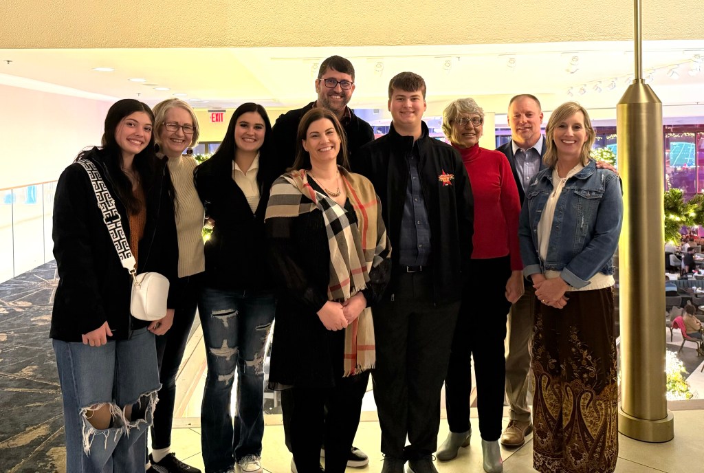
That evening we had a Thanksgiving banquet with the kids.
The “Friends and Family” group were all seated together when the band arrived. As they walked in and past us we all spontaneously rose and applauded.
A couple of minutes later, when the band director came we repeated the standing ovation.
I know I thought they did great, but one of the kids found this posting on a band site about the high school bands in the parade.
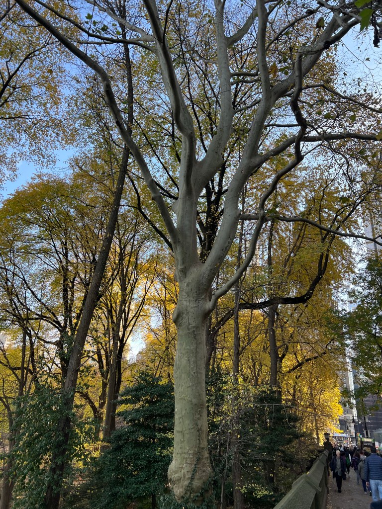
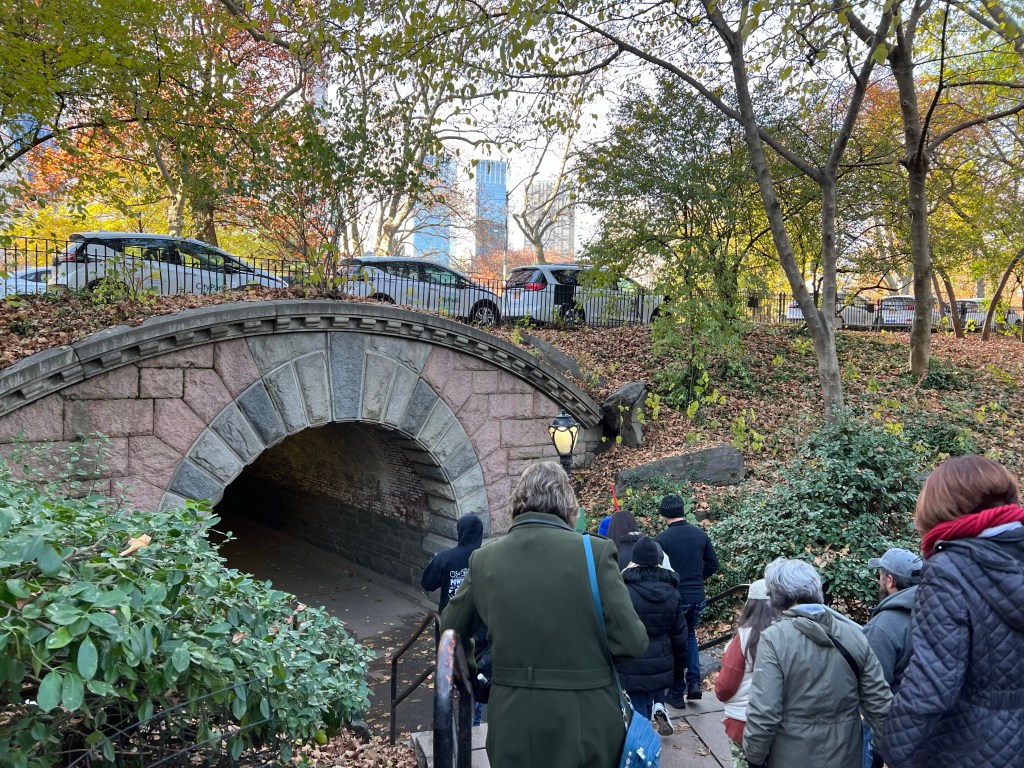
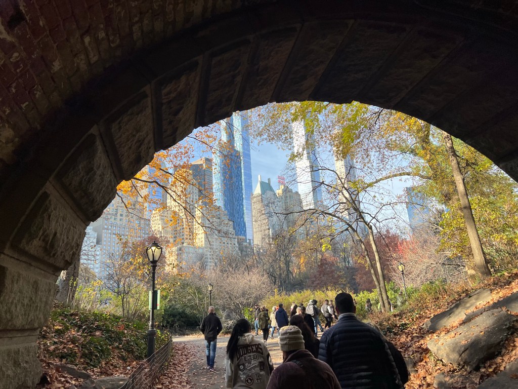
Wednesday was a fine day for me. Sunny again and a lot of walking. We walked as a group from our hotel to the southeast corner of Central Park. Ahh, trees.
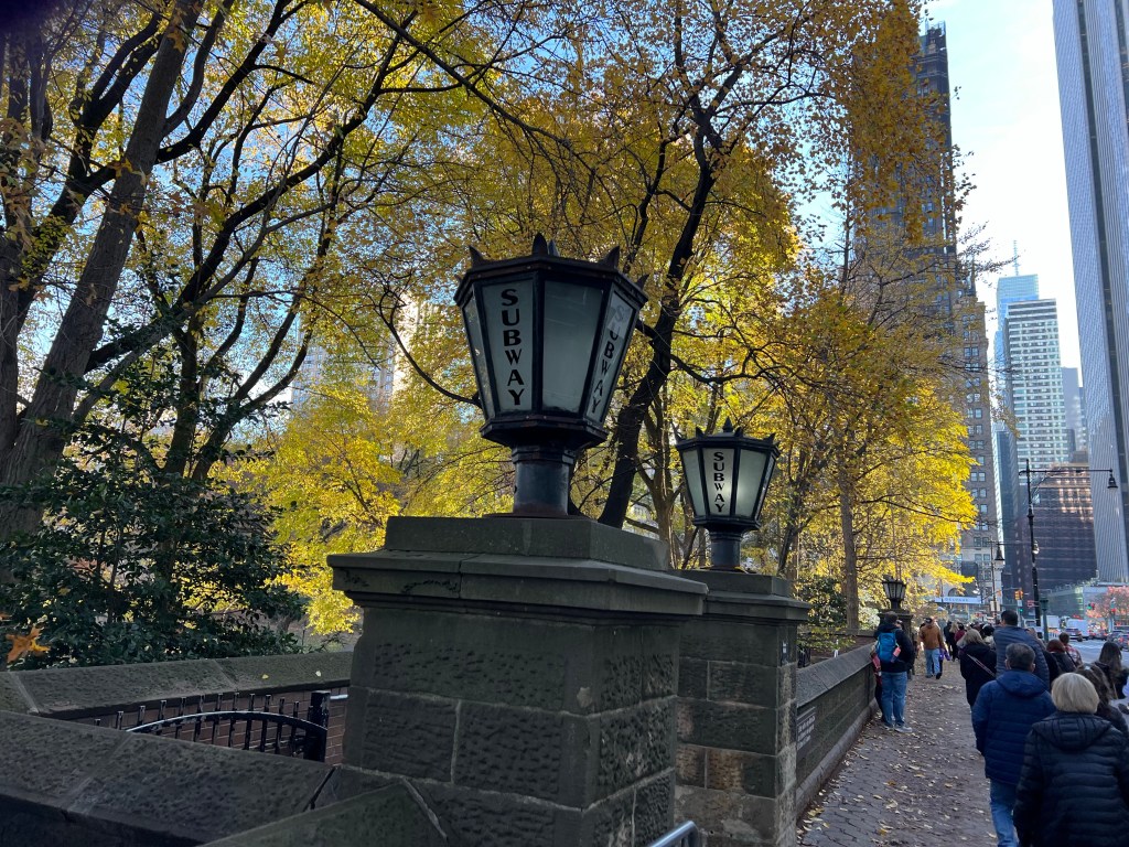
Even the subway entrances are pretty here.
We broke into 3 smaller groups and went with our guides on a tour of the park.
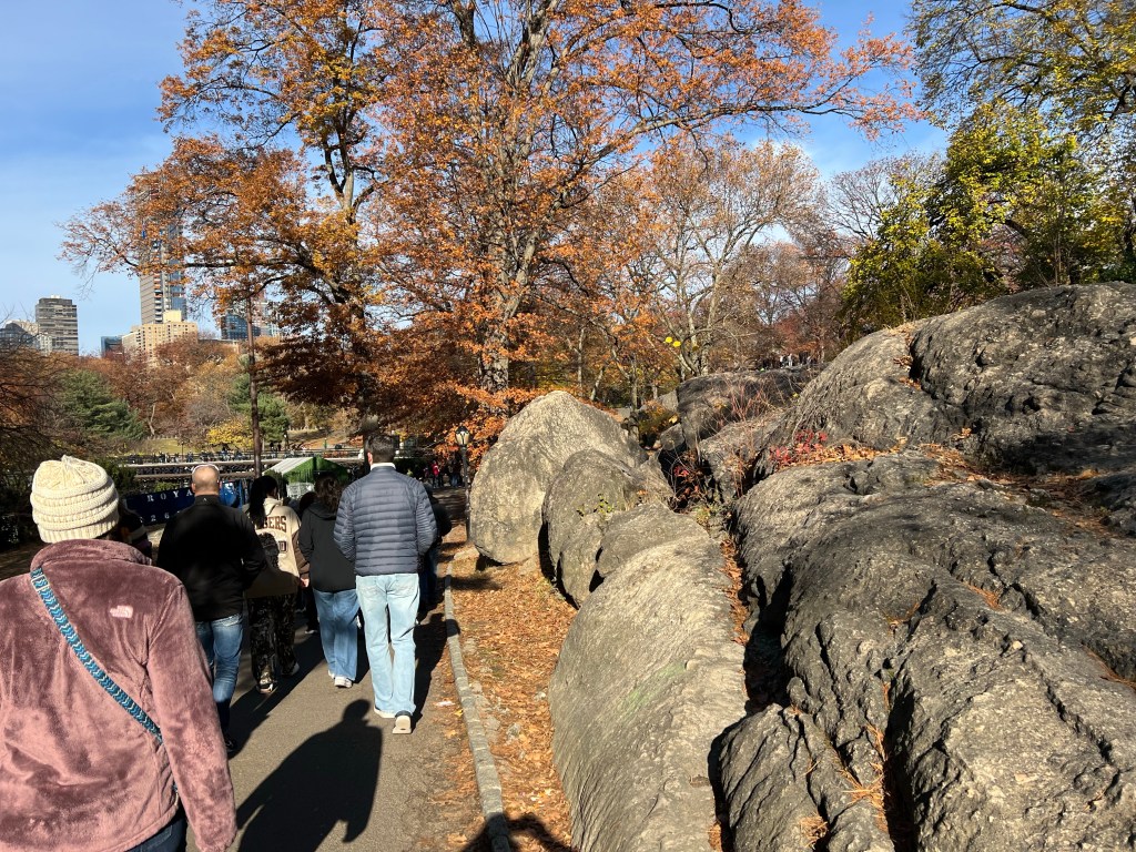
I took lots of pictures. The juxtaposition of park and city made them both more beautiful.
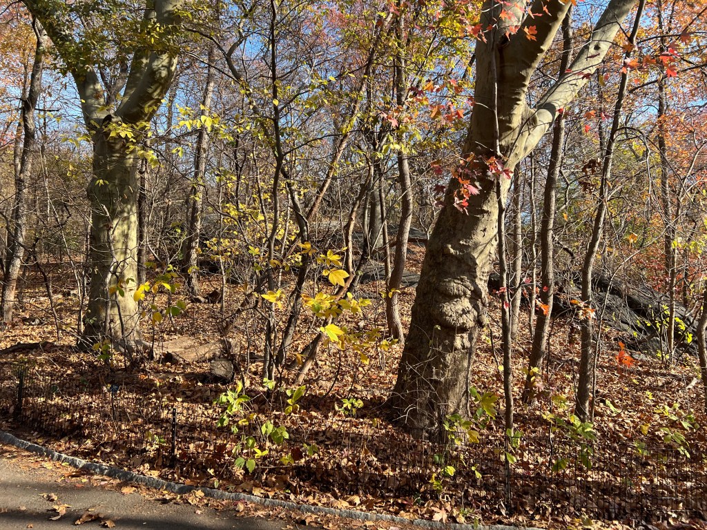
Although extensively landscaped when it was built, starting in 1858, the many rocky areas were left as they were.
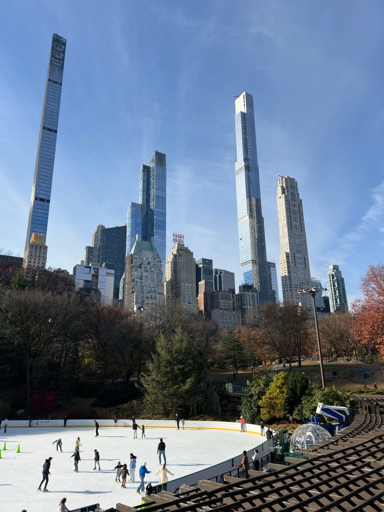
There are two ice skating rinks in the park, this is the more popular one on the southern edge.
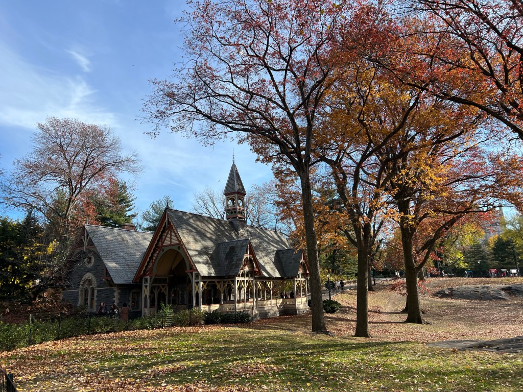
This is The Dairy, which is now a gift shop. Our guide told us one of the reasons for the park was to fight the diseases that were becoming a problem in the now crowded city. Good quality milk was hard to get, so a dairy was installed in the park to provide it.
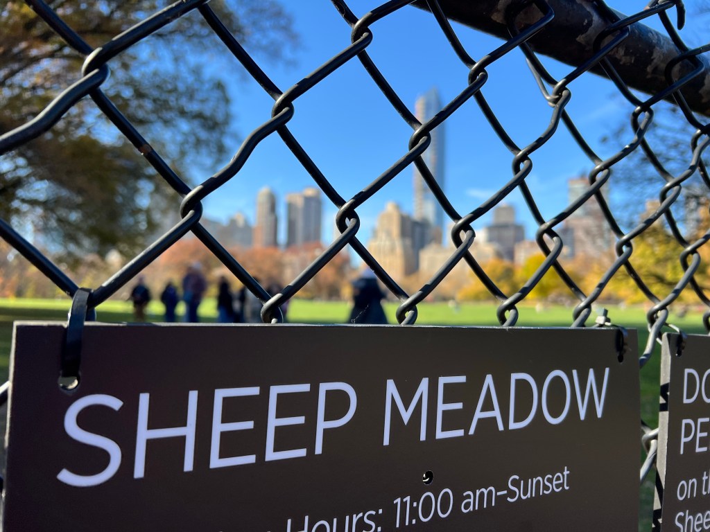
And yes, the Sheep Meadow once had sheep.
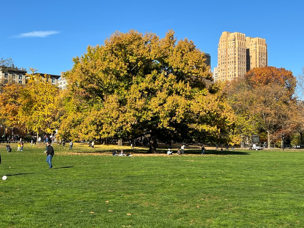
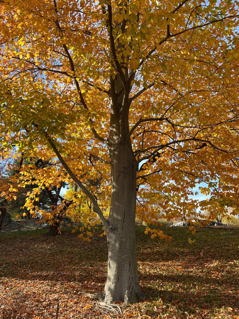
Now it’s a beautiful lawn and home for this gorgeous oak.
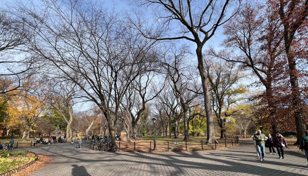
We walked along the divided Promenade, the only straight path in the park.
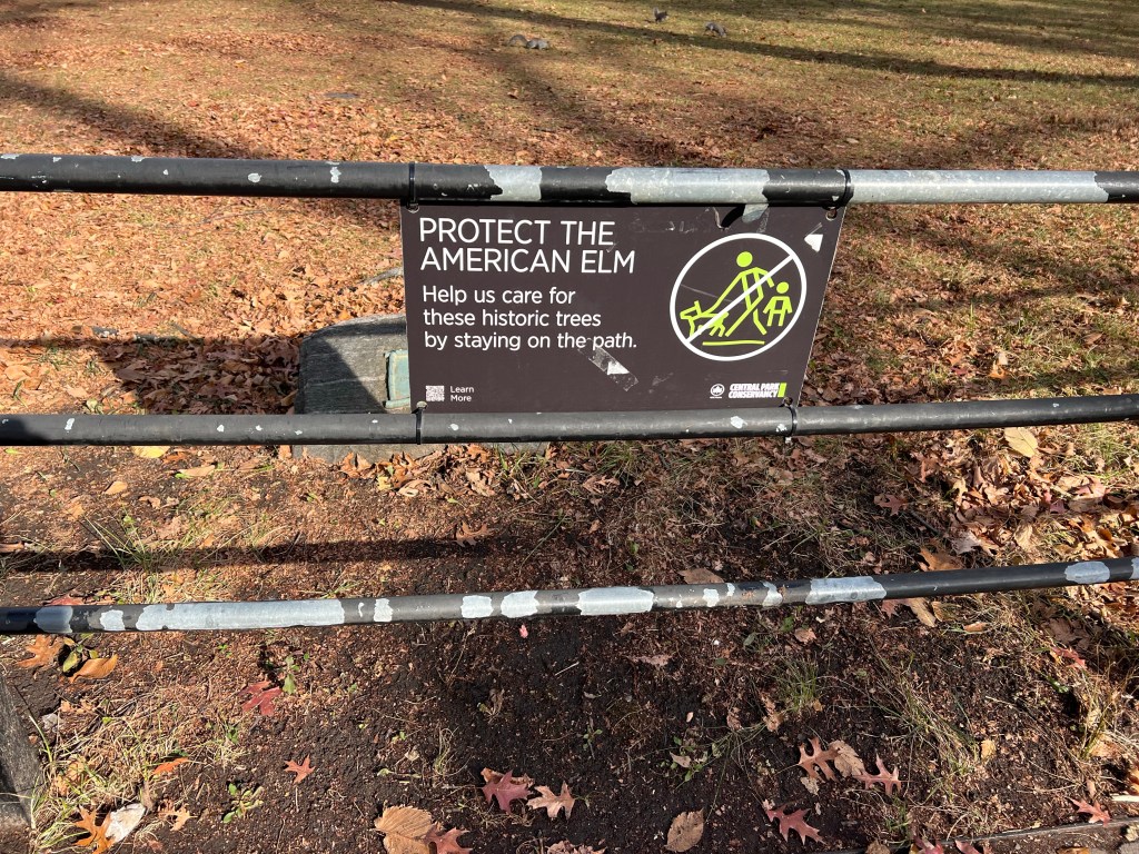
As we drew near I saw this sign, I asked our guide and he confirmed, they do still have American Elms in Central Park! The only mature elms I remember seeing were in my childhood, before Dutch Elm Disease took them out.
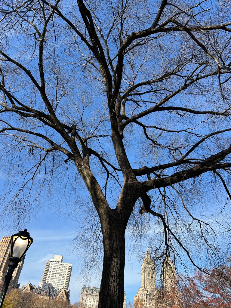
Farther along I saw this beauty, mature and healthy.
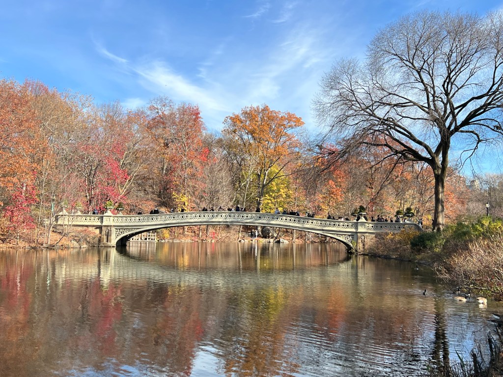
There are vistas galore in the park. Some include places where movie scenes were shot.
Some include famous buildings, like the peaked roof of the Dakota behind Jamie and Sean. Judy Garland lived there along with other famous people, but for me it will always be the place where John Lennon lived and died.
With all of that it is the trees that made the park special to me. There are over 17,000 trees and 200 species. There were beautiful specimens like this…
and more wild places like the Ramble. Our guide did a detour through there because we were showing such an interest in the trees and birds. Nice. There are small birds there that will take peanuts from your open palm. I saw it, but wasn’t quick enough to capture it.
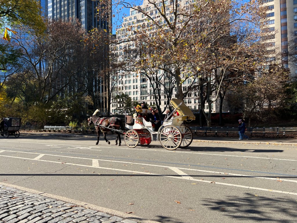
Walkers, runners, bikers and carriages all have a place to be in Central Park.
From there we walked, again, back past our hotel to John’s Pizza.
We had all you can eat pizza and salad in an old building that had been a church.
We went to the 5:00 PM performance of Christmas in NYC at Radio City Music Hall. It’s billed as a Christmas Extravaganza and it is, with a real bus and live camels and a calf as part of a staged nativity scene.
It wouldn’t be the Christmas Season in New York without skating at Rockefeller Center, although the giant tree was not yet decorated. Jamie, Sean, Tia, Jacey, and David gave it a try. Jamie loved being back on skates even though the rentals hurt and the ice was crowded.
Afterwards we went for a bite to eat at Sean’s Bar and Kitchen. Had to try that place. I had a potato leek soup that was very good. By then it was around nine and we called it a night because the parade was the next morning! Another full day in the city.
We are now in hour twelve of the bus ride back to Arkansas. It’s morning, I sort of slept. I will try to post pictures of the rest of this incredible week.
This is Tuesday morning at 7:50. I walked out to meet Jamie, Sean and Terry as they returned from outside the Today Show set. They got there at about 5:45, the cameras went by once and then they were told it would be another 45 minutes before they returned. They were cold, damp and achy and so decided to come back for breakfast.
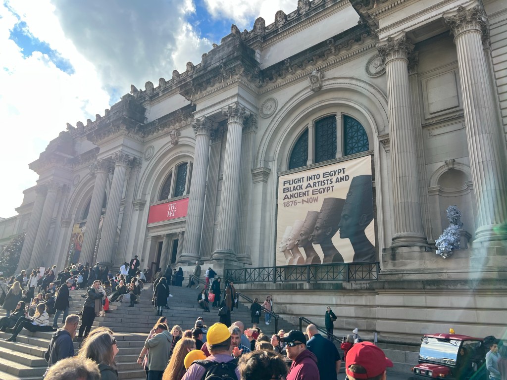
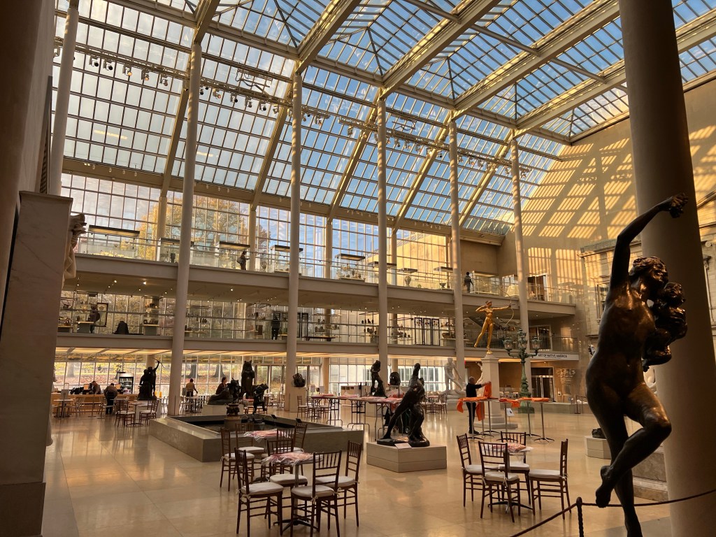
After lunch the group did a tour of the Metropolitan Museum of Art. Jamie and I wanted to see the special exhibit advertised on the front, here.
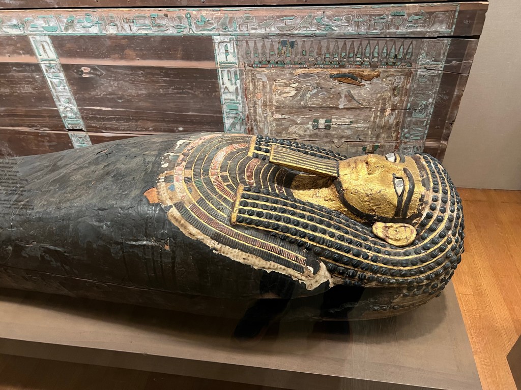
We wandered through the ancient Egyptian collection.
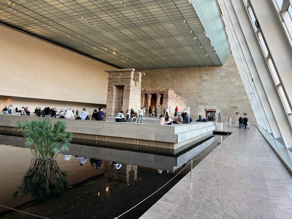
My favorite was the Temple of Dendur which was displayed in its own room.
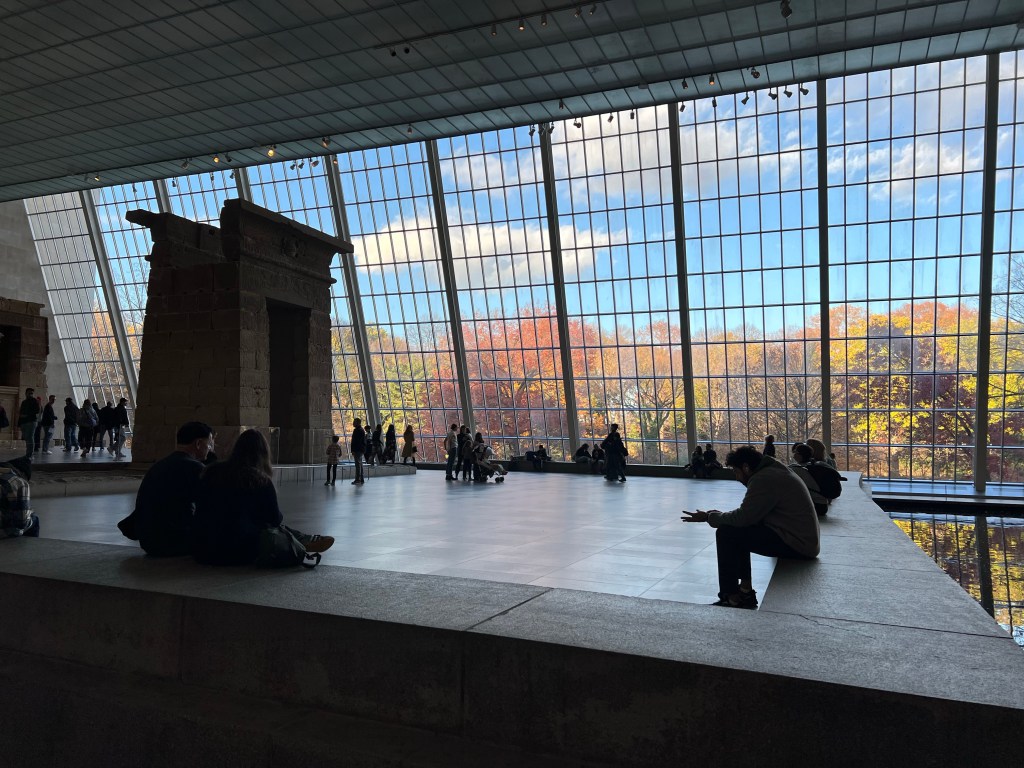
The space itself was most impressive.
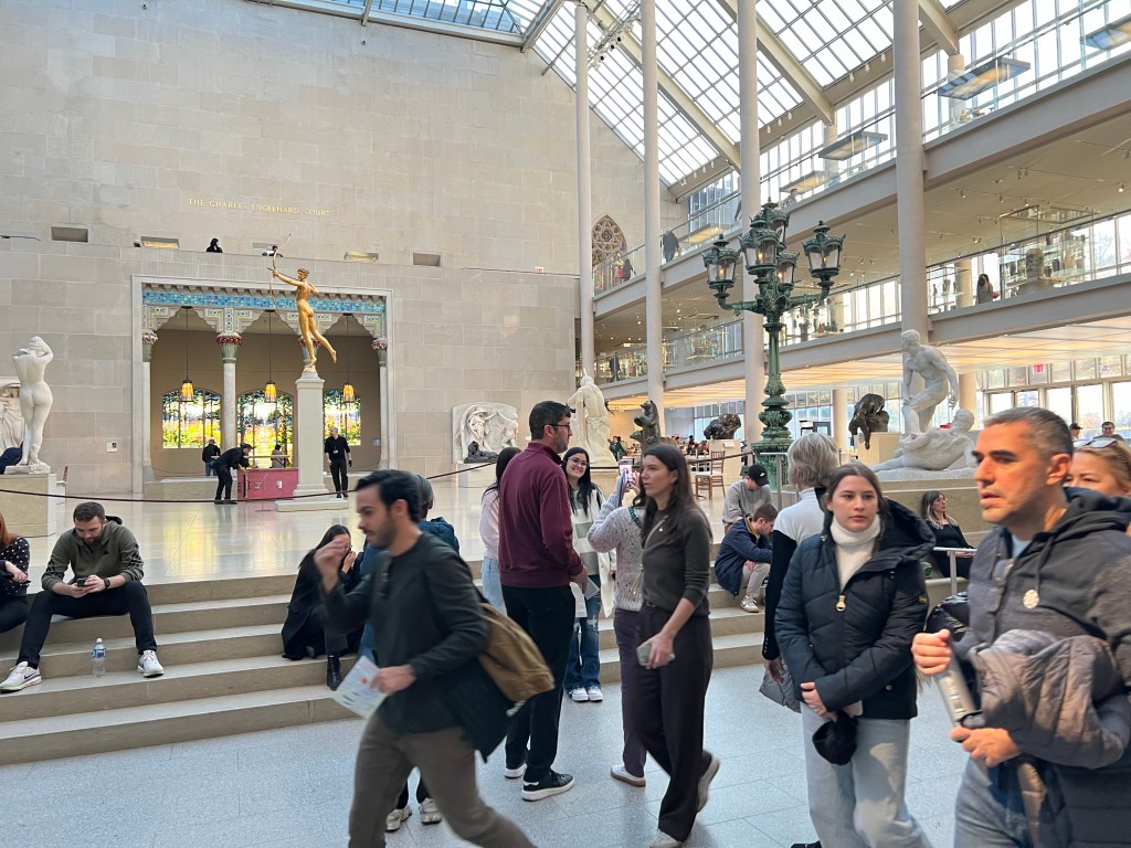
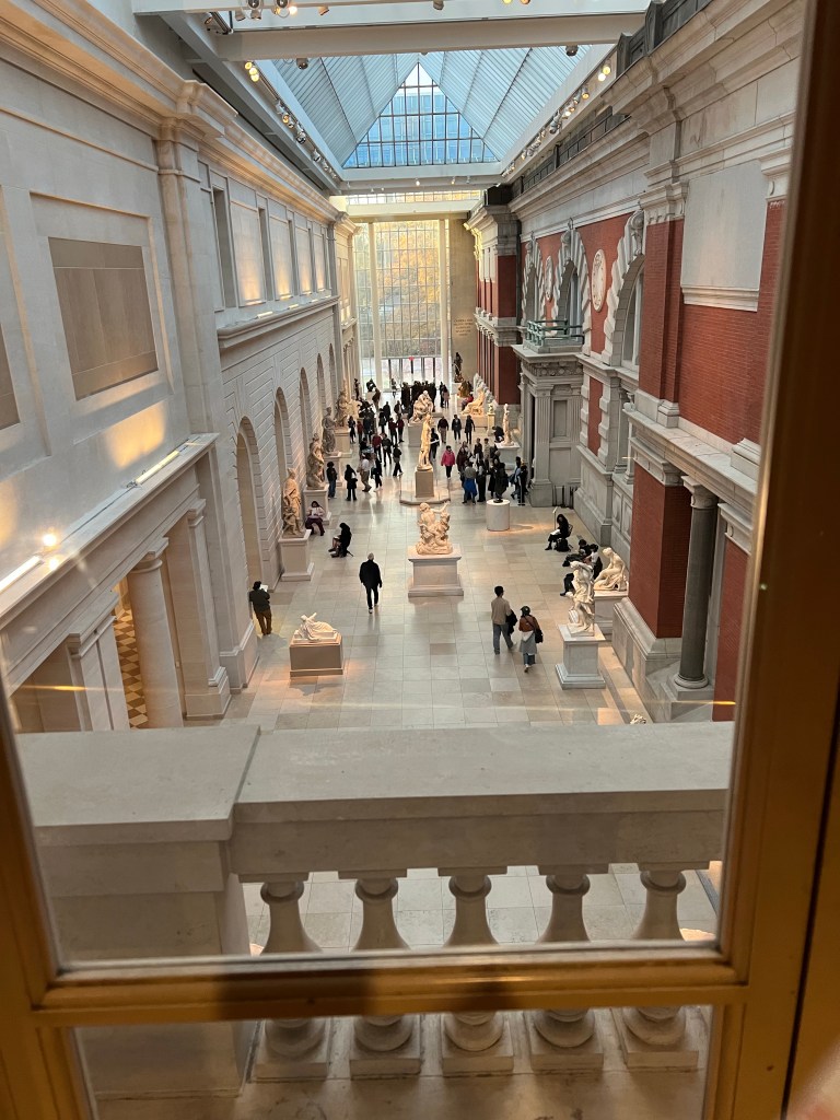
The whole building was huge and beautiful. Here are Jamie and Sean, behind them Tia, Jacey’s shoulder and the back of Terry’s head. It was hard to stay together.
Eventually I took off by myself and started walking quickly to find the exhibit. I saw more of the gorgeous space.
While I was taking this shot a man near me was telling his companions that the wall to the right was the outside of the building at one point. Then everything to the left was added. I finally found the exhibit but had very little time to view it because I had to find my way out of the building and back to the bus for our departure.
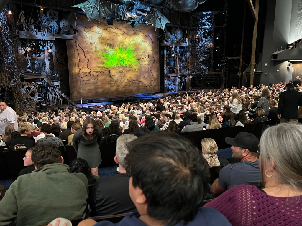
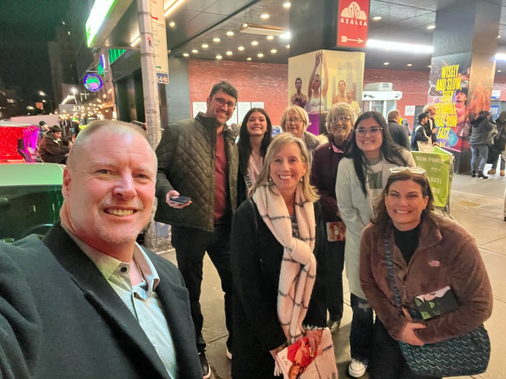
That evening we all went to see “Wicked” at the Gershwin Theater. The kids were there, too, but again we just saw them in passing. It was a great show.
This is our group in front of the theater after the show. Front row, David, Renee and Jamie. In back, Sen Jacey, Terry, me and Tia.
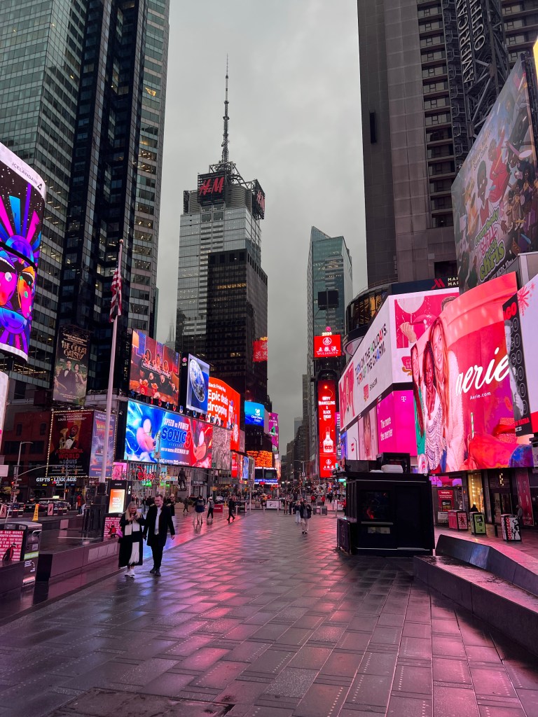
Because it was already after 10 and we had no early morning activity planned we decided to go to Times Square just before midnight. Terry had heard they replaced the video advertising with an art display from 11:56 until midnight. (We did have time to go back to Junior’s for more dessert.) This video was taken at 11:51.
And this one at 11:57. Honestly we weren’t sure if it was an art installation or a technical error, but it was interesting and fun to be there. Another long day.