Last Days in Terra Nova

This is the only picture I have from Friday. These are the stairs down to the southwestern side of the campground trail. Rain was ending at nine or so, then it was going to get hot (up to 82 degrees F). So as soon as it stopped raining I took Matey here. I wanted him to have a good walk before the heat, but he was reluctant to take the trail. I had to repeatedly urge him down until we were on the path below and walking towards Big Brook, which you can see in the distance. It began to mist, which didn’t worry me. When we were just about half way on the trail the mist turned to rain. Bud called to ask if we needed to be picked up. He came, but the closest he could get with the truck was about 80% through the hike. I was literally soaked to the skin. Only my feet were dry because my hiking boots are water resistant. I think Matey knew.

I put on dry clothes and the day became a work day, even though the rain stopped in an hour or so. I did the laundry in the morning. I had mentioned the night before that we might try to clean the coils on our main air conditioner. That meant me going up on the roof. Dennis asked if I wanted help. I told him if he really wanted to I would gladly accept his help, but not to change his plans on my account.

He came and we did it. Bud was ground crew. It was a bit more involved than Bud had described from the YouTube video he’d watched. I was glad Dennis was there to help us decide what to do. The four screws you needed to remove became about fourteen. The foam cleaner did its thing, it didn’t look too bad to start and we’re not sure how much it improved the efficiency, but the coils are clean.

In the evening I took leftover shrimp and grits that Bud had made for our dinner to let the Newfoundlanders try a bit of southern cooking. We had a great time chatting. This morning they left, but Florence and I exchanged cell phone numbers and they said the next time we’re in Newfoundland we need to visit them at home. Hope we do someday.

Today Bud took Matey and me to the government wharf for our morning walk. We finished the Coastal Trail walking the section from there back to the campground. This part of the trail was far less used.

Where light got in it was almost overgrown. It was still easy to follow and the steps and boardwalks were there where you needed them.

And of course it was beautiful.
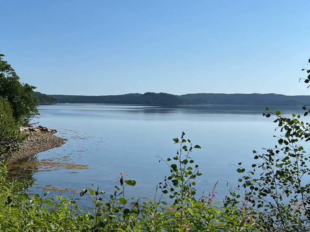
It had views of the sound…

and a section of beach that had the famous National Park Red Adirondack Chairs.

It was cool and still and gorgeous.

I know I’ve posted at least a hundred pictures of beautiful Newfoundland trails. I am still amazed by them. Sometimes I feel like I’m walking in the Shire from Tolkien’s books.

For people here walking is a part of life and they have and share their trails everywhere. It’s definitely my kind of place.

Unfortunately by the time Matey and I got back to the campground Dennis and Florence and Maxine and Barry were gone. I do hope we get to see them again someday.

This afternoon we took a drive to Dover. They had a short trail to this overlook. It was only 0.4 mile but since Matey had walked almost two miles this morning and it was again over 80 degrees we put together the stroller for him. We took him up the boardwalk and a few flights of steps.

When we got to the final flight we decided to park the stroller and let Matey walk.

There were wonderful views…

in all directions.

But the thing we came to see is this. The notch you see in the hills across town is a fault. This fault developed some 410 million years ago when tectonic plates from two continents came together. The land on the left of the notch was from the ancient continent of Gondwana (Africa and Europe). To the right of the notch is land that came from volcanic eruptions in an ancient ocean and became the edge of North America. The eastern part of Newfoundland is land that broke off what is now Europe and Africa. The western peninsula is part of ancient Laurentia, which forms the core of North America. And central Newfoundland is from the volcanoes in the ancient ocean.

We drove into town and the street through the notch was Fault Drive.

Again, Newfoundland is a geological wonder.

Our final stop in the area was back in the park at Ochre Hill.

There’s an old fire tower here that you can climb nearly to the top.

All of Terra Nova is laid out in front of you.

The body of water in the upper right is Newman Sound; the campground is there.

Not a good place if you don’t like heights.
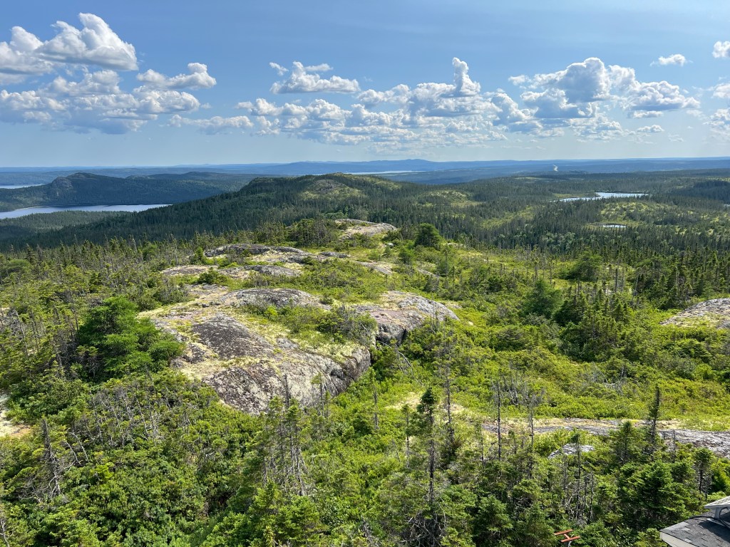
But a fitting end to a wonderful week.

Hikes and Sights

Wednesday there was a chance of showers all day so we puttered around the trailer, went to the little town nearby and stopped at the Welcome Center. It still hadn’t rained and I was getting antsy so I decided to take Matey and walk partway back along the Coastal Trail. Bud said he could pick us up at the Government Wharf which was supposed to be just 2 km along the trail.

It was another nicely done trail…

with just enough structure to protect you and the woods.

We’re getting in to summer here, the creeping dogwood has berries…

and wild roses are in bloom.

The bog laural is still blooming, though.

This is the Coastal Trail and I got some peeks at Newman Sound.

Then the trail took us down on a slip of beach…

and Matey took advantage of that to cool off. It was over 80 degrees here Wednesday and today.

Coming from the beach we got to go up this fern lined boardwalk.

The walk was closer to 2.5 km than 2 km. Bud started wondering where we were so he came walking back and met us.

This is Government Wharf. It has a pretty nice boat ramp…

with some lawn and picnic tables.

There was supposed to be a falls, which we hadn’t seen. It was impossible to miss where the trail went as it crossed the paved area.

Not far on the other side we found the falls.

I felt better for getting a walk in and we never did get rained on.

Today we decided to go back to Skerwink Trail. Last year we hiked it but saw no whales. We were hoping they would be there this year. We arrived a bit before 10 AM and there was still quite a bit of fog around. The first part of the trail is a bike path and I took Matey in the stroller for just under a half mile.

When the bike path ended we left the stroller next to some bushes just off the trail.

It was still a nice path, but not stroller friendly.

We got to the cliffs and little beaches where the whales might be. There was good visibility along the shore but no whales.

It is still a beautiful walk…

among the most gorgeous places we’ve been.

We went a bit further out than we went last year but still didn’t go all the way to the head as the fog was blowing by and we knew there would be no viewing of any kind out there.

Besides, by the time we negotiated all the steps back…

and looked at the beaches from the other side (still no whales)…

Matey had had enough and was happy for a stroller ride.

This was back towards the start and end of the walk, what a beautiful place to live!

Dennis’s sister, Maxine, told me that if we were out there we really should drive around to the little town of Trinity, on the other side of the bay.

It’s one of the oldest European towns in North America and has many old buildings.

It was very pretty.

There were a lot of historical buildings, many painted bright colors.

I could easily have spent a couple of hours walking around.

I think you could tour a number of these quaint houses.

Here’s another unique Anglican Church. (I still like the one at Burnside better.)

Bud and Matey were both tired so we just cruised through and I snapped whatever pictures I could.

So things aren’t quite centered.

There were just so many picturesque buildings.

This is looking across the bay to the peninsula where the Skerwink Trail is. It’s still shrouded in fog.

This is the lighthouse, fog still streaming by. While we were on the trail we heard the foghorn from this lighthouse sounding.

After our too quick tour of Trinity…

we drove back through more beautiful countryside. We detoured a few miles to Clarenville to stop at a store and didn’t get back to the trailer until almost four o’clock. Another full day of beauty.

Strolling in Salvage

At the end of the peninsula just west of us is the little town of Salvage. The guidebook said there were trails through town so we thought this might be a good place to go and walk. We have a dog stroller for Matey (it was originally our daughter’s for her dog that went lame) and we figured if he got tired we could let him ride.

It worked to some extent. Matey walked along and Bud pushed the stroller until Matey had enough of peeing and sniffing and seemed to be getting tired. Then he rode. We took the stroller down the main drag in town to the far side of the harbor.

We walked by the wharf. There was an interesting looking cruising sailboat tied up, it reminded me of Earendil. I would have liked to go out to inspect it more closely, but unauthorized folks were not allowed on the wharf.

It certainly was a beautiful little harbor.

The harbor was bisected by this spit of land.

Past the wharf the road ended, but the trail continued. The stroller did pretty well on the narrow path.

We were walking on what looked like an old road. We did not see any road to take you to the house in front, nor to the two houses behind it on Burden’s Point.

We made it as far as the first house, but then your choice was stairs or a very steep ramp. I would have tried the ramp but we’d discovered that one side of the stroller handle wouldn’t fasten securely. I was afraid to pull it up the ramp.

After looking around Bud took Matey back onto a shady part of the trail while I walked up to the rocks behind the house to take pictures.

That’s Burden’s Point and the entrance to the harbor.

And that’s looking across the harbor to the spit of land that bisects it and beyond.

We made it back to the street with no problem. Walking back we saw this house for sale. I looked it up, price is $69,000 Canadian. I think it must have some serious issues. It is a hundred years old, has only one bathroom and is on a septic system. Still…

As we were walking back I had to get a photo of these flags. The Canadian flag is on top, below on the left is the official flag of Newfoundland and Labrador. On the right is the unofficial flag of Labrador. I love it. The top two fifths is white, for snow. The bottom two fifths is blue, for water, and in between one fifth is green, for the land. Against the snow is a two year twig of black spruce. The older growth is shorter for the hardships of the past. The newest growth is longer, for the hope for the future. The end is three equal twigs for the three peoples; the Innu, the Inuit and the Europeans.

Bud went back to get the truck and Matey and I continued around the harbor. This place was also for sale. It’s $179,900, 3 bedrooms, 2 baths, built in 1960 and renovated in 2004. The best thing about both places is that they overlook the beautiful harbor. It’s hard to find a house in Newfoundland that doesn’t have a great view.

Matey and I continued out the spit of land that divides the harbor. This is looking back at the house where we turned around earlier.

I got a great view of the two houses on Burden’s Point, the Burden House and the Dunn House. They are also for sale. Built in 1912, comprehensive architectural rebuild, water access, dug well and septic. Two named houses for just $1,200,000; bring your own boat.

It really is a pretty place…

no matter which direction you look.

Bud picked us up down near this yellow house. Another nice location.

On the way back we took a detour to Burnside. I was curious about Cottel Island. There’s ferry service from Burnside to the island, and the town of St. Brendan’s sits out there, but although pretty much every route and every town is covered in the official tourist guide there’s not a word about these places.

We got there just in time to see the ferry leave. There was no one on the ferry dock, so the mystery remains.

We took a drive around Loop Road in Burnside. Oh yes, beautiful.

And Bud pulled in and let me take this photo of the Anglican Church there. It gets my vote for the prettiest church ever.

And then we drove back to Terra Nova.

We Did Come Back

Last year when we were at Terra Nova National Park we met Dennis and Florence Porter. They gave us some iceberg ice because we had missed the icebergs. They also told us that Bonavista Lighthouse was worth visiting again in the sunshine, which we did, but saw no whales. We decided we would come back this year, and come earlier to see icebergs and whales.

We did come back, and we saw icebergs in Labrador and one whale. This week we’re back at Terra Nova National Park and last night there was a knock on our door. It was Dennis and Florence! Dennis saw us go by when we came in and recognized out Outdoors RV trailer with Arkansas license plates. They are here again, and at the same time we are, even though we are five weeks earlier than last year! Here they are sitting outside Dennis’s sister and brother-in-law’s trailer.

Today we went back to the Bonavista Point Lighthouse, which is getting a fresh coat of paint.

The puffins are still there.

And so are the beautiful cliffs.

But this year, feeding just beyond the cliffs, there were whales! There were three where we were watching here.

Bud was hanging onto Matey while I took pictures because we were out on a pretty narrow piece of rock.

The whales seemed to be moving up towards the lighthouse, so we walked up there. This, I think is a different whale. It and another one were hunting just off the rocks in front of the lighthouse. What you’re seeing here is the top of its head back to the dorsal fin. It’s swimming towards the right side of the picture. They put on quite a show, but I missed some of the best pictures.

When we couldn’t see them any more we walked back down the headland to the truck.

We stopped quite near the lighthouse at Little Dairy King…

for a lunch of fish and chips. It was a perfect day for sitting out in this lovely setting.

We saw a bit more of the town of Bonavista this time.

Bud was in looking for silicone caulk at Swyers Building Center, so I took the opportunity to get a picture of their food store, “Serving You Since 1892”. I was going to wait until the maroon car moved, but since they had just pulled half off the road to stop and chat with friends in a typical Newfie manner, I decided they should be part of the picture.

I caught the United Church as we drove by…

and we stopped here, at the Visitors Centre.

Along the town wharf was this beautiful yawl out of St John’s.

It was an altogether satisfactory day and I’m glad to be back!

Beothuk Interpretation Centre Provincial Historical Site

Bud and I were going to the Beothuk Interpretation Centre and were not taking Matey so I took him for as long a walk as he would like this morning. We went along the trail here at the park.

I would have loved to go to the end. This sphagnum moss made the woods glow green. But after about a half mile Matey showed signs of flagging and we had to walk back, so we turned around.

We did detour a couple of hundred feet on a path to the beach.

We were well rewarded.

And finding ghost plant or Indian pipe, a parasitic flowering plant, made up for the relatively short walk.

Bud and I then drove just a few miles down the road to the Beothuk Interpretation Centre Provincial Historic Site. This year is the 75th Anniversary of the Confederation of Newfoundland and Labrador as a province of Canada, so anyone with a birthday in 1949 or before got in free. That was me! Bud had to pay the four bucks.

We were pleasantly surprised with how well the center was done. It told the story of the Beothuk people who lived on the Island of Newfoundland for as much as 1000 years before Europeans came. The past generations are named by archaeologists the Little Passage people, after Europeans arrived they were called the Beothuk.

At first the Europeans were seasonal inhabitants setting up fishing stations in the summer. The Beothuk, who probably numbered less than two thousand, simply avoided them. When the Europeans left in the fall the Beothuk scavenged their abandoned camps for useful items, mostly metal, which they then reworked into tools.

The Beothuk relied on the bounty of the sea in spring, summer and fall. In winter many went to the frozen interior and hunted what land mammals there were, though Newfoundland has a paucity of land mammals. There were no moose or porcupines on the island.

Europeans began to settle the shore permanently. The Beothuk continued to resist contact or trade, but did take what was left unguarded. Conflicts arose and the Beothuk suffered. They were pushed to the interior where without the bounty of the sea they starved.

This statue is called Spirit of the Beothuk. It was created by sculptor Gerald Squires who was inspired by what he knew of the Beothuk woman Shanawdithit. Two Beothuk women were captured at separate times, Demasduit and later her niece, Shanawdithit. Each was eventually brought to St. John’s, each was well received and taught the Europeans some of their language and culture. Each died within a year of arriving; Shanawdithit died of tuberculosis, as was probably the case for Demasduit. When Shanawdithit died in 1829 she was the last cultural Beothuk. The people and their culture were gone, though there are probably descendants among the Mi’kmaq people who live to the south.

The statue sits about three quarters of a mile from the Interpretation Centre along this very well made trail.

It sits in a beautiful little glade…

just before the Beothuk village archeological site.

The discovery of this site is the result of the research and effort of Dr. Ralph Pastore. He was looking for sites that might shed light on the history of the Beothuk and the reason for their extinction. There were no missionary or government agent records on these people.

This site is in a protected cove with a small beach where canoes could be landed,

it has a freshwater creek,

and the site itself is a glacial moraine, filled with gravel and rock left by a past glacier. Unlike most of the boggy, stony land around it, it would drain after a rain. 16 likely sites were identified in this part of Newfoundland, two turned out to be from the right era. This was the largest.

Only four of the eleven dwelling sites were excavated, enough to show who lived there and when and answer some of the questions on how they lived. The rest are left for future archaeologists with future technologies at their disposal.

We’ve been to a number of archaeological sites in North America, but the presence of the statue and the story of the women made this site more relatable.

Out in the Islands

Thursday morning started with a ruffed grouse entertaining us by foraging near our trailer door.

Then we went back to Twillingate, where we’d been last year; back to the overlook at the Long Point Lighthouse to look for whales. We saw no whales. We took the trail down from the viewing platform onto the cliffs. I’m always disappointed in how little depth comes out in my photos so I decided to take a video. It does a much better job. My phone was further out than my feet and all of me was a bit closer to the edge than I’m comfortable with.

I think you get some sense of the cliff here.

Next we tried taking a path to this overlook on Top of Twillingate Trail.

It’s the first of three overlooks, but as soon as the trail got a bit steep Matey, who had been zipping along, just stopped. He stood there until we suggested that we go back down then he started happily down hill.

We made one more stop at Kettle Cove and called it an early day. We had things to do around the trailer so we took care of those.

Today started with a rabbit sighting for Matey and me.

Then on our way to catch the ferry to nearby Fogo Island we saw this moose. Bud thought it was a female, but if you enlarge the head you can see an antler, so I think it’s a young male.

So rabbit and moose, the day is starting out fine.

Every ferry we’ve been on so far has been unique. This one had a single deck, but on either side were raised “balconies” with cars on them. These were loaded when we got on.

I had to wait until we got to the other side to see how they worked.

Meanwhile, we sat up top on the sun deck. Poor Matey was in the truck because the deck hand misunderstood my question. He must have thought I asked him if the dog could stay in the truck, when I actually asked if the dog had to stay in the truck. There were dogs up on the deck but it was too late to go get Matey.

When we started unloading they let the cars to our left go first. Then an alarm sounded and the “balcony” lowered. I didn’t see them lower the ramp for those cars as our line exited next.

Our first stop on Fogo was Deep Bay. We were looking for the Deep Bay Footpath Trail, but evidently they’ve upgraded the name.

It was a nice little trail, not too steep for Matey.

Fogo is quite rocky and you could see it here.

It led up to an overlook that gave a great view of the tiny town and its beautiful harbor.

An island in the harbor had this cemetery. I wonder if they still use it, and if so if they have a funeral procession by boat.

By then it was well past noon so we went in search of food. This is my deli-tray. Notice the utensils, they are wood! At least this part of Canada doesn’t seem to have plastic silverware.

We stopped at this little cove in the town of Fogo to eat.

On one side of the cove was Brimstone Head.

We had wanted to hike up the short trail to the top but it was all stairs and we decided Matey couldn’t do it. So we didn’t get to go to the top where the Flat Earth Society has identified one of the four corners of the earth.

Instead we drove over to the Fogo Head Trail. It was just as daunting.

We took the first part down to this grassy meadow…

and admired the view of the Western Tickle.

We didn’t have a whole lot of time before the return ferry we wanted to take so decided to drive out to Tilting Cove. Along the way we passed through Joe Batt’s Arm where we saw this lovely church.

Set back away was this building, Fogo Island Inn. 29 rooms that go for $2875-$6975 per night with a three night minimum stay. Includes all meals, a half day orientation with a local community member and most land based excursions. This inn exists because of Zita Cobb and the nonprofit organization she started, Shorefast. A Newfoundlander told us about it and said to look it up, so I did. Ms. Cobb was born on Fogo Island and watched it almost die with the cod fishery. She studied business and ended up the CFO of a company involved in fiber optics. She became very rich and used her money to start Shorefast. The Inn is creating jobs for folks on Fogo Island and the profits go back to the island. I can’t do her justice here, she’s a great woman. I see now why the Newfoundlander told me to look her up. I recommend it, too.

At the end of that road was Tilting, the fishing town on Tilting Cove. This is Newfoundland and Labrador’s first Registered Heritage District.

I would have liked to spend more time there touring the old part of the town…

but after a quick look around…

we had to go catch the ferry.

This time Matey got to ride on deck.

Back to the Islands

We drove on yesterday. I’ve included this picture on our drive to show that there is traffic in some places. This is TransCanada Highway 1 near Grand Falls-Windsor.

We were driving between thunder showers.

We turned off the TCH onto Highway 340, which is aptly called Road to the Isles.

There are water and islands everywhere.

This is a very different area than the Baie Verte Peninsula, but just as pretty.

We passed pretty little islands on all sides…

and came back to Dildo Run Provincial Park for a second year.

For the next few days we’ll explore these islands.

Oh Well

Matey seems to be doing better so we thought we’d go back and walk the trail at Coachman’s Cove. The sheet from the Visitors Center said halfway down the trail there was another Dorset site.

Matey went right up the sets of stairs.

But he didn’t want to walk down, so I carried him down.

Otherwise he seemed okay, even showing bursts of energy.

On the way out we stopped at a lookout over the harbor.

There are some of the houses lining the inner shore.

As usual I was brought up short by the beauty.

Sometimes it felt like we were walking through a fairy garden.

We’d only walked about a half mile when we came to the end of the land.

To the east was Baie Verte, to the north French Island and to the west Coachman’s Cove.

We’d seen two camp site picnic areas but no signs of any Dorset site.

On the way back we checked out the other camp site…

where we found some ancient coral, but no Dorset site.

We walked down into Cow Cove, which we had missed because we went to the harbor overlook. There was a nice view of Baie Verte, but nothing to indicate a Dorset site.

So we had a very pretty walk along the shore.

When we finished we talked to two locals who had just built a frame for a small concrete pad. The had never heard of a Dorset site other than the quarry. Oh well.

Next we stopped at the store in the town of Baie Verte. Bud bought water and a nice looking pork roast. He wrapped the roast in many layers of plastic bags and we set off for La Scie where we planned to have lunch at the restaurant that was closed yesterday.

We sat out on the front porch…

where Matey could join us. He chose a spot in the shade.

We looked out over the harbor. We were hoping for some traditional Newfoundland cooking, but there is a heat advisory here. It was 76 degrees and the owner and chef said that was too hot to cook. She had macaroni and cheese, which I can’t eat (can’t eat wheat), sandwiches, ditto, and a garden salad with smoked salmon on a bagel.

Bud and I both ordered that, mine without the bagel. It was good, but not the Newfoundland cooking we had hoped for. Oh well.

And then we had to hurry back to save the roast pork and for me to do laundry.

It seems that all our destinations are at the shore. That’s not because the interior is not beautiful.

There are hills and lakes everywhere. But the land is stony and boggy and all the early settlements were fishing villages.

So towns came first and then the roads, which remain largely undeveloped. There’s really nowhere to stop so it’s hard to take pictures. Oh well.

By the way, the pork roast was not what Bud thought; it still had the very thick skin on it. So when it was trimmed up it was neither the cut nor the good buy he thought. Oh well.

Tomorrow we move on and there is still one branch road we haven’t explored. Oh well.

But honestly, looking at these pictures you can see that it was not a day to complain about!

Poking Around

Today we drove out another of the branch highways, 414 heading east. We took it to the end at LaScie. It’s always a bit startling to come from the interior highlands and suddenly see a hill and the ocean in front of you.

Bud stopped as we approached so I could get this photo. We then headed around the harbor and up towards those hills beyond town.

We ended up here and I walked to the edge…

and it was pretty dramatic.

I love the color of the water.

This fishing boat went out just past where it is now, then turned and went back into the harbor.

We weren’t yet at the highest point. See those railings up there?

We went up there. I think this may be the place where Matey stopped. I carried him the rest of the way up.

The view from the top was spectacular. Better than that there was a local man there and he’d just seen a whale. We stayed and watched the whale periodically come to the surface and talked to the man for at least a half hour. He told us it was several hundred feet deep just off this shore, which may be why the whale was spending most of its time under water.

He pointed out where the fish factory used to be and told us what it was like then. There used to be almost 50 big fishing boats in the harbor and they brought in so much cod that it kept 500 people working during the season. He worked for years as a filleter. He showed me a video of himself filleting a cod. He did it with about 6 knife strokes.

He said the valley we see here was his favorite place to hunt moose. He used to hunt seals off the farthest point you can see, walking out on the sea ice. And every little while his stories would be punctuated by one of us pointing down “There it is.” as the whale surfaced again.

When we left to go find something to eat he was still up there enjoying a view he sees every day of his life (though he said he hadn’t been up here in a while, he’d had too much work). Matey was enjoying the smells. We’d seen a red fox run down when we arrived, I think Matey caught his sent.

The local guy told us this ATV trail would take us down so Matey could avoid the steps. (He called it a bike trail, as the folks here refer to even four wheel all train vehicles as bikes).

The restaurant he recommended was closed on Monday so we bought some food at the grocery store and headed about four miles across the peninsula to the tiny little town of Shoe Cove. This is their harbor.

We ate at a little park…

on the freshwater pond in the middle of the town.

The whole place is surrounded by hills. The pond drains into the harbor at the gap in the hills you see here.

And my cousins and my siblings please note, Newfoundlanders still hang out their laundry.

Most of the lines are on pulleys and folks put them where they fit, even in the front yard over the swimming pool.

The information from the Visitor’s Center listed a museum in Tilt Cove, so we headed there next. The sheet didn’t mention that the population of Tilt Cove was now four.

This is another place with a pond on the edge of the ocean.

But here the surrounding hills have all been mined for copper.

We drove around the pond looking for the museum. We didn’t see it, but did see this outhouse, which we decided to use.

I never thought from the outside that it would look like this on the inside, hands down the nicest outhouse I’ve ever been in.

Next door to the outhouse was a little trailer that turned out to be the fishing and hunting camp of a guy who grew up here. Not one of the four official residents, but he was out on his porch and we asked about the museum.

Turns out the museum closed during COVID and they never reopened. Our informant told us Don, who ran the museum could explain better than he could. He then gave us a ton of information about the town and the mine.

The current four residents are:

Don, the mayor, and his wife, and Don’s sister, the treasurer, and her husband, who also happens to be Don’s wife’s brother. Got that?

Anyway, this whole area was a copper mine and that hill is all tailings.

This was a main part of the mine until a cave in. Fortunately the cave in occurred on New Year’s Eve when the company was giving a party and all the miners were at the party, so the mine was empty of people when it collapsed.

Closer inspection shows the collapse left a void…

now filled with water…

that drains out here. The red is not mud, it’s iron. The rocks all around are full of iron.

There is a pond shaft here, though I don’t know what that was for.

And here’s the capped main shaft, 2,952 feet deep. I did not walk out on the concrete cap.

This used to be the structure for the loading dock…

And all this rubble used to be the wharf.

On the way out of town we saw this unusual pile.

This looks like iron slag, but as we’d left our source of information back in town on his “bike” we can’t be sure.

In the little town of Woodstock we saw this little light house out on this pier. We stopped for a picture and a woman across the street called out about something in the lighthouse.

I couldn’t quite hear her but went to look. When I ducked in through this miniature door…

I saw this plaque.

Thanks, Glen Decker, for creating this space.

It’s a nice spot to enjoy the harbor at Woodstock.

Further down the road was this pull-off that gives a view of the harbor entrance and welcomes you to Paquet.

This is another picturesque little town whose harbor is a cove on the west side of the long inlet going to Woodstock. There was another inviting walking trail there, I think it went over those hills for a view of the ocean.

After poking around these beautiful hills and coasts all day I am again convinced that the best thing about Newfoundland is Newfoundlanders.

Accommodating Matey

Saturday when I took Matey out for his morning walk he wouldn’t walk. I urged him about 150 feet, then carried him a bit further to a patch of grass. I took off his leash and started to walk forward thinking he would want to follow and roll in the grass. He did not. I carried him back and we sat outside in the shade for a couple of hours. Finally he got up and shook and we took a short walk.

Bud and I agreed not to go anywhere. Matey is 14 and has a bad heart valve and an enlarged heart. His respiration rate was way up. He is on three medications but I had started the third one, a diuretic, not long ago because his coughing had suddenly increased. Our vet told me that was a sign he had too much fluid around his heart. I started him on half a dose and he seemed much better, but after yesterday I decided to switch him to a full dose.

He finally walked a bit over half a mile and seemed more his old self.

Today we planned an easy day for Matey. It stopped drizzling about 10 AM but was still cloudy. We decided to drive up to the end of route 410 to the town of Fleur de Lys to a museum and soapstone quarry.

We thought we could leave Matey in the truck as it was still cool and cloudy. We needn’t have worried, pets were allowed in the little museum.

Inside it explained that the quarry behind the museum had been written about in 1915, but at the time they didn’t realize that it was used by Paleo-Eskimos, now described as the Dorset peoples, 1600 years ago.

Soapstone is a soft rock with a slippery feel that holds heat. It was used to make cooking pots and smaller vessels that were used as lamps.

Outside a short boardwalk led up to the quarry.

What you are seeing are the impressions left behind after the pots have been cut out.

It was a large outcrop that had been used for many years.

The softest soapstone was below ground level where it hadn’t weathered.

Bud noticed one place…

where they had chiseled around the rock for a pot but hadn’t finished. It showed the technique, but we wondered why they quit. Perhaps, we thought, there was some flaw in that rock.

It was a lovely spot…

and you could be distracted by the scenery and miss the carving. We missed these impressions on our way up, they were on the other side of the walkway.

We left the quarry and drove another block or so to the end of route 410. It ended at a turnaround that was the trailhead for this little trail. I would have liked to walk it, but Bud was worried the three short flights of steps would be too much for Matey, so we skipped it.

We’d seen this little island as we went by. A local pulled into the turnaround. “G’dday,” he said; the standard Newfie greeting. Bud asked if we could go out on the little island. “Sure!” he said, “You can go anywhere, do anything you want. There’s no restrictions.” That’s Newfoundland for you.

So we scared the crows away…

and enjoyed the little island.

When we first passed the island I saw this little blue building. “Is that an outhouse? If it is I’m not sure I’d want to use it.”

It is an outhouse.

We didn’t use it!

I did take this video to show the entrance and the harbor. I’d remarked to the local what a fine harbor it was, so well protected. “Best on the coast.” He said. The video starts looking towards the Atlantic, which is just past where you can see, pans across the entrance and ends looking towards the inner harbor which is again, just past where you can see.

I also took a picture of this memorial, still well tended. I wasn’t going to include it in the blog, but decided those who put this up might approve of others thinking kindly of Dougie and with sympathy for his family.

Shelley’s Island was indeed a place to stir your heart…

and bring you peace.

After a quick stop to view Fleur de Lys…

and its inlet from the wharf we headed out.

We hadn’t gone far when we saw a turn-off for Coachman’s Cove. Since we were all the way up there on 410 we decided to check it out.

I’m glad we did. The end of that road was a neck of land between Coachman’s Cove and Baie Verte. This is a little park on the Baie Verte side. Bud is walking past the French Oven, a replica of one found here from the days when the French fished here. It is used for demonstrations.

On the other side you could look out over Coachman’s Cove.

Someone had a nice little garden going here. There are little gardens all around on public land since many folks don’t have enough soil around their houses for a garden.

There were also some incredible rocks.

I can’t imagine the forces that could have twisted these layers so tightly.

I would love to travel here with a geologist to explain what we are seeing.

I just find it beautiful.

There were inclusions of quartz and this one looked like a fossil to me.

It’s easier for me to deal with the flowers, like these beauties. These are Harebells, Campanula gieseckiana.

This wasn’t nearly as nice a harbor as Fleur de Lys but it did have a small wharf and an old fish factory, now unused since the moratorium on commercial cod fishing.

And it still had its beauty.

There was another trail there I would have loved to take but we decided to bring Matey back and let him rest. Happily, even without the trails there was a lot to enjoy.