
Revelstoke, BC is a small city of just under 10,000 permanent residents…

tucked in the western Rockies.

It sits along the Columbia River. I was surprised to see the size of the Columbia River this far north.

Mount Revelstoke sits on the northern edge of town and Revelstoke National Park is there.

In January I tried to book us for 6 nights there but this is a holiday weekend in Canada, so we have four nights here, at Lamplighter Campground and will move tomorrow for two nights at the park.

This is pretty, but sites are tight. I took this picture when the folks on either side of us had left. However every afternoon the place fills up again, so imagine this picture with two more RV’s, one on either side of us.

But what I like is that the area is so walkable. This is a trail along the levee that runs along the southwest bank of the Columbia River here in Big Eddy where the campground is.

The rest of the town can be reached by crossing this one lane bridge.

I’ve walked across it every day.

It parallels the railroad bridge and beyond that the newer highway bridge on Trans Canada Highway 1. It’s just a mile into the center of town, and people bike and walk a lot.

It can be easier than driving, especially if you need to go out onto Highway 1. Here we’re waiting to make a left turn and there is a steady stream of cars on the Trans Canada Highway.
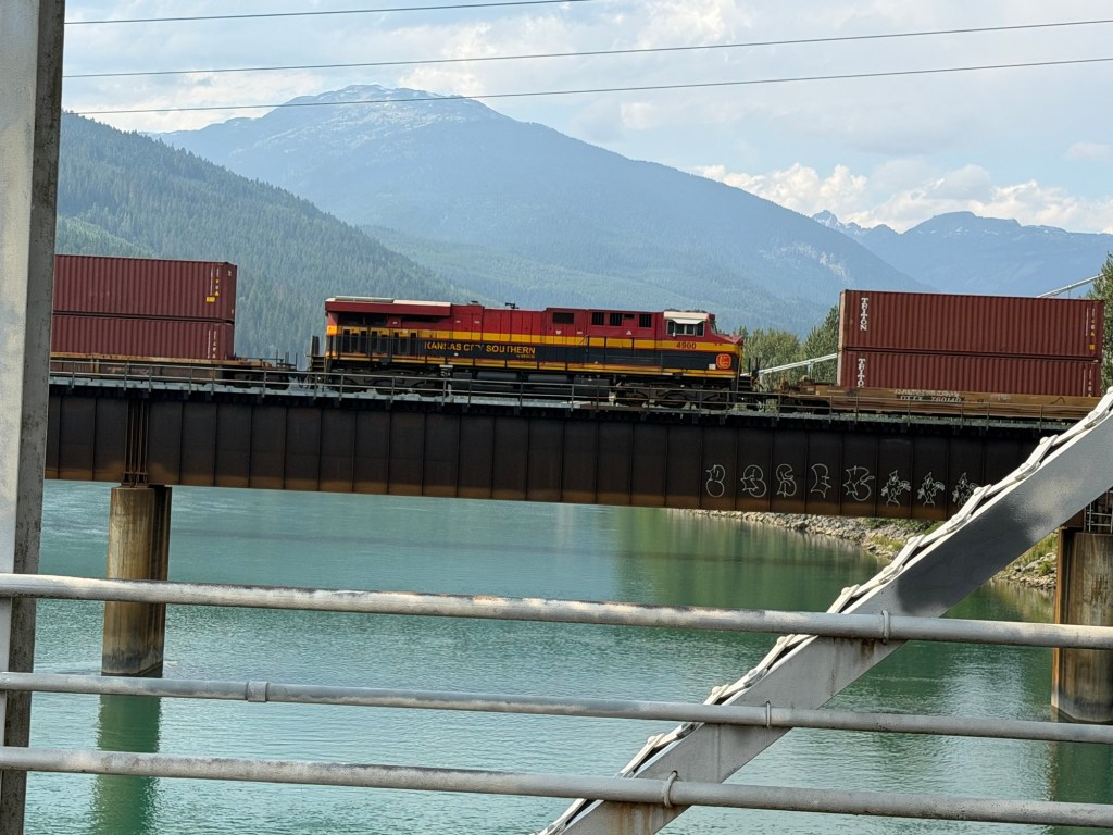
Revelstoke is here because of the railroad. The first Canadian to buy land here was a surveyor named Farwell. He knew the railroad was going to cross the Columbia here so bought the land to sell it to the railroad at a profit. He named his settlement Farwell.

The Canadian Pacific management was not pleased, they thought they had an agreement with the Dominion that all the land for the right of way was theirs. They ended up going around Farwell’s land and built their terminal and work yards away from the river, here at Track Street. They didn’t even keep his name. The town became Revelstoke after Lord Revelstoke from England whose bank funded the completion of the cross Canada route. This is now a railroad museum, there is still a work yard nearby, but passenger service ended here in 1990.

Notice the mountains in all my photos look misty. That’s smoke and it still hasn’t cleared out so we have postponed visiting Mount Revelstoke until we’re camped there. We’ve been exploring the area.

We drove east to Glacier National Park (Canada has one, too.)

We went through several of these structures.

They aren’t tunnels, they are snow sheds. This area is an inland temperate rainforest, and in the winter that means snow. The mountains here get from 40 to 60 feet of snow each winter!

With the steep slopes, that means avalanches. The snow sheds protect the highways and drivers (and they have them on the railroad) in the most avalanche prone areas. They also do blasting for avalanche prevention.

We drove to a trail recommended by the nice young woman at the National Park Visitor Center in the town of Revelstoke. She had information on both Revelstoke National Park and Glacier National Park since there is only 16 kilometers between the eastern border of Revelstoke and the western border of Glacier. These are big parks, so our trip was 50 miles as we went from the western side of Revelstoke to the eastern side of Glacier. Anyway, this was Bear Creek Falls Trail.

It was a short, pretty trail,

leading steeply downhill to the creek.

Just a bit further along was the falls.

The trail went close enough to the base to get you wet from the spray. And it was cold, this water is melt from ice and snow.

We went to a second trail called Rock Garden. Bud turned back because he was being bitten by small horse flies. They didn’t pursue me, so I made it to the rocky piles, left here in the last ice age.

You were supposed to be able to see where Highway One reached the mountain barrier and Roger’s Pass, but with the smoke…

I could only look down at Highway One below me.

It was still a pretty little hike through the rocks. These symbols were along the trail here and there, no doubt meaningful to the First Nations people.

In places it was a bit hard to see the trail, but there were steps where you needed them and these railings, which I appreciated.

Revelstoke has a very nice disc golf course and we played 18 holes there one morning.

Each hole was named, often humorously.

The course abuts the Illecillewaet River, which flows down from the Illecillewaet Glacier in Glacier National Park. That’s an eagle’s nest on the pole.

Today we drove up to the Revelstoke Dam, the second dam from the start of the Columbia River. The parking lot is on top of the powerhouse, where the turbines are located. Those are the five races coming down to the turbines. On the right is the place where a sixth race can go.

This is the second tallest dam on the Columbia.

We took a tour which let us go up to that structure.

We started in a tunnel through the dam, then took an elevator…

to the top. This photo was taken through the glass of the room at the top of the elevator.

From the deck outside you could see the other side of the concrete dam to the earthen dam beyond.

You could also see the water racing down the spillway. They were letting water out of the reservoir for the first time in three years, because they had a full pool, but in areas south of here they need water.

Driving out I was able to get a photo of the water thundering off the end of the spillway into the river below. Our guide told us he thought the spillway gates were only open about 20% of the way. I wonder if they’ve ever opened them all the way and what that would look like.

This afternoon we went to the railroad museum. I liked the cars you could get into. This was a business car inside the museum,
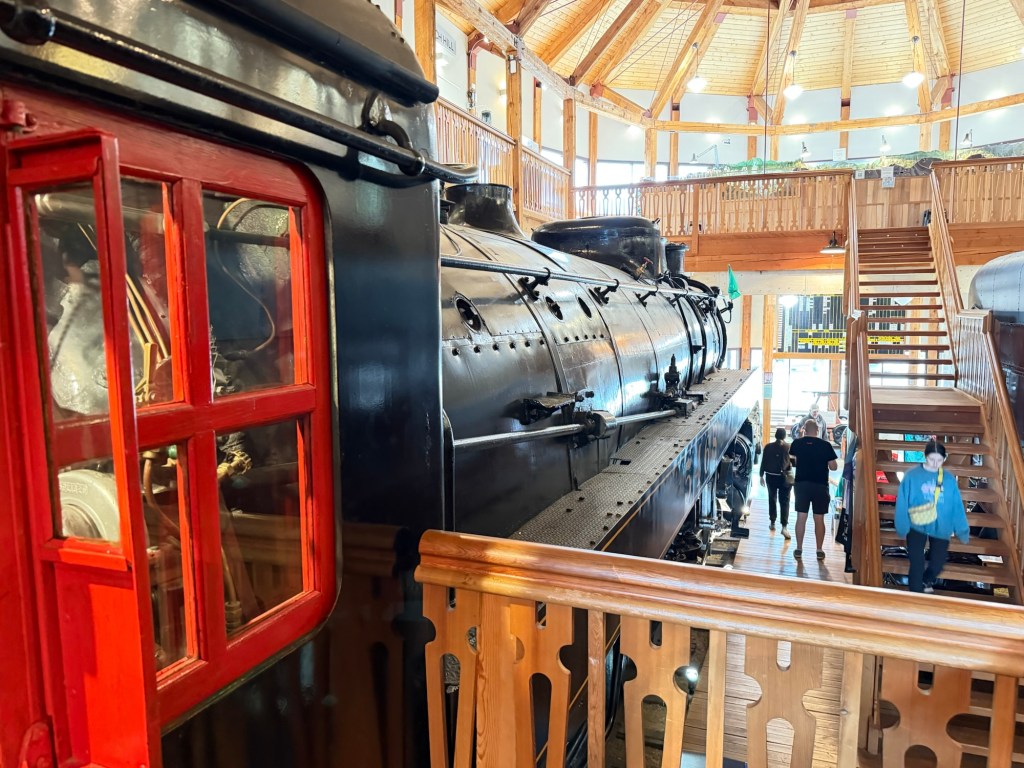
They also had this engine.

It looked pretty complicated to run!

Outside they had a caboose.

I think I would have liked working on a railroad and riding up in the cupola of the caboose. Best seat on the train!

But then there’s that snow. This is a snowplow that could be put in front of an engine. I’m sure plows this size are still used.

We stopped at the store for groceries, Bud drove them home and I got to walk back through this pretty place again. Yes, I like it here (at least in the summer, not sure about 21 feet of snow each winter, which is the average for the valley).


So many interesting things – thank you for all the details you included in your descriptions!! The mountains are so pretty. They would look absolutely beautiful in clear air!
LikeLike
Yes they would, hoping for clear air soon. At least we don’t have as many fires here as in Washington and Oregon.
LikeLike