We spent the rest of the week running errands and exploring this park and mountains around it.
The park is here because of Clear Creek and its canyon.
In the 1980’s I-70 was routed through this canyon. Before the interstate was constructed archeologists were sent to check for any remains that might be destroyed in the construction.
They found the remains of a village attributed to people called the Fremonts by archaeologists. The village, which was along the low hills you can see here, was excavated and the artifacts are now in a museum at the park, Fremont Indian State Park. The museum is in the round building on the left, but unfortunately it is closed for renovations.
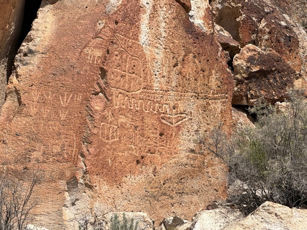
They also found hundreds of panels of petroglyphs and pictographs, and the canyons containing these images became the park.

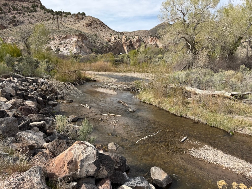
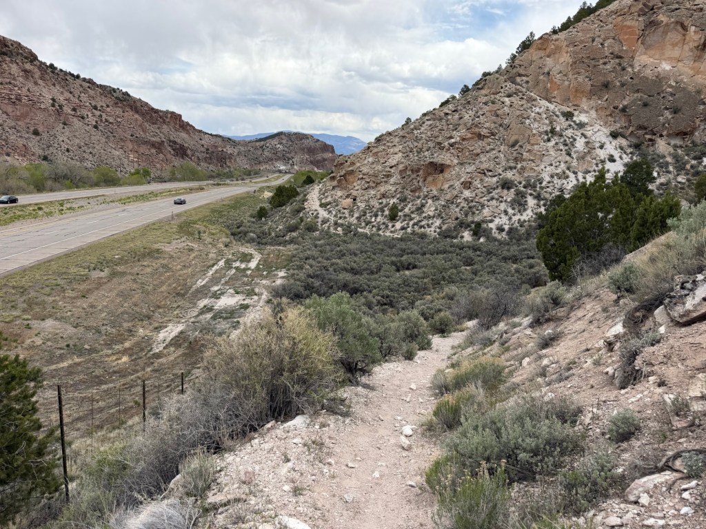
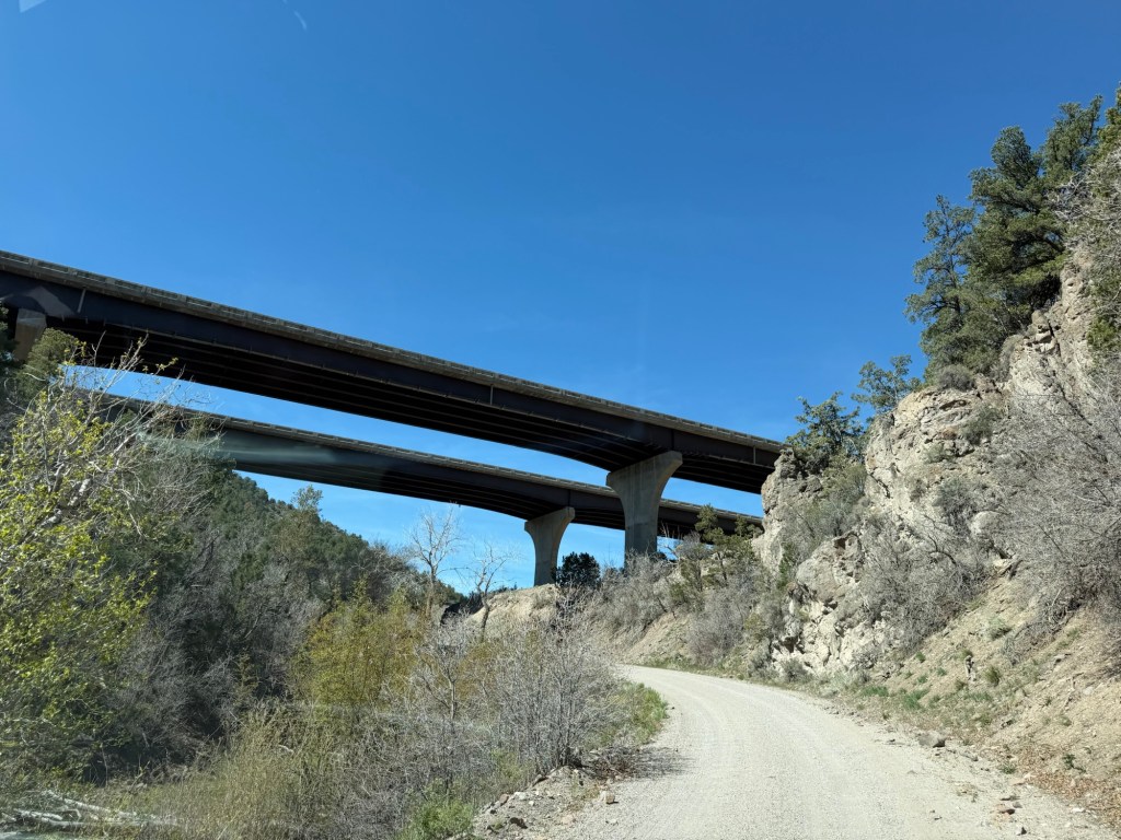
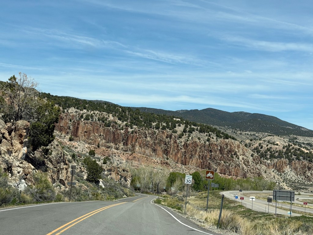
There is one main trail, the Centennial Trail that makes a five mile loop through the central Clear Creek Canyon. It runs on both sides of the interstate,
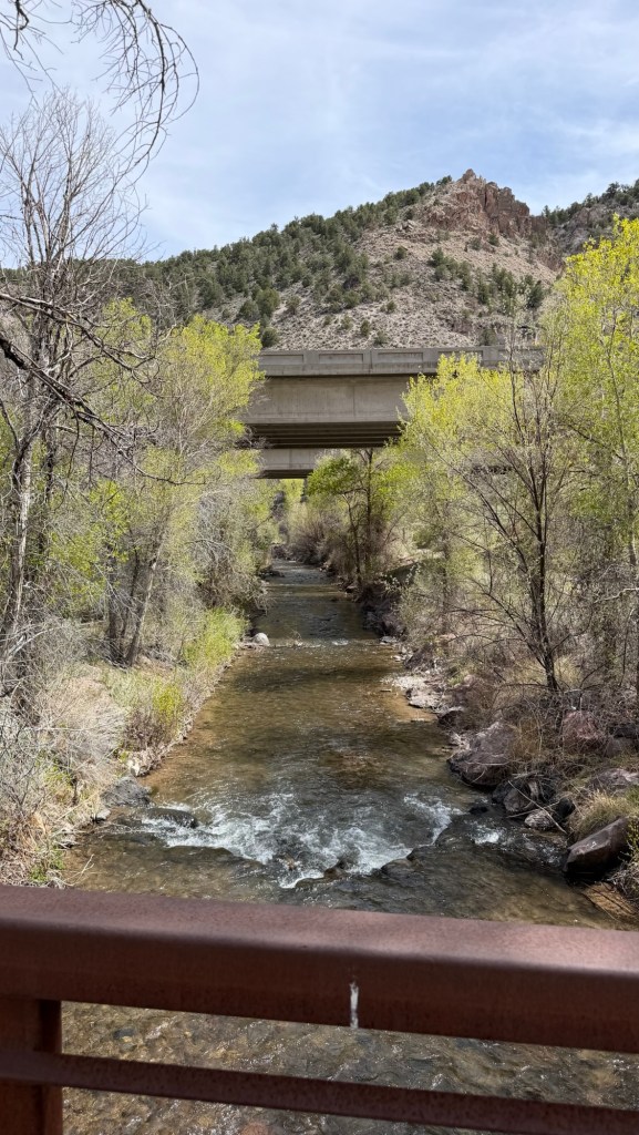
with three crossing points where the interstate bridges cross the meandering creek.
Apparently the wildlife use these crossing areas, too.
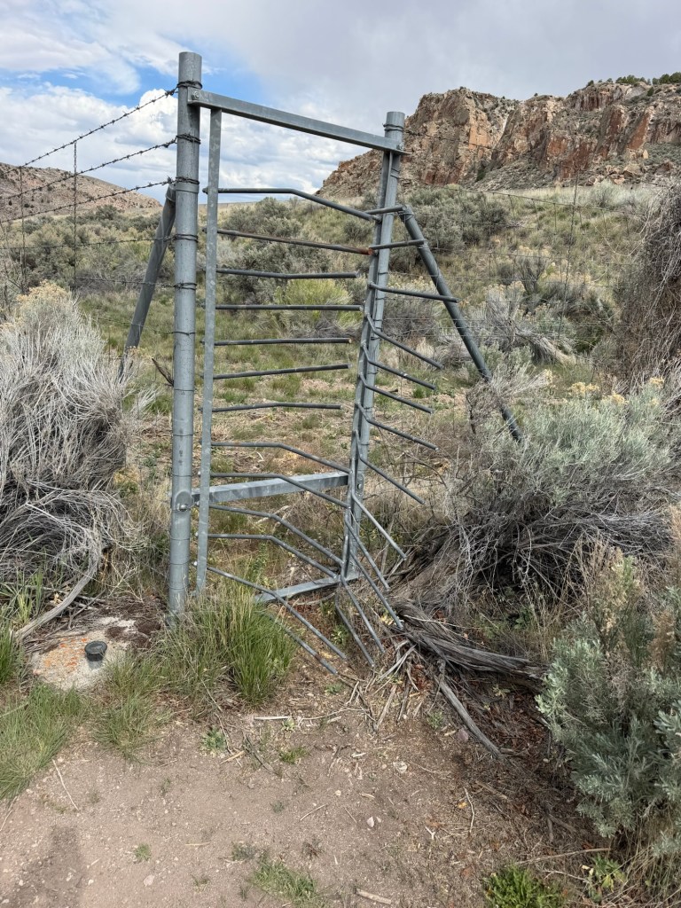
If any large animal manages to get through the fencing into the interstate roadway, they can exit through these ingenious gates that allow only one way passage.
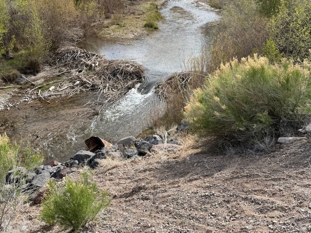
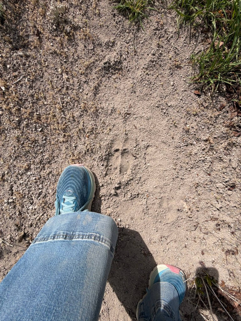
Apparently beaver are active here. Although the three dams I saw all had large breaks in them,
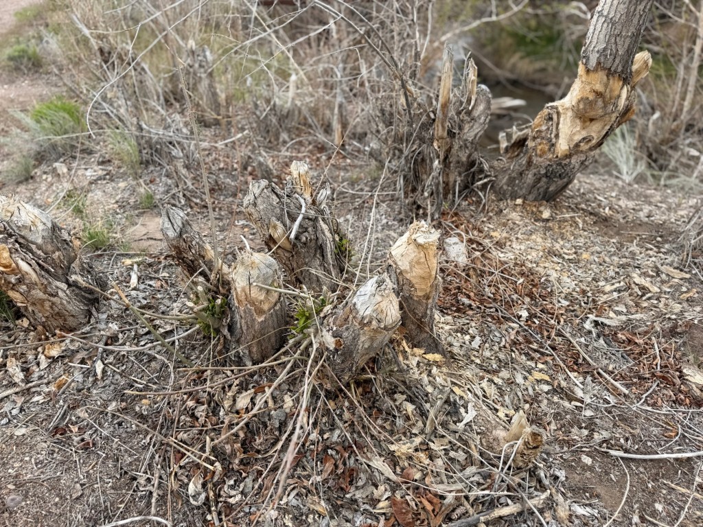
there was what appeared to be recent beaver work. I read that the beavers in Utah are live trapped from problem areas and relocated to creeks where their dams will enhance the ecosystem.
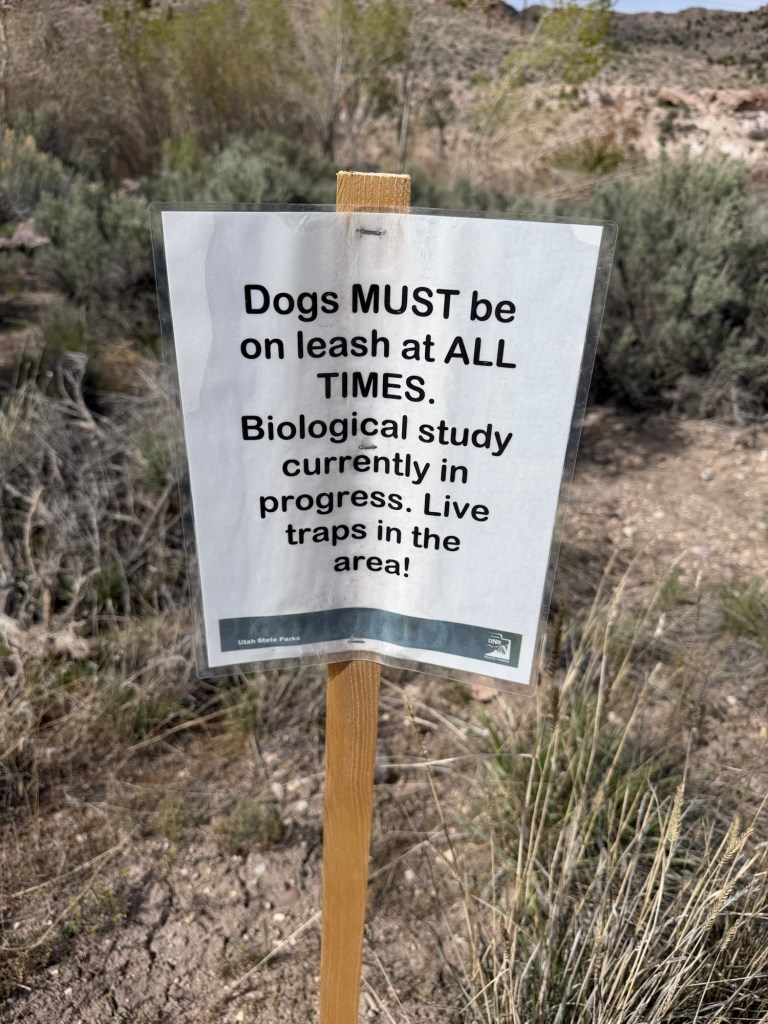
Seeing these signs and the broken dams made me wonder if this was an area they are being removed from, but all the park information lists beaver as residents.
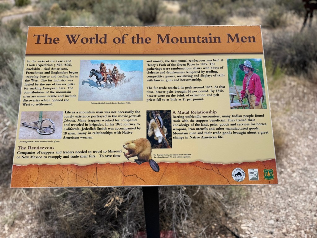
A display about an early trapper, Jedediah Smith, says the population of beaver is now about 5% what it was before white men like Smith trapped them almost to extinction; another example of the greed, hubris and lack of foresight that I’m afraid still defines parts of our culture. Anyway, I still haven’t seen a beaver, but I’m glad they’re around.
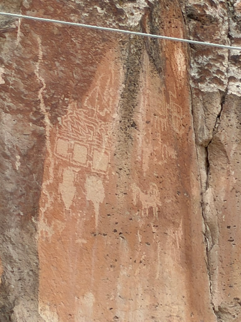
Short side trails lead to other sites of petroglyphs…
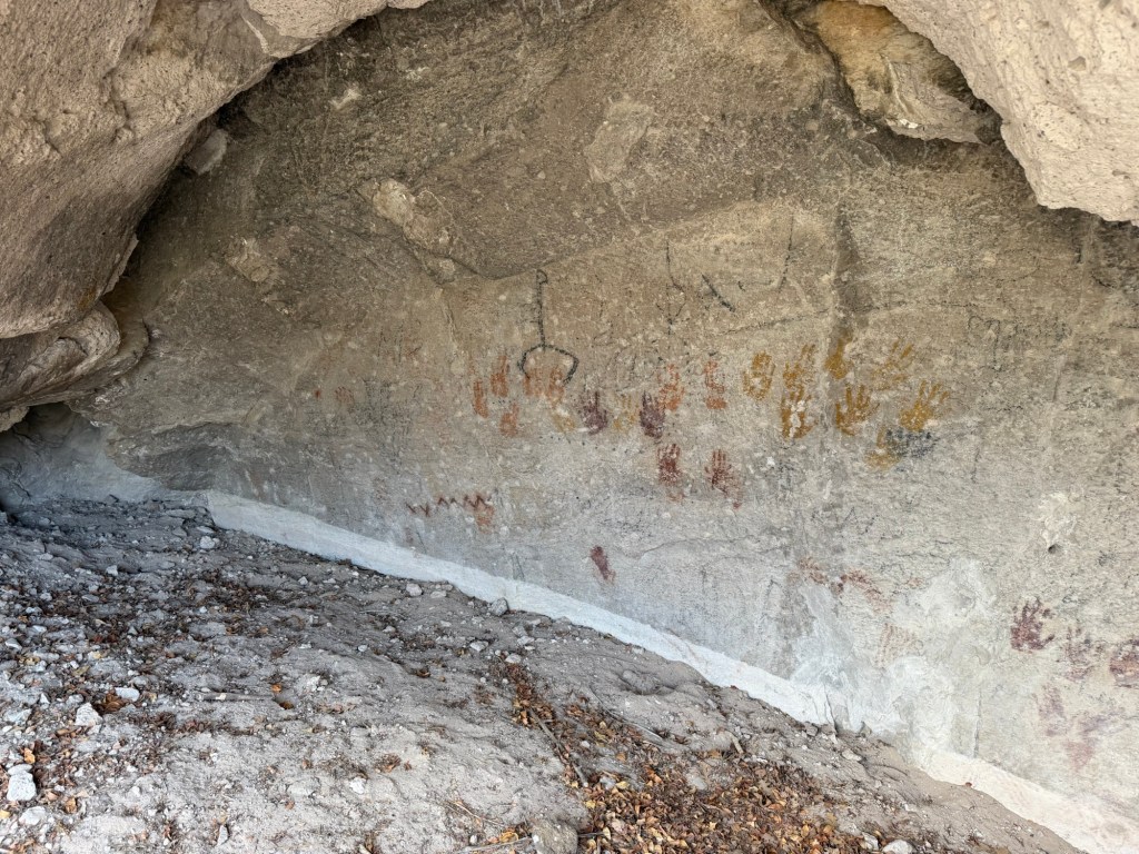
and pictographs like these hand prints.
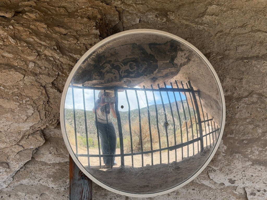
These, seen from outside the overhang through a mirror,
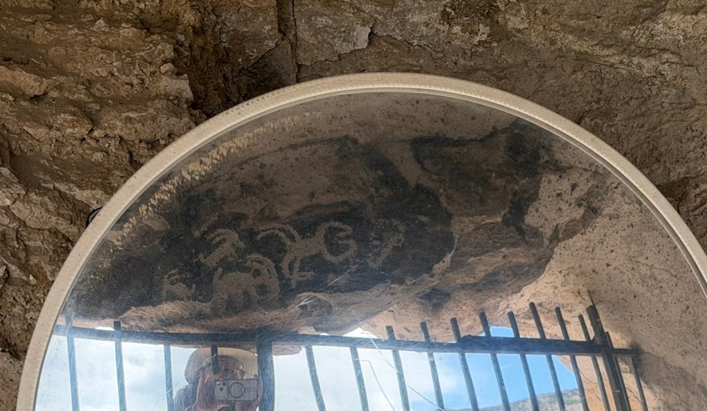
including a sheep and a scorpion,
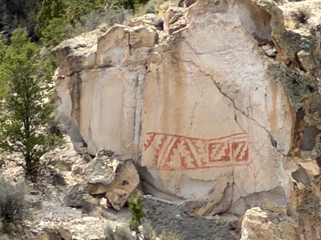
and this geometric design were among my favorites.
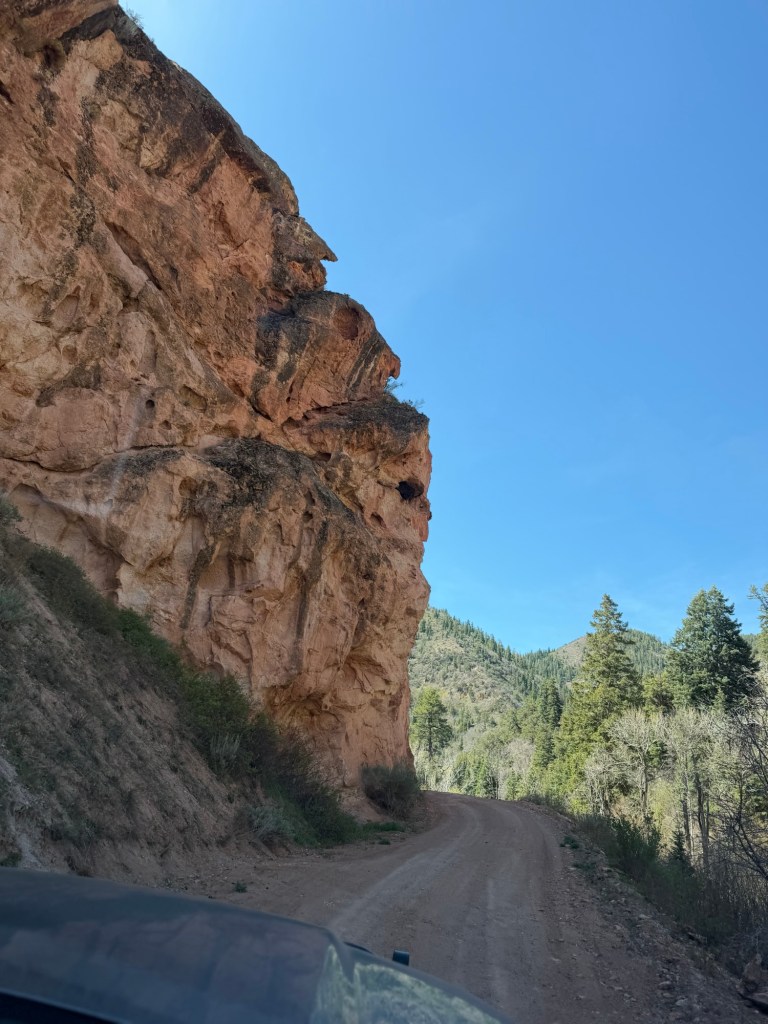
One day we decided to drive up a dirt road to an old mine site.
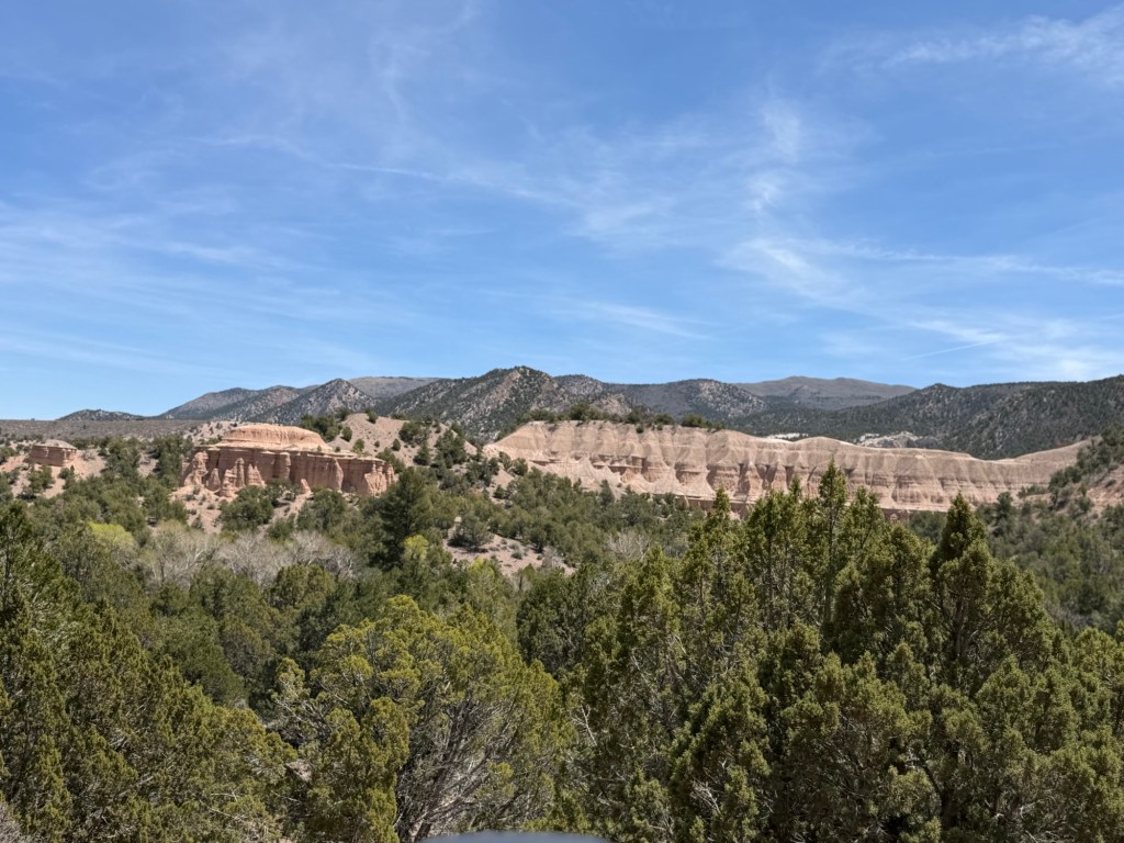
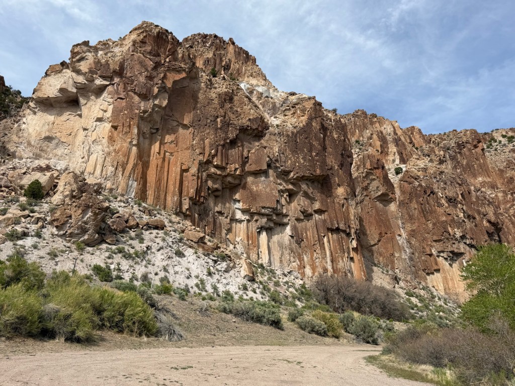
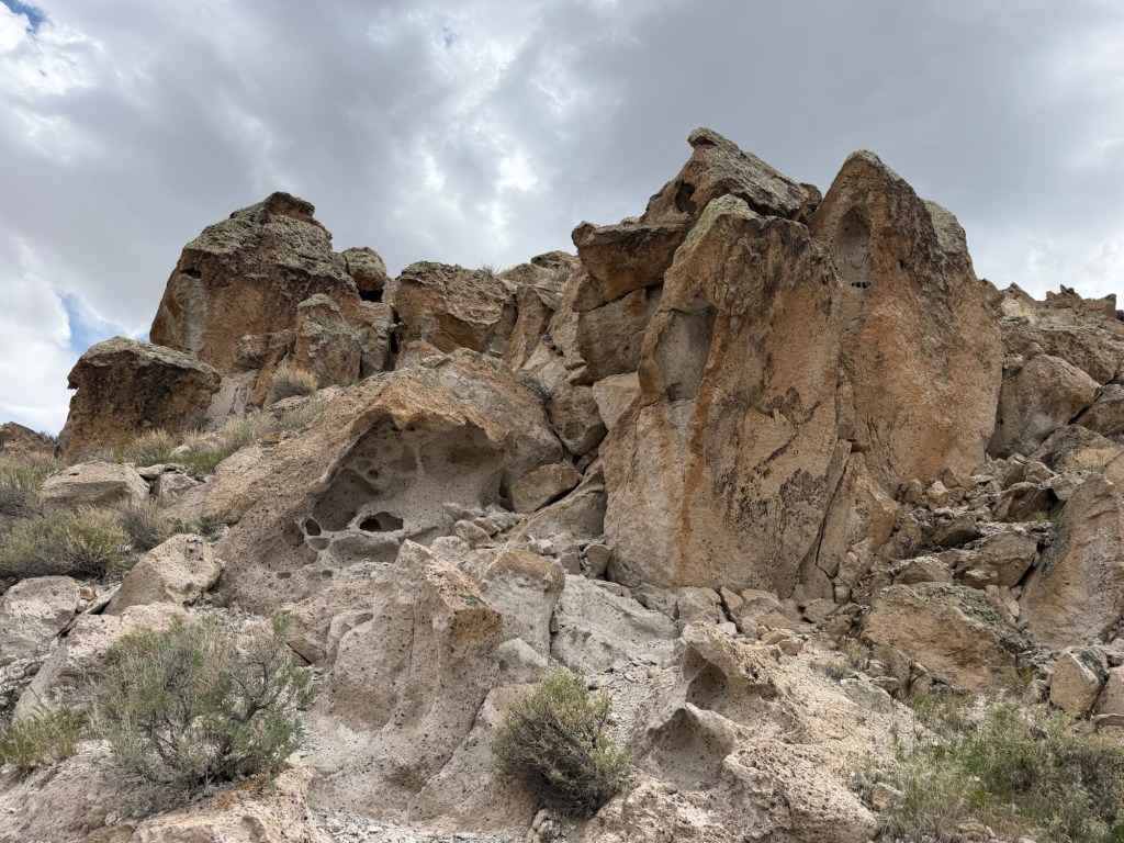
We passed some interesting cliffs while still in Clear Creek Canyon.
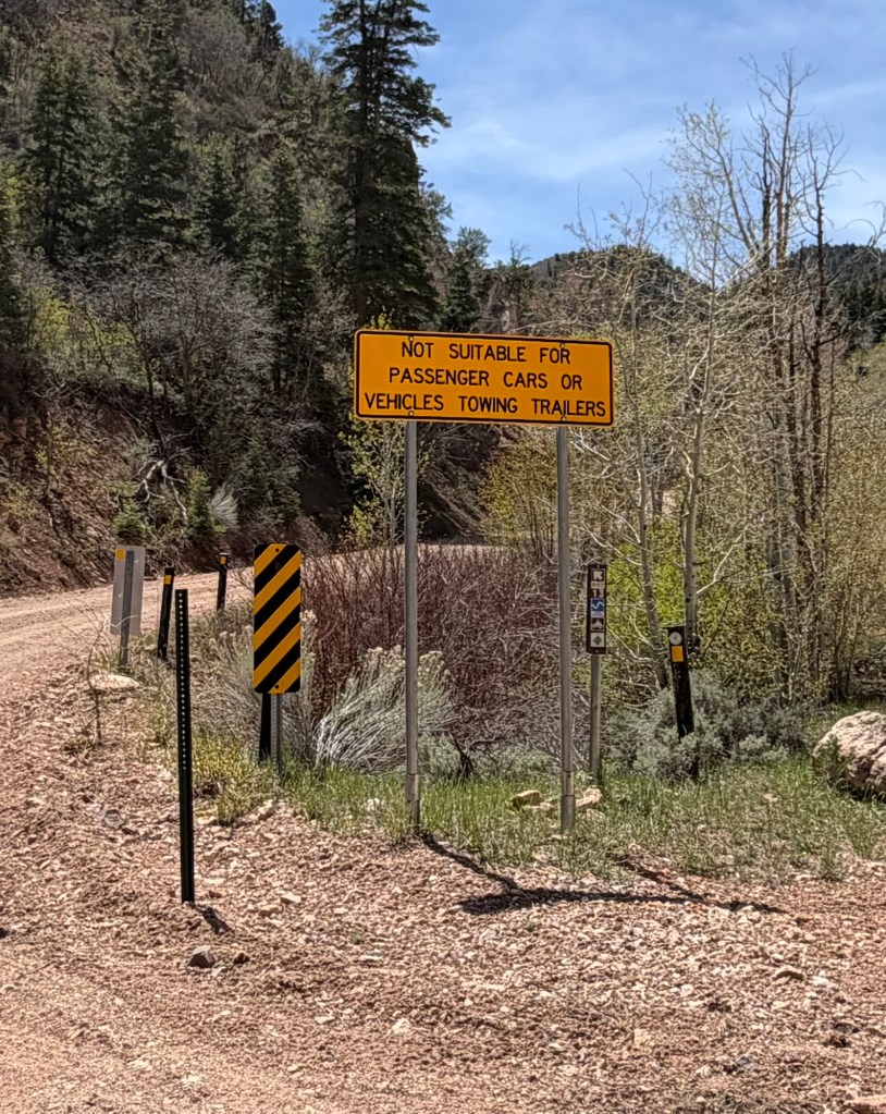
As we left the canyon we passed this sign.
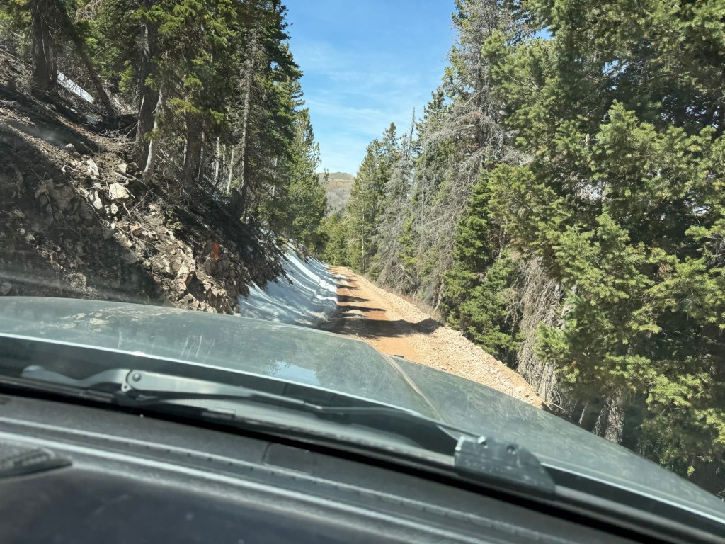
We were headed up,
and the road was getting narrow.
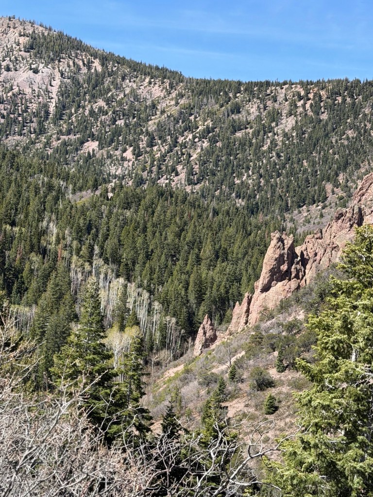
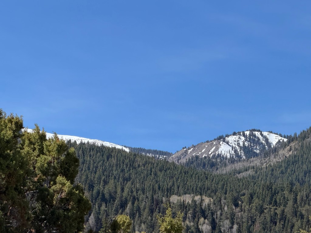
The road had no guardrails and steep drop offs, but the scenery was beautiful.
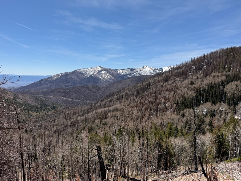
We got high enough that on the shady side of the mountain there was snow. (This is the picture I took on the way down, because it came out better.)
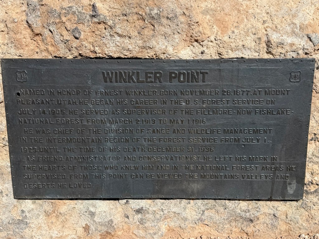
When we got to Winkler Point we were at 9,850 feet above sea level. I thought that would be the highest point.
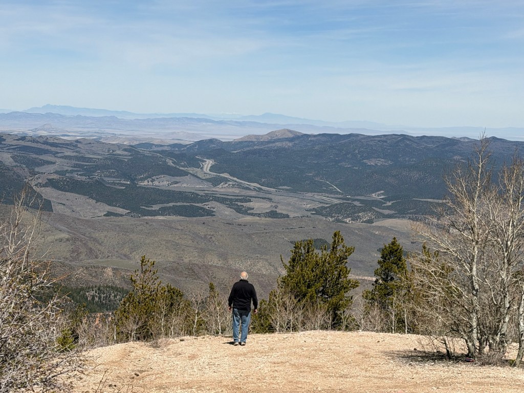
There was a pull off there and the view was spectacular.
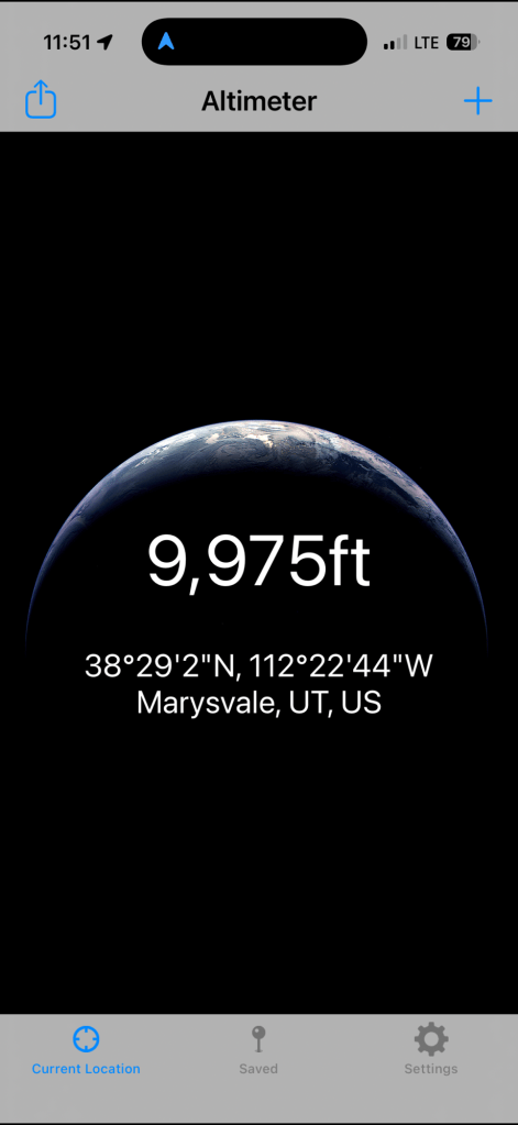
The road continued up another 125 feet,
before we started down the other side of the mountain.
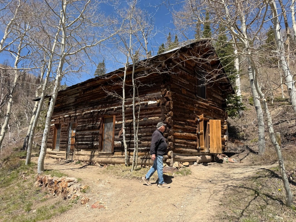
Soon we arrived at the mine site. There wasn’t too much left of the old Silver King Mine. This cabin was constructed by the first owner.
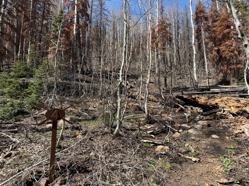
But a recent fire seems to have burned what was left of a lodge and the old mine entrance was both burned and caved in.
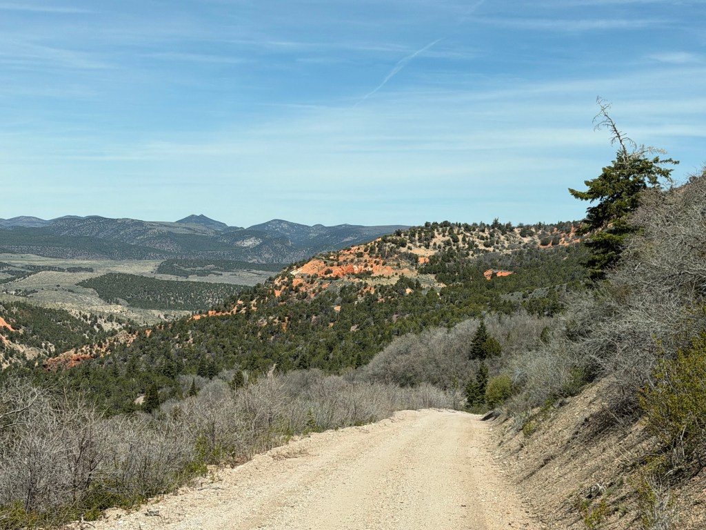
But it gave us a destination for what turned out to be a gorgeous drive.
Whether under brooding skies…
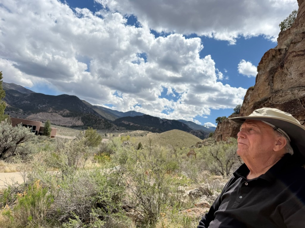
or sunshine Fremont Indian State Park has been a great stop.

More beautiful scenery! My favorite pics were the one of the creek with the interstate bridges visible, and the pics taken up at Winkler Point. I managed, with the aid of my magnifier, to read the info sign and the Winkler Point marker. Interesting. Those narrow roads with no guardrails are a bit scary, especially the area with snow on the road.
LikeLiked by 1 person