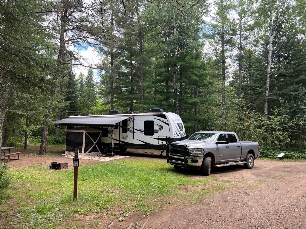
This is our seventh (and last) Ontario Provincial Park on this trip, and this may be our best campsite. It is huge, wider than it is deep, so we have privacy on both sides. And we’re on a short dead-end spur, so almost no one goes by in front of us. It’s also pretty level. But like all Ontario Provincial Parks, the only service is 30 Amp electrical, no water or sewer. We can manage.
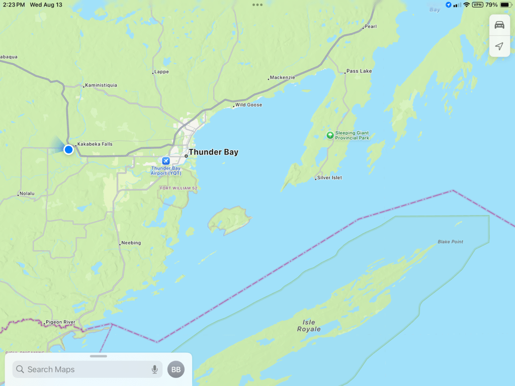
We are at the blue dot, less than 20 miles from Thunder Bay, Ontario. We are also not too far from the Minnesota border and not far, as the crow flies, from the Sibley Peninsula and Sleeping Giant Provincial Park. Also, since Isle Royale is part of Michigan, we’re quite close to that state, too.
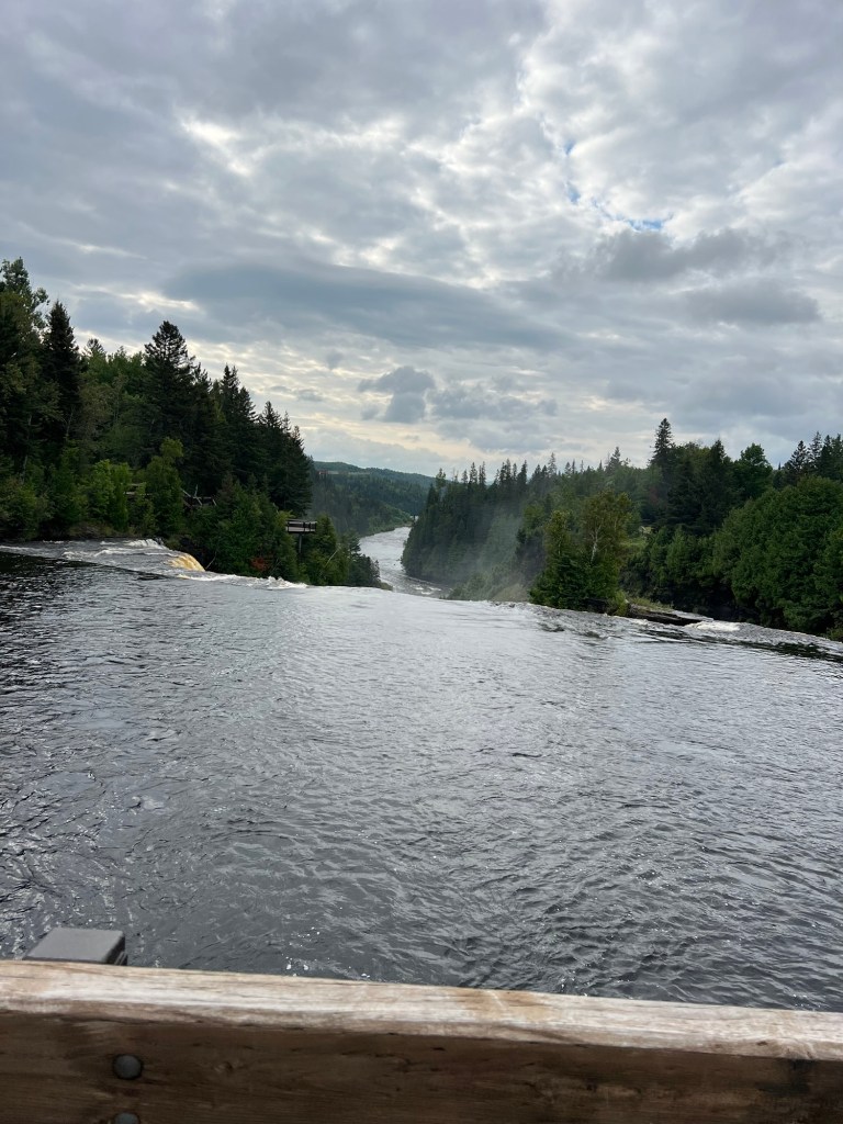
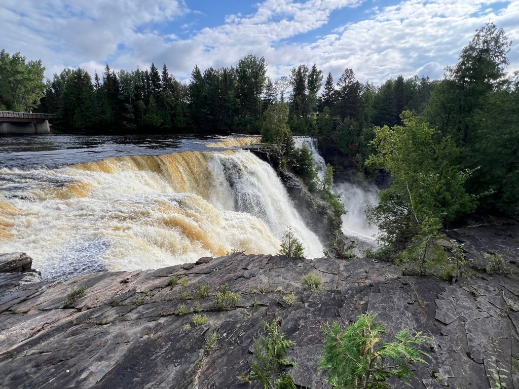
The star of this park is the falls and when you drive across the one lane bridge to the campgrounds, you are certainly aware there’s a falls there, but you really can’t see it. Kakabeka Falls, on the Kaministiquia River, is the second highest falls in Ontario at 40 meters (130 feet).
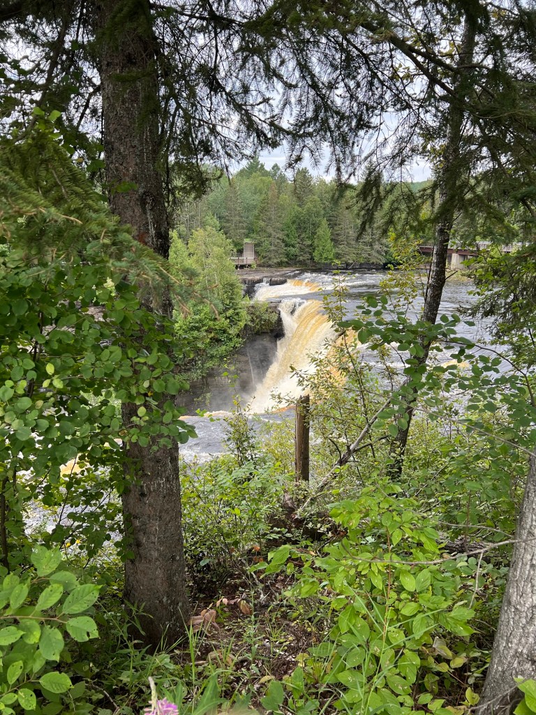
Today we walked the boardwalk and trails that let you view the falls from every which way. Starting on the north side of the river there’s a platform to view the gorge below the falls.
Then you can see the top part of the falls,
and get quite close.
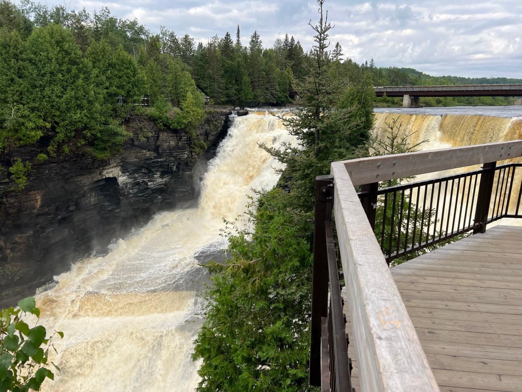
Another platform gets you to the brink on the north side.
You can cross a pedestrian bridge that parallels the one-lane auto bridge and get a nice look from above the falls.
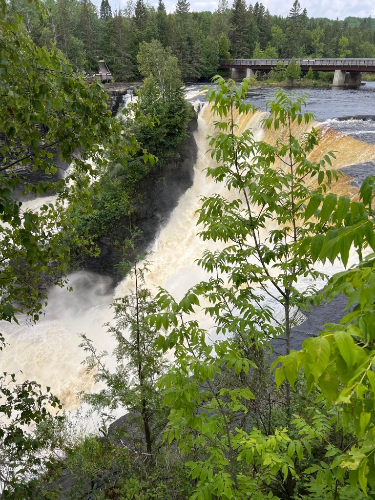
Then you come around to the south side of the river and see the brink of the falls from that side.
A bit past that is a platform for a pretty nice view of most of the falls from the south side.
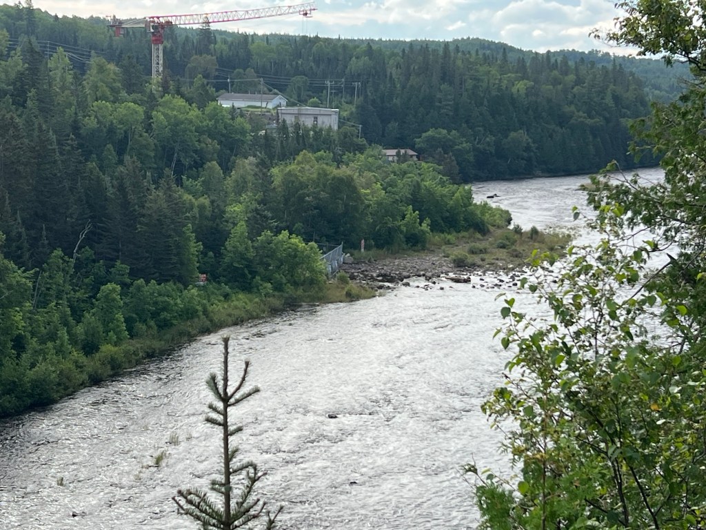
From there you take a short trail which follows down the route of the old “mountain portage” to the point where it descends steeply to the river. The voyageurs used to make that trek repeatedly with two 90 pound loads held by a three inch leather strap which went across their foreheads (just envisioning that gives me a headache). And they reportedly did this at a jog! The park path does not go down the steep portage trail, instead it cuts back to the upper bank for this view of the power plant. Like at Niagara Falls, water is diverted above the falls and brought to the plant, in this case in giant pipes. The crane you see is being used in a huge reconstruction project at the plant.
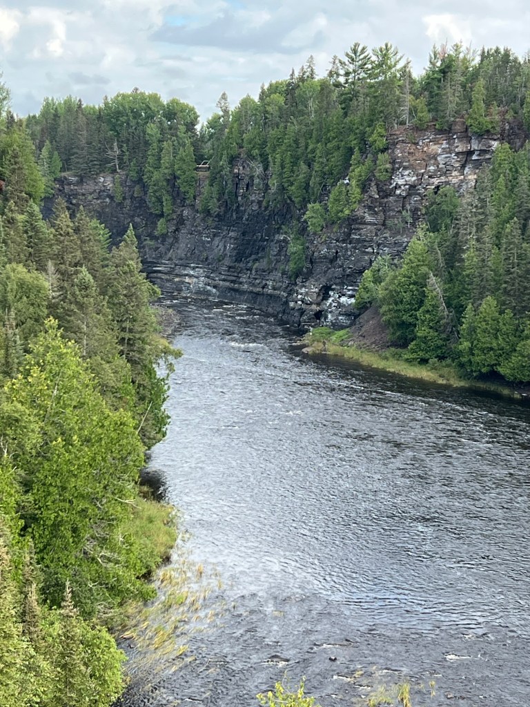
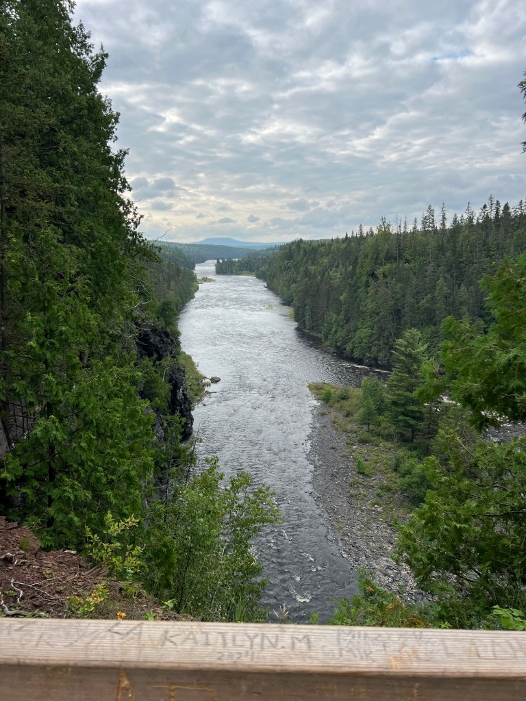
You now walk along the south side of the gorge going upstream…
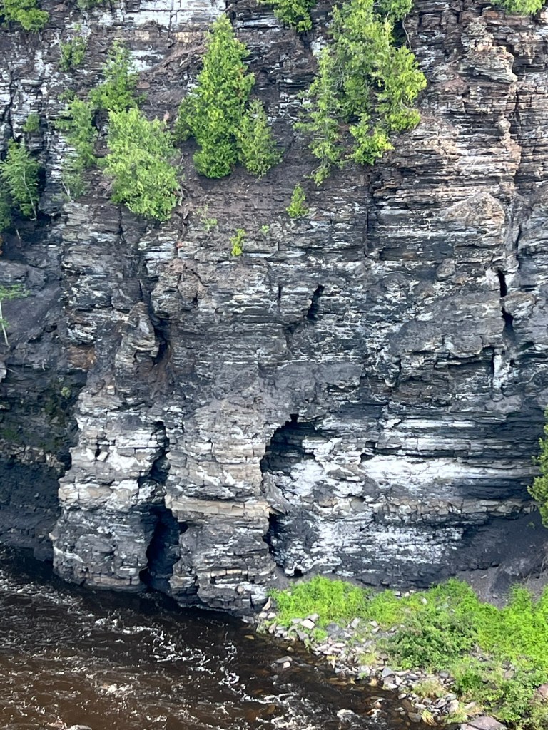
where you can get a great view of the erosion in the shale under the chert caprock that forms the brink of the falls.
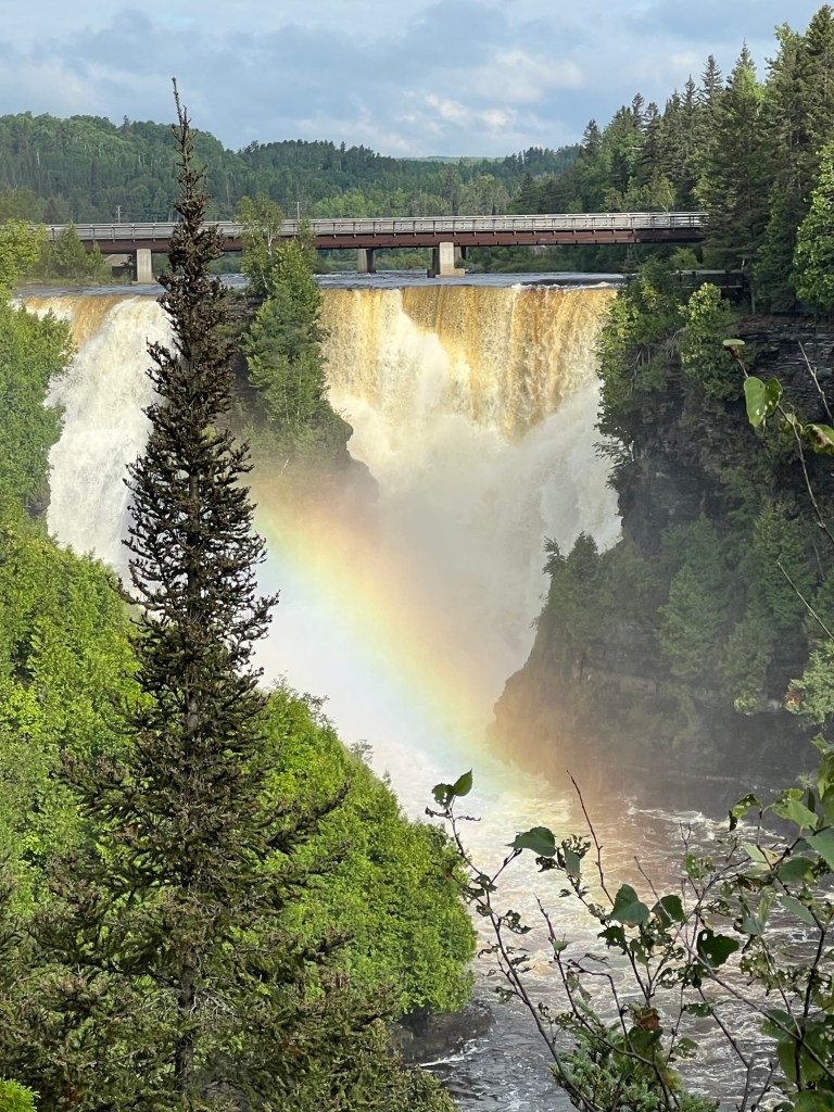
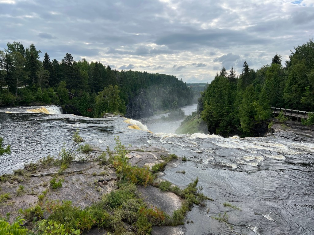
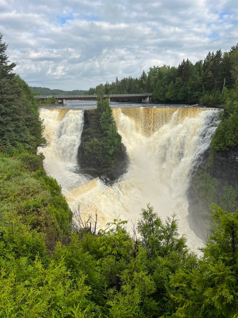
You end on a platform that I think gives you the very best view of the falls. A fitting finale to your short journey.

What a pretty falls! I’m wondering what gives the water its rust color? Is it muddy, or is there some mineral dissolved in the water that gives it that color? It looks pretty colorless when it’s just flowing along in the river bed.
LikeLike
I think it’s organic matter from all the forests, like tannin.
LikeLike
I’m so enjoying this vicarious trip. We are just arrived at Lake Placid for a few days of glamping on our way to Montreal Sunday. Thank you for the lovely photos!
LikeLike
Glad you are liking it. It encourages me to keep blogging. Enjoy your own travels!
LikeLike